Mozambique: geography, history, people, economy and environment
Overview of Mozambique: location, history since Portuguese rule and independence, languages and religions, economy with natural gas and agriculture, environmental risks, conservation and international ties.
Mozambique is a country on the southeast coast of Africa with an extensive Indian Ocean coastline and varied landscapes that include coastal plains, rivers and inland plateaus. It is commonly placed in southeastern Africa and is part of the wider grouping often called southern Africa. The capital and largest city is Maputo, an important port and administrative centre. The country shares land borders with several neighbours and its maritime location has long shaped trade, culture and settlement patterns.
Image gallery
10 Images


History
The territory now known as Mozambique was integrated into Indian Ocean trade networks for many centuries before arriving Portuguese seafarers established forts and trading posts in the late 15th century. Portuguese rule expanded over time and the area became a colony centred administratively on places such as the Island of Mozambique. Following political change in Portugal, Mozambique achieved independence on 25 June 1975 and for much of the next two decades underwent a prolonged armed conflict that devastated infrastructure and displaced populations; the civil war that followed independence is a defining event in the modern era (Portugal, civil war).
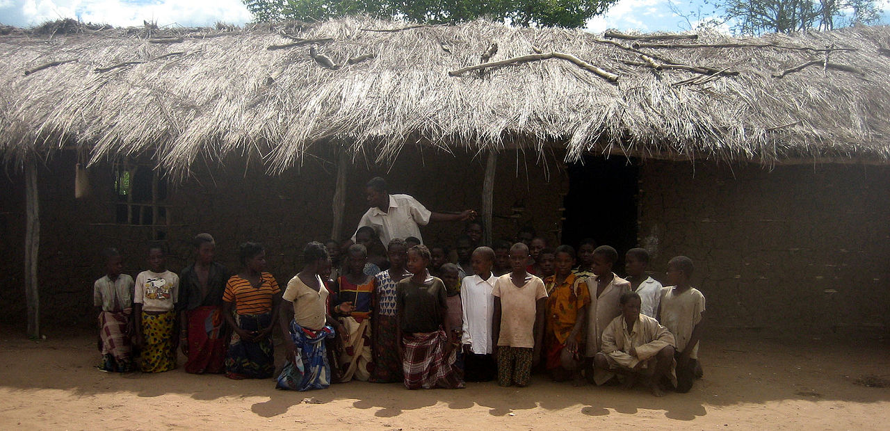
People, languages and religion
Portuguese is the official language and serves as the main language of government, formal education and national media (Portuguese). Many Mozambicans speak Bantu languages as their first languages: Makhuwa, Sena, Tsonga (Xitsonga), Lomwe and others are widely used in daily life. In parts of the north and along portions of the coast, Swahili and related coastal varieties are also present. Christianity is the largest single religious affiliation, with sizeable Roman Catholic and Protestant communities; Islam is significant in northern coastal areas and traditional beliefs continue to play a role in many communities (Christianity).
Economy and resources
Mozambique's economy combines agriculture, fisheries, extractive industries and growing infrastructure investment. The agricultural sector employs a large share of the population and many households rely on subsistence farming. Since the early 2010s, major offshore natural gas discoveries, notably in the Rovuma Basin, have attracted international attention and investment, raising expectations about future revenues and industrial development. The country also has coal deposits and other mineral resources. Despite resource potential, Mozambique faces significant development challenges including poverty, limited access to services and health indicators that are below the global average (life expectancy and health).
Environment, hazards and conservation
Mozambique is vulnerable to tropical cyclones, seasonal floods and droughts, which periodically cause large humanitarian and economic impacts. Cyclone events have highlighted the country's exposure and the importance of disaster preparedness. Mozambique contains diverse ecosystems from coastal mangroves and coral reefs to miombo woodlands and riverine habitats. Conservation areas such as Gorongosa National Park are important both for biodiversity protection and for community-based tourism and restoration projects.
Politics, governance and development
Since peace accords in the early 1990s, Mozambique has rebuilt institutions and developed a multi-party political system. Governance and public management remain central to efforts to translate natural resource wealth into broad-based development. Challenges include strengthening public services, improving infrastructure, addressing inequality and ensuring that resource extraction benefits local communities.
International relations and regional ties
Mozambique is active in regional and global organisations and pursues diplomatic, economic and security cooperation. It is a member of the African Union, the Southern African Development Community and the Community of Portuguese Language Countries. Mozambique joined the Commonwealth despite its Lusophone colonial past and also participates in other multilateral forums, including the Organisation of Islamic Cooperation. Longstanding commercial and cultural links persist with European countries such as Portugal, and there are expanding ties with other partners including Spain and Belgium.
- Capital: Maputo
- Official language: Portuguese
- Major languages: Makhuwa, Sena, Tsonga, Lomwe, Swahili
- Key historical moments: Portuguese colonization, independence 1975, civil war 1977–1992 (civil war)
- Natural resources: natural gas (Rovuma Basin), coal, fisheries
- Regional organisations: AU, SADC, CPLP, Commonwealth
Mozambique's long-term prospects depend on governance of resource revenues, investment in human capital and infrastructure, improved disaster resilience and inclusive economic policies that reduce poverty. For regional context see resources on southeastern Africa and southern Africa, and for historical ties consult materials linked to Portugal and other partners.
Geography
Location and description
Along the 2800 km coastline is a broad coastal lowland. It covers most of the south, but narrows from the mouth of the Zambezi River to the north. Behind the coast the land rises in steps to the table land of the high field, about 1000 m high. The highest mountain is the Monte Binga in the province Manica (at the border to Zimbabwe) with 2436 m.
With a land area of 801,590 km², Mozambique ranks 34th in the world. 18 % of the country's area is forest and bush land, 4 % arable land, 55 % meadows and pastures.
The extension of the country in the north-south direction is 2000 km, in the west-east direction 50 to 600 km. The coast on the Indian Ocean is 2800 km long.
Mozambique has 4571 km of land borders, including 756 km with Tanzania, 1569 km with Malawi, 419 km with Zambia, 1231 km with Zimbabwe, 491 km with South Africa and 105 km with Eswatini.
Climate
Savannah climate with a wet and a dry season prevails. In the rainy season, which lasts from November to April, about 80% of the annual precipitation falls. Depending on the region, this varies between 700 and 1500 mm per year. While the temperatures during the rainy season are hot and humid (tropical), the dry season is characterized by much cooler nights. The whole year the day temperatures are between 25 and 30 °C, in the inland also up to 35 °C. The nights are sometimes very humid at around 15 to 25 °C, especially on the coast.
In some years, such as 2007/2008, there was unusually high rainfall, which claimed lives and threatened crops. Overall, the country experiences high climate variability and frequent extreme weather events (especially droughts, floods, tropical cyclones). Droughts are the most common disasters, occurring about every three to four years and massively hampering the country's development. In terms of the consequences of global warming, it is believed that while cyclones may become less frequent, their intensity, and therefore rainfall, is likely to increase. In 2019, for example, Cyclones Idai and Kenneth were unusually intense and caused severe damage. These weather events may also lead to increased erosion in coastal areas. Since much of the population, and especially many poor people in rural areas, depend on rain-fed agriculture for their livelihoods, they are particularly vulnerable to changes in rainfall patterns.
Waters
The country's numerous rivers flow eastward from the highlands into the Strait of Mozambique. The largest river is the Zambezi (2,574 km), which is dammed in western Mozambique by the Cahora Bassa Dam. Other major rivers include the Rovuma, the border river with Tanzania, and Save and the Limpopo. Lake Malawi forms part of the border with Malawi; its outlet is the Shire, which flows into the Zambezi. Together with the Lurio, the catchments of these rivers account for over half of the country. However, due to its geography, Mozambique has only a comparatively small share in the catchment areas of the International Rivers.
See also: List of rivers in Mozambique
Flora
The predominant vegetation is dry savannah with dry grasslands and some dry forests. The trees in the savannah partially shed their leaves in the dry season and turn green in the course of the rainy season. Typical trees of the dry savannah are umbrella acacias and baobabs. The grass is brown and withered in the dry season, but grows up to 2 meters high during the rainy season.
Population
Demographics
The average life expectancy at birth in 2019 was 60.9 years. 44.4% of the population was under 15 years of age in 2019 and just under 3% was over 65. The total fertility rate was 4.8 children per woman. The rate was still around 6.5 children per woman around 1970 and has been steadily declining since then. This is partly due to the fact that modern contraceptive methods are available to more and more married women. From 2008 to 2019, the rate increased from 12% to 50%. The country has one of the highest HIV prevalence rates in the world (12.3%), which is holding back population growth. This was 2.9% in 2019.
According to the UN medium population projection, the population is expected to exceed 65 million by 2050.
| Development | |
| Year | Population |
| 1950 | 06.152.000 |
| 1960 | 07.389.000 |
| 1970 | 09.162.000 |
| 1980 | 11.848.000 |
| 1990 | 13.248.000 |
| 2000 | 18.068.000 |
| 2010 | 24.221.000 |
| 2020 | 31.255.000 |
| 2030 | 41.185.000 |
Ethnic groups
The majority of the total population belongs to the Bantu people. The Makua are the largest people with about 40% of the population, and the Tsonga are also an influential group with 21%. The Yao, who also live in Malawi, make up 12 % of the population, and the Makonde in the northeast are also a strong minority with 11 %. The East African Swahili ethnic group lives in the coastal area and makes up 7% of the population. In addition, the Chewa still live in the country with a share of 4 % of the population - their main settlement area is Malawi. The smaller minority of the 3% Shona in the west forms the majority of the population in Zimbabwe.
In 2017, 0.8% of the population was foreign-born. Furthermore, Mozambique is home to many people with a migrant background (Indians, Pakistanis, Chinese), Europeans (mainly Portuguese) and South Africans. The return of almost five million internally displaced persons (IDPs) to their places of origin and the return of 1.7 million refugees from neighbouring countries after the end of the Mozambican civil war, as well as around 15,000 Mozambicans from the former German Democratic Republic, so-called Madgermanes, pose major challenges for the country.
Mozambique has a significant diaspora in South Africa. In 2017, approximately 680,000 Mozambican-born people lived there. Other countries with many Mozambicans abroad are Zimbabwe (90,000) and Portugal (70,000).
See also: History of the Indians in Mozambique
See also: Ethnic groups in Mozambique
Languages
| Knowledge of Portuguese (2007) | ||
| Available | 50,37 % | |
| not available | 48,72 % | |
| k. A. | 00,90 % | |
| Most spoken language at home (2007 as well as 1998) | ||||
| Portuguese | 2.088.798 | 12,78 % | 489.915 | 3,0 % |
| Makua | 4.153.811 | 25,42 % | 4.007.010 | 24,8 % |
| 1.710.801 | 10,47 % | 1.799.614 | 11,2 % | |
| Chilomwe | 1.132.755 | 6,93 % | 1.269.527 | 7,9 % |
| Sena | 1.171.673 | 7,17 % | 1.807.319 | 11,2 % |
| Chuwabo | 733.926 | 4,49 % | ||
| Other Mozambican language | 4.718.907 | 28,87 % |
| |
| Other foreign language | 30.969 | 0,19 % |
| |
| K. A. | 5.118 | 0,03 % | ||
| Unknown | 596.735 | 3,65 % | ||
| Total | 16.343.493 | 100,00 % | 16.135.403 | 100,00 % |
In total, over 40 languages are spoken in the country. The indigenous languages belong to the Bantu language group. According to the 2007 census, Portuguese, the only official language, is now spoken as a mother tongue by about 12 % of the total population (mainly in cities), but about 25 % in Maputo. A good 50% speak Portuguese as a second language alongside their native language. Most Mozambicans speak more than one indigenous language. In addition to the official language Portuguese, the most important languages include (sorted by share of speakers):
- Makua, also eMakhuwa - the most important language in northern Mozambique is spoken by 25.3% of the population according to the 2007 census. 40% of the inhabitants are considered ethnic Makua. These speak different variants within an eMakua dialect continuum or "Makhuwa languages" - nine in Mozambique according to Ethnologue - of which the "Central Makhuwa" - with 3.09 million speakers in 2006 - is also known simply as "eMakhuwa" or "eMakua".
- Changana - spoken by 10.7% of the population in the southwest in Maputo Province and Gaza Province, also called Ronga in Maputo City; however, the ethnic Tsonga population is 21%.
- Sena - in Sofala Province by 7.5% of the population
- Chilomwe - 7 % of the population (closely related to eMakhua)
- Chuwabo - 5.1% of the population
- Swahili - in the north (border to Tanzania)
- ChiMakonde - in the northeast (Cabo Delgado province)
- Chichewa - also called Nyanja; in the west (Tete province), the area borders Zambia and Malawi, where this language is also spoken.
- Shona - spoken by the Shona people
- Ndau - spoken in Sofala province, related to the Shona language
- Tswa - in the southeast (Inhambane province)
Among the foreign languages, those spoken by Chinese, Indian and Pakistani immigrants stand out.
Religion
During the colonial period, the Roman Catholic Church was by far the most important Christian denomination. Since independence, however, evangelical movements have gained increasing importance. The popular TV station TV Miramar, which is owned by the Brazilian faith healer sect Igreja Universal do Reino de Deus, which distributes Christian fundamentalist content in addition to well-known Brazilian telenovelas, is of particular importance.
According to a 2007 survey, a total of 28.4% of the population is still Roman Catholic (mainly in the south and southwest) and 17.9% Muslim (mainly Sunni, mainly in the north and coastal regions). 15.5% are Zionist Christians. Protestants make up 12.2% of the population, of which 10.9% are Pentecostal and 1.3% Anglican. 6.7% belong to other religions, mostly traditional religions. 18.7% do not belong to any religion and 0.7% are not recorded.


Questions and answers
Q: What is the capital of Mozambique?
A: The capital of Mozambique is Maputo.
Q: When did Mozambique gain independence from Portugal?
A: Mozambique gained independence from Portugal on June 25th, 1975.
Q: What language is the official language of Mozambique?
A: Portuguese is the official language of Mozambique.
Q: How many people live in Mozambique?
A: Approximately 31 million people live in Mozambique.
Q: What are some natural resources found in Mozambique?
A: Some natural resources found in Mozambique include large natural gas reserves and minerals such as coal, titanium, gold, and bauxite.
Q: What are some important partners for the country?
A: Important partners for the country include Portugal, Spain, and Belgium.
Q: What religions are practiced in Mozambique?
A: Christianity is the largest religion practiced in Mozamibque; however there are also Muslim and African traditional religious minorities present.
Related articles
Author
AlegsaOnline.com Mozambique: geography, history, people, economy and environment Leandro Alegsa
URL: https://en.alegsaonline.com/art/67228
Sources
- commons.wikimedia.org : Mozambique
- ssrn.com : 1644026
- dss.ucsd.edu : "Semi-Presidential Systems: Dual Executive and Mixed Authority Patterns"
- doi.org : 10.1057/palgrave.fp.8200087
- palgrave-journals.com : "Semi-Presidential Systems: Dual Executive And Mixed Authority Patterns" · web.archive.org
- voaportugues.com : "Moçambique tem novo governo"
- esa.un.org : "World Population Prospects: The 2017 Revision"
- imf.org : "Mozambique"
- data.worldbank.org : "Gini Index"
- hdr.undp.org : "2016 Human Development Report"
- online.wsj.com : "UPDATE: Mozambique Talks To Shell On Developing LNG"
- tourisminmozambique.com : tourisminmozambique.com/mozambique-tourist-information/weather-in-maputo
- books.google.com : Mozambique