Mount Rainier: geology, history, ecology, and recreation
Mount Rainier is a glaciated stratovolcano southeast of Seattle and the highest peak in the Cascade Range; important for geology, ecology, cultural history, climbing, and volcanic hazard monitoring.
Mount Rainier is a prominent stratovolcano located about 54 miles southeast of Seattle and within the state of Washington. Rising to 14,410 feet (4,392 m), it is the tallest summit in the Cascade Range. The mountain is heavily mantled by snow and dozens of named glaciers, giving it a distinctive white profile year-round. Although classified as an active volcano, the peak has not produced a confirmed historical eruption in recent centuries and is sometimes described as dormant or quiescent; monitoring continues to assess future activity.
Image gallery
10 Images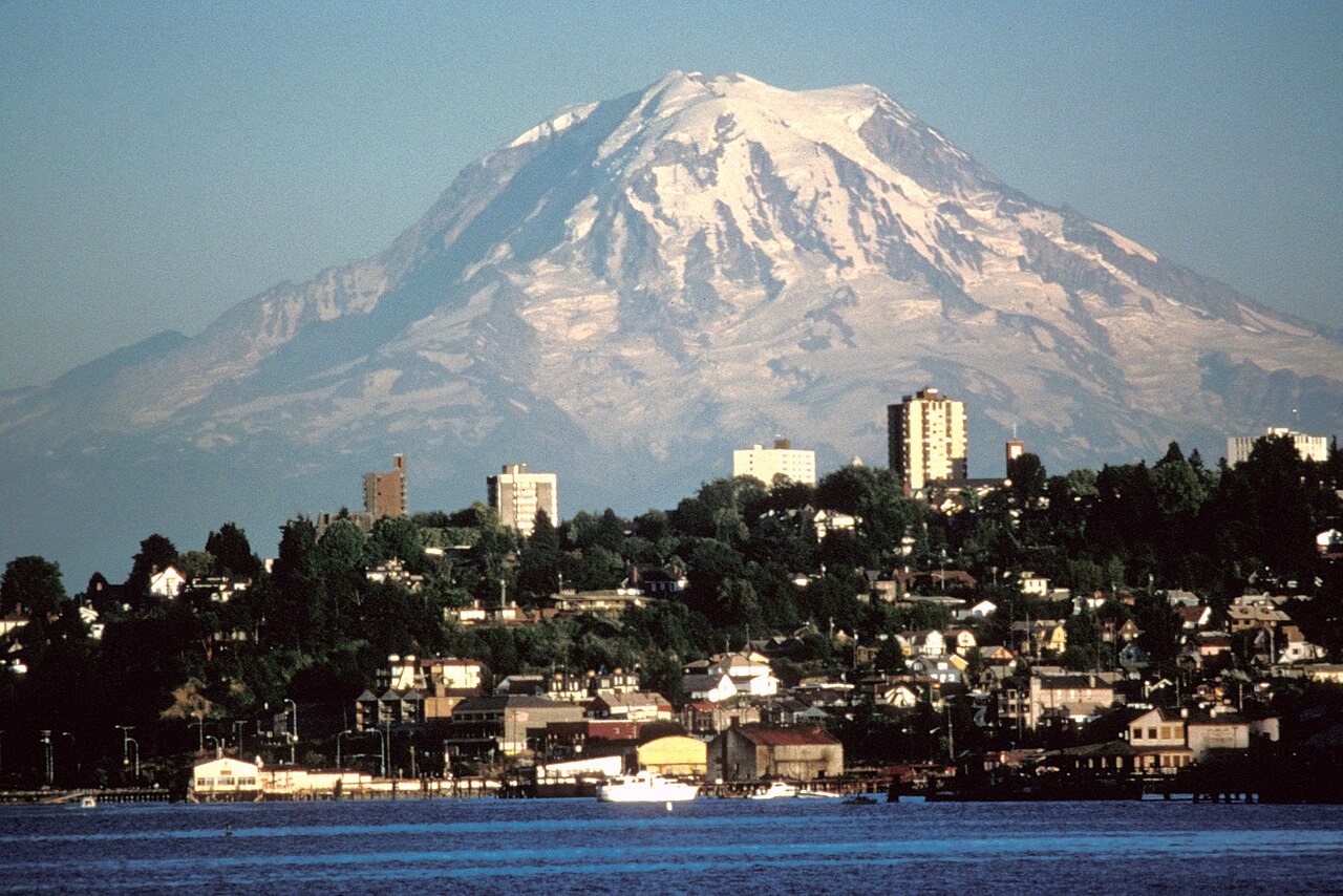


Characteristics and geology
Mount Rainier is a classic composite volcano: layered lava flows, tephra and hardened ash form a steep cone. Its extensive ice fields are among the most extensive in the contiguous United States, and they feed multiple river systems. Seasonal melt and long-term glacial changes influence streamflow, ecology and landscape evolution. The mountain also poses volcanic hazards such as pyroclastic events and fast-moving lahars (volcanic mudflows), which are a major concern for nearby valleys and communities.
Human history and protection
The mountain has long held cultural and spiritual significance for indigenous peoples, who know it by names such as Tahoma or Tacoma. In the modern era the summit and surrounding terrain were set aside to create a national park on March 2, 1899, when President William McKinley signed the designation. Mount Rainier National Park became the fifth national park in the United States and was established to conserve its scenic, geological and ecological values.
Recreation and access
The mountain is a major destination for hikers, climbers and naturalists. Routes to the summit involve glacier travel and crevasse navigation, so many climbers prepare with technical training and equipment. The park offers a network of trails, backcountry camping, winter sports and interpretive programs that emphasize safety and landscape stewardship.
Ecological and societal importance
Glaciers on Rainier act as important water reservoirs that sustain rivers during dry months and support diverse habitats from subalpine meadows to old-growth forests. The mountain’s scenic prominence dominates local weather patterns and drawing tourism that supports nearby communities. Because of both its natural value and its hazard potential, the volcano is closely studied by geologists and monitored by authorities.
Notable facts and practical considerations
- Highest peak in the Cascades at 14,410 ft: a regional landmark and weather indicator (snow and ice are visible year‑round).
- Part of a national park system established in 1899 to protect its landscapes (national park status).
- Active volcano classification requires continuous monitoring; historical activity is limited and sometimes referred to as no recent eruptions.
For more on climbing routes, glacier safety, public access and current monitoring efforts consult official park resources and geological services: local guides, state pages, and scientific updates from monitoring agencies (volcanic observatory, glacier studies, historical archives, status reports, regional summaries, park history). These sources help visitors and residents appreciate Rainier’s natural values while preparing for seasonal conditions and potential hazards.
Questions and answers
Q: How far is Mount Rainier from Seattle, Washington?
A: Mount Rainier is 54 miles (87 kilometers) southeast of Seattle, Washington.
Q: What is the height of Mount Rainier?
A: The height of Mount Rainier is 14,410 feet (4,392 meters).
Q: What covers most of the top of Mount Rainier?
A: Most of the top of Mount Rainier is covered by snow and glaciers.
Q: Is Mount Rainier an active or inactive volcano?
A: Mount Rainier is an active volcano, but it has not had an eruption for more than 100 years.
Q: How was Mount Rainier National Park created?
A: On March 2, 1899, U.S. President William McKinley made the mountain and area around it Mount Rainier National Park, making it the country's fifth national park.
Q: What type of mountain range is Mount Rainier part of?
A: Mount Rainier is part of the Cascade Range, which is the highest mountain range in the Pacific Northwest.
Q: How is Mount Rainier described by some people?
A: Some people describe Rainier as dormant or inactive.
Related articles
Author
AlegsaOnline.com Mount Rainier: geology, history, ecology, and recreation Leandro Alegsa
URL: https://en.alegsaonline.com/art/67079
Sources
- volcano.si.edu : "Rainier"
- geonames.usgs.gov : "Mount Rainier"
- earthmagazine.org : "Voices: Dead or alive ... or neither? Why a dormant volcano is not a dead one,"