
Mount Kyllini (Cyllene) — Peloponnese mountain associated with Hermes
Prominent mountain in the northern Peloponnese rising to 2,374 m, known for its classical associations with Hermes, forested lower slopes, an observatory, and protected natural areas.
Overview
Mount Kyllini, often written Cyllene or known locally as Ziria, is a prominent massif in the northern Peloponnese of Greece. Its summit reaches about 2,374 metres (7,789 feet), making it one of the highest peaks on the peninsula. The mountain occupies a position near the traditional border between Arcadia and Achaea and is visible from many surrounding towns and plains. In antiquity Kyllini was famed as the birthplace and sanctuary of the god Hermes, an association that shaped literary and religious references to the peak for centuries.
Image gallery
2 Images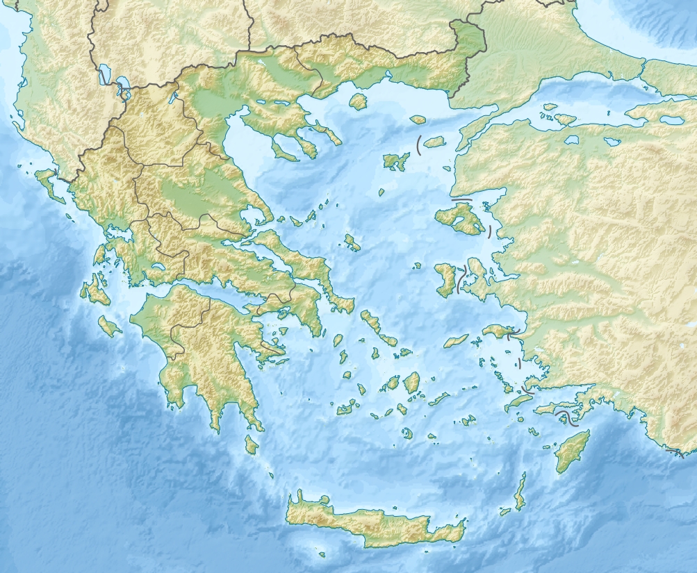

Physical characteristics and ecology
The upper slopes of Kyllini are rugged and largely rocky, with exposed limestone and scree fields typical of high Peloponnesian mountains. Below roughly 2,000 metres the mountain supports extensive mixed forests and shrublands; these include stands of oak, fir and other Mediterranean montane species. The range displays karst features such as sinkholes and caves in places where limestone dominates. Seasonal snow can persist on the summit into spring, and the mountain's elevation produces cooler, wetter conditions than the nearby lowlands.
History, mythology and cultural significance
Kyllini appears in Greek myth primarily because of its long-standing link to Hermes, who was described by classical authors as having been born or nurtured on the mountain. The peak and its slopes hosted altars and local cults in antiquity, and the name survives in ancient texts and geographical descriptions. Over time the mountain has also featured in local folklore, rural traditions and as a landmark for traders and travelers crossing the Peloponnese.
Human use and facilities
Human presence on Kyllini ranges from small mountain villages and pastoral activity to more modern uses. An astronomical observatory is located on the mountain at an elevation near 900 metres; this facility takes advantage of clearer skies and reduced light pollution compared with coastal areas. Roads approach the southern and western flanks, and there are seasonal tracks and marked routes used by hikers and winter recreationists. Parts of the mountain lie within protected parkland, restricting development and conserving natural habitats.
Access, recreation and conservation
Visitors approach Kyllini from several directions: the mountain is west of the Gulf of Corinth and relatively near towns such as Tripoli and Corinth. Trails of varying difficulty ascend through forest to alpine terrain, offering opportunities for day hikes and nature study. Local authorities and conservation groups manage portions of the area to preserve endemic plants, wildlife corridors and water catchments. Recreational use is balanced with efforts to reduce erosion, conserve habitats and protect archaeological sites associated with the mountain's ancient past.
Notable facts and distinctions
- Elevation: approximately 2,374 m (7,789 ft), making it one of the highest peaks of the Peloponnese.
- Mythic association: traditionally linked with the god Hermes in classical sources.
- Landscape: a mix of rocky upper slopes and forested lower reaches with karst features.
- Facilities: includes a mid-elevation observatory and recreational routes; parts are protected.
Related links and resources
- Mount Kyllini — name and language notes
- Geographic overview of the mountain
- Peloponnese peninsula context
- Peninsula and regional geography
- Greece — regional setting
- Hermes and classical associations
- Elevation and summit information
- Historic regional borders
- Arcadia — regional background
- Achaea — regional background
- Relative position and compass directions
- Corinth and nearby urban centers
- Nearby towns and settlements
- Local geography and nearby features
- Tripoli and regional access
- Southern approaches and terrain
- Vegetation zones and forests
- Observatory on Kyllini
- Longitude reference
- Latitude reference
- Roads and access routes
- Park and protected area information
Questions and answers
Q: What is the name of the mountain?
A: The mountain is called Mount Kyllini or Mount Cyllene.
Q: How high is it?
A: It rises to 2,374 metres (7,789 feet) above sea level.
Q: Where is it located?
A: It is located near the border between the historic regions of Arcadia and Achaea in the northeast of Arcadia, west of Corinth, northwest of Stymfalia, north of Tripoli and south of Derveni.
Q: What type of terrain does it have?
A: Much of the mountain is desolate and rocky while areas below 2,000 metres (6,600 feet) are largely forested.
Q: Is there an observatory on the mountain?
A: Yes, there is an observatory at 908 metres (2,979 feet).
Q: Are there many roads on the mountain itself?
A: No, as much of the mountain is part of a park there are not many roads on the mountain itself.
Q: What are its coordinates?
A: Its coordinates are 22.67 east longitude and 37.97 north latitude.
Related articles
Author
AlegsaOnline.com Mount Kyllini (Cyllene) — Peloponnese mountain associated with Hermes Leandro Alegsa
URL: https://en.alegsaonline.com/art/67053
Sources
- ii.uib.no : "Mountain Info"
- mountain-forecast.com : "Mount Kyllini – Climbing, Hiking & Mountaineering"