Mount Frissell — Taconic Range peak on the Massachusetts–Connecticut border
Mount Frissell (2,454 ft / 748 m) is a Taconic Range peak whose summit lies in Massachusetts while its southern slope contains Connecticut’s highest elevation; it spans Mount Washington, MA and Salisbury, CT.
Overview
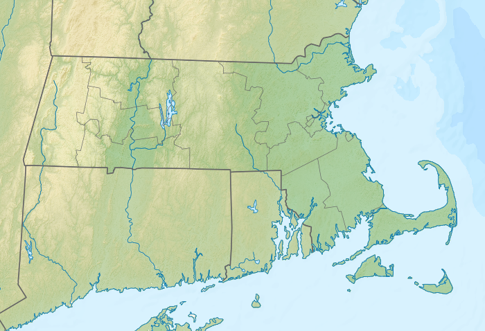
Mount Frissell rises to 2,454 feet (748 m) and is a prominent peak of the Taconic Range. The true summit and the mountain's northern slopes lie within the town of Mount Washington in Massachusetts, while the southern slope descends into the town of Salisbury in Connecticut. Although the highest summit point is in Massachusetts, the highest elevation found within the state of Connecticut is located on Mount Frissell's southern slope, at about 2,379 feet (725 m). For details about the state high point and visitor guidance see Connecticut high point information.
Image gallery
8 Images


Location and surrounding peaks
Frissell sits near the southern crest of the Taconic Ridge, a series of uplands that extend along the New York–New England border region. It is flanked by Mount Ashley to the north, Round Mountain to the southeast, and Brace Mountain to the west. Approximately 1.3 miles (2.1 km) to the east is Bear Mountain, which contains the highest named summit entirely within Connecticut and is often mentioned in the same context as Frissell for visitors interested in the state's high country; see Bear Mountain.
Geology and ecology
Mount Frissell is part of the Taconic Range, which formed by tectonic collisions and uplift during ancient orogenic events. The range is composed primarily of metamorphic and consolidated rocks; steep ridgelines and ledges reflect the area's complex geologic history. Vegetation is typical of northern hardwood forests with species such as maple, birch and beech at lower elevations and cooler-adapted plants in sheltered or higher microclimates. The mosaic of forest, rocky outcrop and small wetlands supports diverse wildlife and native plants, making the area of interest to naturalists and conservationists.
Access and recreation
Large tracts of land on and around Mount Frissell are conserved and provide public access for low-impact recreation. On the Massachusetts side, much land is managed as part of Mount Washington State Forest and adjoining protected parcels; on the Connecticut side the high country is contiguous with preserves such as the Mount Riga area. Marked trails, forest roads and informal paths provide routes to ridgelines and the Connecticut high point; many hikers approach from trailheads on either side of the border. Activities include hiking, birdwatching, seasonal foliage viewing, and winter pursuits such as snowshoeing where permitted. Visitors should consult state and local resources for trail conditions, regulations and safety advisories for Connecticut and Massachusetts before setting out.
Conservation and land management
Management of Mount Frissell and surrounding uplands is shared among state agencies, local municipalities and land trusts. Protected forests and preserves help maintain watershed health, contiguous wildlife habitat and recreational opportunities. Local communities, including Mount Washington and Salisbury, work with regional partners to balance public access with habitat protection and resource stewardship; for municipal information see local services.
History and notable facts
The Frissell area has a history of low-intensity human use, including timbering and small-scale agriculture on lower slopes, followed by growing emphasis on conservation and outdoor recreation. The mountain is frequently visited by hikers aiming to reach the Connecticut high point, a geographic curiosity since the state's highest elevation is not at a distinct summit but on the slope of Frissell. That distinction draws state highpointers and geographers alike.
Quick facts
- Summit elevation: 2,454 ft (748 m).
- Connecticut high point (on southern slope): approximately 2,379 ft (725 m); see state high point resources.
- Range: Taconic Mountains.
- Nearby named peak entirely within Connecticut: Bear Mountain — see Bear Mountain.
- Municipalities: Mount Washington, MA, and Salisbury, CT; local information at municipal resources.
Questions and answers
Q: What is Mount Frissell?
A: Mount Frissell is a peak of the Taconic Range on the border of Massachusetts and Connecticut.
Q: What is the elevation of Mount Frissell?
A: The elevation of Mount Frissell is 2,454 feet (748 m).
Q: Which part of Mount Frissell is in Massachusetts?
A: The peak and northern part of Mount Frissell are in Massachusetts.
Q: Which part of Mount Frissell is in Connecticut?
A: The southern slope of Mount Frissell is in Connecticut.
Q: What is the highest elevation in Connecticut?
A: The highest elevation in Connecticut is 2,379 feet (725 m) and is located on the southern slope of Mount Frissell.
Q: Which mountain summit is the highest in Connecticut?
A: Bear Mountain, located 1.3 miles (2.1 km) to the east of Mount Frissell, is the highest mountain summit in Connecticut.
Q: What are the names of the mountains that border Mount Frissell?
A: The mountains that border Mount Frissell are Round Mountain to the southeast, Mount Ashley to the north, and Brace Mountain to the west.
Related articles
Author
AlegsaOnline.com Mount Frissell — Taconic Range peak on the Massachusetts–Connecticut border Leandro Alegsa
URL: https://en.alegsaonline.com/art/67028
Sources
- americasroof.com : "Mount Frissell"