
Ascension Island
Remote volcanic island in the South Atlantic; a British Overseas Territory known for strategic air and communications facilities, unique ecology and its role in mid‑Atlantic navigation and tracking.
Ascension Island is a remote, sparsely populated island in the central South Atlantic Ocean. It forms part of the British Overseas Territory of Saint Helena, Ascension and Tristan da Cunha and takes its English name from the day of its recorded discovery, Ascension Day. The island’s isolation has shaped a small permanent population and a governance model that blends military, scientific and civilian functions.
Image gallery
10 Images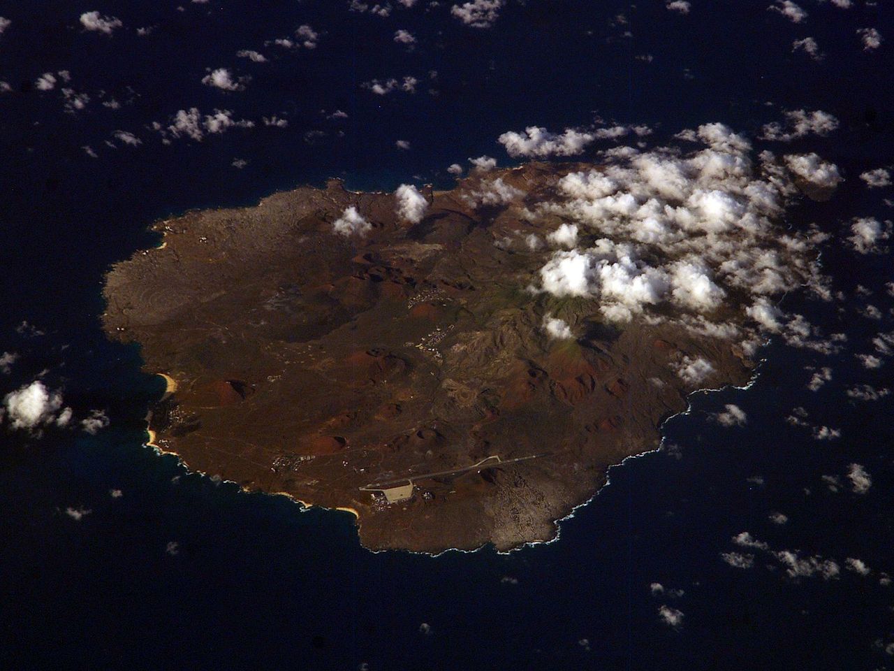


Location and geology
Ascension is an isolated, relatively young volcanic island lying in the central South Atlantic Ocean. It sits roughly west of the mid‑Atlantic Ridge and at sea distances measured from continental points it is several hundred to a few thousand kilometres from nearby coasts: for example, the island lies more than a thousand kilometres from Liberia and from the coast of Brazil near Recife. The nearest inhabited land is the island of Saint Helena, several hundred kilometres to the southeast.
Landscape, settlements and climate
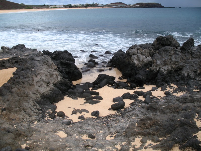
The terrain is volcanic, with rugged lava flows, cliffs and a central high area that supports managed vegetation projects. The principal settlement—Georgetown—is the main service and administrative center and is complemented by smaller clusters of housing near operational facilities. The climate is tropical but relatively dry; freshwater is limited and is obtained from catchment systems, groundwater where available, and desalination. Human activity has altered the original vegetation through introductions and planting programs intended to stabilise soils and increase water capture.
Facilities, communications and strategic role
Despite its small population, Ascension hosts important military and technical infrastructure. It is home to a Royal Air Force presence at an airfield and logistical facilities (Royal Air Force), alongside a notable United States Air Force presence that has supported trans‑Atlantic flights and contingency operations. Scientific and communications installations include a ground tracking and telemetry station operated by the European Space Agency and an associated ESA station, plus relay and broadcasting facilities formerly used by the BBC World Service. The island also hosts a key tracking antenna that contributes to global navigation systems; this antenna is one of a small network that supports the functioning of the GPS constellation and is complemented by sister sites such as Kwajalein, Colorado Springs and Hawaii. The presence of these installations underlines Ascension’s continued strategic and scientific value well beyond its population size. The antenna itself and other transmission arrays are central to the island’s role in international communications and tracking operations (technical antenna).
Ecology and conservation
Ascension supports distinctive island ecosystems with seabird colonies, nesting sea turtles and other wildlife that have adapted to remote conditions. Conservation efforts have focused on protecting endangered seabirds and marine nesting sites, controlling invasive species and restoring habitat. Afforestation and planting programmes carried out in past centuries transformed some upland areas into vegetated zones that improve moisture retention and provide new habitat, though much of the native ecology remains altered or restricted to small refuges.
History and contemporary importance
Discovered by Europeans in the age of sail and named for a feast day, Ascension has served as a waystation, naval base and communication hub across the 19th and 20th centuries. It was used as a staging and refuelling point for ships and aircraft and developed specialised infrastructure for modern telecommunications, space support and navigation. Today the island combines environmental stewardship with an operational profile that supports military logistics, international science and long‑range communications in a uniquely remote setting.
- Key roles: mid‑Atlantic staging, communications relay, space and navigational tracking.
- Notable features: volcanic landscape, limited freshwater resources, active conservation programmes.
- Administration: part of a British Overseas Territory with a small resident community and rotating technical staff.
Questions and answers
Q: Where is Ascension Island located?
A: Ascension Island is located in the South Atlantic Ocean, some 100 km west of the mid-Atlantic Ridge, 1,504 km from Liberia (Cape Palmas), and 2,232 km from Brazil (Recife).
Q: What is the nearest land to Ascension Island?
A: The nearest land to Ascension Island is Saint Helena, 1,296 km to the south-east.
Q: How did Ascension Island get its name?
A: Ascension Island is named after Ascension Day, the day of its recorded discovery.
Q: What is the political status of Ascension Island?
A: Ascension Island is part of the British Overseas Territory of Saint Helena, Ascension and Tristan da Cunha, of which the main island is St Helena.
Q: What important infrastructure is located on Ascension Island?
A: Ascension Island hosts a Royal Air Force station with a United States Air Force presence, a European Space Agency station, and the BBC World Service Atlantic Relay Station. There is also one antenna of the five that assist in the operation of the Global Positioning System (GPS) navigational system.
Q: How old is Ascension Island?
A: Ascension Island is relatively young, as it is a volcanic island.
Q: How far away are the other GPS navigational system antennas located?
A: The other four GPS navigational system antennas are located on Kwajalein Island, Diego Garcia, Colorado Springs, and Hawaii.
Related articles
Author
AlegsaOnline.com Ascension Island Leandro Alegsa
URL: https://en.alegsaonline.com/art/6464
Sources
- birdlife.org : "St Helena (to UK)"
- legislation.gov.uk : "The St Helena, Ascension and Tristan da Cunha Constitution Order 2009"
- mysterra.org : "Ascension History"
- darwin-online.org.uk : "Charles Darwin's Beagle diary"
- onlinelibrary.wiley.com : "The parable of Green Mountain: Ascension Island, ecosystem construction and ecological fitting"
- doi.org : 10.1046/j.0305-0270.2003.01010.x
- weatherbase.com : "Georgetown, Ascension Island Köppen Climate Classification"