Mexico–United States border
The international boundary between Mexico and the United States, spanning from the Pacific to the Gulf of Mexico; its geography, history, crossings, governance, environmental and social impacts.
Overview
The international border between the United States and Mexico stretches roughly 3,169 km (1,969 mi) from the Pacific to the Gulf of Mexico. Its western terminus lies near Imperial Beach, California and Tijuana, and its eastern end near Matamoros, Tamaulipas and Brownsville, Texas. The border is one of the busiest land frontiers in the world, serving as a conduit for people, commerce and cultural exchange while being subject to national regulations and bilateral agreements.
Image gallery
10 Images


Geography and environment
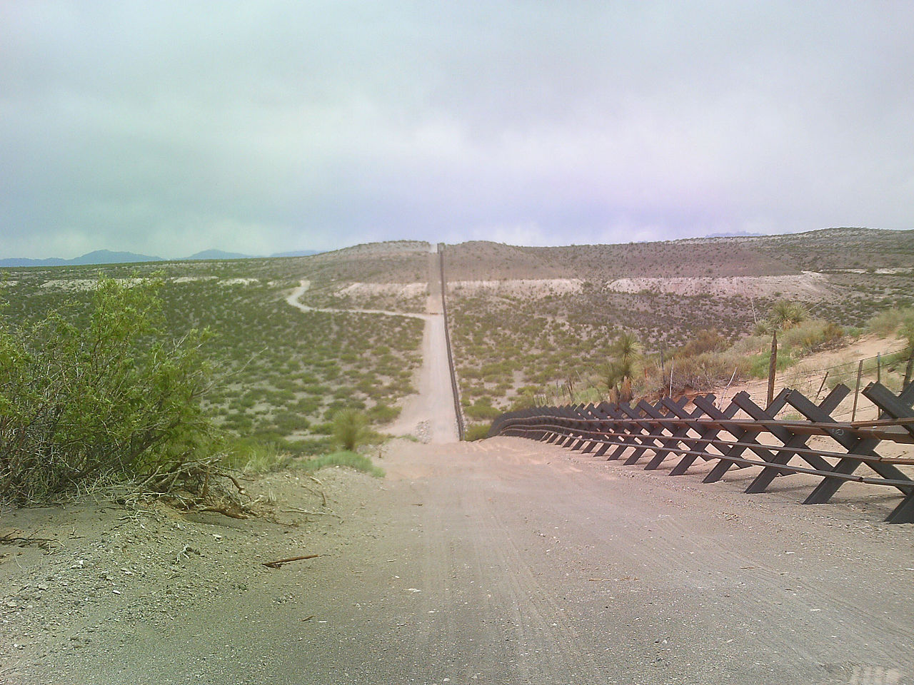
The line traverses a variety of terrains, from dense urban zones to agricultural valleys and sparsely populated desert. On the Pacific coast it separates San Diego and Tijuana and cuts across the Mexican state of Baja California. Eastward the boundary follows natural features in places, including the Gulf of Mexico shore and the Rio Grande (Río Bravo del Norte), which forms much of the eastern segment and runs past cities such as El Paso and Ciudad Juárez. Between watercourses the line crosses extensive arid areas, including the Sonoran Desert and other deserts, and approaches inland wetlands near the Colorado River delta before reaching the Pacific Ocean.
History and governance
The present international boundary reflects 19th-century treaties, surveys and land transfers that followed armed conflicts and diplomatic negotiations. Subsequent bilateral commissions and agreements have established border monuments, water sharing rules and procedures to address shifts in river channels. Governance involves federal and subnational authorities on both sides as well as binational institutions that coordinate technical, legal and humanitarian matters.
Crossings, infrastructure and regulation
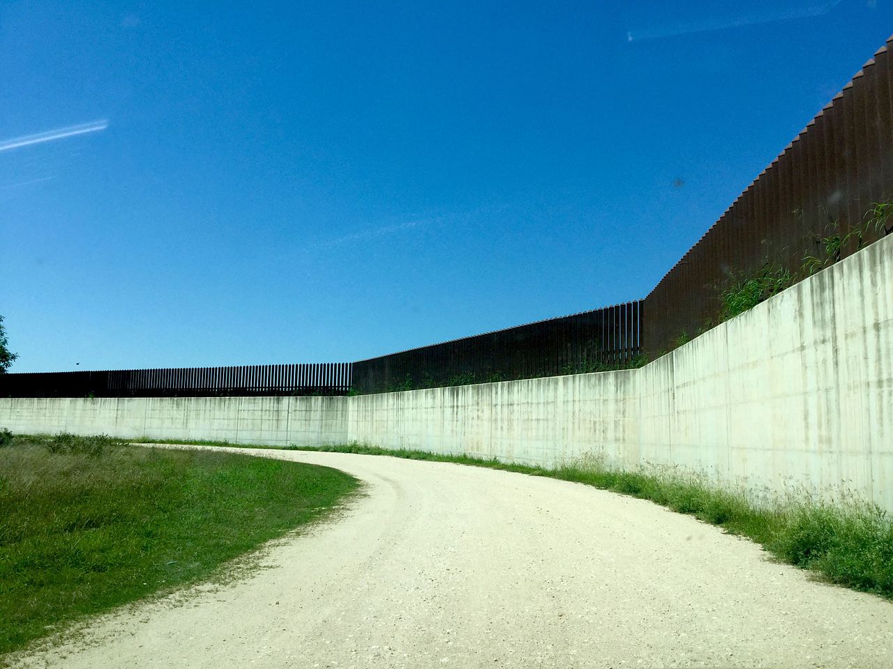
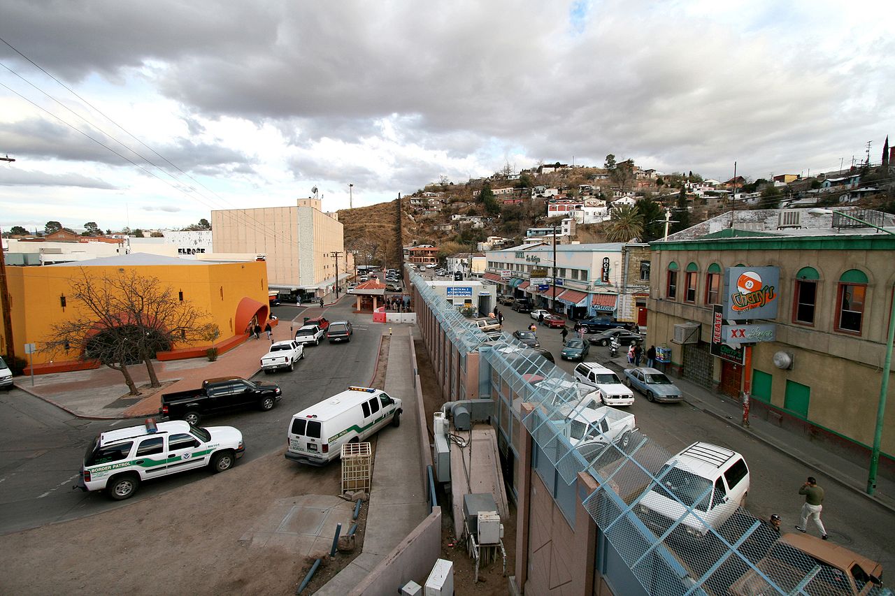
Official ports of entry include bridges, vehicle checkpoints and pedestrian facilities managed by customs and immigration agencies. Infrastructure ranges from large multi-lane international bridges in metropolitan areas to isolated inspection stations in rural sectors. Governments have built barriers, fences and surveillance systems in selected stretches; at the same time, many crossings remain open to lawful traffic under customs and immigration control. Major urban crossings routinely process large daily flows of commuters, tourists and commercial vehicles.
Security, migration and human impact
Migration across the border has long been shaped by economic opportunity, family ties and regional cycles of labor demand. Enforcement and security measures aim to control unlawful entry and transnational crime while humanitarian concerns focus on search-and-rescue, shelter and due process for asylum seekers. The desert environment creates significant risks for migrants; local organizations and authorities on both sides work to reduce loss of life and provide aid.
Economy and trade
Cross-border trade and integrated supply chains are central to the economies of border states. NAFTA and its successor arrangements established frameworks that lowered many trade barriers and increased manufacturing links. Border communities host maquiladora plants, logistics hubs and service sectors that depend on cross-border flows of workers and goods. Economic interdependence extends to labor markets, retail and tourism.
Environment and wildlife
Environmental issues include shared water resources, pollution, habitat fragmentation and the protection of migratory species. Coordinated management is necessary to address water allocation on rivers such as the Rio Grande and the Colorado River, to mitigate industrial and urban runoff, and to maintain wildlife corridors across desert and riparian zones.
Institutions and cooperation
Binational bodies and local partnerships coordinate infrastructure projects, emergency response, public health measures and environmental programs. Municipal, state and federal agencies on both sides maintain dialogue to manage border crossings, trade facilitation and shared resources, while civil society organizations support cross-border civic, cultural and humanitarian initiatives.
Notable crossings and regional examples
- San Diego–Tijuana: one of the largest urban cross-border regions.
- El Paso–Ciudad Juárez: major trade and family-crossing corridor.
- Brownsville–Matamoros: eastern Gulf gateway in the Rio Grande delta region.
- Border states and regions such as Chihuahua and Texas illustrate varied local dynamics.
Statistics, challenges and outlook
Binational authorities report the total boundary length and publish data on crossings, trade tonnage and water allocations. Current challenges include balancing security with humanitarian obligations, managing environmental stresses, and modernizing infrastructure to handle commerce and migration efficiently. Future policy will continue to require cooperative, evidence-based approaches that recognize the historical ties and practical interdependence of communities on both sides of the border.
For further reading and official information consult government and binational sources, local research centers, and cross-border organizations that document legal frameworks, environmental studies and migration trends.
Questions and answers
Q: Where does the US-Mexico border start and end?
A: The US-Mexico border starts at Imperial Beach, California, and Tijuana, Baja California in the west and ends at Matamoros, Tamaulipas, and Brownsville, Texas in the east.
Q: What type of terrain does it cover?
A: The US-Mexico border covers a variety of terrains ranging from major urban areas to inhospitable deserts.
Q: How long is the US-Mexican border?
A: The total length of the US-Mexican border is 3169 km (1969 mi).
Q: Is it considered an open border?
A: Yes, the US-Mexican border is considered an open border.
Q: How many crossings occur per year on average?
A: On average there are approximately 350 million crossings per year on the US-Mexican Border.
Q: Does it follow any rivers or other bodies of water?
A: Yes, from the Gulf of Mexico it follows the course of Rio Grande (Río Bravo del Norte) to El Paso, Texas and Ciudad Juárez Chihuahua before crossing vast tracts of Sonoran and Chihuahuan Deserts then crossing Colorado River Delta to San Diego and Tijuana before reaching Pacific Ocean.
Related articles
Author
AlegsaOnline.com Mexico–United States border Leandro Alegsa
URL: https://en.alegsaonline.com/art/64344
Sources
- pbs.org : pbs.org
- ibwc.gov : "United States Section Directive"
- cnsnews.com : "Senate Democratic Whip Compares Sealing the Mexican Border to Trying to Keep Drugs Off of I-95"
- books.google.com : Retirement Without Borders: How to Retire Abroad--in Mexico, France, Italy, Spain, Costa Rica, Panama, and Other Sunny, Foreign Places
- books.google.com : Guinness World Records 2009
- france24.com : "US, Mexico open first new border crossing in 10 years"