
Mato Grosso: geography, history, ecosystems and contemporary issues
Mato Grosso is a large state in western Brazil known for its Amazon, Cerrado and Pantanal regions, agricultural expansion, indigenous cultures and ongoing conservation and land-use challenges.
Overview
Mato Grosso is a federative state in Brazil, occupying a broad swath of the country’s western interior. Its name, which translates as "thick bush" or "dense forest", reflects the region's historical coverage of tropical forest and savanna. It borders several Brazilian states including Rondônia, Pará, Tocantins, Goiás and Mato Grosso do Sul, and shares an international boundary with Bolivia. The state capital is Cuiabá, which serves as the principal administrative and transport hub.
Image gallery
10 Images



Geography and ecosystems
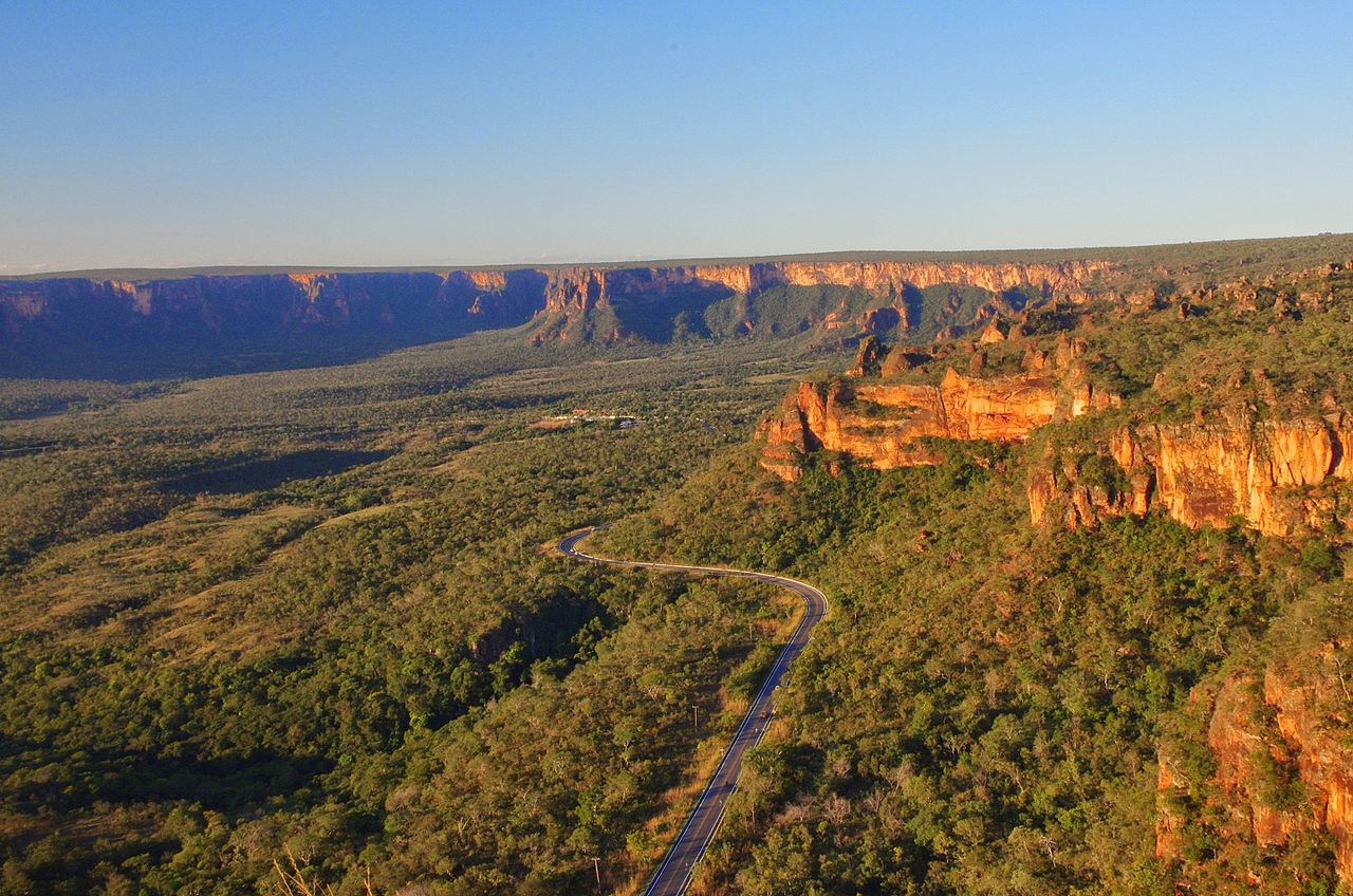
Mato Grosso stands out because three major South American biomes meet within its borders: the Amazon rainforest to the north and northwest, the Cerrado savanna in the central plateau, and the Pantanal wetlands to the south. Major rivers cross the state and feed regional watersheds, creating a mosaic of forests, seasonal wetlands and open country that supports high biodiversity and distinct ecological processes.
Key features
- Biomes: Amazon, Cerrado and Pantanal.
- Hydrology: several tributaries of major Amazon and Paraguay basin rivers.
- Land use: a patchwork of protected areas, ranches, farms and frontier settlements.
History and peoples
The territory of Mato Grosso has long been inhabited by Indigenous peoples, including the Bororo and several other groups who maintain cultural and territorial ties to the land. Colonial and republican-era expansion gradually brought mission settlements, cattle routes and later agricultural frontier projects. In 1977 the state was administratively divided, producing the separate state now known as Mato Grosso do Sul, a change that reshaped regional governance and development patterns.
Economy and environmental challenges
The state's economy relies heavily on agriculture and ranching—soybeans, cotton and cattle are among the principal commodities—which has driven rapid land-use change over recent decades. This transformation has placed Mato Grosso at the center of debates about Amazon loss: large-scale clearing and the conversion of native vegetation have contributed significantly to regional deforestation and greenhouse gas emissions. Efforts to balance production and conservation include protected areas, indigenous territories and emerging sustainable practices.
Conservation, research and notable facts
Mato Grosso contains important protected reserves and parts of the Pantanal, one of the world’s largest tropical wetland systems, whose seasonal floods sustain diverse fish and bird populations. The state is a focus for ecological research, restoration projects and policies aimed at reducing clearing and improving land stewardship. Visitors and researchers alike are drawn by the region’s ecological variety and by ongoing efforts to reconcile economic development with the protection of habitats and Indigenous rights.
For more context and resources on administration, environment and cultural heritage see official and educational links: state overview, regional maps, neighboring states, Amazon connections, ecosystem profiles, agricultural data, state division, international border, conservation issues and historical reform.
Questions and answers
Q: Where is Mato Grosso located?
A: Mato Grosso is located in the western part of Brazil.
Q: Which states share borders with Mato Grosso?
A: Mato Grosso shares borders with the states of Rondônia, Amazonas, Pará, Tocantins, Goiás and Mato Grosso do Sul.
Q: Which country borders Mato Grosso to the southwest?
A: Mato Grosso borders Bolivia to the southwest.
Q: What does the name "Mato Grosso" mean?
A: The name "Mato Grosso" means "thick jungle".
Q: Which state in Brazil has the most deforestation of the country's part of the Amazon Rainforest?
A: Mato Grosso is the state in Brazil that has experienced the most deforestation of Brazil's part of the Amazon Rainforest.
Q: When was Mato Grosso split into two halves?
A: Mato Grosso was split into two halves in 1977.
Q: Which native people live in the Mato Grosso area?
A: The Bororo native people live in the Mato Grosso area.
Tags
Related articles
Author
AlegsaOnline.com Mato Grosso: geography, history, ecosystems and contemporary issues Leandro Alegsa
URL: https://en.alegsaonline.com/art/62842
Sources
- ibge.gov.br : ibge.gov.br/