Arros (river)
Arros is a river in southwestern France (Occitanie) flowing through Hautes-Pyrénées and Gers to join the Adour. Its valley, historically part of the County of Bigorre, supports agriculture, local communities and riparian habitats.
The Arros is a modest river in southwestern France that forms part of the Adour drainage system. Its location is sometimes cited with its map coordinates 43°39′46″N 0°1′42″W. The watercourse itself (river) runs within southwestern France, principally through the departments of Hautes-Pyrénées and Gers, two administrative departments of the Occitanie region. It is a right tributary of the Adour, joining that larger river and contributing to its basin.
Image gallery
7 Images


Course and characteristics
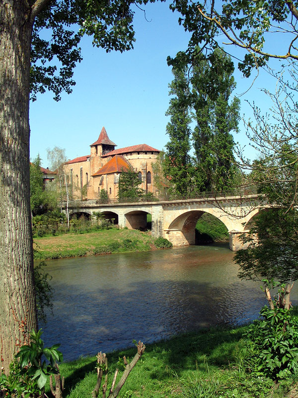
The Arros rises in the lower foothills and upland landscapes of the Pyrenean fringe. From its headwaters it follows a generally northward and northwestward route across mixed farmland, small woodlands and village settlements before meeting the Adour. As a regional waterway it is relatively modest in scale: it has a clear channel with seasonal variation in flow, a narrow floodplain in places, and a mixture of natural banks and sections altered by past land use.
History and cultural landscape
The valleys of the Arros and the Adour have been a continuous human landscape for centuries. In medieval times both valleys lay within the historic County of Bigorre; the Arros valley was often referred to as the Rivière-Haute ("Upper River"), in contrast to the Adour valley called the Rivière-Basse ("Lower River"). Local place names, old roads and former mills attest to the river's role in agriculture and rural life.
Ecology, uses and recreation
The Arros supports riparian vegetation and provides habitat for a range of freshwater and marginal species typical of southwestern French lowland rivers. Along its course it is used for irrigation in nearby fields, for small-scale recreational fishing and for rural leisure activities such as walking. Local authorities and landowners manage the river corridor to balance flood protection, agricultural needs and habitat conservation.
Notable facts and practical information
- Administrative setting: flows through Hautes-Pyrénées and Gers in Occitanie.
- Hydrological role: a right-bank tributary feeding the Adour basin.
- Cultural link: part of the historic landscape of the County of Bigorre, with the Arros valley known as the Rivière-Haute.
- Recreation and management: valued locally for agriculture, biodiversity and outdoor activities.
Further geographic or administrative details are typically available from regional mapping and local environmental resources (map, departmental pages). For historical or cultural research related to the valley and the County of Bigorre, consult local archives and regional heritage guides (regional sources).
Questions and answers
Q: Where is the Arros river located?
A: The Arros river is located in southwestern France, flowing through the Hautes-Pyrénées and Gers departments in the Occitanie region.
Q: What is the Arros river a tributary of?
A: The Arros river is a right tributary of the Adour river.
Q: What were the valleys of the Arros and Adour rivers part of historically?
A: The valleys of the Arros and Adour rivers were historically part of the Comté de Bigorre, also known as the "County of Bigorre."
Q: What nickname was the valley of the Arros given?
A: The valley of the Arros was called the Rivière-Haute, which means "Upper River."
Q: What was the nickname of the valley of the Adour?
A: The valley of the Adour was called the Rivière-Basse, which means "Lower River."
Q: What are the coordinates of the Arros river?
A: The coordinates of the Arros river are 43°39′46″N 0°1′42″W / 43.66278°N 0.02833°W / 43.66278; -0.02833
Q: What region is the Arros river located in?
A: The Arros river is located in the Occitanie region of France.
Tags
Related articles
Author
AlegsaOnline.com Arros (river) Leandro Alegsa
URL: https://en.alegsaonline.com/art/6160
Sources
- commons.wikimedia.org : Arros
- sandre.eaufrance.fr : "L'Arros (Q0--0250)"
- hydro.eaufrance.fr : "L'Arros à Juillac"
- geoportail.gouv.fr : "Source de l'Arros"
- geoportail.gouv.fr : "Confluence de l'Arros"