Malwa
![]()
The title of this article is ambiguous. For other meanings, see Malwa (disambiguation).
Malwa (Malwi: माळवा, Māḷavā) is a region in west-central North India, occupying a plateau of volcanic origin in the western part of the state of Madhya Pradesh. This region was a separate political entity from the time of the Malawa tribe of India until the merger of the British Malwa Agency in Madhya Bharat (1947). Despite boundary shifts throughout history, it has developed its own specific culture and language.
The plateau that occupies a large part of the region is called the Malwa Plateau after the region. Its mean elevation is 500 meters and the landscape generally slopes towards the north. Most of the region is drained by the Chambal and its tributaries, and the western part by the headwaters of the Mahi. At the time of Malwa's independence, Ujjain was the political, economic and cultural capital of the region; today Indore, as the largest city, forms the economic centre. Overall, most of Malwa's people are engaged in agriculture. For example, the region is one of the most important opium producers in the world. However, cash crops such as cotton and soybeans are also grown. Another important economic sector is textile production.
Malwa includes the districts of Dewas, Dhar, Indore, Jhabua, Mandsaur, Neemuch, Rajgarh, Ratlam, Shajapur, Ujjain, and parts of Guna and Sehore, as well as the Jhalawar district of the state of Rajasthan and parts of Bansware and Chittorgarh. Malwa is bounded by the Hadoti region to the north, Mewar to the northwest, and Vagad and Gujarat to the west. Sometimes Nimar in the south of the Vindhyas is still included in Malwa politically and administratively. Geologically, however, the term Malwa Plateau refers to the volcanic highlands south of the Vindhyas that comprise Malwa, extending eastward to the upper Betwa Basin and the headwaters of the Dhasan and Ken rivers. The region has a tropical climate with dry deciduous forests that are home to several tribes, including the Bhil. Culturally, the region has been influenced by the cultures of Gujarat, Rajasthan and Maratha. The most common language, especially in rural areas, is Malwi, while Hindi is mostly used in urban areas. Ujjain, Mandu, Maheshwar, Omkareshwar and Indore serve as tourist attractions.
The first significant kingdom of the region was Avanti, a major power of western India at the transition from the 6th to the 5th century BC. In the 4th century BC, the region was annexed by the Maurya Empire. The late Gupta Empire in the 5th century AD was a golden period in Malwa's history. The dynasties of the Parmaras (Sultans of Malwa) and the Marathas ruled Malwa time and again. Leading artists and scientists were born in this region, including the poet and writer Kalidasa, the author Bhartrihari, the mathematicians and astronomers Varahamihira and Brahmagupta, and the polymath King Bhoja.
History
Several dwellings of the Early Stone Age and the Old Palaeolithic have been excavated in eastern Malwa. The name "Malwa" itself is derived from the name of the ancient Aryan tribe of Malava, about whom little is known except that the Bikram Sambat dates back to them. This is a calendar dating from 57 BC, used in much of India and generally associated with King Chandragupta Vikramaditya. The name of the Malava is in turn derived from the Sanskrit term "Malav" meaning "part of the abode of Lakshmi". The settlement area of the Malwa or Moholo is identified with present-day Gujarat, according to the mention of the 7th century Chinese traveller Xuanzang. The region is mentioned as Malibah in Arabic records such as the Kamilu-t Tawarikh Ibn Asir.
Ujjain, historically known as Ujjaiyini or Avanti, emerged as the first major center of the Malware region during the second wave of urbanization of India in the 7th century BCE (the first wave of urbanization is best known as the Indus culture). Around 600 BC, Ujjain, which was then of considerable size, was surrounded by an earthen wall. Avanti was one of the well-known Mahajadpadas (kingdoms) of the Indo-Aryans. In the post-Mahabharata period, around 500 B.C., Avanti was still among the important kingdoms of western India; it was ruled by the Haihayas, a people who probably arose from an amalgamation of Indo-Aryans and descendants of the aborigines, and who were responsible for the decline of Naga power in western India.
The region was conquered by the Maurya Empire in the mid-4th century BC. After the death of Ashoka, a Maurya emperor who was governor of Ujjain in his youth, in 232 BC, the Maurya Empire began to collapse. Although there is little evidence, it is believed that Malwa was probably ruled by the Kushans and Saks in the second and first centuries BC. Dominance over this region was the subject of conflict between the western Kshatrapas and the Satavahanas in the first three centuries of our era. Already in the first century Ujjain developed into a great trading centre.
During the reign of Chandragupta II (375-413 AD), also known as Vikramaditya, who conquered the region and expelled the secular Kshatrapas, Malwa became part of the Gupta Empire. This Gupta period is generally regarded as the golden period in Malwa's history, when Ujjain served as the western capital of the empire. Kalidasa, Aryabhata and Varahamihira hailed from Ujjain, which became a great centre of science, especially astronomy and mathematics. Around 500, Malwa rose again from the crumbling Gupta Empire as a separate kingdom; in 528, Yasodharman of Malwa defeated the Alchon, who invaded India from the northwest. In the seventh century, the region became a part of Harsa's empire, which disputed with King Pulakesin II of the Chalukya dynasty of Badami in the Deccan.
The region was conquered in 786 by the kings of the Rashtrakuta dynasty from the Deccan, who disputed it with the kings of the Pratihara dynasty from Kannauj until the beginning of the tenth century. From the middle of the tenth century, Malwa came under the rule of the Paramara dynasty of Rajputs, who made Dhara their capital. King Bhoja (circa 1010-1060) is considered the great universally gifted philosopher-king of the Indian Middle Ages; his voluminous writings cover philosophy, poetry, medicine, veterinary science, phonetics, yoga, and archery. Under his rule, Malwa became the intellectual center of India. Bhoja is also credited with the founding of the city of Bhopal, which was to secure the eastern part of his kingdom. His successors ruled until about 1200, when Malwa was conquered by the Delhi Sultanate.
Dilawar Khan Gori, formerly governor of Malwa under the rule of the Delhi Sultanate, declared himself Sultan of Malwa in 1401 after the Mongol conqueror Timur attacked Delhi, causing the breakup of the Sultanate into smaller states. Khan thus established the Malwa Sultanate, and his son Hoshang Shah built Mandu, situated high in the Vindhya Mountains overlooking the valley of the Narmada, into a residence and capital. Hoshang's son, Ghazni Khan, could hold on to power for only a year. He was succeeded by Sultan Mahmud Khalji (1436-1469), the first of the Khalji sultans of Malwa, who expanded the state to include parts of Gujarat, Rajasthan and the Deccan. The Muslim sultans invited the Rajputs to settle in the country. However, in the 16th century, the Sultan sought help from the Sultans of Gujarat in containing the increasing power of the Rajputs, while they in turn sought assistance from the kings of the Sisodhya clan of Rajputs who ruled Mewar. Gujarat stormed Mandu in 1518 and 1531, after which the Malwa Sultanate collapsed a short time later. Akbar I, emperor of the Mughal Empire, conquered Malwa in 1563 and fashioned it into a province of his empire. Mandu was finally abandoned in the 17th century.
When the Mughal Empire lost its power after 1700, the Maraths took over the rule of Malwa. Nemaji Shinde and Chimnaji Damodar were the first Marathi generals to cross the Maharashtra border to invade Malwa in 1698. In 1724, Malharrao Holkar (1694-1766) became commander-in-chief of the Marathi forces in Malwa, and in 1733 he was given control of most of the region after the Mughals officially resigned in 1738. Ranoji Scindia noted that the Marathi commander established his headquarters at Ujjain in 1731. This seat of government was later shifted to Gwalior by Daulatrao Scindia. Another Marathi general, Anand Rao Pawar, set himself up as Raja of Dhar in 1742, and the two Pawar brothers became Rajas of Dewas. In the late 18th century, Malwa became the scene of fighting between the rival forces of the Maraths and the headquarters of the Pindari, extra-regular raiders. The Pindari were wiped out by a campaign of the British general Baron Hastings, and further regulations were introduced under John Malcolm. The Holkar dynasty ruled Malwa from Indore and Maheshwar on the Narmada until 1818, when the Maraths were defeated by the British in the Third Marath War and Indore, ruled by the Holkars, became a princely state of British India. After 1818, the British incorporated the numerous princely states of central India into the Central India Agency; the Malwa Agency was a division of it, having an area of 23,100 sq. km. and a population of 1,054,753 (as of 1901). It consisted of the states of the Dewas (senior and junior branches), Jaora, Ratlam, Sitamau and Sailana, together with a large portion of Gwalior, parts of Indore and Tonk, and about 35 small estates and holdings. Political power was exercised from Neemuch. With India's independence (1947), the Holkars and other princes joined India, and most of Malwa became part of the new state of Madhya Bharat, which was incorporated into Madhya Pradesh in 1956.
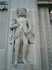
Sculpture of a Holkar court servant from Fort Ahilya
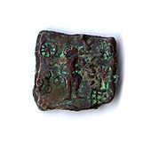
Depiction of Kartikeya and Lakshmi on a coin; Ujjain; c. 150-75 BC.
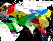
Location of Malwa in comparison to other states around 1200 AD before the conquest by the Delhi Sultanate.
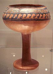
Ceramic cup from Navdatoli, Malwa, c. 1300 BC.
Geography
Malwa extends on a plateau in western Madhya Pradesh and southeastern Rajasthan (between 21° 11' north, 73° 45' east and 25° 10' north and 79° 14' east) with Gujarat to the west. To the south and east are the Vindhya Mountains, and to the north the Bundelkhand Plateau. The plateau is an extension of the Deccan Trapp, which was formed about 68 to 68 million years ago at the end of the Cretaceous period. The soils of this region belong mainly to the black, brown and stony earths. The volcanic, clayey soil in this region owes its black color primarily to the high iron content of the basalt from which it was formed. These soils require less irrigation due to their high moisture storage capacities. The other two soil types are lighter and have a higher sand content.
The average altitude of the plateau is 500 meters, but there are some peaks of over 800 meters at Sigar (881 meters), Japanav (854 meters) and Ghajari (810 meters). The plateau is generally sloping towards the north. The western part of the Regin is drained by the Mahi, while the Chambal drains the central part and the Betwa and the headwaters of the Dhasan and Ken drain the eastern part of the region. The Shipra is of historical importance because of the Simhasth mela, which takes place every 12 years. Other rivers worth mentioning are the Parbati, Gambhir and the Choti Kali Sindh. Its altitude gives Malwa a mild, pleasant climate; a cool morning breeze, the Karaman, and an evening breeze, the Shab-e-Malwa, also make summers less hot.
The year is usually divided into three seasons: Summer, rainy season and winter. Summer covers the months of Chaitra to Jyestha (mid-March to mid-May). During these months, the average daytime temperature is 35 °C, rising to around 40 °C on some days. The rainy season begins with the first showers of Aashaada (mid-June) and lasts until mid-Ashvin (September). The greatest rainfall occurs under the influence of the southwest monsoon and ranges from 1000 mm in the west to 1650 mm in the east. Indore and the immediately surrounding areas receive an average of 1400 mm of rainfall annually. The growing season, during which average daily temperatures are usually between 20 and 30 °C, lasts between 90 and 150 days. Winter is the longest of the three seasons and lasts about five months (mid-Ashvin to Phalgun, which is from October to mid-March). Average daytime temperatures are usually between 15 and 20 °C; they can drop to around 7 °C during some nights. Some farmers claim that an occasional winter shower during the months of Pausha and Maagha has a positive effect on early summer wheat crops.
The region is part of the Kathiarbar-Gir dry deciduous forest ecoregion. Its natural vegetation is tropical dry forests and scattered teak forests. The most common tree species are Butea, Bombax, Anogeissus, Acacia, Buchanania and Boswellia. The most common smaller tree species and shrubs include Grewia, Indian Jujube, Casearia, Prosopis, Capparis, Woodfordia, Phyllanthus and Carissa. Fauna mainly includes cloven-hoofed animals like sambar, deer-goat antelope and Indian gazelles. During the last century, deforestation progressed rapidly, leading to environmental problems such as acute water scarcity and the threat of desertification.
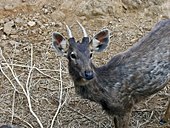
The sambar is one of the most widespread wild animals in the region. .
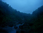
The Vindhya Mountains border the plateau to the south and are the source of many rivers in the region.
Search within the encyclopedia