Malta — island nation in the central Mediterranean
Malta is a small, densely populated island republic in the central Mediterranean. Noted for its prehistoric sites, strategic history, English and Maltese languages, tourism, and EU membership.
Overview
Malta is a sovereign island state in Southern Europe, situated near the centre of the Mediterranean Sea. It is a member of the European Union and lies south of Sicily in the central Mediterranean basin; the relationship with Sicily is often noted in regional descriptions of Southern Europe and of the Mediterranean Sea. The capital city is Valletta. With an area of about 316 square kilometres it is one of the smallest countries by land area, and with roughly half a million residents it ranks among the world’s most densely populated nations.
Image gallery
10 Images


Geography and environment
The Maltese archipelago comprises three inhabited islands—Malta, Gozo and Comino—and several smaller islets. The islands are predominantly low-lying, formed of limestone, and have limited natural fresh water. The climate is Mediterranean, with mild, wet winters and hot, dry summers. Urban development has linked many settlements so towns and cities are closely spaced; this pattern is reflected in descriptions of Malta’s compact urban landscape and the historic clusters of communities known locally as the Three Cities and other dense conurbations.
History and heritage
Malta has a long recorded history. Its prehistoric temples and megalithic structures are among the oldest free-standing stone buildings in the world. Over centuries the islands were part of Phoenician, Roman, Byzantine and Arab spheres, and later were shaped by medieval and early-modern European powers. The legacy of the Knights Hospitaller left substantial fortifications and the planning of Valletta. British rule ended when Malta became independent in 1964 and a republic in 1974; the country joined the EU in 2004.
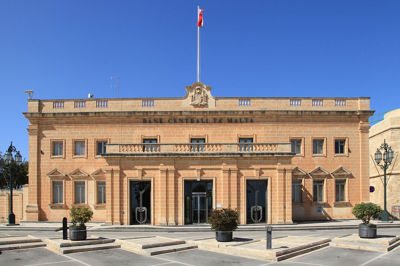
Government, language and economy
Malta is a parliamentary republic. Maltese and English are official languages, a reflection of local tradition and long ties with Britain. The euro is the national currency. The economy depends on tourism, financial and professional services, maritime trade, information technology and film production. Limited land and resources have influenced economic choices and urban planning.
Culture and notable facts
Maltese culture blends Mediterranean and European influences. Local traditions include festas (village feasts), a distinct Maltese language written in the Latin alphabet, and a cuisine that mixes Italian, North African and British elements. Malta’s coastline and clear sea make it a popular destination for diving and boating. Important cultural and archaeological sites are protected and some are listed by international conservation bodies.
Quick facts
- Location: central Mediterranean Sea, south of Sicily.
- Capital: Valletta.
- Population: about 500,000; noted for high population density (density).
- Area: approximately 316 km².
- Urban pattern: many cities and towns are closely spaced across the main island.
For visitors and researchers, Malta offers a compact mix of archaeological heritage, fortified towns, and maritime landscapes whose influence on Mediterranean history has been outsized relative to the country’s small territory.
Geography
With an area of 316 square kilometres, Malta is one of the dwarf states, slightly smaller than the city of Bremen and just under twice the size of Liechtenstein. The Maltese archipelago lies 81 kilometres south of the coast of Sicily, 350 kilometres north of the Libyan port city of al-Chums, 150 kilometres northeast of Lampedusa and about 285 kilometres southeast of the Tunisian peninsula of Cap Bon. It is the only country in the European Union, apart from Cyprus, that lies entirely south of the 37th parallel.
The main island of Malta (Maltese Malta) is 246 square kilometres in size, facing southeast and reaching a length of 28 and a maximum width of 13 kilometres. Between its northwestern end and the second main island, Gozo (Maltese Għawdex), stretches the 4.4-kilometre-wide Gozo Channel, which contains the 2.7-square-kilometre island of Comino (Kemmuna) and the uninhabited rocky islet of Cominotto (Maltese Kemmunett). Gozo, 67 square kilometres in size, measures 14.3 kilometres in length and up to 7.25 kilometres in width from east to west. The state's other islands - all uninhabited - are Filfla, 4.4 kilometres south of Malta, and Saint Paul's Islands (Gżejjer ta' San Pawl in Maltese), at the northern end of St Paul's Bay, which lie 83 metres offshore and are in fact contiguous, though their junction can be washed over in rough seas. In western Gozo, on the Black Lagoon near Dwejra Point, the 60-metre-high Fungus Rock (Maltese Il-Ġebla tal-Ġeneral) rises out of the sea, a large limestone outcrop. Manoel Island (Maltese Il-Gżira Manwel) in Marsamxett Harbour between Valletta and Sliema is no longer commonly counted as an island, as it is connected to the mainland by a causeway and a road.
The most characteristic geographical feature of Malta is the diversity of its coastlines, which is particularly evident on the main island. While the east and north-east sides are characterised by flat beaches and wide bays such as Marsaxlokk Bay, Marsamxett Harbour, Grand Harbour, Mellieħa Bay and St Paul's Bay, the south-west and north have very sharply defined coastlines with rock formations and grotto-like inlets. On this side, Malta rises very ruggedly from the sea, forming elongated cliffs that culminate at the Dingli Cliffs in Ta' Dmejrek, the highest elevation in the country at 253 metres. Other karst ridges are found in the northwest with the Mellieħa Ridge, the Bajda Ridge and the Marfa Ridge, which rises up to 122 metres. The highest elevations of Gozo measure 127 meters.
Due to the extreme lack of water (see section on water supply), there are no permanent rivers on Malta, Gozo and Comino. After heavy rainfall in winter, some dried-up streambeds may temporarily fill with rainwater. These mostly small rivulets converge in narrow rocky valleys, the wieds, where they do not evaporate so quickly. The longest intermittent stream can be observed in the Wied il-Għasri, which drains into a fjord-like sea bay on the north coast of Gozo. The only major lake in the archipelago is man-made and is located within the Għadira Nature Reserve on the isthmus off Marfa Ridge just under two kilometres northwest of Mellieħa. It measures 350m by 220m and has numerous inland islands.
Geology
General presentation
The geological history of Malta began at the end of the Tertiary period, when a land bridge existed between southern Sicily and northern Africa, dividing the early Mediterranean into two basins. After rising sea levels flooded these, sediments of coral and shell limestone were deposited at the site of the present-day archipelago during the Palaeocene, some 60 million years ago. Over the course of the geological eras, deposits of globigerine limestone and blue clay followed, and in the Oligocene, sandstone and another coralline layer. Finally, in the Pliocene, the islands slowly rose from the sea. During the Würm Ice Age, the sinking water level again formed the land bridge, but it was finally broken with the end of the ice age just over 13,000 years ago. The Maltese islands lie in the zone between the Eurasian and African tectonic plates, but for centuries Malta was considered an island of North Africa.
After the emergence of the islands, the surface of the main island tilted towards the northeast over the course of several centuries due to the still unstable base, so that the southwestern coast was raised and the steep edges with the Dingli Cliffs formed. Malta is criss-crossed by several tectonic faults which, although small by global standards, shape the geological relief of the islands. Two fault systems dominate: the older Great Fault, which extends in many separate sections for five kilometres from the south-western coast to the north-east, and the younger Magħlaq Fault. The latter runs from northwest to southeast and was responsible, among other things, for the formation of the plateau on the small island of Filfla off the coast of Malta.
Sediments that can be found in the Maltese islands are the blue clay, the Globigerine limestone (subdivisible into upper, middle and lower) and the upper greensand, a division of the Cretaceous formation. Upper greensand is very clayey and sandy, rich in chlorite, its upper layers are chalky and may change to chloristic chalk. In Gozo there is a mixture of these different soil constituents, whereas in Malta the boundary is more clearly drawn. The northwest is dominated by coralline limestone and greensand, but the majority of the rest of the island is dominated by globigerine limestone. This beige natural material is Malta's only natural resource and is intensively mined and used by the population.
Coastal erosion
Coastal erosion is a natural phenomenon that affects maritime states worldwide. To date, however, no published study has addressed the rate and risks of coastal erosion in Malta.
In Malta, the effects of faulting and different types of erosion play a role. Erosion shapes, forms and develops the coastlines of the islands. In the north-east of the island there is a gently sloping rocky coastline, while in the south-east and west a steep cliff dominated coastline prevails.
Different formations created by erosion can be found on the islands. In the case of the lower coral limestone, waves wash incisions or plains at the base of the cliffs, which are usually below sea level. On the Globigerina Limestone coast, smooth and gently sloping plains are formed, while bays are formed where clay and marl have been rapidly eroded, such as Xrobb l-Għaġin or Peter's Pool. Scree slopes on land and in water occur where erosion of the blue clay undermines the upper coral limestone, forming the typical coastline. Examples of this are Għajn Tuffieħa, Qammieħ and San Blas. There are also karst land formations in Malta.
The world famous Azure Window in Gozo, a rock gate itself created by erosion, collapsed during a storm on March 8, 2017.
In addition, after heavy rainfall events, rainwater saturates the clay, which can become plastic and cause mudslides.
Coastal erosion in Malta is accelerating due to a combination of natural processes and anthropogenic influences. One reason for this may be destabilisation of the subsoil during infrastructure construction, as can be seen in the coastal road along Baħar iċ-Ċagħaq. Another reason that accelerates coastal erosion is the construction of hotel buildings on the coast, as Għajn Tuffieħa and Golden Bay show. In Malta, much of the economic activity and infrastructure is located close to the coast, which requires precise planning, as the possibilities for alternative development on an island of this size are limited.
In order to protect the coastline, the government of Malta thereby applies the Do Nothing strategy according to Doody's (2004) classification for the management of coastal erosion in the 21st century. This means that no coastal protection measures are initiated and there is no explicit shoreline management, although 11 of the 14 ministries are directly involved in the regulation of the coastal area. The only official document with a reference to shoreline management is the Structure Plan, but this is only intended to regulate development on the coast.
In practice, some inter-agency networks exist and there are cooperations with the nature conservation organisations Nature Trust Malta and "The Gaia Foundation". The latter has concluded a contract with a competent ministry for the management of some coastal areas that belong to the Europe-wide Natura 2000 network and are looked after by the nature conservation organisation.
Climate
Malta has a subtropical, dry Mediterranean climate. This balanced maritime climate is characterized by mild, humid winters and dry, warm, but not excessively hot summers. The annual rainfall on the islands is just over 620 millimetres, with the lowest rainfall tending towards zero in summer - especially in June and July - and the most frequent in winter. The rain is mostly short and heavy over the country, whereas continuous rain is uncommon. Humidity in Malta averages 74 percent in summer and around 70 percent in the winter months.
As is typical for island locations, the daily temperature differences are mostly very low at five to ten degrees Celsius. The highest temperatures are reached in the summer months of July and August, when the average values rise up to 31.8 degrees. The lowest monthly average temperature occurs in January with 9.5 degrees Celsius. Especially in the weeks of rising temperatures in March and April, strong, cold winds can negatively affect the perceived temperature. The water temperatures in the Mediterranean Sea around the islands vary according to the climate. In August they are around 22.8 degrees Celsius and only drop below 20 degrees Celsius from December onwards. Below this mark, they usually hold until May, where lows of 15 degrees Celsius can be reached.
The state weather and climate measuring station is the Meteorological Office Malta International Airport at the country's international airport near the village of Luqa in the southeast of the main island. The lowest temperature ever recorded and officially confirmed on the Maltese archipelago was 1.2 degrees Celsius in Valletta on 19 February 1895. Unconfirmed is the value of -1.7 degrees Celsius on February 1, 1962 at Ta'Qali airfield. In August 1999, 43.8 degrees Celsius was recorded at the airport, the highest temperature since weather records began. In keeping with the climatic conditions, snow is an extremely rare phenomenon on Malta. There has been no recorded snow cover on the islands since 1800; however, light snow showers were observed and recorded in February 1895, in January 1905 and on 31 January 1962.
| Malta | ||||||||||||||||||||||||||||||||||||
| Climate diagram | ||||||||||||||||||||||||||||||||||||
| ||||||||||||||||||||||||||||||||||||
| Monthly average temperatures and precipitation for Malta
Source: missing | |||||||||||||||||||||||||||||||||||||||||||||||||||||||||||||||||||||||||||||||||||||||||||||||||||||||||||||||||||||||||||||||||||||||||||||||||||||||||||||||||||||||||||||||||||||||||||||||||||||||||||||||||||||||||||||||||||||||||||||||||||||||||||||||||||||||||||||||||||||||||||||||||||||||||
Nature: General overview
All Maltese islands are rocky. The main island is a mountain range of limestone rock rising up to 260 meters. The south and southwest drop steeply to the sea. The coast of Malta there is unindented and inaccessible. Between the jagged rocks there are picturesque little bays. In the north and northeast of Malta, hills and flatter plains dominate the landscape. The coastline there gradually slopes down to the sea and is cut by bays enclosed by sandy beaches. There are no mountains or rivers in Malta. Remarkable are the numerous caves, which were formed by erosion of the limestone. Due to the scarcity of water, the vegetation in Malta consists of little demanding but numerous plants, large trees are rather rare. Fig trees grow partly wild at the roadside and on the stony fields.
Flora
→ Main article: Flora and vegetation of the Maltese islands
With around 800 native plant species, the Maltese islands show a great plant diversity for an area of this size. This is all the more remarkable as Malta shows no significant differences in altitude, knows little diversity in terms of locations and has already been strongly reshaped by human influences over thousands of years. The species spectrum is typically Mediterranean, the flora of Malta is closely related to that of Sicily, but also shows strong North African influences.
As early as Neolithic times, people began clearing the islands' forest for boat building and other purposes, so that the islands are now forestless. The exception is the man-made woodland of Buskett Gardens, 900 metres long and up to 200 metres wide, which lies 1.1 kilometres east of Dingli and the same distance south of Rabat. The predominant vegetation types are maquis, garrigue and steppe, important special sites are especially those of the flat and steep coasts, but also the few fresh waters. Formations of disturbed sites are widespread.
Common plant species include carob tree, olive tree, thyme, mastic bush, multiflorous heath, Teucrium fruticans and Euphorbia melitensis. Furthermore, various spurge and allium plants as well as beach lilac species and almost 15 orchid species grow. Nodding wood sorrel (Oxalis pes-caprae) is widespread. Endemic species are Cremnophyton lanfrancoi, Darniella melitensis, Euphorbia melitensis, Limonium melitense, Limonium zeraphae, Cheirolophus crassifolius, Jasonia bocconei, Helichrysum melitense, Hyoseris frutescens, Zannichellia melitensis, Allium lojaconoi, Allium melitense and Ophrys melitensis.
Since the end of the 20th century, nature conservation issues have gradually come to the attention of the Maltese public, in particular with the accession to the European Union in 2004, the first protected areas were designated under the Natura 2000 programme. Notwithstanding this, some Maltese plants are considered critically endangered or endangered, with the IUCN listing three plants found only in Malta among its Top 50 Mediterranean Island Plants threatened with extinction, including, in addition to Cremnophyton lanfrancoi and Helichrysum melitense, Cheirolophus crassifolius, which was proclaimed the island nation's national plant in 1971. The Maltese national tree, the sandarac tree, is also considered critically endangered. The Maltese sponge, on the other hand, which is mainly of historical importance and occurs on Fungus Rock, is protected there, as access to Fungus Rock is only permitted for scientific purposes. The nodding wood sorrel, which originated in South Africa and was introduced in the 19th century, is problematic as an invasive species. From Malta it has conquered the coasts of the entire Mediterranean and the Atlantic as far as Great Britain. So far only problematic in Malta is Chilean Aster squamatus, which has become one of the most common weeds on the island since the 1930s. Also of significance as invasive neophytes are the wonder tree, introduced as an ornamental, which is displacing native species in the islands' few wetlands. The edible noonday, Agave americana and Opuntia ficus-indica are spreading along the fragile coasts.
Fauna
Palaeontological findings
The Għar Dalam (mt.: Cave of Darkness) is a karst cave in the south-east of the island of Malta, near the town of Birżebbuġa and only about 500 m from St George's Bay. It has a maximum width of 18 m, is up to 8 m high and continues for about 145 m into the limestone cliffs. The lowest fossil-free layer has an assumed age of about 180,000 years, while the hippopotamus layer on top belongs to the last warm period (Eemian warm period, 126,000 to 115,000 years ago). It represents a compact bone breccia. Researchers found numerous bones of Pleistocene fauna in the layer, such as the eponymous hippopotamus, which occurs in two size variations with Hippopotamus pentlandi (slightly smaller than today's hippopotamus) and Hippopotamus melitensis (very small pygmy hippopotamus). Also of importance are the pygmy elephants, which also exist in two species of different sizes. Elephas mnaidriensis, for example, reached a shoulder height of 1.9-2 m and weighed about 2.5 t. In contrast, its relative Elephas falconeri was only 0.9-1.1 m high with a reconstructed weight of 170 kg. Besides these, remains of various other animal species such as dormice (Leithie cartei), various bats and a rich bird fauna were found.
Present
Overall, Malta's fauna is considered relatively species-poor. Animals living on the islands include mice, rats, the long-winged bat, rabbits, hedgehogs, weasels, lizards, wall geckos, chameleons and several populations of non-poisonous snakes, such as the leopard snake.
The islands are home to several families of birds, such as larks, finches, swallows and thrushes. The turtle dove, the oriole and some species of birds of prey are also part of Malta's fauna. The common blue rock thrush is also the island state's national bird. In spring 2008, the government registered 27 protected areas for fauna and flora as part of Natura 2000. These areas include the limestone cliffs of Rdumijiet ta' Malta, which serve as nesting sites for many seabirds, such as the Levant shearwater (Puffinus yelkouan). In addition, the Għadira Bird Reserve exists in the north of the main island. Furthermore, in spring and autumn Malta is one of the few stops for migratory birds on their way from Europe to Africa or in the opposite direction.
Endemic species
- Crocidura sicula ssp. calypso (subspecies of Sicilian shrew)
- Phragmatobia fuliginosa ssp. melitensis (subspecies of cinnamon bear)
- Eukoenenia christiani
- Papilio machaon ssp. melitensis (subspecies of the swallowtail)
- Maltese freshwater crab (Potamon fluviatile lanfrancoi)
- Pimelia rugulosa ssp. melitana
- Ogcodes schembrii
- several subspecies of the Malta lizard (Podarcis filfolensis)
Bird hunting and protection
Bird hunting is considered a traditional folk sport in Malta. With around 18,000 official hunting licenses, Malta has the highest density of hunters in Europe. One of the largest hunting grounds is the Marfa Ridge. Until its accession to the EU in 2004, Maltese regulations allowed even the hunting of protected species such as snipe, pygmy snipe, ruff and birds of prey. Estimates of the total number of birds killed vary between 200,000 and 1,000,000 annually. The animals are mostly stuffed and sold as trophies or - if caught alive - also illegally sold as caged birds. This bird hunting was and still is mostly considered a decidedly male domain and was "inherited" over generations.
Since 2004, Malta has been subject to European regulations such as the Birds Directive and the Habitats Directive. However, the Maltese government was able to negotiate a transitional compromise. Spring hunting was restricted to turtle doves and quails and the capture of seven finch species was allowed until 2008 in order to establish a breeding system. To monitor the implementation of this compromise, the 23-strong Law Enforcement Police was created, which is also responsible for controlling prostitution and gambling. Since 2004, NABU and BirdLife Malta have been calling for an end to migratory bird hunting on the Mediterranean island. In autumn 2007, bird conservationists logged not only bird migration but also extensive hunting in the south of the island. A total of 209 violations were documented and reported to the local police. Most of the cases involved the illegal shooting of birds of prey. Among these, the honey buzzard, which is particularly rare in Central Europe, was in first place. On 31 January 2008, the European Commission initiated legal proceedings against Malta before the European Court of Justice, focusing on ending the particularly harmful spring hunting of quail and turtle doves.
Despite all protests and proceedings, the government again issued an exemption in 2012 to shoot thousands of migratory birds that are endangered throughout Europe.
After initial progress had been made in 2014 in curbing bird hunting, the Maltese government again allowed the hunting of seven finch species, golden plovers and song thrushes with huge collapsible nets in autumn 2014. The Committee against the Killing of Birds reported extensively on this and documents this offence against applicable EU law in detail.
Environmental protection
Acceptance from the end of the 20th century
Nature conservation has only found favour in Malta since 1990. In that year, the protected area amounted to approximately 0.1 percent of the country's total area. In the following years, this value increased significantly, so that in 2013 already 13 percent of the country's land was protected (protected areas according to the Habitats Directive). In the country's aquatic areas, an area of 193 km² was protected in 2014. In these areas, the original Mediterranean landscapes are protected. Among the most popular nature reserves in Malta are the island of Filfla and the Għadira and Simar wetlands. However, the percentage of artificial areas in Malta is considered high. Approximately one third of the country can be placed in this category.
Malta has made great efforts to improve environmental protection since joining the EU, but the overall picture is contradictory. The share of all environment-related tax revenues in GDP was 3.74 per cent in 2008, exceeding the European average, but data on environmental protection expenditure by the public sector or environmental protection investments by industry are not available. The share of agricultural land under agri-environmental subsidies in total agricultural land was 21 percent in 2005, compared to about 6.9 percent the previous year. However, greenhouse gas emissions have been rising steadily for years, reaching 149.2 CO2 equivalents in 2007 (no targets have been set for Malta and Cyprus). On the other hand, the urban population's exposure to air pollution with suspended particulate matter is 23.9 micrograms per cubic meter. This value is below the European average and, for example, below that of the Netherlands. However, the urban population's exposure to ozone pollution is well above the European average and is the second highest in Europe after Greece.
Problems for nature conservation
Nature is primarily threatened by population growth, suburban land growth and tourism. These factors lead on the one hand to a reduction of habitats, and on the other hand also to a fragmentation of the landscape. In Malta, waste is completely landfilled. With an annual 648 kg of waste per capita, Malta reaches a lonely negative peak in the European Union after Cyprus. Because of the small size of the island and the high population density, this is particularly problematic. There is hardly any large area of land on the islands that could be used for agriculture, so many products have to be imported. Due to the low existing or missing environmental awareness of the locals, some of this waste ends up in the landscape.
Water supply
According to United Nations statistics published in March 2011, the ratio of renewable drinking water to the number of inhabitants, 191 m³ per capita per year, makes Malta the most water-scarce country on earth. Of the already low rate of incoming rainfall - about 580 mm annually - only about half remains on the surface or in the groundwater, as this rainfall, typical of semi-arid areas, is infrequent and brief, but intense during the winter months from October to February. In summer, much of the precipitation evaporates. In addition, Malta has few surface freshwater sources that could feed the precipitation, the limestone soil formed from corals is very dry due to the high temperatures and can absorb water poorly.
The shortage of freshwater on islands such as Malta is due to the fact that saline water is being washed into the groundwater reserves and therefore the quality of drinking water is extremely degraded. In addition, the supplies have been excessively anthropogenically exploited, which has induced subsidence and alteration of the aquifers. Due to irrigation of agricultural land, which was done through underground water withdrawals, the seepage water became saline and the groundwater table lowered. Rain from precipitation should be collected, homeowners are required by law to install a cistern.
The agricultural sector accounts for the second highest share of water consumption in Malta. The highest consumption is recorded by Maltese households due to their density and the high standard of living of the population. The water supply as a central infrastructural task is taken over by both the public and the private sector. However, there is only one company that produces drinking water according to different methods:
- It is possible to resort to natural processes. In the limestone aquifer, for example, water reservoirs are formed in which small quantities of salt-free water float on top of the salt water due to its lower density and can be extracted. At Ta Kandja near Siġġiewi is the Water Services Corporation's Groundwater Pumping Station, completed in 1963, which extracts collected freshwater from tunnels about 6.2 kilometres long. A system of these galleries runs under Malta's villages for a good 42 kilometres.
- The second source of supply, the pumping of groundwater via deep wells, is avoided wherever possible, except for use in agriculture.
- The process of reverse osmosis, i.e. desalination of sea water, is an intensively used method. Especially on Gozo, the tap water is therefore noticeably salty. The process consumes a large amount of energy, which is obtained from the burning of fossil resources and is therefore environmentally harmful and costly. In the 2010s, methods are being tested for extracting drinking water from rainwater, most of which would otherwise run off into the sea. However, the infiltration of saltwater into the island's wastewater systems causes further water quality problems. Therefore, about 85 percent of the drinking water is imported to Malta, among others from Sicily.
The provision of clean drinking water and the sustainable use of water resources remains a key task for the Maltese government - not only in terms of environmental protection, but also from an economic perspective. Economic promoters cite the lack of resources such as water as a major challenge for the state's economy. Attempts are being made to address the problem with the establishment of an effective water distribution system and the permanent monitoring of possible leaks from the sewerage system. With the Water Catchment Management Plan published in 2011, based on the ideas of the EU Water Framework Directive (an organisation of the EU for the provision and sustainable use of sufficient and high quality water), the shortage is to be remedied step by step.


History
→ Main article: History of Malta
There are Stone Age temples on the islands, built between 3800 BC and 2500 BC. In the Bronze Age there was a new settlement. Malta was under the changing influence of almost all the great cultures of the Mediterranean: Phoenician rule (from 800 BC) was followed by Roman rule in 217 BC and Eastern Roman-Byzantine rule in 395 AD. In 455 Malta was part of the Wandal Empire, followed by the Ostrogoths in 494, before Malta was again Byzantine in 533 and conquered by the Arabs in 870, who Islamized it and introduced a new language, Arabic. According to a census taken in 991, there were 6,339 Christian and 14,972 Muslim families living on the islands at that time. Around 1049, Arabic-speaking settlers arrived in Malta from Sicily. After 1091, the archipelago became Norman; again, Arabic-speaking Sicilians settled on Malta. It was not until after 1240 that the Muslims were expelled from Malta by the Staufer Frederick II; a significant proportion of the Muslim population may have converted to Christianity in this situation and remained in Malta. In the following centuries Malta shared the fate of Sicily under the Hohenstaufen, the Angevins (from 1266) and the Aragonese (from 1284). The local rule was mostly exercised by feudatories of the respective king.
In 1530, when Malta, together with Aragon and Castile, belonged to the united Kingdom of Spain ruled by the Habsburgs, Emperor Charles V gave the islands in fief to the Order of Saint John. The Order of St John of Jerusalem, of Rhodes and of Malta, also known as the Hospitaller Order and, since the takeover of the Maltese archipelago, often called the Order of Malta, strengthened the fortifications at the harbour and defended the islands against Ottoman attacks. As a result of the Great Siege by the Ottomans in 1565, the fortified city of Valletta was founded in 1566, named after the then Grand Master of the Order, Jean Parisot de la Valette.
In 1798, the Order of Malta gave way to French revolutionary forces of Napoleon Bonaparte; nevertheless, the Order (though not universally recognized) maintains a state-like status under international law, but without territorial claims to the Republic of Malta. Following a request for help from Maltese rebels against the French, the British blockaded the ports of the archipelago, which had been plundered by the French. When the latter were forced to withdraw in 1800, a British regiment was stationed on Malta, and with the First Peace of Paris of 1814, the archipelago became a British crown colony.
During the Second World War, Malta earned a reputation as an "unsinkable aircraft carrier" from which the British hindered the supplies and advance of the German Afrika Korps. During the siege of Malta in 1941/42, the main island was hit by a massive supply shortage and thousands of air raids, which claimed the lives of more than a thousand inhabitants. For Malta's role in the Second World War, the British King awarded its people the George Cross in 1942, which is still displayed on Malta's national flag. On 20 July 1945, a bill was introduced in the National Assembly to give the right to vote to all men and women over 18. Until then, only selected men over 21 could vote. The bill was passed.
In 1947, Britain granted self-government to the country. On 5 September 1947, the MacMichael Constitution came into force, which included universal suffrage for women and men over 21 and the principle of "one person, one vote", abolishing multiple votes. Universal suffrage for men and women was thus introduced simultaneously. Six weeks later, on 25, 26 and 27 October 1947, the first elections were held.
Finally, Malta gained independence as a parliamentary democracy in 1964. It remained a member of the Commonwealth. Only since the proclamation of the Republic on 13 December 1974 has the Queen ceased to be Malta's Head of State. Malta joined the European Union on 1 May 2004. On 1 January 2008, the euro replaced the Maltese lira (lira maltija in Maltese) as the official national currency.


Questions and answers
Q: Where is Malta located?
A: Malta is an island located near the center of the Mediterranean Sea, south of Sicily.
Q: What is the capital of Malta?
A: The capital of Malta is Valletta.
Q: How many people live in Malta?
A: Around 500,000 people live in Malta.
Q: Is Malta part of the European Union?
A: Yes, Malta is a country in the European Union.
Q: Which region of Europe is Malta considered part of?
A: Malta is considered part of Southern Europe.
Q: What is the land area of Malta?
A: Malta is 316 sq km, which makes it one of the smallest countries.
Q: Why are the cities and towns in Malta close to each other?
A: The many cities and towns in Malta grew close to each other over time.
Related articles
Author
AlegsaOnline.com Malta — island nation in the central Mediterranean Leandro Alegsa
URL: https://en.alegsaonline.com/art/61077
Sources
- independent.com.mt : "Maltese sign language to be recognized as an official language of Malta" · web.archive.org
- jstor.org : 43620704 · web.archive.org
- imf.org : "Malta"
- appsso.eurostat.ec.europa.eu : "Gini coefficient of equivalised disposable income (source: SILC)"
- hdr.undp.org : "2016 Human Development Report"
- books.google.com : Frommer's Malta and Gozo Day by Day