Main (river) — a major German tributary of the Rhine
The Main is a 524 km river in Germany, flowing through Bavaria and Hesse, bordering Baden-Württemberg, notable for navigation, vineyards in Franconia, and cities such as Frankfurt, Würzburg and Bamberg.
Overview
The Main is a principal river in Germany, rising in the uplands of northern Bavaria and joining the Rhine as one of its largest tributaries. It runs for about 524 kilometres and drains a substantial central German basin. The Main has been an important regional waterway for centuries, linking inland towns and agricultural regions with larger trading routes.
Image gallery
10 Images


Course and physical characteristics
The river flows generally westward through a mix of low hills and river valleys before reaching the Rhine. Along its route it traverses and shapes parts of several federal states, notably Bavaria and Hesse, and for a short distance runs along the border with Baden-Württemberg. The Main's discharge varies with season and tributary inflow; at major urban harbours such as Frankfurt's eastern port its average flow is often cited around 190 cubic metres per second. The middle valley is characterised by fertile slopes planted with vineyards and by a mix of farmland and historic towns.
History and name
Human settlement and use of the Main valley date back to prehistoric and early historic periods. The river's name reflects that long history: early Celtic-speaking peoples called it after a local deity, often rendered as Mogon in classical sources. Later Roman writers recorded the name as Moenus. Through the Middle Ages the form evolved into Meyn and eventually the modern German name Main (pronounced like the English word "mine"). The name is unrelated to the English adjective "main" or the French word for hand.
Navigation, engineering and waterways
The Main is extensively modified for navigation: many sections are canalised and equipped with locks to allow commercial and leisure traffic. Its link to wider European inland waterways is especially important. Through the Rhine–Main–Danube Canal vessels can travel from the Rhine basin into the Danube system and onward toward parts of Eastern Europe, creating a transcontinental river route. This infrastructure supports freight movement, tourism cruises and regional barge traffic.
Economic and cultural importance
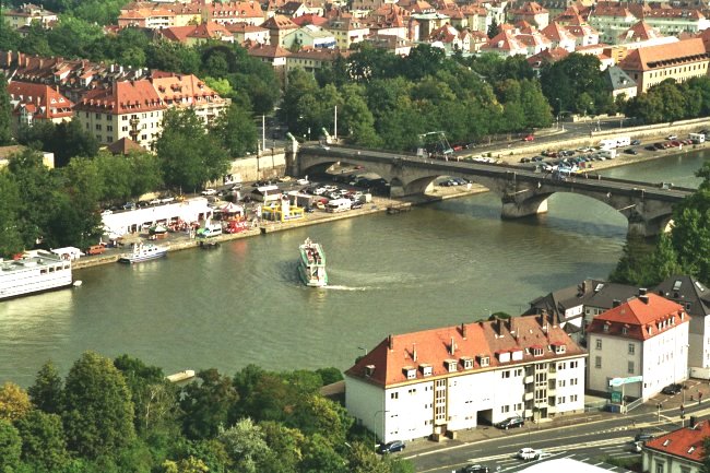
The river corridor supports agriculture, industry, transport and tourism. The mid-Main valley, part of the Franconia wine region, is known for its terraced vineyards and local wine production. Urban centres along the river combine commerce with cultural heritage; the Main has played a role in shaping local economies, from medieval trade fairs to modern logistics hubs.
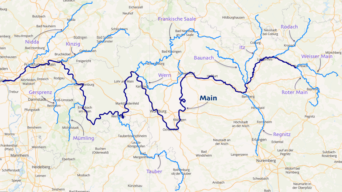
Major towns and notable facts
Several important towns and cities lie on or near the Main. The largest is Frankfurt, a major European financial and transport centre. Other historic and regional centres include Bayreuth, Bamberg, Würzburg, Hanau and Offenbach. These towns feature castles, old town centres and riverside promenades that reflect the Main's long influence on settlement patterns. In addition to navigation and viticulture, the river corridor is valued for recreation, nature conservation and cultural festivals that celebrate local history and products.
- Length: ~524 km
- Major uses: navigation, wine-growing, urban commerce
- Connected waterways: Rhine–Main–Danube Canal
The Main continues to be both a working river and an element of regional identity in central Germany, balancing modern transport and economic roles with preservation of historic landscapes and towns along its banks.
Data
Different lengths are given for the Main. The reason is that different origins and thus headwaters are attributed to the river in each case. Together with the longer headwaters, the Roter Main, a flow length of 527 km results, together with the larger but shorter headwaters Weißer Main one of 518 km. From the confluence of these two headwaters, the Main has a length of 472 km. About 81 km downstream of the confluence the Regnitz enters, which is much larger than the Main there. If one considers the waterway from the course of the Regnitz together with its main headwaters Rednitz and again its own main headwaters Fränkische Rezat as a source river, the total length is even 553 km. Before German reunification, the Main was sometimes called the longest river flowing exclusively in the then Federal Republic.
The catchment area of the Main and its tributaries covers 27,292 km² and extends over most of Franconia, the north-easternmost part of Baden and the north of southern Hesse. It borders the Danube catchment area in the south (a few hundred metres south of the source of the Weißmain lies the source of the Fichtelnaab, which drains into the Black Sea via the Naab and Danube); the boundary between the two is part of the main European watershed.
With an average discharge of 211 m³ per second at its mouth into the Rhine, the Main is the fourth largest tributary of the Rhine after the Aare (560 m³/s), Meuse (357 m³/s) and Moselle (315 m³/s).
The 388 km long navigable stretch begins near Bamberg and has been connected to the Danube via the Main-Danube Canal since 1992. There are several large inland ports, especially in the Rhine-Main conurbation around Frankfurt.
The Main runs through the federal states of Bavaria and Hesse. Baden-Württemberg has a share of the left bank in the area of the towns of Freudenberg and Wertheim over a length of around 25 km.
The Main hiking trail and the Main cycle path run along the Main.
See also: List of cities and towns on the Main River

Name
The name Main is of Celtic origin; the Celts called the river Moin or Mogin. When the Romans came to the area at the beginning of the 1st century AD, they Latinized the name to Moenus. The oldest record (as Moenis) is given by Pomponius Mela (shortly after 43/44 AD), later mentions are found e.g. in Pliny (Naturalis historia) or Tacitus (Germania). Rivers with similar names exist in Ireland (Maoin) and Britain (Meon, lat. maionus). Several explanations are considered for the origin of the name. Some authors trace it back to an Indo-European word mei meaning water (cf. Latvian maina or Lithuanian maiva: marsh), others to a wall or fence (cf. Latin moenia: ring wall). In the Middle Ages the river was mostly handed down as Moyn or Moyne, the name Meyn first appeared in the 14th century.
In the dialects spoken on the Main (from the 17th to the 19th century also called Main river) the river has the following names:
- Maa in Upper Franconia,
- Mee in eastern Lower Franconia,
- Moa Wertheim area, Miltenberg area, Aschaffenburg area (district)
- Mää City of Aschaffenburg, Main-Spessart
- Maa (locally partly nasalized, partly evaporated), Seligenstadt area, Frankfurt area
Related articles
Author
AlegsaOnline.com Main (river) — a major German tributary of the Rhine Leandro Alegsa
URL: https://en.alegsaonline.com/art/60795