Ludwigshafen am Rhein: city, industry and riverside hub
Ludwigshafen am Rhein is a German city on the Rhine in Rhineland-Palatinate, an industrial and transport centre opposite Mannheim and a core member of the Rhine–Neckar metropolitan region.
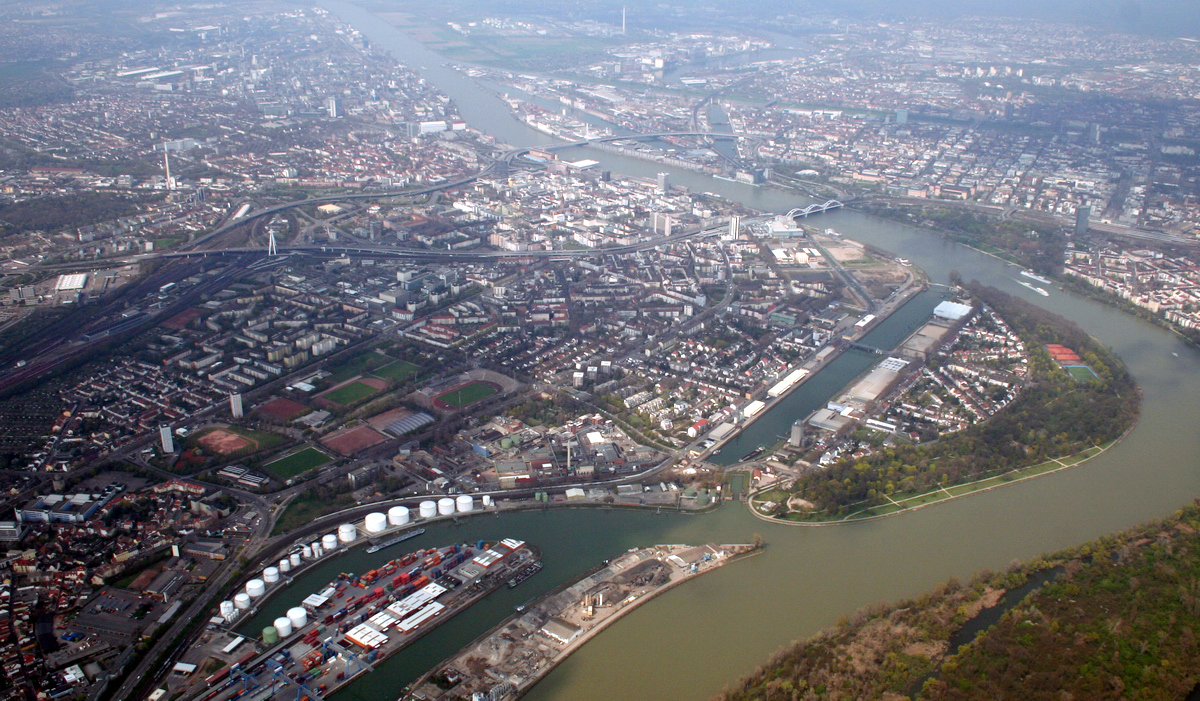
Ludwigshafen am Rhein, commonly called Ludwigshafen, is a city on the left bank of the Rhine in the German state of Rhineland-Palatinate. It sits directly across the river from Mannheim and is one of the principal municipalities of the Metropolregion Rhein-Neckar. Although administratively independent of the surrounding district (a kreisfreie Stadt), Ludwigshafen serves as the administrative seat for the neighbouring district authorities.
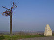
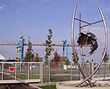
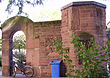
Image gallery
10 Images


Geography and character
The city occupies a riverside plain and developed historically as an industrial and logistical hub because of its access to the Rhine and to overland rail routes. Much of its urban fabric reflects industrial and postwar rebuilding; residential neighbourhoods, commercial zones and large industrial sites lie side by side. Bridges and river crossings link Ludwigshafen to Mannheim and create a contiguous urban area across the Rhine.
History and development
Ludwigshafen emerged in the nineteenth century as a river port and industrial settlement and grew rapidly during the era of industrialisation. The development of chemical and manufacturing enterprises shaped the city in the late 1800s and into the twentieth century. Like many German cities with heavy industry, Ludwigshafen suffered extensive damage in World War II and underwent major reconstruction in the postwar decades.
Economy and industry
The local economy is dominated by chemicals, petrochemicals and related manufacturing. Large industrial complexes and research facilities are a prominent feature of the cityscape, and river transport supports bulk goods and export. The presence of major employers has influenced urban planning, housing and local services while also drawing commuter traffic within the Rhein-Neckar region.
Culture, institutions and transport
Ludwigshafen offers cultural institutions, parks and museums that serve the city and its neighbours. Notable cultural sites include modern and contemporary art collections as well as municipal theatres and community venues. The city is integrated into regional public transport networks, including tram and rail connections and the Rhine-Neckar S-Bahn, which link it to Mannheim and other cities. A riverfront port and freight terminals maintain the Rhine’s role in freight movement.
Places of interest and practical information
- Major museums and cultural venues showcasing regional and modern art.
- Parks and riverside promenades used for leisure and events.
- Industrial areas and ports that illustrate the city’s economic base.
- Strong transport links within Rheinland-Pfalz and the wider metropolitan area.
As a riverside, industrial, and administrative centre, Ludwigshafen plays a distinct role in the urban network of southwest Germany: a working city shaped by its river location, its industrial heritage, and its close relationship with neighbouring Mannheim.


Geography
Geographical position
Ludwigshafen is located in the floodplains on the left bank of the Rhine in the Upper Rhine Graben, opposite the mouth of the Neckar into the Rhine. The city lies in the core of the Electoral Palatinate and is also one of its largest cities.
Climate
Ludwigshafen has a very mild and dry climate. The average annual temperature is 11.2 °C. In summer it often becomes oppressively humid due to the proximity to the Rhine, Neckar and the 17 ponds. In addition, during this time of year, stronger storms haunt the city, approaching from the southwest to the west. The previous highest temperature was reached during the 2003 heat wave in August and was 40.1 °C. The highest average monthly temperature was measured in July 2006 at 25.18 °C (long-term average at around 20 °C). On 11 August 2006, a tornado or funnel was observed in the Rhine-Palatinate district near Maxdorf. On 19 July 2015, another funnel was detected near Rheingönheim.
Neighboring communities
The following cities and communities border the city of Ludwigshafen (listed clockwise, starting in the east):
Mannheim (city district in Baden-Württemberg), Altrip, Neuhofen, Limburgerhof, Mutterstadt as well as Fußgönheim and Maxdorf (municipality of Maxdorf) (all belonging to the Rhine-Palatinate district) and Frankenthal (Palatinate) (independent city).
City breakdown
According to § 2 of the main statutes of the city of Ludwigshafen, the urban area of Ludwigshafen is divided into ten local districts.
In each local district there is a local advisory council consisting of seven to 15 members and a local chairman. They are elected for five years. The local advisory councils are to be heard on important matters affecting the local district. However, the final decision on a measure is then the responsibility of the Ludwigshafen City Council.
Some of the local districts are subdivided into further city districts or statistical districts. This division only serves statistical purposes.
Districts
Since 1974, the districts have been: Mitte, Süd, Nord/Hemshof, West, Friesenheim, Oppau, Edigheim and Pfingstweide, Gartenstadt, Mundenheim, Oggersheim, Rheingönheim, Maudach and Ruchheim.
Local districts
Local districts with their associated city districts are:
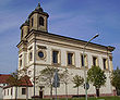
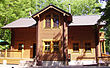
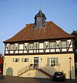
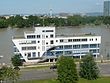
| Location | Coat of arms | Example image | Local district | Breakdown | Local Advisory Council |
|
|
|
| Friesenheim | FriesenheimFroschlache | 15 members |
|
|
|
| Gartenstadt | HochfeldLiederfeldErnst-Reuter-Siedlung | 15 members |
|
|
|
| Maudach | - – | 7 members |
|
|
|
| Mundenheim | - – | 11 members |
|
|
|
| Northern city centre | NorthHemshofWest | 15 members |
|
|
|
| Oppau | OppauEdigheimPfingstweide | 15 members |
|
|
|
| Oggersheim | OggersheimMelmEmergency turnaround | 15 members |
|
|
|
| Rheingönheim | - – | 7 members |
|
|
|
| Ruchheim | - – | 7 members |
|
|
|
| South downtown | CentralSouth | 15 members |


See also: List of places in the independent city of Ludwigshafen am Rhein
History
Early and ancient times
The Ludwigshafen area has been settled since very early times. According to some historians, the Roman fort Rufiniana existed in the area of the district Rheingönheim. The Roman Rhine Valley Road from Speyer to Worms led through the districts of Maudach and Oggersheim.
Rheinschanze
In 1607, Elector Friedrich IV of the Palatinate founded the Mannheim Rhine Redoubt on the west bank of the Rhine as a bridgehead for the Mannheim fortress. It was further expanded after the re-foundation of the city of Mannheim in 1720 and was razed by French troops between 1799 and 1804 - during the French period.
In 1811, a private shipping landing field on the Rhine was built on this site.
Bavarian time
After the Congress of Vienna, the Palatinate on the left bank of the Rhine became part of Bavaria in 1816, while the Electoral Palatinate on the right bank of the Rhine, with its former capital Mannheim, remained with Baden, to which it had joined in 1803. The area of the later city of Ludwigshafen initially belonged to the canton of Mutterstadt. In 1818, this canton became part of the Speyer district commissariat in the Rhine district, the forerunner of the Speyer district.
From 1820 onwards, a private trading settlement with an artificial harbour basin was built on the site, which was acquired by the Bavarian state on 14 March 1843, on the initiative of the Palatine government president Prince Eugen von Wrede. The latter renamed it Ludwigshafen in honour of King Ludwig I of Bavaria and supported its rapid expansion as an industrial counterpart to the Baden city of Mannheim. Nine years later, the burgeoning settlement was declared an independent municipality within the Speyer district commissariat, formally established effective April 14, 1853. Its municipal area was 366 ha, which it received as follows: 240 ha from the municipality of Friesenheim and 126 ha from the municipality of Mundenheim. Both places were later incorporated.
In 1852, King Maximilian II. Ludwigshafen the rights of a municipality:
"His Majesty the King has graciously approved the formation of a separate political municipality of Ludwigshafen, consisting of the settlements of Ludwigshafen, the Hemshöfen, the Ganter and Rohrlachhofe, and then the Gräfenau, as well as the banns between the municipalities of Friesenheim, Mundenheim and Ludwigshafen."
| Political affiliation of Ludwigshafen since 1853 | ||
| State | Administrative Unit | Affiliation |
| Kingdom of Bavaria | Palatinate | 1853–1871 |
| Kingdom of Bavaria | 1871–1918 | |
| Free State of Bavaria | 1918–1933 | |
| German Reich | Bavaria | 1933–1945 |
| 1945–1946 | ||
| 1946–1949 | ||
| Rhineland-Palatinate | since 1949 | |
On November 8, 1859, the municipality of Ludwigshafen was elevated to the status of a city. In 1860, it took over the district seat previously located in Mutterstadt, so that there was now a separate district of Ludwigshafen in the Speyer district commissariat.
On May 8, 1865, the concession was granted for the settlement of the Badische Anilin- und Sodafabrik (BASF). This company had been founded shortly before, but had not been granted a site by the Mannheim city council, which is why the company, which according to its name was "Baden", moved to the opposite bank of the Rhine to the Palatinate, which belonged to Bavaria. BASF later became a globally operating chemical company that has shaped the face and history of the city to this day. In the meantime, the abbreviation BASF has become the official name of the company. In the local vernacular, it is still often called "the aniline", and its employees "aniliners".
In 1882, the town was given the name addition "am Rhein" to distinguish it from other towns of the same name. In 1886, the former district commissariat of Speyer, called Bezirksamt since 1862, was divided. Ludwigshafen thus became the seat of its own district office, from which the county of Ludwigshafen am Rhein emerged in 1939.
In 1920, Ludwigshafen became independent of the district, i.e. it left the district office of Ludwigshafen, but initially remained under the financial jurisdiction of the district office. The mayor was given the title of Oberbürgermeister (Lord Mayor). Ludwigshafen became a major city in 1925.
In Oppau (which was incorporated in 1938), 561 people were killed and more than 2000 injured on September 21, 1921, when BASF's nitrogen plant exploded.
Second World War
During the Second World War, Ludwigshafen, together with Mannheim with its war-important industries, became one of the most bombed conurbations in southern Germany. Over 80% of the built-up area in the inner city was completely destroyed by the 124 air raids, some of which were devastating. Ludwigshafen and Mannheim were also possible targets of the USA for an atomic bomb drop. Since the bomb was not completed until after the end of the war in Europe, the first use of an atomic weapon in a war occurred on August 6, 1945 over Hiroshima.
See also: Air raids on Ludwigshafen am Rhein
During the Second World War, around 50,000 foreign workers and prisoners of war were conscripted into forced labor in Ludwigshafen. Already subjected to harsh working and living conditions - this applies especially to the so-called Eastern workers - the forced laborers suffered particularly from the effects of the bombings.
End of the war until the turn of the millennium
After the end of the Second World War, Ludwigshafen was initially under the control of the American military government. From 10 July 1945, Ludwigshafen belonged to the French occupation zone and was - ahead of Freiburg im Breisgau and the heavily destroyed Mainz - its most populous city. The establishment of the state of Rhineland-Palatinate was ordered on August 30, 1946, as the last state in the western occupation zones, by Decree No. 57 of the French military government under General Marie-Pierre Kœnig. It was initially referred to as the "Rhineland-Palatinate" or "Land Rheinpfalz"; the name Rhineland-Palatinate was not established until the constitution of 18 May 1947.
Due to the different policies of the occupying powers in occupied Germany, it took a relatively long time in Ludwigshafen - it was located in a region disadvantaged by the occupiers - for reconstruction to get fully underway compared to other cities. The city was hastily rebuilt in a simple style, with the aim of meeting the acute housing shortage even in the inner city. As a result, almost everywhere in the cityscape there is a lack of architecturally high-quality development, of successful and well-thought-out urban planning - as well as contextually of many parts that are important for a functioning infrastructure.
On the afternoon of July 28, 1948, a rail tank car carrying 30 tons of highly flammable dimethyl ether exploded at BASF, aided by the summer heat. The death toll was 207, and almost 4,000 people were injured. There was severe damage to buildings on and around the BASF site.
In terms of traffic, major projects were implemented in the 1960s. In addition to the relocation of the railway station and the abandonment of the railway facilities between the districts of Nord and Mitte, the Visitenkarte project realized the construction of elevated roads based on the American model.
In the course of the Rhineland-Palatinate territorial reform, the municipality of Ruchheim was incorporated in 1974. Thus, the city area reached its current extent.
21st century
In 1997, the city began AnschLUss 2000 - the second major urban planning challenge after the Visitenkarte project. The project included the redesign of Berliner Platz and its connection to the Rhine, the construction of a second railway bridge and the Ludwigshafen-Mitte S-Bahn stop at Berliner Platz, and the construction of the Walzmühle shopping center in the south of the city center. The project was realized in 2006/07.
On 3 February 2008, a serious house fire occurred in Ludwigshafen, in which nine Alevis of Turkish descent lost their lives. Rumours about a possible arson as well as about too slow help by the fire brigade proved to be unfounded; they temporarily strained the German-Turkish relationship.
On 25 May 2009, the city was awarded the title "Place of Diversity" by the German government.
The inner city was brought back to the Rhine in 2010 with the construction of a new urban quarter on the site of the former Zollhofhafen (shopping center Rhein-Galerie Ludwigshafen, town square with extension and expansion of the existing Rhine promenade, gastronomy, event hall in the first construction phase). Investor of the 220 million Euro project is the Hamburg-based ECE Projektmanagement, which also operates the shopping centre. The redesign of the Zollhof is part of the urban redevelopment programme "Today for Tomorrow".
In June 2013, Ludwigshafen was hit by a Rhine flood, which partially or completely flooded the Stadtpark on Parkinsel, the Rhine promenade and the Stadtplatz at the Rhein-Galerie. The Rhine reached a maximum level of 8.35 m. The city park on Parkinsel was up to two metres under water.
On 26 November and 5 December 2016, two attempted attacks occurred at the Ludwigshafen Christmas market and at the town hall square. A 12-year-old boy, of Iraqi and German nationality, attempted to carry out an attack using a nail bomb and another homemade explosive device. According to the police, there was a connection to the terrorist organization Islamic State, which allegedly instructed the boy to build the bombs via messenger services. The case caused an international sensation; never before has a suspected assassin been so young. Due to his age, however, he is liable to prosecution.
Incorporations
A number of formerly independent towns and communities were incorporated into the city of Ludwigshafen am Rhein:
| Date | incorporated village | Increase |
| January 1, 1892 | Community Friesenheim | 772 ha |
| December 1, 1899 | Parish of Mundenheim | 1027 ha |
| April 1, 1938 | City of Oppau | 1677 ha |
| April 1, 1938 | City of Oggersheim | 1087 ha |
| April 1, 1938 | Community of Maudach | 787 ha |
| April 1, 1938 | Community Rheingönheim | 1172 ha |
| March 16, 1974 | Parish of Ruchheim | 961 ha |
When the municipality of Ludwigshafen was founded in 1853, the municipal area covered only 366 ha.
Population development
See also: Population development of Ludwigshafen am Rhein
In 1888, Ludwigshafen had 25,000 inhabitants; by 1899, this number had doubled to more than 50,000. The city's population exceeded 100,000 in 1921, making it a major city. In 1965, the population reached its historic high of about 180,000. On 31 December 2006, the "Official Population" for Ludwigshafen was 163,560 according to the update of the Rhineland-Palatinate Statistical Office (only main residences and after comparison with the other state offices). The proportion of foreigners was 21.1 %.
As of December 31, 2019, Ludwigshafen ranked 45th in the list of large cities in Germany by population; neighboring places are occupied by Potsdam, Hamm, Oldenburg, and Osnabrück, for example.
Religions
Confession statistics
According to the 2011 Census, 26.5% of residents were Protestant, 28.5% were Roman Catholic, and 45.0% were non-denominational, belonged to another denomination, or did not specify. The number of Protestants and Catholics has since declined, and the number of residents with other denominations or no denomination is increasing by about 1% per year. Currently (as of May 31, 2021), 23.5% of residents are Catholic, 18.4% are Protestant, and 58.1% either belong to another religion or are non-denominational.
History
The area of the city of Ludwigshafen belonged to the Electoral Palatinate and was thus a predominantly Protestant area. However, Roman Catholic residents also moved in shortly after the community was founded, so that both denominations were represented in a relatively balanced way.
The Protestant residents initially belonged to the parishes of Oggersheim and Frankenthal (Palatinate) respectively, before receiving their first independent parish in 1862. In 1913, the Protestant deanery of Ludwigshafen was founded within the Protestant Church of the Palatinate (Protestant Landeskirche), to which all Protestant parishes of the city belong, unless they are members of a free church. Since 1702 there has been a Mennonite congregation, initially in Friesenheim. After the Second World War, the previous Mennonite church was demolished in the course of road construction work and the present building in the city centre was made available. The congregation rooms are located behind a residential building.
The Roman Catholic residents initially belonged to the parishes of Friesenheim, Mundenheim and Oppau before receiving their first independent parish in 1857. Around 1913, the Catholic city deanery of Ludwigshafen was created within the diocese of Speyer, to which all Catholic parishes of the city belong.
In 1891 Joseph Queva, after whom a square in Oggersheim was named because of his involvement in trade unionism and politics, founded a free religious congregation in Ludwigshafen. In 1926 the congregation was granted corporate rights. It was banned by the National Socialist regime on April 5, 1933. In 1946 it was re-founded. Since 1952 it has had a celebration room and its office in the Johannes Ronge House. The Freireligiöse Landesgemeinde Pfalz, K.d.ö.R., also has its headquarters there.
See also: Churches in Ludwigshafen
An independent Jewish community existed until the "Wagner-Bürckel-Aktion" in 1940. The state association of Jewish communities in Rhineland-Palatinate runs a community centre in Ludwigshafen.
Due to immigrants, other religions - especially Islam - were added in the time since the Second World War. There are twelve mosques in Ludwigshafen (as of January 2018).


Questions and answers
Q: What is Ludwigshafen?
A: Ludwigshafen is a city in the German state of Rhineland-Palatinate.
Q: What is the meaning of Ludwigshafen am Rhein?
A: Ludwigshafen am Rhein means Ludwigshafen on the Rhine.
Q: How is Ludwigshafen referred to commonly?
A: Ludwigshafen is commonly referred to as Ludwigshafen.
Q: Which city is the second largest city of the Metropolregion Rhein-Neckar after Ludwigshafen?
A: Mannheim is the second largest city of the Metropolregion Rhein-Neckar after Ludwigshafen.
Q: Does Ludwigshafen come under the local district government?
A: No, Ludwigshafen is independent of the local district government.
Q: Is Ludwigshafen administrative seat of the surrounding district?
A: Yes, Ludwigshafen is administrative seat of the surrounding district.
Q: Which German state is Ludwigshafen located in?
A: Ludwigshafen is located in the German state of Rhineland-Palatinate.
Related articles
Author
AlegsaOnline.com Ludwigshafen am Rhein: city, industry and riverside hub Leandro Alegsa
URL: https://en.alegsaonline.com/art/59790
Sources
- destatis.de : "Alle politisch selbständigen Gemeinden mit ausgewählten Merkmalen am 31.12.2018 (4. Quartal)" · web.archive.org
- destatis.de : destatis.de/DE/ZahlenFakten/LaenderRegionen/Regionales/Gemeindeverzeichnis/Administrativ/…
- statistik.rlp.de : "Gemeinden in Deutschland mit Bevölkerung am 31. Dezember 2015"