Lower Saxony
Lower Saxony (Niedersachsen) is a large northwestern German state known for diverse landscapes, strong agriculture and industry, historic cities, and maritime and cultural heritage.
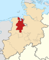
Lower Saxony (German: Niedersachsen) is a federal state in northwestern Germany. It is one of the country's largest states by area and combines coastal plains, heathland, forests and river valleys. The state seat and largest city is Hanover, while other important urban centres include Bremen (a city-state enclave), Braunschweig and Osnabrück.
Image gallery
10 Images


Geography and population
Lower Saxony stretches from the North Sea coast and the East Frisian Islands inland to the Harz mountains. The Weser and Ems rivers cross the region, supporting both agriculture and shipping. Population density varies widely: urban districts concentrate industry and services, while rural districts remain dominated by farming and natural reserves.
History and development
The region developed from a patchwork of medieval duchies, bishoprics and free cities. Modern Lower Saxony was formed after World War II by merging several historical territories; its institutions reflect federal German structures and cooperative ties with neighboring states. Historic trading towns and Hanseatic influence shaped much of its urban architecture.
Economy, culture and transport
The economy combines agriculture (notably livestock and crops), automotive manufacturing, engineering, and port activities along the coast. Cultural life includes folk traditions, museums and festivals. Transport links are well developed, with railways, highways and seaports connecting the state domestically and internationally.
Administrative structure and cities
Administratively, Lower Saxony is a Bundesland with its own elected government and parliament. Major cities and districts include:
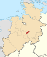
- Hanover (capital and cultural hub)
- Braunschweig (industrial and historical centre)
- Osnabrück (trade history and universities)
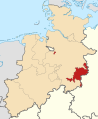
- Wolfsburg (home to major automobile manufacturing)
Notable facts and distinctions
Lower Saxony is notable for combining maritime traditions with inland industry, and for conserving large natural areas such as heathland and the Wadden Sea. Its Low German and regional dialects remain part of local identity, while the state plays a significant role in national politics and economy as a key state within the German federal system.
Geography
Geographical position
Lower Saxony has a natural boundary in the north by the North Sea and the lower reaches and lower middle reaches of the Elbe. Excluded from this classification are the Amt Neuhaus, which lies northeast of the river, and the southern Elbe parts of Hamburg. Surrounded by the state territory as an enclave is the state of Bremen, consisting of the cities of Bremen and Bremerhaven, which together with the surrounding area forms the Northwest Metropolitan Region. In the southeast, the state border runs through the low mountain range of the Harz. The northeast and the west - altogether about three quarters of the state area - belong to the North German Plain, the south to the Lower Saxony Uplands with the Weserbergland, Leinebergland, Schaumburger Land, Braunschweiger Land, Untereichsfeld, Elm and Lappwald. In the north-east of Lower Saxony lie the Lüneburg Heath and the Elbe-Weser triangle dominated by the Stade Geest.
While poorer sandy soils of the Geest predominate there, in the middle east and southeast in the Lössbörden zone there are productive soils with high natural fertility. Under these conditions (loamy and sandy soils), the land is considered well developed agriculturally. To the west lie the Grafschaft Bentheim, the Osnabrücker Land, the Emsland, the Oldenburger Land, the Ammerland, the Oldenburger Münsterland and - on the coast - East Frisia.
The lowest point of the terrain is a depression near Freepsum in East Frisia with about two and a half meters below sea level. The highest mountain in Lower Saxony is the Wurmberg in the Harz Mountains at 971 metres above sea level. Most mountains and hills are found in the southeast of the state.
See also: List of mountains and elevations in Lower Saxony
The settlement, economic and infrastructural focus of Lower Saxony is located in the area of the cities Stadthagen - Hannover with Region Hannover - Celle - Braunschweig - Wolfsburg - Hildesheim - Salzgitter. Together with Göttingen, which is located in southern Lower Saxony, they form the core of the metropolitan region Hannover-Braunschweig-Göttingen-Wolfsburg.
Parts of the country
Large areas
Lower Saxony has a clear regional division, which manifests itself both in landscape features and in historical, traditional-confessional and cultural lines of development. In the formerly independent sub-regions of Braunschweig, Hanover, Oldenburg and Schaumburg, especially in their core areas, one often finds a pronounced local patriotism to this day, as well as in East Frisia and in the traditionally Roman Catholic regions of Emsland, Eichsfeld and Oldenburger Münsterland. In the surrounding areas of the Hanseatic cities of Bremen and Hamburg, on the other hand, an orientation towards these centres more often dominates. Today's metropolitan regions, which are located on Lower Saxony territory, take into account the regionally predominant orientation relevant in everyday life, which manifests itself, for example, in the form of economic cooperation and commuter flows.
See also: List of cities and municipalities in Lower Saxony
Former administrative and governmental districts
Even today, the catchment areas of many ecclesiastical and social institutions, boundaries of chambers of commerce and crafts and cultural institutions are based on the historical areas that existed until 1978 in the form of administrative and governmental districts and currently continue to exist in the landscapes and regional associations. The catchment area of today's regional commissioners of the state government is based on the enlarged administrative districts created by mergers after 1978. The NUTS 2 regions in Lower Saxony also correspond to the former administrative districts of Lower Saxony.
Neighbouring countries
Together with its nine neighbours Bremen, Hamburg, Schleswig-Holstein, Mecklenburg-Western Pomerania, Brandenburg, Saxony-Anhalt, Thuringia, Hesse and North Rhine-Westphalia, Lower Saxony is the state with the most neighbours.
→ Main article: German-Dutch border question
Lower Saxony also has a border with the Dutch provinces of Overijssel, Drenthe and Groningen. In the area of the Ems estuary, the exact course of the border between Germany and the Netherlands is not precisely defined under international law. Although the two states agreed on good cooperation in a spirit of partnership in the Treaty between the Federal Republic of Germany and the Kingdom of the Netherlands on the Regulation of Cooperation in the Ems Estuary of 8 April 1960, disagreements repeatedly arise on detailed issues, most recently, for example, over the approval of planned offshore wind farms.
Waters
Rivers
→ Main article: List of rivers in Lower Saxony
All rivers in Lower Saxony flow directly or indirectly into the North Sea. A distinction is made between the three catchment areas of the Ems, Weser and Elbe. Only the rivers Vechte, Harle, Jade and Maade as well as some other marshland waters that drain directly into the North Sea do not belong to any of the aforementioned catchment areas.
Lakes
See also: List of lakes in Lower Saxony
Lower Saxony is rich in natural lakes, which usually have only a small average depth. The largest lake is the Steinhuder Meer with an area of 29.1 km², followed by the Dümmer with 13.5 km² and the Zwischenahner Meer with 5.5 km². The fourth largest lake is the Großes Meer in East Frisia with 2.89 km².
The Lower Saxony bathing water atlas provides various information on the 280 or so bathing waters in Lower Saxony. In addition to bathing water quality, you can also find information about the location and infrastructure, such as parking spaces, sanitary facilities or bathing supervision. Bathing water quality is determined on the basis of the monitoring results of the last four bathing seasons. Each bathing water is accordingly given a quality category ranging from 'excellent' to 'poor'.
Dams
See also: Dams in the Harz Mountains
In Lower Saxony there are 86 dams which are monitored by the Lower Saxony State Agency for Water Management, Coastal Protection and Nature Conservation (NLWKN). According to the dam definition, this total number also includes about 30 Upper Harz reservoirs of the Oberharzer Teiche, which represent an essential part of the Oberharzer Wasserregal. The Oberharzer Wasserregal is considered the world's most important pre-industrial mining water management system and was declared a UNESCO World Heritage Site in 2010.
Most of Lower Saxony's dams are located in the Harz region, which is one of the areas in Germany with the highest precipitation. 78 dams are located in the water catchment areas of Oker, Innerste, Rhume, Leine and Aller. There are five dams in the water catchment areas of the Ems, Hase and Hunte, two dams are located in the area of the Ilmenau, only one dam exists in the Lower Saxony water catchment area of the Weser. The dams are used both for drinking water production and for flood protection.
The largest dam in Lower Saxony is the Okertalsperre with a storage volume of 47.4 million cubic metres. The oldest dam is the Thülsfelder dam in the district of Cloppenburg, which was built between 1924 and 1927.
Land use
Around 82 percent of the area of Lower Saxony consists of forest and agricultural land. The building, open and traffic areas take up a share of about twelve percent. The total other land use can be seen in the following table:
| Land use in 2016 | Area in km² | Percent |
| Agricultural land | 28.599 | 60,9 |
| Forest areas | 10.339 | 21,6 |
| Building and open spaces | 03.475 | 07,3 |
| Traffic areas | 02.429 | 05,1 |
| Water areas | 01.119 | 02,3 |
| Recreational areas | 00.436 | 00,9 |
| Operational areas | 00.323 | 00,8 |
| Areas of other use | 00.909 | 01,9 |
| Total area | 47.613 | 100,00 |
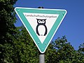
Landscape conservation areas
→ Main article: List of protected landscape areas in Lower Saxony
· 
conservation district
· 
Nature reserve
· 
National Park
At the end of 2011, there were 1,272 landscape conservation areas in Lower Saxony with a total area of 9,857 square kilometres. This is 18.58 percent of the total area of Lower Saxony. The largest landscape conservation areas are the Südheide landscape conservation area with 43,775 hectares, the Harz landscape conservation area in the district of Goslar with 39,018 hectares and the Elbhöhen-Drawehn landscape conservation area with 37,105 hectares.
Nature reserves
→ Main article: List of nature reserves in Lower Saxony
Furthermore, at the end of 2011 there were 772 nature reserves with an area of 1,988 square kilometres, which corresponded to a share of 3.75 per cent of the total area of Lower Saxony. The largest nature reserve is the Lüneburger Heide nature reserve with 23,437 hectares, followed by the Borkum Riff nature reserve with 10,000 hectares and the Esterweger Dose nature reserve with 4,747 hectares. The Lüneburg Heath nature reserve is also the oldest nature reserve in Lower Saxony. It was already placed under protection on 12 January 1922.
Nature Parks
Lower Saxony also has 13 nature parks with a combined area of 937,721 hectares. That is 17.68 percent of the state's area. These are the nature parks Dümmer, Elbhöhen-Wendland, Elm-Lappwald, Harz, Lüneburger Heide, Münden, Terra.vita, Solling-Vogler, Steinhuder Meer, Südheide, Weserbergland, Wildeshauser Geest, Bourtanger Moor-Bargerveen. The largest nature park is the Wildeshauser Geest with 155,400 hectares.
National Parks
For the protection of the ecosystem and for recreation, Lower Saxony joins an almost continuous chain of protected areas of the Wadden Sea between Blåvandshuk (Denmark) and Den Helder (Netherlands) with the Lower Saxony Wadden Sea National Park (345,800 ha). Together with Saxony-Anhalt, the Harz National Park (approx. 15,800 ha in Lower Saxony and 8,900 ha in Saxony-Anhalt) with its extensive forest areas and moors has also been designated as a German national park.
Climate
Lower Saxony belongs to the temperate climate zone of Central Europe in the area of the west wind zone and is located in the transition area between the maritime climate in Western Europe and the continental climate in Eastern Europe. This transition is clearly noticeable within the country: While the northwest has an Atlantic (North Sea coast) to sub-Atlantic climate with comparatively low temperature amplitude during the year and a water balance surplus, the climate becomes increasingly continental in influence towards the southeast. This is evident in stronger temperature differences between summer and winter half-years as well as in lower and seasonally unevenly distributed precipitation. This subcontinental colouring is most pronounced in the Wendland, in the Weserbergland (Hameln to Göttingen) and in the Helmstedt area. The highest precipitation is recorded in the Harz mountains, as the Lower Saxony part represents the windward side of these low mountain ranges, where, among other things, uphill rain is discharged. The annual mean temperature is 8 °C (7.5 °C in the Alte Land and 8.5 °C in the district of Cloppenburg).


History
History until the founding of the country
Until the Congress of Vienna (1814/1815)
The area of today's federal state of Lower Saxony belonged to different territories in its history. Before 1946, the terms "Lower Saxony" and "Lower Saxon" referred only temporarily to different parts of the present federal state. The name and the coat of arms of today's state refer back to the Germanic tribe of the Saxons and the tribal duchy of Saxony. From about the 7th century onwards, the Saxons had occupied a settlement area which roughly corresponded to today's Lower Saxony (with the parts of Engern and Eastphalia), Westphalia and some adjoining areas to the east, such as the western and northern parts of Saxony-Anhalt, and also included the older settlement areas in northern Albingia. The territory of the Saxons was divided into about 60 Gaue. The originally predominant language of the population in the area of Old Saxony was Saxon, a linguistic variety of Low German. In the east of the tribal area (in today's Drawehn and Wendland), Slavic-speaking Polabians had already settled since the 8th century, who were soon subjugated by the Saxons. In contrast, the Frisians who settled on the North Sea coast retained their independence (Frisian Freedom) for centuries and were loosely assigned to the Duchy of Lower Lorraine in their majority.
The permanent demarcation of the area later called Lower Saxony from Westphalia and some eastern parts of the country began in the 12th century. The last Duke of Saxony to rule over the entire tribal duchy was Henry the Lion. After he was deposed in 1180, the old tribal duchy was divided, while the Saxon dukedom passed first to the Ascanians, then to the margraves of Meissen (Wettins, 1423). In 1260, in a treaty between the archbishopric of Cologne and the duchy of Brunswick-Lüneburg, the areas of interest of the two territories were demarcated from one another, and Westphalia was assigned to the Cologne sphere of influence. The border ran as far north as Nienburg along the Weser. The northern part of the Weser-Ems region was assigned to Braunschweig-Lüneburg's sphere of influence.
The term "Lower Saxony" was first used before 1300 in a Dutch rhyming chronicle. From the 14th century it referred to the Duchy of Saxe-Lauenburg as opposed to Saxe-Wittenberg, which shared the Saxon dukedom and were then ruled by two branches of the Ascanians. When the Imperial Circles were established from 1500 onwards, the Lower Saxon Imperial Circle was distinguished from the Lower Rhenish-Westphalian Imperial Circle. The latter was assigned the following territories, some of which today belong to the state of Lower Saxony: the High Diocese of Osnabrück, the High Diocese of Münster, the County of Bentheim, the County of Hoya, the Principality of East Frisia, the Principality of Verden, the County of Diepholz, the County of Oldenburg, the County of Schaumburg and the County of Spiegelberg. At the same time, the eastern part of the old Saxony was distinguished from the central German principalities later called "Upper Saxony" for dynastic reasons (see also Electorate of Saxony, History of Saxony).
The close historical connection of the states of the Lower Saxony Imperial Circle located in present-day Lower Saxony existed for centuries primarily in dynastic terms. Most of the predecessor territories of the state were part principalities of the medieval Guelph Duchy of Brunswick-Lüneburg. All the Guelph princes called themselves Dukes of Brunswick and Lüneburg in their respective principalities, which were often fragmented and always reunited.
Between 1806 and 1813, most parts of what is now Lower Saxony belonged to the Confederation of the Rhine or Napoleonic France. After the Battle of Jena and Auerstedt in 1806, East Frisia and Jeverland were incorporated into the Kingdom of Holland and thus into the French sphere of power. In 1810, the area was directly subordinated to the French Empire as the department of Ems-Orientale. In the process, the Rheiderland in western East Frisia was separated from East Frisia due to old Dutch claims and added to the Dutch department Ems-Occidental with its capital Groningen.
On 1 January 1811, the three Hanseatic departments of Ober-Ems (with the capital Osnabrück), Wesermündung (with the capital Bremen) and Elbmündung (with the capital Hamburg) were formed. On April 27, 1811, the department of Lippe was added, with Münster as its capital. Parts of today's Emsland belonged to this department. After Napoleon's defeat, these departments were dissolved again from 1813 to 1815.
Until the fall of the Kingdom of Hanover
Over time, two larger principalities remained east of the Weser: the Kingdom of Hanover and the Duchy of Brunswick (after 1919 Free State/Land). Historically, there is a close connection of the noble house in Hanover (Electorate of Brunswick-Lüneburg) to the United Kingdom of Great Britain and Northern Ireland, established by the personal union of the 18th century.
West of the Hunte, a process of "de-westernization" began in 1815: After the Congress of Vienna, the areas of the later administrative districts of Osnabrück and Aurich became part of the Kingdom of Hanover.
Until the end of the Weimar Republic
After the German War of 1866, the Kingdom of Hanover was annexed by the Kingdom of Prussia and "demoted" to a Prussian province. After 1918, the province of Hanover belonged to the Free State of Prussia. In contrast, the Grand Duchy of Oldenburg, the Duchy of Brunswick and the Principality of Schaumburg-Lippe retained their territorial autonomy within Germany until 1 November 1946.
In a lecture on 14 September 2007, Dietmar von Reeken described the emergence of a "Lower Saxony consciousness" in the 19th century, the spatial basis of which had been invented as a spatial construct in the 19th century: the emerging Heimatvereine (local history societies) and the associated journals bore the term "Lower Saxony" or "Lower Saxon" as a programmatic element in their names. At the end of the 1920s, in the context of the discussions about an imperial reform and forced by the spreading homeland movements, a twenty-five-year dispute between "Lower Saxony" and "Westphalia" had begun. Administrative officials and politicians had been the bearers of this dispute; scholars from various disciplines working in the region had provided the arguments. In the 1930s, a real Lower Saxony had not yet existed, but a plethora of institutions had called themselves "Lower Saxony". The motives and arguments in the disputes between "Lower Saxony" and "Westphalia" were very similar on both sides: economic interests, political objectives, cultural interests and historical aspects. In 2006, Thomas Vogtherr said in a commemorative lecture on the occasion of the 60th anniversary of the founding of the state of Lower Saxony the process: "Lower Saxony [...] is an invention of the 19th century, which became a political reality via many intermediate stations as a result of the Second World War."
According to Vogtherr, anyone who spoke of "Lower Saxony" after 1866 was thinking in terms of an anti-Prussian point. Whoever invoked the values of the Lower Saxon homeland wanted to distance himself from Berlin centralism. Those who claimed that the concept of Lower Saxony should be extended to Oldenburg or Brunswick attempted, as it were, to place the inhabitants of these still independent dominions under anti-Prussian collective liability. In the years after 1866, the number of books in whose title the keyword "Lower Saxony" appeared increased almost explosively.
In 1920, the entire Weser-Ems region of Lower Saxony today (including the city of Bremen) was assigned to an electoral district association IX (Lower Saxony). This can be seen as an indication that at that time the western administrative districts of the Prussian province of Hanover and the state of Oldenburg were perceived as "Lower Saxony". In 1927, the "Lower Saxony Regional Employment Office" (as predecessor of today's "Lower Saxony-Bremen Regional Directorate of the Federal Employment Agency") became responsible for the same area.
The forerunners of today's state of Lower Saxony are states that were geographically and also in part institutionally interlocked with each other early on. The county of Schaumburg (not to be confused with the principality of Schaumburg-Lippe) around the cities of Rinteln and Hessisch Oldendorf belonged until 1932 to the Prussian province of Hessen-Nassau, which also included large parts of today's state of Hessen, including the cities of Kassel, Wiesbaden and Frankfurt am Main; in 1932, however, the county of Schaumburg became part of the Prussian province of Hanover.
Also before 1945, namely in 1937, the city of Cuxhaven was completely incorporated into the Prussian province of Hanover by the Greater Hamburg Act, so that only four states had to be merged when the state of Lower Saxony was founded on November 1, 1946. With the exception of Bremen and the areas that had been ceded to the SBZ after 1945, all areas that had already been combined in 1920 to form the "Electoral District Association of Lower Saxony" were assigned to the state of Lower Saxony in 1946.
Until the end of the Second World War
In 1934, Hermann Lübbing expressed his views on the future of the state of Oldenburg. He sees the state of Oldenburg in the role of a courted bride with two suitors, namely the supporters of a state of Lower Saxony and the supporters of a Westphalia in the tradition of the Lower Rhine-Westphalian Imperial Circle. Lübbing reproaches both groups for not respecting the realities, i.e. firstly the existing political borders associated with traditions, secondly the natural borders ("Nieder-" refers to the North German Plain; the inclusion of further low mountain regions thus lacks justification; likewise there is no coherent natural explanation for the eastern border of Lower Saxony) and thirdly the tribal borders (Frisians are not Saxons). According to Lübbing, the "bride Oldenburg" had reserved "the sacrifice of her independence for a new German Reich" (with the National Socialists as "bridegroom", as it were). Apparently, in 1934, Lübbing advocated neither a "Greater Hanover" nor a "Greater Westphalia" as a new homeland for the Oldenburgers, but rather a kind of "Greater Oldenburg", which was said to have been rejected at the Congress of Vienna in 1815, but which took shape in the form of the Weser-Ems Gau of the NSDAP in 1925 (internal to the party) and 1933 (decisive for the organization of the state). This Gau actually represented a kind of "Greater Oldenburg" in that both Gauleiters, Carl Röver and Paul Wegener, came from the state of Oldenburg and in that the previously independent city of Bremen was also to be administered from the city of Oldenburg, where the National Socialists were able to form their first state government in the German Reich in 1932. However, the Gauleiter Weser-Ems was also Reichsstatthalter only in the state of Oldenburg and in the Hanseatic city of Bremen. The position comparable to an Reich governor in the administrative districts of Aurich and Osnabrück was held by the chief president of the Prussian province of Hanover, so that Röver's and Wegener's influence remained limited to these parts of the Gau Weser-Ems.
After the end of the Second World War
After the Second World War, Northwest Germany was largely in the British occupation zone. With Decree No. 46 of the British Military Government of 23 August 1946 "concerning the dissolution of the provinces of the former Land of Prussia in the British Zone and their reconstitution as independent Länder", the Land of Hanover was initially established on the territory of the Prussian province of Hanover. Its Minister President Hinrich Wilhelm Kopf had already suggested the formation of a state of Lower Saxony in June 1945, which was to cover as large an area as possible in the middle of the British zone. In addition to the areas that were later actually assigned to Lower Saxony, Kopf called in a memorandum of April 1946 for the inclusion of the former Prussian district of Minden-Ravensberg (i.e., the Westphalian cities of Bielefeld and Herford and the Westphalian counties of Minden, Lübbecke, Bielefeld, Herford, and Halle (Westf.)), the county of Tecklenburg, and the state of Lippe. Kopf's plan was ultimately based on a draft for the reform of the German Empire already presented by Georg Schnath and Kurt Brüning at the end of the 1920s. According to Thomas Vogtherr, the "Guelph-heavy" nature of this draft did not facilitate the development of a "Lower Saxon identity" after 1946.
An alternative model propagated by politicians in Oldenburg and Braunschweig envisaged the establishment of a separate state "Weser-Ems" in the northwest, consisting of the state of Oldenburg, the Hanseatic city of Bremen and the administrative districts of Aurich and Osnabrück. Some representatives of the state of Oldenburg even demanded the inclusion of the Hanoverian districts of Diepholz, Syke, Osterholz-Scharmbeck and Wesermünde in the new state of "Weser-Ems" to be founded. Likewise, in the southeast, a Land of Braunschweig enlarged by the administrative district of Hildesheim and the administrative district of Gifhorn was to be retained. If this plan had been implemented, the territory of today's Lower Saxony would have consisted of three states of roughly equal size.
On June 12, 1946, the district council of the district of Vechta protested against an assignment of the district to the "Greater Hanover Area". In the event of the dissolution of the state of Oldenburg, the district of Vechta should rather be integrated into the area of Westphalia. Especially in political Catholic circles, the opinion was widespread that the Oldenburg Münsterland and the administrative district of Osnabrück should be added to a newly founded state of "Westphalia".
Since the founding of the states of North Rhine-Westphalia and Hanover on 23 August 1946, the northern and eastern borders of North Rhine-Westphalia have been largely identical to the corresponding borders of the Prussian province of Westphalia. Only the state of Lippe was not assigned to North Rhine-Westphalia until January 1947. As a result, a large part of the areas left of the Upper Weser became North Rhine-Westphalia.
Areas of present-day Lower Saxony in the British occupation zone (1946)
· 
Land Hanover
· 
Free State of Oldenburg
· 
State of Brunswick
· 
State of Schaumburg-Lippe
Ultimately, at the meeting of the Zonal Advisory Council on September 20, 1946, Kopf's proposal regarding the division of the British occupation zone into three territorial states proved to be acceptable to the majority. Since this division of their occupation zone into relatively large states also corresponded to the interests of the British, Decree No. 55 of the British Military Government was issued on November 8, 1946, by which the state of Lower Saxony with its capital Hanover was founded retroactively to November 1, 1946. The state was created by uniting the states of Braunschweig, Freistaat Oldenburg and Schaumburg-Lippe with the previously formed state of Hanover. There were exceptions to this:
- In the state of Braunschweig, the eastern part of the Blankenburg district as well as the exclave Calvörde of the Helmstedt district fell into the Soviet occupation zone and were later integrated into the state of Saxony-Anhalt.
- In the state of Hanover, the Amt Neuhaus and the villages Neu Bleckede and Neu Wendischthun fell into the Soviet occupation zone and thus to the later GDR. They were only reincorporated into Lower Saxony in 1993.
- Wesermünde, a large city in the former administrative district of Stade, was renamed Bremerhaven in 1947 and incorporated into the new state of Bremen.
Demands by Dutch politicians that the Netherlands should receive German territories east of the German-Dutch border as reparations were not largely shelved until the London Conference on Germany on 26 March 1949. In fact, approximately 1.3 square kilometres in western Lower Saxony were ceded to the Netherlands in 1949.
→ Main article: Dutch annexation plans after the Second World War
History of the State of Lower Saxony
Postwar
On 9 December 1946, the first Landtag of Lower Saxony convened. It was not elected, but appointed by the British occupation administration (appointed Landtag). On the same day, the Landtag elected Hinrich Wilhelm Kopf (SPD), the former government president of Hanover, as the first Minister President. Hinrich Wilhelm Kopf remained - interrupted by the reign of Heinrich Hellwege (1955-1959) - head of government in Lower Saxony until 1961. On 13 April 1951 the "Provisional Lower Saxony Constitution" came into force.
The most important problem in the first post-war years was the large number of refugees from the former eastern territories of the German Reich who sought refuge in the large state. Lower Saxony was located at the western end of the direct escape route from East Prussia and had the longest border with the Soviet occupation zone. On October 3, 1950, Lower Saxony took over the sponsorship of the very numerous refugees from Silesia. According to official figures, there was still a shortage of around 730,000 homes in 1950.
During the period of German division, the main transit traffic to West Berlin was handled via the Helmstedt checkpoint in Lower Saxony to the German Democratic Republic.
During the Cold War, Lower Saxony was a focal point of NATO stationing for decades due to the state's location on the "Iron Curtain" and the strategic importance of the North German Plain; in addition to British and Dutch troops, strong army units of the German Bundeswehr have been stationed here since the end of the 1950s.
Consolidation
The Volkswagen Group, which began producing civilian vehicles again in 1945, initially under British supervision, and then passed into the ownership of the newly founded West German state (FRG) and the state of Lower Saxony in 1949, had a formative influence on the state's economy. All in all, Lower Saxony, with its large rural area and its few urban centres, was for a long time one of the structurally weak regions of the Federal Republic. In 1957, 30.4% of the working population were still employed in agriculture and forestry, and in 1960, 20% were still employed in agriculture. In the rest of the Federal Republic this figure was 14 %. Even in economically favourable times, the unemployment rate in Lower Saxony remained constantly higher than the national average.
In 1961 Georg Diederichs succeeded Hinrich Wilhelm Kopf as Minister President of Lower Saxony. He was succeeded in this office by Alfred Kubel in 1970. The disputes over the Gorleben nuclear waste repository, which began during the reign of Minister President Ernst Albrecht (1976-1990), have played an important role in Lower Saxony's state and federal politics since the late 1970s.
After German reunification
In 1990 Gerhard Schröder took office as Minister President. On 1 June 1993, the state's new constitution came into force, replacing the "Provisional Lower Saxony Constitution" of 1951. For the first time, it allows for referendums and plebiscites and enshrines environmental protection as a principle of the state.
The former Hanoverian Amt Neuhaus with the former municipalities Dellien, Haar, Kaarßen, Neuhaus (Elbe), Stapel, Sückau, Sumte and Tripkau as well as the districts Neu Bleckede, Neu Wendischthun and Stiepelse of the municipality Teldau and the historical Hanoverian area in the forest district Bohldamm in the municipality Garlitz changed from Mecklenburg-Vorpommern to the state Lower Saxony (district Lüneburg) with effect from 30 June 1993. Neu Bleckede and Neu Wendischthun were reincorporated into the town of Bleckede on the same day, to which they had belonged until 1945. The new municipality Amt Neuhaus was formed from the remaining municipalities and districts on 1 October 1993.
In 1998 Gerhard Glogowski replaced Gerhard Schröder, who had moved to the Federal Chancellery. Because he was associated with various scandals in his hometown of Braunschweig, he resigned in 1999 and was succeeded by Sigmar Gabriel.
Recent developments
![]()
This article or section needs a revision:
It lacks (here or better elsewhere, with reference in the table) an up-to-date list of the direct subdivisions of Lower Saxony, apparently that is, the counties.
Please help to improve it, and remove this marker afterwards.
From 2003 until his acceptance of the election as Federal President in 2010, Christian Wulff was Minister President of Lower Saxony. Like his successor David McAllister, the Osnabrück native headed a CDU-led coalition government with the FDP.
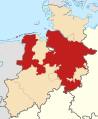
On 1 January 2005, the four administrative districts into which Lower Saxony had been divided since 1978 were dissolved. These were the administrative districts of Braunschweig, Hanover, Lüneburg and Weser-Ems. The administrative district of Braunschweig was itself formed in 1978 from the merger of the administrative district of Braunschweig with parts of the former administrative district of Hildesheim and parts of the former administrative district of Lüneburg, the "new" administrative district of Hanover from the expansion of the former administrative district of Hanover by parts of the former administrative district of Hildesheim, the administrative district of Lüneburg from the merger of the largest part of the old district of Lüneburg with the former administrative district of Stade, the administrative district of Weser-Ems from the merger of the administrative district of Oldenburg (Oldb) with the former administrative districts of Aurich and Osnabrück. Instead of the district governments, government representations were established for special tasks at the locations of Braunschweig, Hanover, Lüneburg and Oldenburg.
After the state elections in January 2013, a government was formed under Stephan Weil of the SPD. Instead of the government representations for the areas of the former government districts, so-called state commissioners were installed as regional contact persons of the state government, who have extended competences. So there are no more government districts.
On 4 August 2017, the defection of MP Elke Twesten from the Bündnis 90/Die Grünen parliamentary group to the CDU led to a government crisis. This was ended after new elections by the formation of a government of SPD and CDU under the leadership of Stephan Weil.


Related articles
Author
AlegsaOnline.com Lower Saxony Leandro Alegsa
URL: https://en.alegsaonline.com/art/59606