
London Docklands: history, redevelopment and urban character
Former docks on the River Thames in east and southeast London transformed by late 20th‑century regeneration into mixed commercial, residential and transport hubs with complex social effects.
Overview
London Docklands refers to a large area of riverfront and former docklands on the Thames in east and southeast London. Historically the docks handled much of the city's overseas trade and were a defining feature of London in the nineteenth and early twentieth centuries. The Docklands lie within several modern boroughs and are part of the wider economic and urban fabric of the United Kingdom capital.
Image gallery
10 Images




Location and components
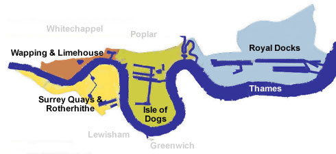
The Docklands are not a single site but a collection of dock basins, quays, warehouses and adjoining neighborhoods. Much of the area falls inside the boroughs listed below, each with its own local history and character:
Within this patchwork were many named docks and wharves, plus industrial estates and riverside communities. Physically the area extends from central London’s eastern edge downstream toward the Outer Thames Estuary.
Historical development
From the late Georgian and Victorian eras through the early twentieth century the docks were part of the broader Port of London, once one of the busiest ports in the world. Large lock‑protected docks, cranes and warehouses concentrated shipping activity on the Thames. The docks suffered severe damage from aerial bombing during the Second World War and never fully returned to their pre‑war prominence.
In the post‑war period the economics of shipping changed. The growth of containerization and larger oceangoing vessels required deeper, purpose‑built facilities, and trade gradually moved away from many inner‑city wharves. A shift toward large container terminals on the east coast and improved road and rail freight routes diminished traditional dock operations—processes often summarized under the general move to container ports such as Felixstowe and other modern terminals, referred to here in connection with container technologies (container).
Regeneration and infrastructure
The name "London Docklands" entered government and planning usage in the 1970s and the area became a focus for large‑scale redevelopment in the 1980s. A key instrument in this transformation was a government‑appointed development agency that coordinated investment, land assembly and infrastructure. Major projects replaced derelict docks with new office districts, housing developments, retail and leisure facilities.
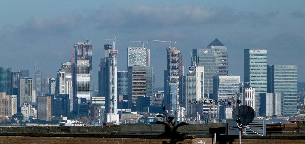
One of the most visible outcomes of regeneration is Canary Wharf, an international business district built on former docklands and now home to high‑rise offices and financial services. Transport improvements—most notably the introduction and extension of the Docklands Light Railway, new road links and later Underground connections—were central to making the area accessible and commercially viable.
Uses, impacts and contemporary character
Today the Docklands combine high‑value commercial towers, apartment neighborhoods, converted warehouses, marinas and public riverside promenades. Redevelopment brought new jobs and investment, but also tension: long‑standing local communities faced rising rents, displacement and debates about who benefits from regeneration. Cultural venues, museums and community organizations coexist alongside global finance firms and luxury housing.
Notable distinctions and legacy
London Docklands illustrates an extended transition from industrial waterfront to post‑industrial cityscape. It is often studied as an example of late twentieth‑century urban renewal, showing both the potential of targeted investment to create economic hubs and the social costs when development outpaces inclusive planning. The area continues to evolve, with ongoing projects that aim to balance commercial growth, housing need and public access to the Thames for residents and visitors alike.
For further reading and planning documents see local authority resources and specialized studies on urban regeneration and port history.
More on London | About the United Kingdom | Southwark | Tower Hamlets | Lewisham | Newham | Greenwich | Port of London | Container shipping | Felixstowe | Canary Wharf
Questions and answers
Q: What is London Docklands?
A: London Docklands is the name for the riverfront and former docks in London, the capital of the United Kingdom. It is part of several boroughs in east and southeast London.
Q: When was the area redeveloped?
A: The area was redeveloped for commercial and residential use beginning in the 1980s.
Q: What caused the decline of the port?
A: As cargo ships got larger, it began to lose trade. This led to a government decision to build a new container port on England's east coast at Felixstowe, which is mostly served by road transport motorways.
Q: How did redevelopment become possible?
A: The value of property in London made it possible to rebuild old port areas into high-value property. Canary Wharf is an example of this redevelopment.
Q: When was London Docklands first used as a name?
A: The name 'London Docklands' was used for the first time in a government report on redevelopment plans in 1971.
Q: What happened during WWII?
A: During WWII, many associated buildings (such as warehouses) were largely destroyed by bombing, though they were working again by late 1950s.
Q:What has been created through regeneration efforts?
A:The regeneration efforts have created wealth but also led to conflict between new and old communities living in the area.
Related articles
Author
AlegsaOnline.com London Docklands: history, redevelopment and urban character Leandro Alegsa
URL: https://en.alegsaonline.com/art/59024