Linz — Austrian Danube city, industrial center and cultural hub
Linz is Austria's third-largest city and the capital of Upper Austria, known for its Danube setting, industrial economy, festivals, museums and university life.
Overview
Linz is a major city in northern Austria on the Danube River. With a population approaching 200,000 it ranks after Vienna and Graz as the third-largest city in the country. Linz is the administrative capital of Upper Austria and combines an industrial profile with an active cultural scene.
Image gallery
10 Images


Geography and climate
The city occupies a strategic riverside position that has shaped its economy and transport links. Linz experiences a humid continental climate, classified as Dfb in the Köppen system: moderately warm summers, cold winters and a seasonally variable precipitation pattern. The Danube corridor provides river transport and scenic waterfronts used for recreation and events.
History and development
Linz developed from a regional market and administrative center into an industrial city during the 19th and 20th centuries. Heavy industry, most visibly the steel sector, played a large role in shaping the urban landscape and local employment. In recent decades the city has diversified into technology, services and education while also investing in cultural infrastructure.
Culture, institutions and festivals
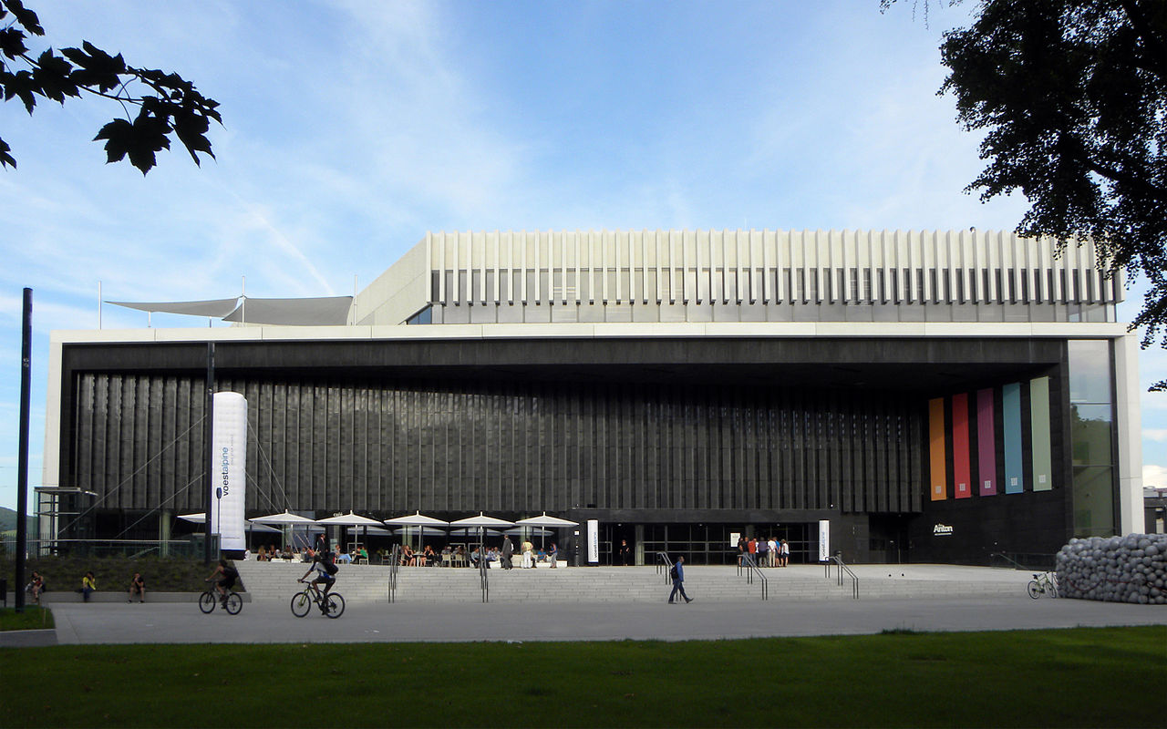
The city hosts important cultural venues and events. Notable institutions include the modern art museum Lentos, the concert hall Brucknerhaus, and the Ars Electronica Center, which focuses on electronic art and digital technology. Linz was European Capital of Culture in 2009 and today stages festivals that attract national and international audiences.
Education, economy and transport
Linz is a regional center for higher education and research, anchored by universities and applied-science institutions. The economy mixes industry (including steel production and related manufacturing), information technology and logistics. The Danube, an extensive rail network and nearby motorways link Linz to domestic and central European routes, supporting commerce and tourism.
Landmarks, local life and distinctions
- Historic old town with churches and squares, including the New Cathedral (Dom) and Schlossmuseum.
- Pöstlingberg hill with panoramic views and a historic tramway.
- Prominent cultural sites such as the Lentos and the Brucknerhaus, plus the Ars Electronica Center.
- Culinary note: Linzer Torte, one of the region's best-known pastries, takes its name from the city.
As Austria's third city and the capital of Upper Austria, Linz is notable for its combination of riverfront geography, industrial heritage and a growing reputation as a center for culture and technology. Visitors and residents alike find a mix of historic streets, modern museums and a calendar of events that reflects both local tradition and contemporary creativity.

Geography
Geographical location
Linz is located in eastern Upper Austria and stretches on both sides of the Danube. The north-south extension is 18.6 km, the east-west extension 12.3 km. The city is located in the Linz Basin and borders the Kürnberg Forest and the fertile Eferding Basin to the west. North of the Danube, in the district of Urfahr, Linz is bounded by the Pöstlingberg (539 m), the Lichtenberg (927 m) and the hills or mountains of the Mühlviertel. The eastern city boundary is marked by the Danube, which first flows through and then around the city in a northeast-southeast semicircle. The Traun flows into the Danube 7 km southeast of the city center and marks the inner-city border to the largest district Ebelsberg. South of the city begins the Alpine foothills.
Of the approximately 96 km² of urban area, 29.27% is grassland, 17.95% is forest, 6.39% is water, 11.63% is transport land and 34.76% is building land.
Neighboring communities
To the north and east, on the left bank of the Danube, Linz borders on seven municipalities of the district of Urfahr-Umgebung (UU), to the south and west on five municipalities of the district of Linz-Land (LL), and to the southeast, in a short section also on the left bank of the Danube, on one municipality of the district of Perg (PE).
The following tables give an overview of the municipalities which, according to political boundaries, border directly on Linz and the municipalities which do not border directly on Linz but follow immediately behind it and, due to high commuter rates to the city, are also to be counted as part of Linz's "Speckgürtel". Also indicated is the district in which the respective municipality is located, as well as the most recently surveyed population figure.
An incorporation of some neighbouring municipalities (Groß-Linz) is occasionally discussed by politicians and in the media. The reason for this is that Linz finances many supra-regional projects from its budget which also benefit the inhabitants of the surrounding municipalities without them contributing anything financially. The borders between the urban area and the surrounding countryside are still there politically, but they are not recognizable socially or in the cityscape.
| Resident population, sorted as of 2019 | |||||||
| Community | Ref. | Surface area | Population |
| |||
| 1981 | 2001 | 2011 | 2021 |
| |||
| The following municipalities border directly on Linz |
| ||||||
| LL | 24,04 | 19.389 | 22.203 | 25.295 | 28.938 |
| |
| Traun | LL | 15,49 | 21.464 | 23.470 | 23.810 | 24.828 |
|
| Ansfelden | LL | 31,35 | 13.324 | 14.789 | 15.673 | 17.433 |
|
| Engerwitzdorf | 41,09 | 5.258 | 7.516 | 08.416 | 8.859 |
| |
| Asten | LL | 8,48 | 3.431 | 6.025 | 6.230 | 6.835 |
|
| Saint Florian | LL | 44,17 | 4.129 | 5.530 | 5.913 | 6.152 |
|
| Steyregg | UU | 33,08 | 4.394 | 4.749 | 4.764 | 4.934 |
|
| Gramastetten | UU | 40,2 | 3.663 | 4.525 | 4.677 | 5.100 |
|
| Puchenau | UU | 8,19 | 3.368 | 4.674 | 4.426 | 4.531 |
|
| Altenberg | UU | 36,2 | 2.853 | 4.075 | 4.334 | 4.633 |
|
| Luftenberg on the Danube | 16,86 | 3.079 | 3.665 | 3.867 | 4.352 |
| |
| Lichtenberg | UU | 18,49 | 1.554 | 2.389 | 2.606 | 2.787 |
|
| Kirchschlag | UU | 16,78 | 1.378 | 1.903 | 2.009 | 2.187 |
|
| Other municipalities within a radius of about 10 km |
| ||||||
| Pasching | LL | 12,48 | 6.325 | 6.123 | 6.584 | 7.688 |
|
| Gallneukirchen | UU | 5,18 | 4.398 | 6.183 | 6.306 | 6.625 |
|
| Wilhering | LL | 29,97 | 4.108 | 5.191 | 5.778 | 6.284 |
|
| Hörsching | LL | 29,97 | 4.683 | 5.233 | 5.780 | 5.890 |
|
| Ottensheim | UU | 11,81 | 3.579 | 4.312 | 4.503 | 4.764 |
|
| St. Georgen an der Gusen | PE | 7,12 | 3.093 | 3.529 | 3.639 | 4.384 |
|
| Community | Ref. | Surface area | 1981 | 2001 | 2011 | 2021 |
|
| Population |
| ||||||
Agglomeration Linz
The agglomeration describes the number of inhabitants of a core city, in this case Linz, and the settlements directly connected to it by construction, without regard to politically defined boundaries. From this point of view the agglomeration of Linz comprises about 271,000 people. The official number of inhabitants of Linz and all 13 neighbouring municipalities is larger with 289,107 persons (2001), since not all settlements of the neighbouring cities and municipalities are directly connected to Linz.
Another way to determine the importance of a city region is the commuting rate. Since Linz has more than 154,867 jobs, but only 83,245 of its 188,118 inhabitants are employed, 89,294 people commute to work in Linz every day - 7,687 even from other provinces, mostly from nearby Lower Austria. In addition to the daily commuters there are 18,525 Linzers who do not work in Linz but mainly in the commercial and industrial areas to the south and southwest. With an average employment rate of 50% in the surrounding communities and 45% in the core city, some 367,000 people depend on jobs in Linz. Including the tens of thousands of jobs located primarily in the southern suburbs, the Linz metropolitan area ties up a population of about half a million, most of whom live in the central region of Upper Austria and the traditionally structurally weaker hilly region of Mühlviertel to the north of Linz.
![]()
The following parts of this section seem to be out of date since 2001: Renew numbers please!
Please help to research and insert the missing information.
Wikipedia:WikiProject events/past/missing
Of the 89,294 commuters to Linz, 24,593 (27.5%) come from the 13 neighbouring municipalities of Linz. All in all, 41,489 commuters, or about 46.5%, come from the four districts of the Mühlviertel and another 23,403 or 23.2% from the district of Linz-Land. 21.7% come from the remaining districts of Upper Austria, mainly from the nearby districts of Eferding, Wels, Wels-Land, Steyr and Steyr-Land. The remaining 8.6 % come from other provinces.
City breakdown
The city forms a single locality. Since 1 January 2014 (decision of the City Senate of September 2013) the city is divided into 16 statistical districts:
| No. | Stat. district | Ones. | Surface ha |
| 1 | inner city | 25.386 | 278,9 |
| 2 | Urfahr | 24.017 | 426,8 |
| 3 | Pöstlingberg | 4.619 | 858,1 |
| 4 | St. Magdalene | 11.990 | 655,3 |
| 5 | Dornach-Auhof | 7.298 | 682,6 |
| 6 | Kaplanhof | 9.914 | 243,2 |
| 7 | Franck Quarter | 6.856 | 120,7 |
| 8 | Bulgariplatz | 16.721 | 260,3 |
| 9 | Froschberg | 11.733 | 452,8 |
| 10 | Bindermichl-Keferfeld | 20.303 | 412,0 |
| 11 | Spallerhof | 12.725 | 297,1 |
| 12 | New home | 13.823 | 413,2 |
| 13 | Kleinmünchen-Auwiesen | 22.386 | 645,1 |
| 14 | Industrial area-port | 137 | 1.277,4 |
| 15 | Ebelsberg | 10.804 | 1.291,2 |
| 16 | Pichling | 8.183 | 1.290,0 |
| TOTAL | 206.895 | 9.604,7 | |
City structure until 2013
In 1957 Linz was divided into nine city districts and 36 statistical districts. These in turn consisted of a total of 863 building blocks. A division of the urban area into districts as political units exists in Austria only in the cities of Vienna and Graz. When the inner-city boundaries were redefined, the boundaries of the once incorporated municipalities were only taken into account to a limited extent. Thus, for example, all incorporated municipalities south of the Traun were combined into a single district and at the same time into the statistical district of Ebelsberg. The area of the former St. Peter was also significantly changed, to name just two examples. The city districts and statistical districts existing until the end of 2013 can therefore not be equated one-to-one with the dimensions of the former suburbs of Linz.
The largest statistical district in terms of both population and area was the already mentioned Ebelsberg in the south of the city with 25.81 km² and about 17,421 inhabitants. The second largest and at the same time least populous part of the city and statistical district was St. Peter. It had only 377 inhabitants on 9.13 km², but this was due to the fact that the area of the demolished, formerly independent municipality and district, is almost exclusively industrial area, of which voestalpine occupies most of the space (since the beginning of 2014 Industriegebiet-Hafen). The smallest statistical district in terms of area was the 45.6-hectare Old Town district.
Cadastral communities
Slightly deviating from this, the town is divided into 14 cadastral municipalities for land registry purposes (area: as of 31 December 2018):
- Ebelsberg (467.39 ha)
- Katzbach (1,252.67 ha)
- Kleinmünchen (1,304.36 ha)
- Linz (612.93 ha)
- Lustenau (968.30 ha)
- Monk's ditch (175.35 ha)
- Pichling (397.87 ha)
- Posch (651.65 ha)
- Pöstlingberg (822.65 ha)
- St. Peter (800.23 ha)
- Shore (478.76 ha)
- Urfahr (549.04 ha)
- Waldegg (712.74 ha)
- Wambach (404.83 ha)
Incorporations
When the municipal system was introduced in Austria in 1848, it was already planned that the then Linz suburbs of Lustenau and Waldegg would be incorporated. However, since the two towns wanted to remain independent and even planned to merge, the incorporation could only take place compulsorily in 1873, after an application by the Linz municipal council to the provincial parliament had been granted. The urban area of Linz thus grew from 6 km² to 20 km².
In 1906, when Linz had already become much more attractive, parts of the municipality of Leonding, namely Gaumberg, Untergaumberg and Landwied, sought to be incorporated into Linz. The then municipality of Leonding, however, made unacceptable demands, so that the negotiations failed. There was no resistance, however, to the incorporation of St. Peter. As early as 1912, an agreement was reached with the municipal council of St. Peter. The incorporation came into effect in 1915 and Linz grew to 29 km² of urban area. At the same time, after several failed attempts, negotiations with the town of Urfahr were already well advanced, but they had to be postponed due to the outbreak of the First World War. After the end of the war the negotiations were continued, so that on 31 May 1919 the incorporation of Urfahr, including the until then independent municipality of Pöstlingberg, which had been annexed to Urfahr shortly before, became legally effective. Linz now reached an area of 42 km².
In 1923 the industrial town of Kleinmünchen, which at that time bordered Linz to the south and covered an area of 13 km², was incorporated. In 1934 the city area was rounded off with cessions of uninhabited land on both sides of the Danube from Katzbach (Heilham) and Steyregg (Steyregg had until then owned uninhabited land west of the Danube in today's harbour district as a relict of the time before the Danube was regulated) and thereby grew by an area of 2 km².
After the "Anschluss" of Austria to Germany in 1938, the community of Ebelsberg was incorporated into Linz. North of the Danube, St. Magdalena was incorporated. Thus the city size grew to 95 km² in 1938, and since the last minor expansion in 1939 (Keferfeld of Leonding) the city size is 96 km².
The division of the city districts and boroughs, which was valid until the end of 2013, goes back to a resolution from 1957. The division of the city into its incorporated municipalities thus came to an end. The city was divided into nine districts, some of which combined several incorporated municipalities or expanded their former boundaries to include newly designated statistical districts. Within these districts, a total of 36 boroughs were created, the boundaries of which were, as far as possible, based on former cadastral municipalities or existing or expected closed settlements. Traffic routes also served to define the boundaries. For example, the Landstraße, the Wiener Straße and the Stadtautobahn served as boundaries for numerous statistical districts. When naming the new city districts, the common name of the settlement area was chosen in most cases. With the redistricting of 1 January 2014, this division was abandoned and 16 new statistical districts were established instead. Numerous old statistical districts were merged, for example the Hafenviertel and St. Peter were merged into the district Industriegebiet-Hafen. The previously largest district Ebelsberg, on the other hand, was divided. In the east it now borders on the newly created district of Pichling.
Climate
The climate around Linz is both sub-oceanic and sub-continental. The long-term monthly average temperature varies between -0.4 °C in January and 19.9 °C in July. The average precipitation amounts to about 60 mm in the months of September to April and rises to about 95 mm in the summer months of June, July and August. The average annual precipitation is around 870 mm.
The long-term average annual temperature (determined in the years 1981-2010) is 9.9 °C.
| Linz | ||||||||||||||||||||||||||||||||||||||||||||||||
| Climate diagram | ||||||||||||||||||||||||||||||||||||||||||||||||
| ||||||||||||||||||||||||||||||||||||||||||||||||
| Monthly average temperatures and precipitation for Linz
Source : https://www.linz.at/zahlen/095_SonstigeDaten/010_Klima/010_Normalwerte/ | |||||||||||||||||||||||||||||||||||||||||||||||||||||||||||||||||||||||||||||||||||||||||||||||||||||||||||||||||||||||||||||||||||||||||||||||||||||||||||||||||||||||||||||||||||||||||||||||||||||||||||||||
Ecology and environment
Linz has shed its formerly problematic environmental image as an industrial location thanks to a policy that has been extremely consistent in this respect since the mid-1980s. Emissions of the air pollutants sulphur dioxide (SO2), particulate matter and nitrogen dioxide (NO2) have been reduced from about 47,000 tons in 1985 to about 14,000 tons in 2003. The greatest reduction was for sulphur dioxide, around 80% of which came from voestalpine, still the city's largest industrial enterprise. However, the decrease from 18,000 tons in 1985 to 4,000 tons in 2003 was not only due to voestalpine.
Whereas private households once caused almost 1,000 tonnes of SO2 emissions, this figure has now virtually disappeared from the statistics. Heating plants and the chemical industry, once responsible for around 2,000 tonnes of SO2 emissions, reduced their emissions to less than 100 tonnes by 2003. Up to 2002, the value increased slightly only in the case of motor vehicle traffic, which, after emitting about 250 tons in 2002, produced slightly less than the chemical industry and heating plants one year later. The remaining emissions are caused on the one hand by voestalpine, namely about 3,700 tons, and on the other hand by other industrial and commercial enterprises with about 200 tons, instead of 750 in 1985.
NO2 emissions were once around 60% attributable to the city's chemical plants, but these reduced their emissions from just under 10,000 tonnes in 1985 to around 800 tonnes in 2003. After NO2 emissions from motor vehicle traffic were also halved to just under 2,000, the main polluter is now voestalpine, which was only able to reduce NO2 emissions by 1,000 tonnes to 3,000 over the same period. Dust emissions, for which voestalpine was 80% responsible in 1985, were reduced from 8,000 to 1,500 tons by 2003. Motor vehicle traffic is the only area where increases in dust pollution were observed. In the case of particulate matter, all measuring stations in the city exceeded the legal maximum values in 2006.
The increase in CO2 emissions from 7.7 million tons in 1988 to 10.4 million tons in 2007 can be attributed to the heating plants, the chemical industry and, above all, to voestalpine, which was still responsible for the decrease in emissions to a total of 6.8 million tons until 1993, the year with the lowest total value, but thereafter again emitted more CO2. Other commercial enterprises, private households and motor vehicle traffic, however, were able to reduce these emissions somewhat throughout.
In the years 2007 to 2011 only minor changes in the level of pollution in Linz were recorded. Linz is not in any extreme position in the international air quality comparison. Only sulphur dioxide (SO2) was slightly above average in an international comparison and in a comparison with the other provincial capitals in the years 2007 to 2011. However, the pollution trend in Linz is constant. For nitrogen dioxide (NO2) and CO2, on the other hand, Linz was better than average.
As of 2008, the air quality comparison was supplemented by the particulate matter PM2.5. These particles have a considerable impact on human health. This could be measured in Linz in 2011 with 19 μg/m³. For a more transparent comparison of the density of measuring points, the population size and the size of the immission area were also included.
In Linz, with a population density of 189,845 and an immission area of 96 km², the annual mean value is 4 μg/m³ sulphur dioxide (SO2), for NO2 emissions 32 μg/m³ and for CO values 360 μg/m³. The fine dust pollution (PM10) is 18 μg/m³. Linz is in the middle of the field in terms of exceeding the PM10 daily mean value of 50 μg/m³ with 45 days. Compared to 2001, the number of days was significantly reduced from 62 to 45. Linz reached the lowest value in 2009 with 30 days.
Immissions to the Linz environment have fallen to roughly the same extent as emissions have declined. Only the ozone values have stagnated at a high level and vary slightly depending on the summer. In spite of this, Linz has been able to improve further in terms of air pollution in a comparison of provincial capitals in recent years and is now on a par with Vienna in first place.
In 2006 the city of Linz won the title of "Austria's most nature-friendly municipality" in an Austria-wide competition organized by the Austrian Society for Nature Conservation. The award was given above all for the achievements of the city of Linz in the field of species protection (e.g. nesting box campaigns on buildings), stream renaturation (a total of 9 km of regulated streams were renatured) and the promotion of ecologically oriented landscape conservation by city farmers. Responsible for nature conservation and urban ecology is the Natural History Station of the City of Linz, which together with the Botanical Garden is part of the Linz Municipal Gardens. The station publishes the quarterly magazine ÖKO.L.
Center
The centre of gravity of the city of Linz is located in the cadastral municipality of St. Peter, Aigengutstraße 20, on a plot of land owned by ÖBB-Postbus GmbH. This point represents the geometric centre of gravity of a flat surface (= centre of area).
In concrete terms, the centre of the city of Linz is located at the following coordinates:
N48°17'03,6" E014°18'58,1" (WGS84)
5,348,128 449,269 (UTM 33N)


History
Prehistory
Around 400 BC, several Celtic fortifications and settlements were built within the present-day city area and in the immediate vicinity, along the Danube. Within today's city limits, the oppidum of Gründberg, in the area of today's Urfahr west of the Haselgraben, and the Freinberg, west of the city centre, were located as impressive Celtic ramparts.
The settlement on the Freinberg probably already bore the Celtic name Lentos, which means flexible or curved. The name was subsequently transferred to the later Roman fort. The fort probably fell to Rome with the largely peaceful incorporation of the Kingdom of Noricum.
Ancient
Linz was first mentioned in the Roman state manual Notitia dignitatum as "Lentia". To secure the connection across the Danube, the Romans built a wooden-earth fort in the middle of the 1st century, which was replaced by a larger stone fort in the 2nd century. After the 2nd century, Lentia was destroyed several times by Germanic invasions (e.g. between 166 and 180 during the Marcomannic Wars), but survived the storms of the migration of peoples and thus has a continuity of settlement beyond Late Antiquity.
Medieval
In the early Middle Ages, Linz became more significant again due to the advance of the Bavarian duchy to the east. In 799 the German name of the city was first mentioned in documents as "Linze". In the Raffelstetten customs order (between 902 and 906) Linz is mentioned for the first time as a royal market and customs town. During the rule of the Carolingians, Linz fulfilled market and customs duties for the Traungau. Until 1210 Linz was subject to the dukes of Bavaria.
Under the Babenbergs, Linz developed into a city, which was laid out according to plan in 1207, incorporating the old settlement core. In 1230 the new main square was created. By 1240 Linz had been given a town magistrate and a town seal. The Linz toll was one of the most important sources of income for the Austrian dukes, which helped the city to prosper. It was also interesting as a place for princely assemblies due to its peripheral location to Bavaria. In 1335 the acquisition of Carinthia by the Habsburgs was concluded there.
Since the end of the 13th century Linz had been the seat of the provincial governor, and thus became the central city of Austria above the Enns. Frederick III even chose the city as his residence and thus made it the centre of the Holy Roman Empire from 1489 to 1493, after Matthias Corvinus had conquered Vienna. This, as well as the court of Duke Albrecht VI, which was located in Linz from 1458 to 1462, on the one hand brought the city an increase in cultural and political importance, but at the same time the demands of court life placed a burden on the city.
The first Upper Austrian Diet was held in Enns in 1408. Other early provincial assemblies were held in Enns and Wels. The first provincial assembly in Linz was held at Linz Castle in 1457. In 1490 Linz was designated as a provincial capital for the first time and the city council was given the right to elect a mayor and a city judge. On March 3, 1497, Linz was granted the right to build a bridge over the Danube by the Roman-German King and later Emperor Maximilian I. This was only the third bridge over the Danube. It was only the third Danube bridge in Austria after Vienna and Krems.
Modern Times
At the time of the Reformation Linz was Protestant until 1600. For a time there was also a radical reformist Anabaptist community in Linz under the reformer Wolfgang Brandhuber. During the Protestant period the estates built the Landhaus in the Renaissance style on the site of the former Minorite monastery as a sign of their power. The Landhaus later also housed the Landschaftsschule, where Johannes Kepler taught between 1612 and 1626. From 1600 onwards the Jesuits and Capuchins carried out the Counter-Reformation. The Upper Austrian Peasants' War, which was triggered by this, also affected the city in 1626, when it was besieged for nine weeks under the leadership of Stefan Fadinger.
At the time of the Counter-Reformation, the Jesuit Georg Scherer worked here as a flaming preacher against the Reformation. In 1605, during a sermon on the persecution of witches in the church, he was struck by a blow in the pulpit and died.
After the end of the Thirty Years' War the town was baroqueized. New monastery foundations by religious orders played a significant role in this. In 1672 Christian Sint founded the "Wollzeugfabrik", the first textile factory in Austria. In the 18th century this was nationalised; at times over 50,000 people worked there.
During the War of the Austrian Succession Linz was occupied by Bavarian and French troops in 1741. On 3 May 1809, during the Coalition Wars, the bloody battle of Ebelsberg between the Austrians and the French took place at the crossing of the Traun, which provided the impetus for the construction of a fortification, which was realised from 1830 onwards.
In 1761 the first textile factory in Austria was built with the woolen cloth factory (on the banks of the Danube, demolished in the 1960s), spinning and weaving was still outsourced to home work.
On the Feast of the Assumption, 15 August 1800, a major fire broke out which severely damaged the castle, the country house and the old town. As a result, the town moat and rampart were levelled.
During the March Revolution of 1848 Linz was spared the kind of fighting that raged in Vienna. On 15 March people celebrated the freedom of the press and the abolition of censorship, which Emperor Ferdinand had decreed the day before in Vienna under public pressure. At the same time, by imperial patent, he permitted the arming of the bourgeoisie. As early as 16 March a National Guard was therefore founded in Linz, which took up the old tradition of the civic guard and saw itself committed to the maintenance of public order and the protection of property. The first commander of the Guard, which never had more than 1,600 members during its roughly three-year existence until the National Guards were banned in 1851, was Count Johann von Weißenwolff. Parallel to the Viennese Academic Legion, the Student Corps was founded in Linz in the course of the revolution, but was still affiliated to the National Guard in 1848. After 15 March 1848 a citizens' committee was formed which organised itself on the basis of the Pillersdorf constitution and called the first mayoral elections for June. The winner was the democrat Reinhold Körner, who replaced Joseph Bischoff, who had ruled for 27 years, and became provisional mayor.
In 1850 a provisional municipal code came into force, on the basis of which the first municipal elections were held. Although due to various restrictions only six percent of the population, predominantly the educated and propertied bourgeoisie and other better-off people, were allowed to vote, Reinhold Körner won again. After the New Year's Patent of 1851, which ushered in the phase of neo-absolutism, however, democrats and the liberal bourgeoisie were rapidly pushed back from political life. Karl Wiser was the first prominent democratically minded politician to be forced to resign from his political posts. In 1854 he was succeeded by Reinhold Körner. Thereafter Linz was governed by provisionally appointed mayors until 1861. In the municipal elections of 1861, however, the democrats were once again able to hold their own. Reinhold Körner began his second term in office.
From the middle of the 19th century, steam navigation was introduced on the Danube. The horse-drawn railway, built in 1832 from ?eské Bud?jovice, was the first railway on the continent. Until 1861 the city became an important junction on the way from Vienna to Salzburg and Passau respectively due to the Westbahn ("Empress Elisabeth Railway"). In 1880 a horse-drawn tramway was built in Linz. This was electrified in 1897. The Pöstlingbergbahn, the steepest adhesion railway in the world, was opened in 1898.
From the middle of the 19th century onwards industrialisation also took hold of Linz. In 1840 Ignaz Mayer founded the Linz shipyard, the city's first large-scale metal processing company, and the German locomotive manufacturer Krauß set up a branch in Linz in 1879 due to high import duties. The textile industry also had an important location in Linz.
The 8th German Fire Brigade Day was held in Linz from 6 to 8 July 1870.
In 1892, the factory arm of the Danube was filled in, which had been created in 1572 during a flood together with the Straßerinsel (also Straßerau or Soldatenau). The name Fabriksarm goes back to the woolen cloth factory located there. When the river was regulated, the island also disappeared. It was first called Au, later Soldatenau after barracks buildings and finally Straßerau or Straßerinsel after an owner.
By 1923, numerous former suburbs had been incorporated, including Urfahr on the northern bank of the Danube in 1919.
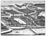
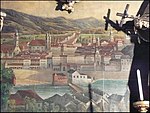
Views
· 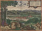
Linz anno 1594
· 
View around 1674. copper engraving from the Topographia Austriae superioris modernae.
· 
Town view (around 1694), Floriani altar of the town parish church
· 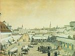
View from the "Platzl" in Urfahr to Linz (around 1830)
First Republic
After the end of the First World War and the proclamation of the Republic there was a revolutionary mood in Linz - as in many places - which also expressed itself in demonstrations and looting. In February 1919 and in May 1920 martial law was imposed in the city after violent riots.
In contrast to the province of Upper Austria, where the Christian Social Party had an absolute majority in the Republic as in the Monarchy, in the city of Linz the first municipal election in 1919 under universal and equal suffrage brought a political upheaval: the two-thirds majority of the German Nationalists became an absolute majority for the Social Democratic Workers' Party of Austria.
During the democratic phase of the First Republic Linz developed into a large city: due to immigration and incorporation the 100,000 population mark was exceeded in 1923. With the unification with the city of Urfahr in 1919, Linz's urban area also expanded north of the Danube. This meant that the infrastructure had to be expanded under the most difficult economic conditions: social welfare was extended by new maternity advice centres, kindergartens and increased youth welfare services, and the municipal depot was expanded to become the central enterprise for refuse collection and transport as well as a materials procurement centre. Furthermore, the focus was on municipal housing, but the extremely great housing shortage could not be solved. Despite the will to cooperate, the fundamental differences between the political parties became apparent here: the bourgeois parties wanted to push settlement housing and rejected the larger residential buildings as "interest barracks". They saw urban enterprises as undesirable competition for private enterprise, while the Social Democrats insisted on urban enterprises for combating unemployment and as a price regulator.
During the First Republic, the commitment to democracy and the willingness to cooperate united Christian Socialists, Social Democrats and Greater Germans in Linz, despite their differing ideologies and views, until 1933. After that, due to developments in domestic and foreign policy, cooperation on substantive issues was also permanently disrupted in Linz.
February 1934
The Austrian Civil War can be seen as a consequence of the intensifying conflicts between the ideological camps in the First Republic and the anti-democratic course of the federal government under Engelbert Dollfuß. It began in Linz with a search for weapons at the party headquarters of the Social Democratic Workers' Party. This was preceded by a letter from the Linz Schutzbund leader Richard Bernaschek and other functionaries to the party executive in Vienna on 11 February 1934. In this letter, resistance was announced in the event of further arrests of Schutzbünders or weapons seekers. The letter arrived in Vienna late in the evening. Otto Bauer gave instructions by telephone not to take any action without the approval of the party leadership. However, the telephone conversation was intercepted. The police thus knew of Bernaschek's will to resist when they began a search for weapons at the Hotel Schiff, the Social Democratic Party headquarters on the Landstrasse, at about seven o'clock on February 12. Von Bernaschek, even before he was arrested, alerted the Republican Schutzbund and gave the signal for the uprising. The Schutzbund occupants of the Hotel Schiff fought battles until noon with the invading executive and the Federal Army, which was called in to help. Other centres of fighting in Linz were the Eisenhandkreuzung, the Diesterweg School, the Dorfhalle, the Parkbad and the railway bridge, in Urfahr the Spatzenbauer and on the Freinberg the Jägermayrhof. A particularly momentous incident occurred at Polygonplatz (today Bulgariplatz): A taxi with four members of the Austrian army drove towards the position of the Schutzbund, in the ensuing firefight three soldiers were killed under circumstances that have not been fully clarified to this day. A court-martial passed three death sentences on the Schutzbünders involved, whereby only that of the worker Samaritan Anton Bulgari was carried out on 22 February.
At daybreak on 13 February, the Schutzbund abandoned the last remaining street blockades and occupations in Linz. The fighting had claimed at least 27 lives in Linz: four civilians, eight Schutzbund members and 15 killed on the side of the executive. On the part of the Schutzbund, however, the wounded and dead were concealed for fear of reprisals by the authorities, so that precise information on the wounded and killed is not possible.
Estates
Still on 12 February 1934 the Social Democratic Party was banned and its subordinate organizations were broken up. In Linz a government commissioner was appointed and from November 1934 onwards a municipal council was set up, consisting primarily of Christian Socialists and representatives of the Home Army. There was a radical change of personnel in the municipal administration, and some of the municipal enterprises had to curtail their activities or were sold. The Ständestaat also tried to anchor itself symbolically: streets were renamed and monuments erected to those who had fallen on the government side on 12 February 1934. The cult of Chancellor Dollfuß, who had been killed in a National Socialist coup attempt on 25 July 1934, also found resonance in Linz, among other things with the renaming of the Diesterweg School as the "Dollfuß School". In addition, cultural life was to be reshaped in accordance with the ideological positions.
Anschluss and the period of National Socialism
With the invasion of German troops on 12 March 1938, Adolf Hitler embarked on a "triumphal journey" from his native town of Braunau to Vienna and spoke for the first time as Reich Chancellor on Austrian soil in Linz. It was only here, in the face of popular jubilation and reserved reactions from abroad, that he decided to carry out Austria's annexation to the German Reich immediately and in full. Due to his emotional connection to Linz, Hitler took over the "sponsorship" of Linz (which also became one of the five Fuehrer cities) on this very day and promised investments from the Reich.
On 13 March 1938 Hitler signed the Anschluss Act at the Weinzinger Hotel.
Hitler, who had attended school in Linz, intended to spend his retirement here one day. He therefore intended the city to play an outstanding economic and cultural role in the Reich. The expansion plans included a boulevard with magnificent buildings such as the opera, theatre and galleries, but especially the "Führer Museum", which was to house the world's largest art and painting gallery. For this collection, corresponding works of art were looted from the museums of the occupied and conquered countries as part of the "Special Order Linz" (see also: Architecture under National Socialism). In addition, Linz was to be developed into an industrial and administrative center with representative buildings for the National Socialist German Workers' Party (NSDAP) and its sub-organizations and oversized administrative buildings. This would have meant large-scale demolition of the historic building stock on both the Linz and Urfeld sides. Apart from a few exceptions such as the Nibelungen Bridge, the bridgehead buildings and today's Heinrich Gleißner House, the plans pushed by Albert Speer were not put into practice.
In the expansion of the existing industry, the restructuring to large-scale operations in the metallurgical and chemical sectors is particularly noteworthy. With the steel and armaments factory Reichswerke AG für Erzbergbau und Eisenhütten "Hermann Göring" Linz, which was built from 1938 onwards during the National Socialist era, as well as the Stickstoffwerke Ostmark, the foundations were laid for the later VÖEST and all its successor companies, as well as for the Linz chemical industry. The inhabitants of the village of St. Peter-Zizlau were relocated and the buildings demolished for the construction of the factory premises and the harbour that was to be built there at the same time.
In 1941-1943, the railway line to Gusen, including a bridge over the Danube, was built next to the two large industrial plants across to Steyregg as a branch from the Western Railway. Gusen was the site of several concentration camps, with the underground production of large parts of Messerschmitt aircraft. Circumstantial evidence from 2019 also points to the construction of the V2 rocket and research into nuclear fission.
In addition to prisoners of war and foreign workers, prisoners of the Mauthausen concentration camp were also used in the above-mentioned industrial plants.
The expansion of industry, the associated relocations and the influx of workers exacerbated the already existing housing shortage. As a remedy, entire districts were built, such as at Bindermichl or the "Neue Heimat" with large housing estates, which still characterize the appearance of these districts today. The expansion of the necessary infrastructure (schools, kindergartens) was omitted. With the simultaneous incorporations, the city area was almost doubled and reached the expansion that still exists today.
But Linz was also a centre of persecution: More than 100,000 people from all over Europe lost their lives in the nearby Mauthausen concentration camp and its subcamps. A total of three subcamps of the Mauthausen concentration camp as well as 77 camps for forced laborers were located on Linz city territory. The 600 Jews had to leave Linz - 150 of them were murdered by the National Socialists. Hundreds of victims of National Socialist euthanasia were either in the Linz sanatorium and nursing home Niedernhart, today's Wagner-Jauregg state mental hospital, or were transferred from there to the Nazi euthanasia institution Schloss Hartheim near Linz.
In the end, even those who had served the regime out of enthusiasm or forced loyalty had to suffer the consequences of National Socialist policies. In Linz, for propaganda reasons, the construction of air-raid shelters for the population was not pushed until the end of 1943. As late as November 1944 whole districts of the city were still without safe cover during air raids. More than 1,600 people died in the 22 bombing raids on Linz between July 1944 and April 1945, thousands of Linzers lost their lives as members of the German Wehrmacht.
In Linz tanks were built in the Göring factories and submarines in the area of the harbour.
On May 4 and 5, 1945, the city was under American artillery fire and Gauleiter August Eigruber retreated to southern Upper Austria. The original plan to defend the town by fighting in the houses was abandoned. On 5 May at 11:07 a.m. the first American tanks arrived at the Hauptplatz.
Postwar
From 1945 until the end of the occupation in 1955 Linz was divided along the Danube. The north (Urfahr) was occupied by the Soviets, the south (Linz) by the US Americans.
In 1966 Linz became a university city with the "Hochschule für Sozial- und Wirtschaftswissenschaften" (University of Social and Economic Sciences), from which the Johannes Kepler University Linz emerged in 1975. From 1971 to 1991 Linz reached its highest population level (see section Population). Until the end of the 1970s many residential buildings were erected, which today are called "building sins" of that time. Within a few years the simplest high-rise buildings were erected in many parts of the city to meet the enormous demand for housing. Projects such as Lentia 2000 and other housing parks were built in this environment.
From the end of the 1970s Linz tried to get away from the "steel city" image of the grey and dirty industrial city. Environmental measures and requirements for industrial companies to improve air quality were taken (see section on ecology), which to this day have made Linz one of the cleanest large cities in Austria. At the same time new cultural institutions were founded. In 1974 the Brucknerhaus was opened on Donaulände, and in 1978 the Anton Bruckner Institute Linz (ABIL). In 1979 the city government launched Ars Electronica, a festival of computer art. This festival has since become one of the most important and significant of its kind. Thanks to the Ars Electronica Center and the city's Lentos Museum of Modern Art (opened in 2003), Linz has also become important as a city of culture. This importance was recognized by the European Union when Linz was chosen as European Capital of Culture in 2009. The construction of a new music theater at the Blumauer Kreuzung site, near the main train station and adjacent to the Volksgarten, was decided in 2004.
With the rising prosperity in post-war Austria, the desire of many families for a "house in the countryside" increased. This had serious consequences for Linz in the 1990s. Although there were about 12,000 people looking for housing in 1990, Linz lost about 20,000 inhabitants to the surrounding communities within only ten years because there was no suitable housing available in the city area. Since then Linz has been trying, often with the support of the province of Upper Austria, to improve its appearance and attractiveness. This has been achieved on the one hand by means of infrastructure projects such as the construction of the new main railway station and the development of the surrounding area into an office district with high-rise buildings belonging to ÖBB, Energie AG and the city-owned Wissensturm, which has housed the adult education centre and the city library since 2007. Furthermore, the tram network has been extended to the south and the bus and tram fleet is continuously renewed. Measures to improve the quality of life included the underpassing of the city motorway at Bindermichl and the construction of the new General Hospital, the Accident Hospital and the Wagner-Jauregg State Neurological Clinic. Direct measures to increase the number of inhabitants include increased residential construction activity. Several large housing projects have been realised since the end of the 1990s: Solar City Pichling, Lenaupark and development of the urban area in the south. The 1,300 apartments of Solar City, built between 1999 and 2005, are not only considered a pioneering project of social housing in the 21st century, but at the same time an example of ecologically well thought-out construction.
In 2007, the construction of 1,700 apartments was started. Most of these will be built on the site of the former women's clinic (415 apartments), 200 residential units are being built at Winterhafen. The south of the city is also being further expanded, for example with the residential project at the former Laskahof civil engineering depot and the Traunausiedlung in Kleinmünchen. Construction of a new city district on the site of the former freight station began at the end of 2013. Since the last census up to 2006, 5,000 inhabitants have thus already been regained or newly acquired.
Coming to terms with the NS past
On September 19, 1996, the City Council of Linz decided to have the city's archives conduct a comprehensive scientific study of the National Socialist era, including the period before 1938 and denazification after 1945. Linz was thus the first city in Austria to deal intensively with its own National Socialist past. At the final presentation in May 2001 reference could be made to seven scientific publications, Internet presentations and numerous lectures as a result of the project.
The culture of remembrance also manifests itself in the erection of monuments and memorial plaques for victims of National Socialism. Especially since 1988, numerous places of remembrance have been created in public space. Street renamings or new street names also reflect the confrontation with the Nazi past: while in 1945, immediately after the end of the Nazi dictatorship, 39 streets in Linz were renamed, between 1946 and 1987 only two were. Since 1988, on the other hand, 17 new traffic areas have been named after victims of National Socialism or resistance fighters. In the recent past several Nazi victims and activists against National Socialism received high honors from the city of Linz, such as Simon Wiesenthal, who founded his first Jewish documentation center in Linz after 1945.


Related articles
Author
AlegsaOnline.com Linz — Austrian Danube city, industrial center and cultural hub Leandro Alegsa
URL: https://en.alegsaonline.com/art/58329