
Linkinhorne: parish and village in southeast Cornwall
Overview of Linkinhorne, a rural parish in southeast Cornwall, covering its geography, settlements, mining heritage, the parish church of St Melor, and recreational routes near Bodmin Moor.
Linkinhorne is a civil parish and village in southeast Cornwall, in the United Kingdom. The village lies on the valley of the River Lynher at grid reference SX 320 736, roughly northwest of Callington and south of Launceston. The parish combines agricultural lowlands, wooded river valleys and upland terrain to the west where the slopes of Caradon Hill rise toward the granite outcrops of Bodmin Moor, creating a varied rural landscape.
Image gallery
5 Images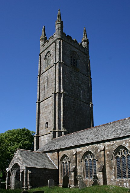


Geography and settlements
The parish boundary follows natural features in places: the River Inny marks parts of the north‑eastern edge while the River Lynher runs through the parish. Land use is predominantly pastoral and mixed farmland, with pockets of heath and moorland toward the west. In addition to Linkinhorne village itself, the parish contains a number of small settlements and hamlets including:
- Bray Shop
- Caradon Town
- Downgate
- Henwood
- Ley Mill
- Minions
- Upton Cross
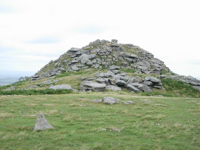
Minions, on the eastern fringe of Bodmin Moor, is notable for its windswept granite tors and remains of prehistoric and industrial activity; it is a gateway for walkers exploring the moorland and rocky features.
History and landmarks
Linkinhorne has a long rural history shaped by agriculture and, from the 18th into the 19th century, by mining on Caradon Hill. The mining era left a legacy of engine houses, spoil heaps and altered landscapes that now attract interest from industrial archaeologists and visitors tracing the county's mining past. The parish church of St Melor, built of local granite and with medieval fabric, dates principally from the 15th century and contains traditional features typical of rural Cornish churches.
Economy, heritage and recreation
Farming remains an important part of local life, while tourism and outdoor recreation contribute to the contemporary economy. The mix of valleys, moorland and historical sites makes the parish a destination for walking, birdwatching and heritage trails. Caradon Hill and the edges of Bodmin Moor offer panoramic views and access to moorland ecology. The remains of the Caradon mining district are interpreted at local museums and through waymarked routes that explain the industrial past.
Transport and community
Linkinhorne is reached by minor roads and lanes; the B3254, which runs between Launceston and Liskeard, provides a regional route close to the parish. Local services are concentrated in larger nearby towns, including Launceston to the north and Callington to the south, while Liskeard is another nearby centre offering amenities and rail connections. Community life is centred on parish institutions, village halls and events that reflect rural Cornish traditions.
Points of interest
- The parish church of St Melor: a granite medieval building notable for its tower and local stonework.
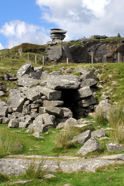
- Mining heritage on Caradon Hill: scattered ruins and landscape features from the 19th‑century copper and tin industry.
- Bodmin Moor and Minions: tors, archaeological remains and routes for walkers exploring upland heath.
Visitors or readers seeking more detailed maps, historical records or conservation information can consult local parish resources and county heritage services. The area's combination of natural features, historic industry and village life makes Linkinhorne a representative example of rural Cornwall's changing landscape.
Questions and answers
Q: Where is Linkinhorne located?
A: Linkinhorne is a parish and village in southeast Cornwall, United Kingdom.
Q: Can you provide the grid reference for the village of Linkinhorne?
A: The grid reference for the village of Linkinhorne is SX 320 736.
Q: How far is Linkinhorne from Callington?
A: Linkinhorne is approximately four miles (6.5 km) northwest of Callington.
Q: What other settlements are included in the parish of Linkinhorne?
A: Other settlements in the parish include Bray Shop, Caradon Town, Downgate, Henwood, Ley Mill, Minions, and Upton Cross.
Q: What natural features border the area of Linkinhorne?
A: The area is bordered by the River Inny in the north-east and Bodmin Moor to the west.
Q: Is Linkinhorne a largely rural area?
A: Yes, the parish is largely rural.
Q: What is the name and age of the parish church in Linkinhorne?
A: The parish church is St Melor and it dates back to the 15th century.
Related articles
Author
AlegsaOnline.com Linkinhorne: parish and village in southeast Cornwall Leandro Alegsa
URL: https://en.alegsaonline.com/art/58294