Liechtenstein
Small Alpine principality between Austria and Switzerland. A constitutional monarchy known for banking, light manufacturing and being one of two doubly landlocked countries in Europe.
Overview
Liechtenstein is a small sovereign country in the Alps of central Europe. It ranks among the world's smallest states and is often noted as the sixth smallest by area. The principality shares borders with Austria and Switzerland and has a very small population and compact territory compared with most nations.
Image gallery
10 Images


Geography and government
Liechtenstein's landscape is predominantly Alpine, with steep valleys and forested slopes. It is one of only two countries, along with Uzbekistan, that are described as doubly landlocked—meaning any journey to a seaport crosses at least two national borders. Politically it is a hereditary constitutional monarchy headed by a prince, with democratic institutions and local municipalities administering everyday affairs.
History and international ties
The modern principality emerged in the early 18th century and consolidated sovereignty as Europe's political map changed in the 19th and 20th centuries. After the collapse of the Austro-Hungarian arrangements around World War I, Liechtenstein reoriented many of its economic and monetary relationships toward Switzerland and today participates in close bilateral arrangements, including a longstanding customs union.
Language, capital and institutions
German is the official language and local Alemannic dialects are commonly spoken; cultural life reflects Germanic and Alpine traditions. The capital is Vaduz, a small administrative and cultural center with a prominent princely residence and museums. Liechtenstein maintains modern public services while preserving a compact urban and rural character.
Economy and society
Despite its size, Liechtenstein has a diversified economy. It is known for private banking and financial services, and for specialized manufacturing such as precision instruments and dental products. Tourism, small farms, and cross-border commerce with neighboring states also contribute to prosperity. The use of the Swiss franc and close ties to Swiss markets are practical features of daily life.
Distinctive facts
- Official language: German.
- Capital: Vaduz, notable for its castle and cultural institutions.
- Unique status: doubly landlocked alongside Uzbekistan.
- Close relationships with Austria and Switzerland in transport, trade and finance.
For concise maps, histories and administrative details see overview pages and country profiles: general outline, regional context at European references, and specialized entries on banking, law and governance available through dedicated links.
Geography
Liechtenstein is a small state located on the right bank of the Rhine in the Alps, surrounded by the Swiss cantons of St. Gallen in the west (on the opposite side of the Rhine) and Graubünden in the south, and the Austrian state of Vorarlberg in the east and north. Its state border with Switzerland in the west corresponds to the course of the Rhine, while the southern and eastern state borders are marked by the high mountains of the Alps, the Rätikon. The border with Austria runs for the most part along the mountain ridge. Apart from Uzbekistan, Liechtenstein is the only landlocked State that is in turn surrounded exclusively by landlocked States.
The country covers an area of 160.477 square kilometres, making it the fourth smallest state in Europe and the sixth smallest in the world. It measures 24.77 kilometres at its longest point and 12.35 kilometres at its widest.
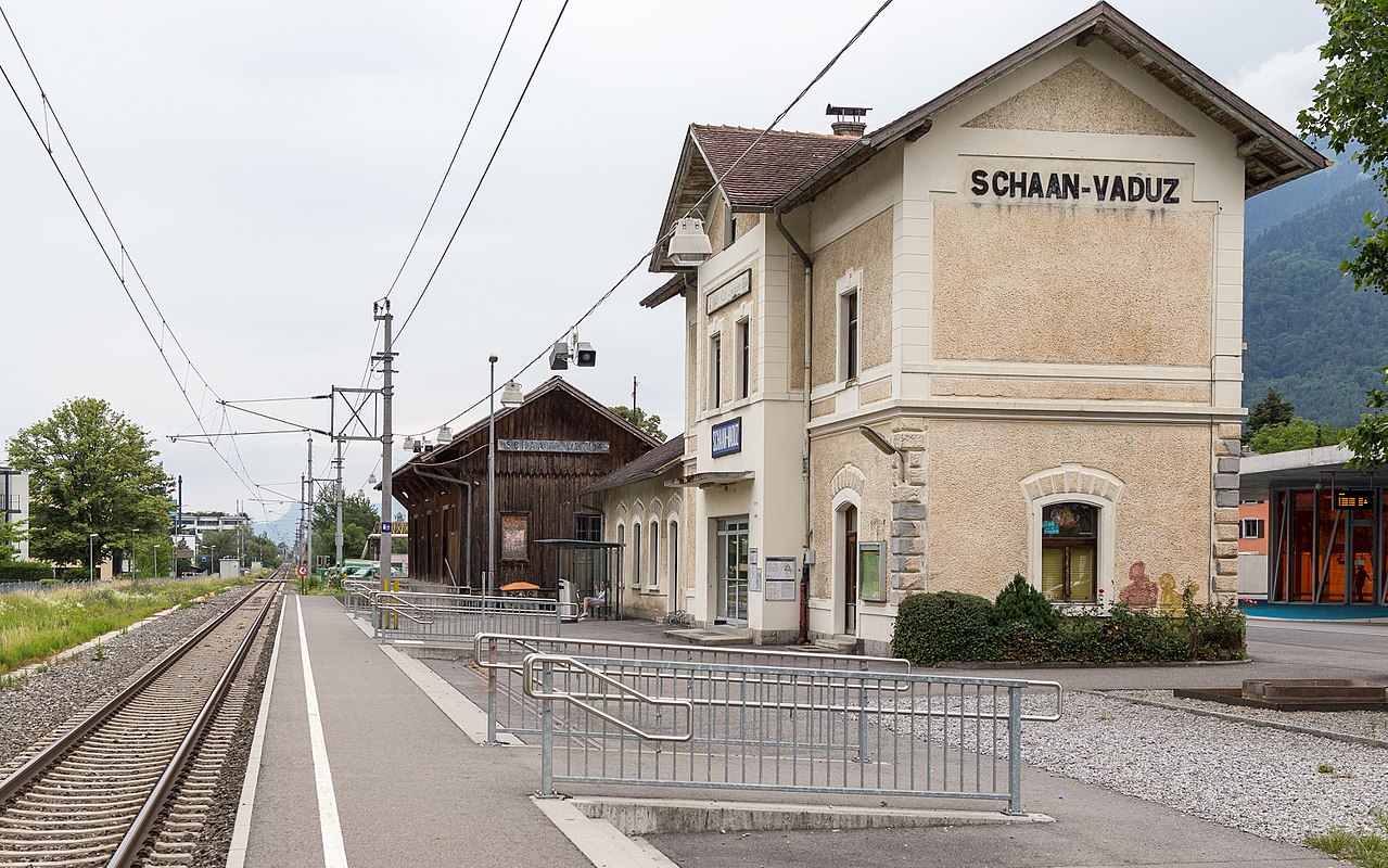
Liechtenstein shares a 41.2-kilometre border with Switzerland, of which 27.2 kilometres are in the canton of St. Gallen and 14 kilometres in the canton of Graubünden. The length of the state border with the Republic of Austria (federal state of Vorarlberg) is 36.7 kilometres. The largest town by population is Schaan.
On Alp Bargälla, east of Gaflei, about 120 m southwest of the alpine hut on the Samina valley side, at 1721 m above sea level, lies the geographical centre of Liechtenstein.
Natural classification
Liechtenstein is divided into two landscapes, the main settlement area being the Rhine Valley in the west and the Samina Valley with its side valleys in the east. The latter changes the border in the further course and flows near Frastanz into the lower Walgau of Vorarlberg. This part of the state is separated from the Rhine Valley by a mountain ridge ranging from 1000 to over 2000 metres in height, is scarcely populated and makes up about one third of the state's area.
The country is further divided into two regions, the Unterland and the Oberland. The Unterland comprises the municipalities north of Schaan and Planken (roughly on the line of the Three Sisters), while the Oberland includes the southern part of the Principality. In terms of natural space, these two regions differ in that the Oberland is more strongly characterised by the alpine mountains, while the Unterland extends mainly - with the exception of the Eschnerberg - onto the Rhine valley plain.
Of the country's land area, 11 percent is settlement land, 33 percent agricultural land, 41 percent forest land, and 15 percent unproductive land.
Mountain
About half of Liechtenstein's territory is mountainous. Liechtenstein lies entirely in the Rhaetikon and is thus - depending on the division of the Alps - assigned to the Eastern Alps (two-part division of the Alps) or the Central Alps (three-part division of the Alps).
The highest point of Liechtenstein is the Vordere Grauspitz (Vordergrauspitz) with an altitude of 2599 m above sea level. while the lowest point is the Ruggeller Riet with an altitude of 430 m above sea level.
In total, there are 32 mountains in Liechtenstein with an altitude of at least 2000 metres. The Falknishorn, at 2452 metres above sea level, is the fifth highest mountain in Liechtenstein and represents the southernmost point of the country. The border triangle Liechtenstein-Graubünden-Vorarlberg is the Naafkopf (2570 m above sea level ).
In addition to the peaks of the Alpine chain, which belong to the Limestone Alps, two inselbergs, Fläscherberg (1135 m above sea level) in the south and Eschnerberg (698 m above sea level) in the north, rise out of the Rhine Valley and belong to the Helvetic cover or flysch zone of the Alps. The Eschnerberg represents an important settlement area in the Liechtenstein Unterland.
Geology
Liechtenstein lies at the western end of the Rätikon and thus at the geological western end of the Eastern Alps. The country occupies a central position in the east-west Alpine border region.
The geological structure of Liechtenstein is formed in three regionally different marine environments, which were formed both at different times and in different facies. The depositional environments form the three-part geological structure of the Principality in storey-like blankets: At the bottom are the Western Alpine, Helvetic Limestone Alps. The rocks originate from the Jurassic and the Cretaceous. Sedimentation took place in a shallow sea that gradually became deeper. In the process, sandstones and marls were formed in addition to limestones.
In the middle, to the east of the Rhine, which Liechtenstein borders on the west, is a thick layered package of various flysch rocks. They are attributed to the Penninic period. The origin of the marine deposits is dated to the Upper Cretaceous and the Old Tertiary. Their composition consists of alternating layers of mudstone, sandstone, marl, calcareous sandstone. The southern flysch zone was overlain by a sedimentary mass.
The uppermost geological level of the Eastern Alps is formed by the Lech Valley cover, which is divided into floes in Liechtenstein.
Geomorphology
Geomorphologically, Liechtenstein consists of two parts: On one side is the plain along the Rhine in the west, while on the other side in the east are high mountains. A geological peculiarity is that the western end of the Rätikon forms the geological end of the Eastern Alps as part of a microplate torn away from Africa. The rocks of the Liechtenstein mountains and hills consist almost entirely of marine sediments. The sediments consist of three different layers, which originate from different bodies of water: At the top is the Lechtal cover, formed from several floes, which lies above a large flysch rock layer. Below the flysch rock layer are the Western Alpine Limestone Alps. They were formed in the Mesozoic and in the Tertiary in the "primeval Mediterranean" Tethys by lithogenesis. Through tectonic movement processes, which came from the south and east, the African plate overlapped and underlapped with the European blankets of the Helveticum as well as the Flysch. Tectogenesis resulted in extensional processes, folding, metamorphism, scaling and fracturing.
Short watercourses formed on steep valley slopes. This led to the formation of torn valleys, ditches, gullies and ravines. Due to the easily weathered rock of the flysch and the main dolomite found there at the same time, debris cones and heaps were formed. At the end of the Würmkaltzeit, during which glaciers up to 1700 m high were found on the territory of present-day Liechtenstein, ice streams of the Rhine Glacier were deposited, carrying with them moraine material that was transported from the south. Around 14,500 BC, the Rhine Glacier had finally retreated from the Liechtenstein area. On the south-eastern flank of the Eschnerberg, drumlins up to 1600 m long appeared.
Waters
The Rhine is the most important and largest body of water in Liechtenstein. Over a length of approximately 27 kilometres, it represents the natural border to Switzerland and is of great importance for Liechtenstein's water supply. In addition, the Rhine is an important recreational area for the population. At 10 kilometres, the Samina is the second longest river in the Principality. The white-water river rises in Triesenberg and flows into the Ill in Austria (near Feldkirch).
The only naturally formed lake in Liechtenstein is the Gampriner Seelein, which was only formed in 1927 by a flood of the Rhine with enormous erosion. In addition, there are other artificially created lakes that are mainly used to generate electricity. One of these is the Steg reservoir, the largest lake in Liechtenstein.
Climate
The climate of the country is relatively mild despite its mountainous location. It is strongly influenced by the foehn (warm, dry downdraft wind), which extends the growing season in spring and autumn, and temperatures of around 15 °C are not uncommon in winter due to the strong foehn. The offshore Swiss and Vorarlberg mountain ranges provide protection against Atlantic and polar cold air, creating a typical inner-Alpine shelter. Thus, the Principality has a fruit culture with scattered meadows and a long tradition of viticulture. The small spatial extent of Liechtenstein hardly plays a role in the climate differences, but the vertical division into different altitudes is of great importance, so that significant climate differences arise.
In winter, the temperature rarely drops below minus 15 degrees, while in summer the average temperatures fluctuate between 20 and 28 degrees. Measurements of annual precipitation yield an average of around 900 to 1,200 millimetres, while in the direct Alpine region precipitation is often as high as 1,900 millimetres. The average sunshine duration is around 1,600 hours per year.
Flora and vegetation
→ Main article: Flora and vegetation of the Principality of Liechtenstein
Natural disasters
Floods in Liechtenstein have always been threatened primarily by the Rhine. The earliest recorded flooding of the Rhine dates back to 1343. Between the 15th and 19th centuries, 48 floods can be documented on the Alpine Rhine. Overexploitation of the Grisons forests in the 18th and 19th centuries led to more bedload deposits and a gradual raising of the river bed due to increased rip-rapping and landslides. As a solution, Switzerland and Liechtenstein concluded a treaty in 1837 which laid the foundation for today's Rhine protection structures. The numerous floods of the 19th century brought the impoverished country to the brink of ruin. For the last time to date, the Rhine flooded the valley north of Schaan in September 1927.
Despite the imminent danger of destruction by landslides, settlements were built in the area of the debris cones, as the Rhine plain was marshy and subject to regular flooding. Damage caused by landslides is frequently recorded, e.g. in Vaduz in 1666 and 1817. After the heavy floods in the summer of 1854, the first flood defences were built. Despite the large investments in the Rüfe defences, a risk remains, as demonstrated by a devastating event in Triesenberg and Triesen in 1995.
Föhn winds fanned village and forest fires in the Oberland. Avalanches destroyed nine huts in Malbun in 1951 and 15 holiday homes in 1999. Since the 1970s, the number of danger spots has been considerably reduced by shoring and reforestation.


Population
Liechtenstein had a total population of 38,557 on 30 June 2019. In 2019, about two-thirds of the residents were native Liechtensteiners (66.1%). Almost 60% of the foreign resident population came from the rest of the German-speaking world (28.1% from Switzerland, 17.2% from Austria and 12.7% from Germany), followed by 9.2% from Italy and 5.5% from Portugal. 4.4% of foreigners in Liechtenstein came from Turkey, and 23% came from other States. Overall, Liechtenstein's permanent resident population includes people from around 90 nationalities. In 2019, the population growth was 0.9% (increase of 356 people). The average population density is around 238 people per square kilometre.
The last child was born in the Liechtenstein National Hospital in spring 2014. Since April 2014, expectant mothers from Liechtenstein have had to go abroad for hospital births because the country's only maternity ward has been closed.
Population development
For the period of the Middle Ages, there are no reliable figures on the population in the territory of present-day Liechtenstein. It was not until 1584 that the first estimate was made, according to which about 2,500 persons lived in the County of Vaduz and about 1,300 in the County of Schenkenberg - i.e. about 3,800 inhabitants in total.
Although no figures are available for the period of the Thirty Years' War, it can be assumed that the population stagnated or declined, as in the rest of Central Europe. Thereafter, it rose sharply until a renewed stagnation due to a succession of epidemics and food crises between about 1730 and 1760; likewise during the Napoleonic Wars of Liberation, where there was even a slight population decline after Austrian troops brought in epidemics in 1796. After that, the population grew again until 1840, only to stagnate again. However, the population growth at the beginning of the 19th century was so high that fears of a general impoverishment arose, to which political reaction was made with restrictive measures such as marriage restriction, the success of which, however, is unknown.
It was not until the beginning of the 20th century that slow growth began again - interrupted by the departure of foreign workers during the First World War. After the Second World War, the population increased rapidly as a result of the economic upswing - mainly due to the influx of foreign workers.
| Year | Population | annual growth |
| 1584 | approx. 3'800 | |
| 1815 | 6'117 | 0,21 % |
| 1901 | 7'531 | 0,24 % |
| 1950 | 13'758 | 1,24 % |
| 1960 | 16'495 | 1,83 % |
| 1970 | 21'265 | 2,57 % |
| 1980 | 25'866 | 1,98 % |
| 1990 | 28'747 | 1,06 % |
| 2000 | 33'286 | 1,48 % |
| 2010 | 36'003 | 0,79 % |
| 2018 | 38'155 | 0,73 % |
Source: until 1901 HLFL, from 1950 UN
Migration
Until the First World War, Liechtenstein was a country of emigration due to the poor supply situation and its poverty. From early on, it was common for people to serve as soldiers for foreign states, to marry abroad or to enter foreign monasteries. From the 18th century onwards, seasonal work abroad also gained in importance, which only ceased with the economic upswing after the Second World War. In order to limit emigration, restrictions on emigration were enacted in 1805 and, after previous relaxations, were lifted altogether in 1848. North America was probably just as important a destination as the neighbouring countries of Austria and Switzerland, to which migration was particularly favoured by agreements on freedom of movement (Switzerland) or customs treaties (Austria).
With industrialisation, migration patterns changed and foreign workers and skilled labour entered the country. While the proportion of foreigners in the population at the beginning of industrialization was still 16.2% in 1941, it rose to 53.9% by 1970. In order to slow down this trend, Liechtenstein has pursued a very restrictive immigration policy since 1945, which, however, was opposed by international trade agreements. Thus, the Principality committed itself to a minimum annual quota of immigrants vis-à-vis both the EEA states and Switzerland.
In 2018, 649 persons immigrated to Liechtenstein, of whom 26.3% had Liechtenstein citizenship, and 484 persons emigrated, of whom 49.0% had Liechtenstein citizenship.
birth and death rate
In the early modern period, the death rate was several times higher than the birth rate during the stagnation phases. While the birth rate rose sharply at the end of the 18th century, the death rate declined in the long term from the beginning of the 19th century due to hygienic and medical improvements as well as those in the food supply. Epidemics - as they have always recurred with a certain regularity throughout history - now became rarer on the one hand and, above all, no longer meant the death of an ill person with such a high probability. This can also be seen in life expectancy, which rose from 29 in the 1830s to 39 at the beginning of the 20th century, 62 at the beginning of the 1960s and 76 in 2003.
As industrialisation progressed, the number of children per family declined, as they were no longer needed for farm work but rather represented a financial burden. This trend was briefly interrupted by the baby boom of the 1940s/50s, but in the 1960s the birth rate rapidly declined to its present level with the pill crunch. Various societal factors (such as a rise in single-person households, enabling divorces, or a pronounced consumerism) kept the birth rate low thereafter.
Language
→ Main article: Liechtenstein dialects
In Liechtenstein, according to the Constitution Article 6, German is the official language. Liechtenstein is the only State with German as the sole recognised official and national language; in the other States of the German-speaking area, other languages are also recognised as official or minority languages.
The written and media language is usually Swiss High German. In Liechtenstein, like Switzerland, a double s is written instead of the ß.
The Liechtenstein population speaks various Liechtenstein dialects, the vast majority of which belong to a Middle Alemannic-High Alemannic transitional dialect, as it is also spoken across borders in the Rhine Valley in the neighbouring Canton of St. Gallen (Switzerland) and in neighbouring Vorarlberg (Austria). The local dialects differ considerably from community to community.
However, the High Alemannic-Walser German dialect of Triesenberg is still clearly distinguishable from the High Alemannic dialects of the old-established population. Their bearers arrived in the country around 1300 AD in the course of the Walser migration from the Swiss canton of Valais. In the course of the Middle Ages, this population here - as in the entire Lower Rhaetian region - had abandoned the old Rhaeto-Romanic language in favour of Alemannic.
Religion and church
According to Art. 37 II of the National Constitution, the Roman Catholic Church is a national church and as such enjoys the full protection of the state. However, the separation of church and state is being sought in modern times. Since 20 December 2012, every Liechtenstein citizen over the age of 14 may freely choose his or her religious confession, even without the consent of a legal guardian.
According to the results of the 2015 census, 73.4% of Liechtenstein residents were Roman Catholic, 8.2% Protestant, and around 5.9% belonged to an Islamic religious community. 2.3% were members of another Christian denomination or non-Christian religion, 7% described themselves as non-denominational, and a further 3.3% of the population did not state their religious affiliation.
In a representative survey on religious affiliation commissioned by the Liechtenstein Government in 2008, 78% of Liechtenstein and foreign residents indicated their religion as Roman Catholic, 11% were Protestant, about 3% belonged to an Islamic religious community, and 6% did not provide any information. The proportion of the population in Liechtenstein without a religious denomination thus amounted to 2.8%. The number of Jews in Liechtenstein amounts to about three dozen persons.
Until 1997, Liechtenstein belonged to the diocese of Chur. Finally, on 2 December 1997, the Archbishopric of Vaduz was erected by Pope John Paul II and detached from the Diocese of Chur. Since the establishment of the Archbishopric of Vaduz, Wolfgang Haas has been Archbishop, and the parish church of St. Florin in Vaduz has been elevated to the status of cathedral church.
There are two Protestant churches in the Principality, organized as an association: the Evangelical Church in the Principality of Liechtenstein and the Evangelical Lutheran Church in the Principality of Liechtenstein, as well as a Christian Orthodox church.


Questions and answers
Q: Where is Liechtenstein located?
A: Liechtenstein is located in Western Europe.
Q: What is unique about Liechtenstein's geography?
A: Liechtenstein is doubly landlocked, meaning it is completely surrounded by landlocked countries.
Q: What countries is Liechtenstein located between?
A: Liechtenstein is located between Austria and Switzerland.
Q: What is the official language of Liechtenstein?
A: The official language of Liechtenstein is German.
Q: What is the capital city of Liechtenstein?
A: The capital city of Liechtenstein is Vaduz.
Q: What is Liechtenstein famous for?
A: Liechtenstein is famous for its private banks.
Q: Was Liechtenstein always linked with Switzerland?
A: No, Liechtenstein was previously linked with Austria until the end of World War I, after which it became linked with Switzerland in a customs union.
Related articles
Author
AlegsaOnline.com Liechtenstein Leandro Alegsa
URL: https://en.alegsaonline.com/art/57826
Sources
- llv.li : Raum, Umwelt und Energie
- llv.li : Bevölkerungsstatistik 30. Juni 2010
- llv.li : Bevölkerungsstruktur – Band 1
- llv.li : Key Figures for Liechtenstein
- data.worldbank.org : World Development Indicators
- llv.li : Bevölkerungsstatistik
- hdr.undp.org : Human Development Report 2010 · web.archive.org
- unstats.un.org : Population by sex, rate of population increase, surface area and density