
Latakia Governorate (Syria)
Coastal province in western Syria centered on the port city of Latakia. Features a Mediterranean coast, Alawite majority, several minority communities, mountainous hinterland and historic towns.
Overview
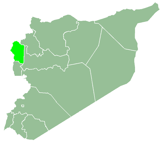
Latakia Governorate (Arabic: مُحافظة اللاذقية / Muḥāfaẓat al-Lādhiqīyah) is a coastal province in western Syria that faces the eastern Mediterranean and shares a land border with Turkey to the north. The governorate is centered on the city and port of Latakia, which functions as the region's administrative and economic hub. Reported area figures vary between sources, generally cited in the range of approximately 2,297–2,437 km². Estimates put the governorate's population at just under one million around 2010, with the city of Latakia itself home to roughly 400,000 people at that time.
Image gallery
10 Images


Geography and climate
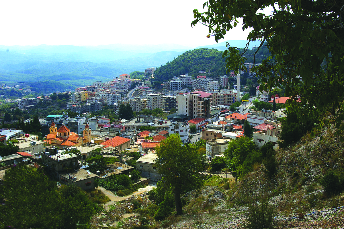
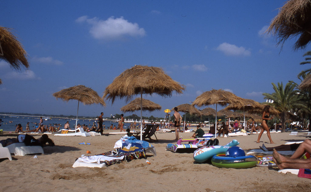
The governorate combines a narrow coastal plain and a sharply rising inland zone formed by a coastal mountain chain often called the Alawite or Nusayriyah Mountains. This topographic contrast produces a typical Mediterranean climate along the shore — mild, wet winters and warm, dry summers — while higher elevations receive greater rainfall and sustain forests and terraced agriculture. The shoreline includes beaches and small ports; the main port city handles much of the region's maritime trade and fishing activity.
Population and communities
Latakia Governorate is noted for its religious and ethnic diversity. Members of the Alawite community form the largest single religious group in the province, and the area has historically been a stronghold of Alawite social and political life (Alawite). Other significant communities include Christians and Armenians — notably concentrated in the coastal town of Kessab and nearby villages (Armenians) — as well as Turkmen in parts of the coastal highlands and Sunni Kurdish communities in certain inland highland enclaves. Urban populations tend to be more mixed, while some rural settlements retain distinctive local identities.
Economy, transport and land use
The economy is anchored by the port of Latakia, which supports shipping, fisheries and related industries. Agriculture remains important in the plains and mountain terraces, with olives, citrus fruits and vegetables among common crops; small-scale livestock herding and forestry occur in upland areas. The coast attracts domestic tourism to beaches and resorts, and road links connect the governorate to Syria's interior. Public services and light manufacturing in the regional center provide additional employment.
History and cultural significance
The coastal strip of Latakia has a long recorded history stretching back to ancient Phoenician and classical eras, reflected in archaeological remains and historic coastal towns. Over centuries the region came under successive empires and administrations, including Ottoman rule and later the French Mandate before becoming part of the modern Syrian state. In the modern period the governorate has gained prominence because of its social and political ties to national leadership figures and as the birthplace region of prominent families associated with the Syrian state, including the town of Qardaha.
Administrative structure and notable places
- Capital and principal city: Latakia (major port and administrative center)
- Other notable towns and localities: Kessab, Jableh, Al-Haffah, Qardaha
- Key sectors: maritime trade, agriculture, fisheries, tourism
For further background on administrative details, geography and cultural groups, consult regional overviews and demographic studies that focus on western Syria and the eastern Mediterranean (Syria). Additional local histories and ethnographic sources can clarify the roles of specific minority communities such as Armenians, Turkmen and Kurds in particular districts (Armenians) and (Alawite).
Note: place names and population estimates for the governorate have varied between sources and over time; the figures and descriptions above reflect broadly reported information around the early 21st century and general geographic and cultural patterns.
Questions and answers
Q: What is Latakia Governorate?
A: Latakia Governorate is one of the fourteen governorates (provinces) of Syria located in western Syria, bordering Turkey.
Q: What is the area of Latakia Governorate?
A: The reported area of Latakia Governorate varies in different sources from 2,297 km² to 2,437 km².
Q: What is the population of Latakia Governorate?
A: The governorate population was 991,000 according to the 2010 estimate.
Q: What is the majority religion in Latakia Governorate?
A: Members of the Alawite sect are the majority in Latakia Governorate.
Q: Who are the majority populations in certain regions of Latakia Governorate?
A: Armenians, Turkmen, and Sunni Kurds form the majorities in the Kessab, Jabal Turkman, and Jabal al-Akrad regions respectively.
Q: What is the population breakdown in the capital of Latakia by religion?
A: By 2010 estimates, the capital of Latakia had 400,000 inhabitants, 50% of whom were Alawites, 30% were Sunni, and 20% Christian.
Q: Where is Latakia Governorate located?
A: Latakia Governorate is located in western Syria, bordering Turkey.
Related articles
Author
AlegsaOnline.com Latakia Governorate (Syria) Leandro Alegsa
URL: https://en.alegsaonline.com/art/56176
Sources
- citypopulation.de : "Syria: Governorates, Major Cities & Localities - Population Statistics, Maps, Charts, Weather and Web Information"
- statoids.com : "Syria Provinces"
- wsj.com : "Syria's Alawites: The People Behind Assad"
- washingtoninstitute.org : "Latakia Is Assad's Achilles Heel"
- britannica.com : "Syria - History, People, & Maps"
- gors.sy : "المراقبة والإدارة البیئیة لنھر الكبیر الشمالي"
- dwd.de : "Klimatafel von Lattakia / Syrien"
- meteo-climat-bzh.dyndns.org : "Station Lattakia"
- cbssyr.org : Latakia city population
- lattakiaport.gov.sy : "حول مرفأ اللاذقية - مرفأ اللاذقية"