Laptev Sea
Shallow marginal sea north of Siberia in the Arctic Ocean, known for long seasonal ice cover, large river runoff, sparse population, and importance for Arctic climate and ecological research.
Overview
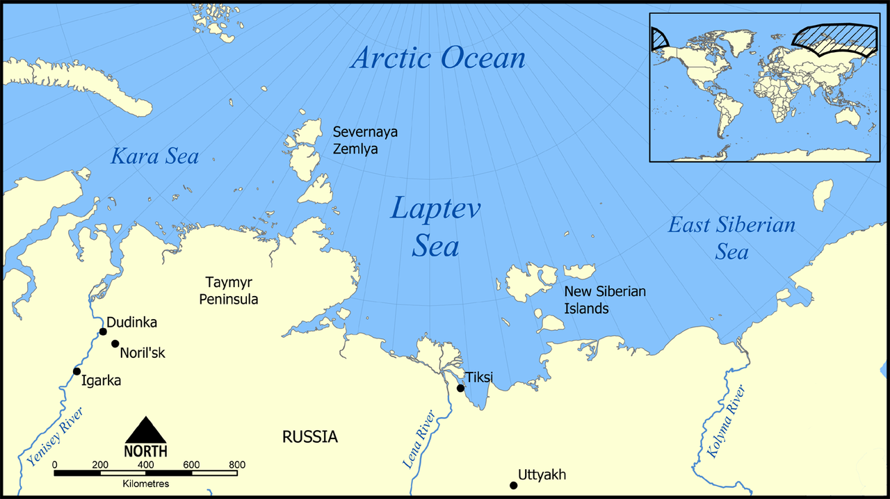
The Laptev Sea is a shallow marginal arm of the Arctic Ocean located off the northern coast of Siberia. It lies between the Taimyr Peninsula and the New Siberian Islands and forms part of the Arctic maritime boundary with neighboring basins. As a marginal sea of the Arctic Ocean, the Laptev Sea connects westward toward the Kara Sea and eastward toward the East Siberian Sea. Its coastline is bounded by mainland Siberia and island groups including Severnaya Zemlya and the New Siberian archipelago.
Image gallery
10 Images


Physical characteristics
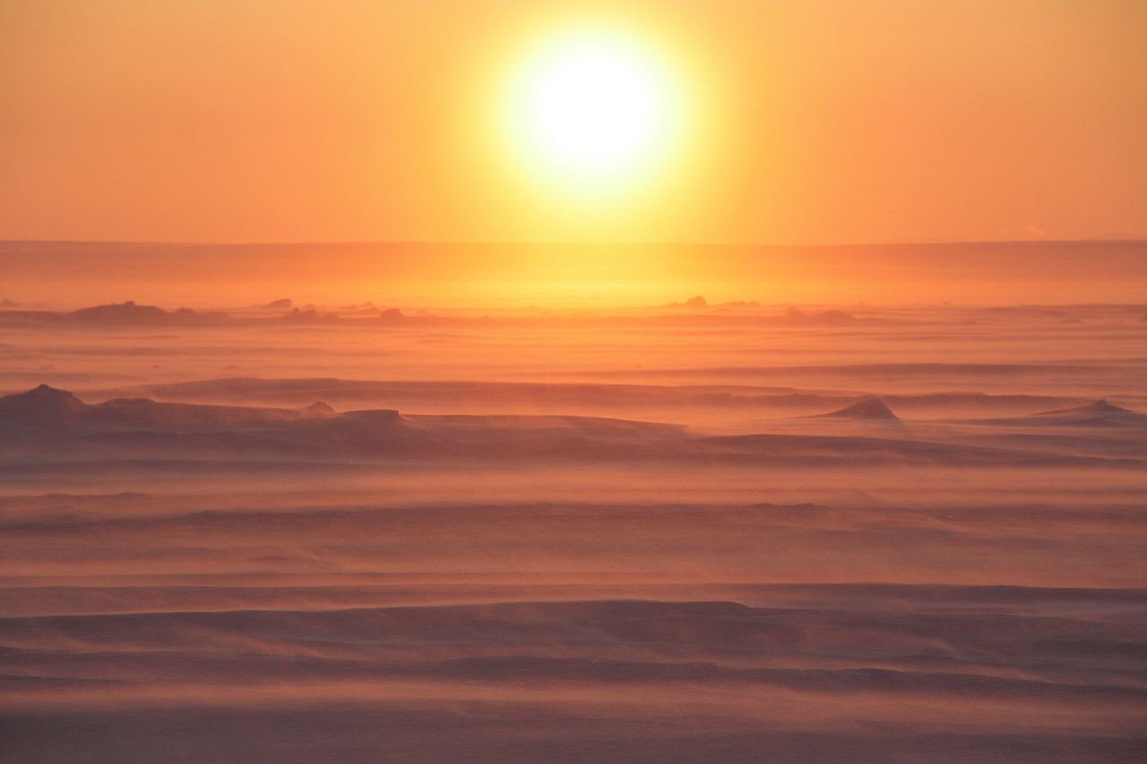
The sea is notably shallow over much of its extent, with large areas remaining less than fifty metres deep. Strong seasonal river discharge and coastal ice formation create a pronounced stratification: large freshwater input lowers surface salinity and a colder, saltier layer lies beneath. The region experiences long periods of ice cover; waters are typically free of fast ice only during late summer months when the sea opens up, most reliably in August and September.
Climate, ice and hydrology
Winters are severe and prolonged, with air temperatures far below freezing for most of the year and an ice season that can extend nine months or more. Major Siberian rivers empty into the Laptev Sea, delivering sediment, organic matter and fresh water that influence salinity, turbidity and coastal dynamics. Major inflows include:
- Lena River
- Khatanga River
- Anabar River
- Olenyok River
- Omoloy River
- Yana River
Ecology and natural features
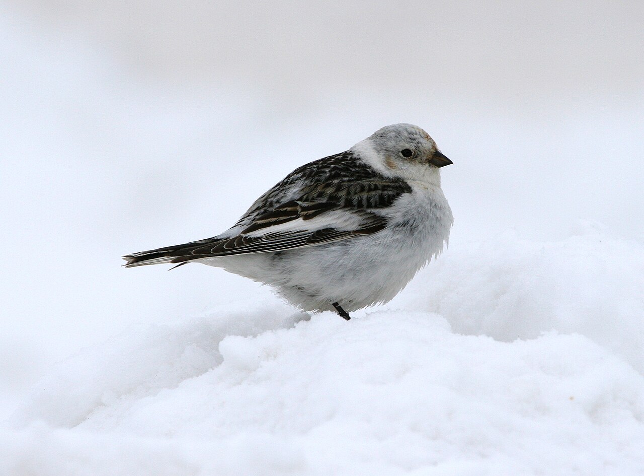
The Laptev Sea supports typical high-Arctic marine life, including plankton blooms during the short summer, benthic communities adapted to cold shallow waters, and megafauna such as seals and polar bears at the ice edge. Migratory birds use coastal and island habitats for breeding. Low productivity relative to temperate seas, harsh conditions and seasonal ice limit biodiversity and human use in most areas. Several islands and coastal permafrost zones preserve well-preserved Pleistocene remains, notably woolly mammoth material reported from parts of the Siberian littoral and island groups (mammoth remains).
Human presence and history
Indigenous peoples including Yukaghirs, Evens, Evenks and later Yakut populations have lived along the Laptev coastline for millennia, practicing reindeer herding, fishing and hunting adapted to Arctic conditions. Russian exploration intensified from the 17th century onward; the sea itself was named after the Russian navigators Dmitry and Khariton Laptev. Permanent settlement is sparse; the largest port and administrative center on the sea is Tiksi, used seasonally for resupply and scientific access.
Uses, research and notable facts
Navigation is seasonal and often constrained to the short ice-free period; the area is crossed by portions of the Northern Sea Route when conditions permit. The Laptev Sea is an active focus of climate and cryosphere research because coastal permafrost, sea-ice dynamics and river runoff interact strongly there. Scientists monitor the region for changing ice seasons, coastal erosion and ecosystem responses. For further geographic and oceanographic context see regional summaries of the northern coast of Siberia and the mapping of Severnaya Zemlya and adjacent islands. Additional technical and historical resources are available through regional atlases and polar research institutions (salinity and hydrography studies, Arctic basin descriptions).
Readers seeking detailed maps, recent satellite imagery or expedition reports can consult specialized polar archives and maritime guides that track seasonal navigability and scientific surveys (East Siberian Sea region, Kara Sea connections, Lena delta studies).
Questions and answers
Q: What is the Laptev Sea?
A: The Laptev Sea is a marginal sea of the Arctic Ocean located between the northern coast of Siberia, the Taimyr Peninsula, Severnaya Zemlya and the New Siberian Islands.
Q: What are the boundaries of the Laptev Sea?
A: The northern boundary of the Laptev Sea passes from the Arctic Cape and ends at the Anisiy Cape. The Kara Sea is to the west, and the East Siberian Sea is to the east.
Q: How did the Laptev Sea get its name?
A: The Laptev Sea is named after the Russian explorers Dmitry Laptev and Khariton Laptev.
Q: What is the climate like in the Laptev Sea?
A: The Laptev Sea has a severe climate with temperatures below 0°C (32°F) over more than 9 months per year.
Q: Is the Laptev Sea heavily populated?
A: No, there are few flora, fauna, and humans in the Laptev Sea.
Q: Which rivers empty into the Laptev Sea?
A: Several large rivers which empty into the Laptev Sea include the Lena River, the Khatanga, the Anabar, the Olenyok, the Omoloy, and the Yana.
Q: What is the largest town and port in the Laptev Sea?
A: The largest town and port in the Laptev Sea is Tiksi.
Related articles
Author
AlegsaOnline.com Laptev Sea Leandro Alegsa
URL: https://en.alegsaonline.com/art/55999
Sources
- bse.sci-lib.com : Laptev Sea
- britannica.com : Laptev Sea
- books.google.com : Arctic animals and their adaptations to life on the edge
- unep.org : Ecological assessment of pollution in the Russian Arctic region
- forpost-x.com.ua : Северная Земля. Часть II
- polaris.nipr.ac.jp : "Preliminary results of botanical and microbiological investigations on Severnaya Zemlya 1995"
- lme.noaa.gov : Laptev Sea: LME #56
- 2mn.org : Список видов морских млекопитающих, встречающихся в море Лаптевых
- pubs.aina.ucalgary.ca : Bird Observations in Severnaya Zemlya, Siberia
- oopt.info : Усть-Ленский государственный природный заповедник