Labrador Peninsula
Large northeastern Canadian peninsula bounded by Hudson Bay, Hudson Strait, Labrador Sea and the Gulf of Saint Lawrence; sparsely populated, rich in natural resources and distinct ecosystems.
Overview
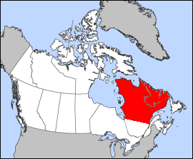
The Labrador Peninsula is a vast landform in eastern Canada that projects into the North Atlantic and Arctic regions. It covers about 1,400,000 km2 and is framed by major waterways: the Hudson Bay to the west, the Hudson Strait to the north, the Labrador Sea to the east and the Gulf of Saint Lawrence to the southeast. It is often shown on regional maps as one of the largest peninsulas in the world.
Image gallery
5 Images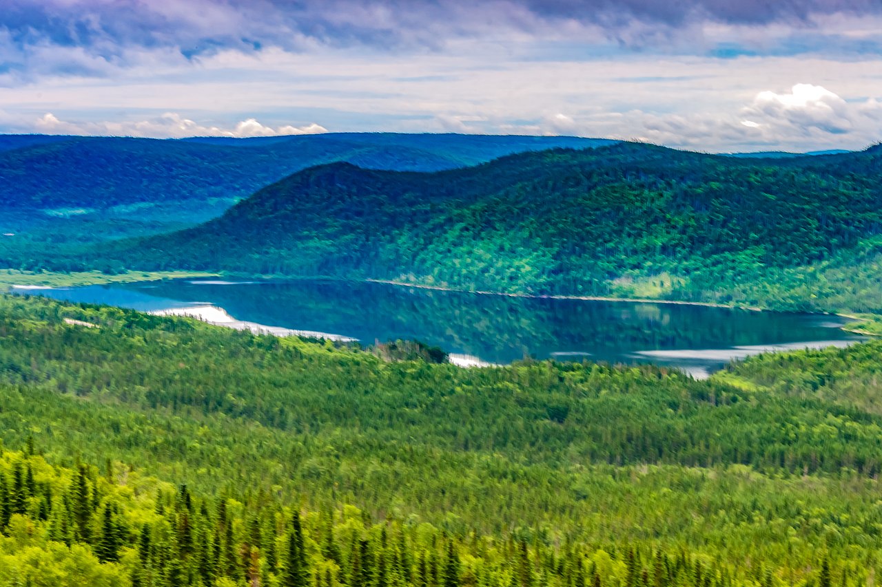


Political and regional divisions
The peninsula is split between the province of Quebec and the province of Newfoundland and Labrador. The eastern portion contains the territory commonly called Labrador, while the western and southern sectors include Quebec regions such as Côte-Nord, Nord-du-Québec and Saguenay–Lac-Saint-Jean. Administratively the land spans provincial jurisdictions but shares many geographic and ecological characteristics.
Geography, climate and ecosystems
The peninsula includes boreal forest in its southern parts, transitioning to tundra and polar landscapes toward the north. Bedrock and glacial geology dominate much of the terrain, producing rocky coasts, lakes and river networks. The climate varies from subarctic to polar, with long, cold winters and short summers; maritime influences moderate temperatures along the eastern coast.
People, history and economy
Indigenous peoples, including Inuit and Innu communities, have lived on the peninsula for millennia and continue to shape its cultural landscape. European exploration and later resource development altered settlement patterns. Today the region is sparsely populated, with most communities concentrated along the coast. Economic activities emphasize natural resources: mining, forestry, commercial fishing and hydroelectric development are important, together with subsistence harvesting and growing tourism focused on wilderness and wildlife.
Distinctive features and uses
- Remote and sparsely settled: large tracts remain undeveloped and relatively pristine compared with southern Canada.
- Resource-rich: mineral deposits, forests and marine fisheries have regional economic significance.
- Ecological transition zone: the peninsula is a meeting place for boreal and tundra ecosystems, supporting diverse flora and fauna.
Researchers and policymakers often highlight the peninsula for its environmental importance and the challenges of delivering services across great distances. Transportation is focused on coastal shipping, seasonal roads and air links rather than dense road networks. Conservation efforts balance traditional land use, economic development and protection of sensitive habitats. For general orientation and further reading see regional sources and maps available through provincial and national outlets such as Canada references and local government pages (Newfoundland and Labrador, Québec, Côte-Nord). Additionally, historical routes and northern passages tie into broader Arctic and Atlantic navigation via the Hudson Strait and the Gulf of Saint Lawrence.
Questions and answers
Q: Where is the Labrador Peninsula located?
A: The Labrador Peninsula is located in eastern Canada.
Q: What are the boundaries of the Labrador Peninsula?
A: The Labrador Peninsula is bounded by the Hudson Bay to the west, the Hudson Strait to the north, the Labrador Sea to the east, and the Gulf of Saint Lawrence to the southeast.
Q: Which regions are included in the Labrador Peninsula?
A: The regions of Labrador, Saguenay–Lac-Saint-Jean, Côte-Nord, and Nord-du-Québec are included in the Labrador Peninsula.
Q: Which province is Labrador a part of?
A: Labrador is part of the province of Newfoundland and Labrador.
Q: What is the area of the Labrador Peninsula?
A: The Labrador Peninsula has an area of 1,400,000 km2 (541,000 sq mi).
Q: Is the Labrador Peninsula densely populated?
A: No, the Labrador Peninsula is very sparsely populated, especially in the north.
Q: What is the general geography of the Labrador Peninsula?
A: The Labrador Peninsula is a large peninsula with various regions and is surrounded by bodies of water, such as the Hudson Bay and Labrador Sea. The north part of the peninsula is mostly uninhabited.
Related articles
Author
AlegsaOnline.com Labrador Peninsula Leandro Alegsa
URL: https://en.alegsaonline.com/art/55236