Kurram District
Kurram District is a mountainous district in northwestern Pakistan along the Afghan border, known for the Kurram River valley, diverse Pashtun tribes, orchards and pine forests, and a complex modern administrative history.
Overview
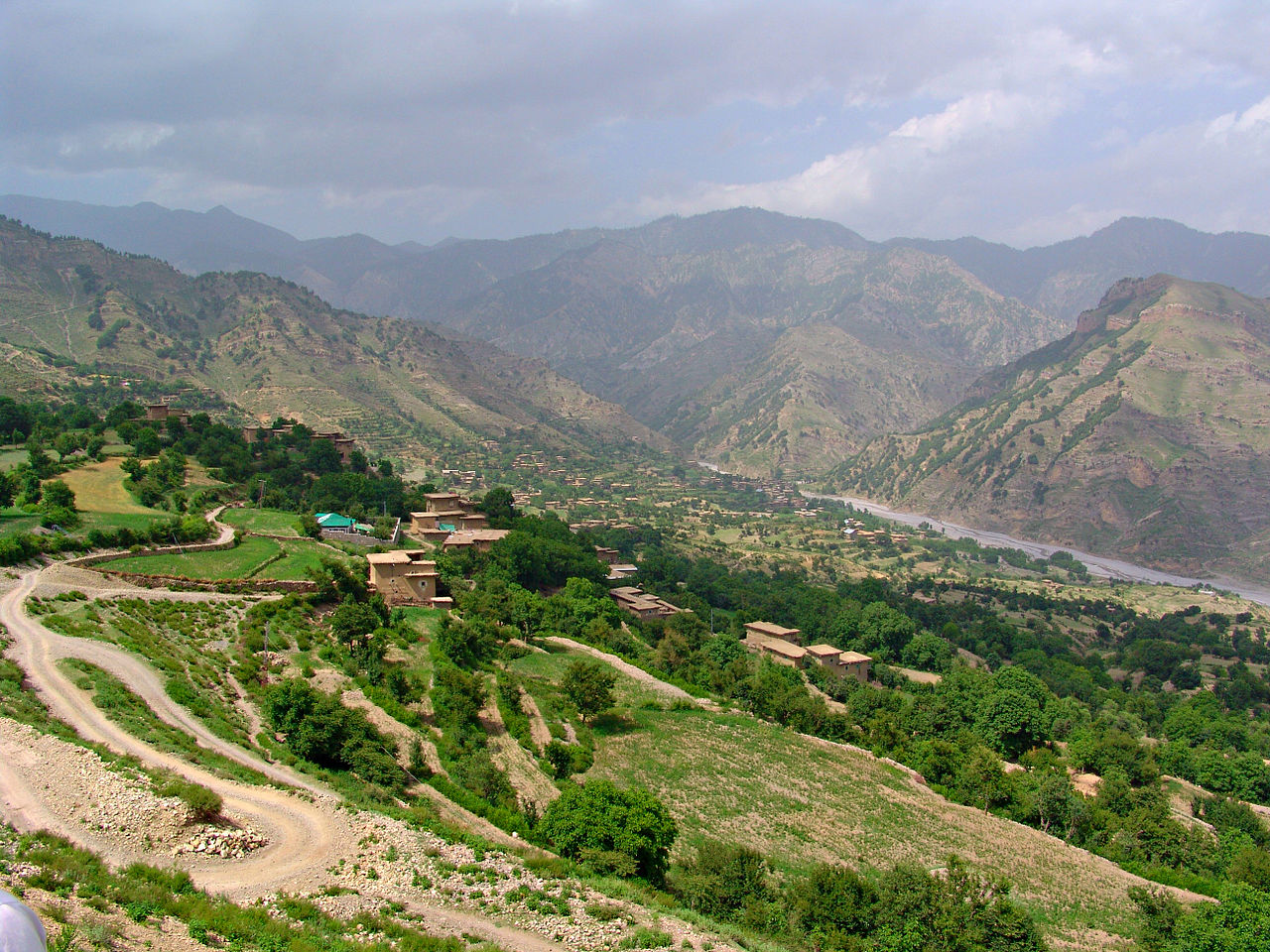
Kurram District lies along Pakistan’s western frontier, occupying a valley drained by the Kurram River. Historically part of the Federally Administered Tribal Areas (FATA), it was administered under special arrangements until reforms in the 2010s integrated these territories into the mainstream provincial system. The district’s principal town and administrative center is Parachinar. Kurram’s location on the border with Pakistan and near routes into Afghanistan has shaped its culture and strategic importance.
Image gallery
7 Images


Geography and environment
The district occupies roughly 3,310 km² and is framed by the Safed Koh (White Mountains) to the north and west. The Kurram River issues from the highland slopes, flows across the valley and crosses into Afghanistan before ultimately joining the Indus plain after a course of about 320 km. Alpine snow, dark pine forests and irrigated groves are characteristic features; orchards of apricot, apple and walnut occupy many terraces. The Peiwar (Paywar) Pass, which rises to more than 3,000 meters, lies west of Parachinar and historically provided one of the most direct mountain routes toward Kabul and Gardez, although seasonal snows often impeded travel.
People, language and society
Kurram is inhabited primarily by Pashtun tribal groups including sections identified locally as Bangash, Orakzai, Para-Chamkani and Mangal, alongside the Turi tribe, who have both Turkic and Pashtun ancestry according to traditional accounts. Pashto is the dominant language; Persian and Urdu are understood in administrative and cross-border contexts. The population has a Sunni majority with a significant Shia (Turi) minority in parts of the valley. These demographic distinctions have influenced local politics and social life.
History and administration
Under British colonial arrangements and later Pakistani governance, Kurram was treated differently from settled districts, with a tribal-agency system that limited the application of central law. Until administrative reforms around the year 2000 the area was included in the erstwhile Peshawar Division (Peshawar Division) for some functions. More recently, legislation merged the former tribal agencies into Khyber Pakhtunkhwa province, bringing Kurram into the regular district framework and changing the administration, judicial reach and development programming for the area.
Economy and infrastructure
The local economy is largely agrarian, relying on irrigated farming, orchards and timber from pine stands. Small-scale trade and cross-border commerce also contribute, particularly in market towns. Roads connect Parachinar to nearby valleys and to border crossings; however, rugged terrain and winter snows at higher passes have historically limited year-round transport. Basic public services have expanded since the area’s administrative integration, though challenges remain in health, education and reconstruction after episodic unrest.
Conflict, security and notable features
Kurram’s border position and mixed sectarian composition have made it the scene of periodic conflict, including local sectarian clashes and militant activity during the last decades of the 20th and early 21st centuries. Security operations and peacebuilding efforts have alternately reduced and reopened tensions. Notable cultural and historical features include scattered remains of garden works attributed to Mughal-era patrons, and the valley’s long-standing reputation for scenic orchards and pine-covered slopes. The Kurram River’s course, passage points like the Peiwar Pass, and the district’s role as a corridor toward Jalalabad (Jalalabad) have given it enduring geographic significance.
Key facts
- Area: approximately 3,310 km².
- Principal town: Parachinar.
- Main language: Pashto; other languages used administratively and commercially.
- Landscape: river valley, orchards, pine forests and high mountain passes.
- Administrative note: formerly part of the tribal agency system; now incorporated into provincial administration.
Questions and answers
Q: What is Kurram or Karam?
A: Kurram or Karam is a tribal agency located in the Federally Administered Tribal Areas (FATA) area of Pakistan.
Q: When did Kurram District become part of the Peshawar Division?
A: Until 2000, Kurram District was part of the Peshawar Division of the Khyber Pakhtunkhwa province of Pakistan.
Q: Where does the Kurram River enter the Indus plains?
A: The Kurram River enters the Indus plains north of Bannu.
Q: How long is its course?
A: The course of the Kurram River is more than 320 km (200 miles).
Q: What are some tribes that inhabit this district?
A: The district is inhabited by Bangash, Mangal para-Chamkani, Orakzai and Turis, a tribe of Turki and Pathan origin.
Q: What language do these tribes speak?
A: These tribes speak Pashto.
Q: How did Mogul emperors travel to this region in ancient times?
A: In ancient times, Mogul emperors traveled to this region via the Kurram River which crossed over an Afghan-Pakistan border about 80 km southwest from Jalalabad.
Related articles
Author
AlegsaOnline.com Kurram District Leandro Alegsa
URL: https://en.alegsaonline.com/art/54671