Kurnool district, Andhra Pradesh
Kurnool district is a large district in west‑central Andhra Pradesh, India, anchored by the city of Kurnool. It has varied terrain, historical sites, an agriculture‑based economy and connections to Telangana and Karnataka.
Overview
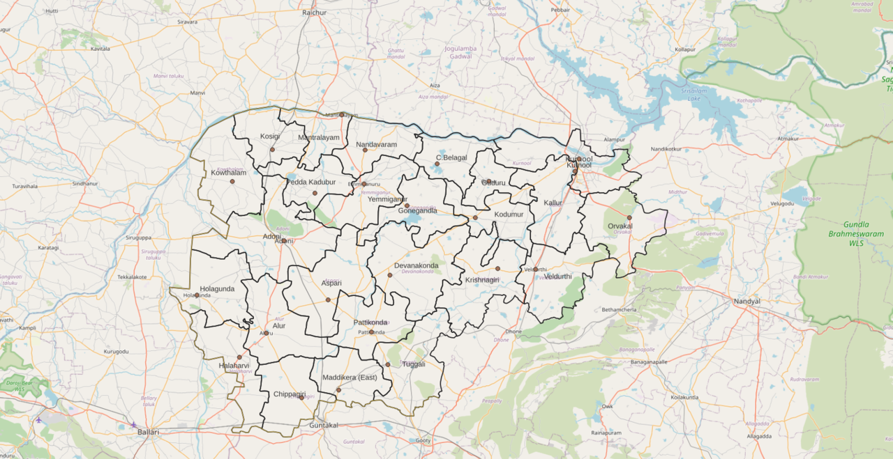
Kurnool district lies in the west‑central part of the Indian state of Andhra Pradesh and has the city of Kurnool as its administrative headquarters. It occupies a substantial area within the region traditionally known as Rayalaseema and sits close to state borders. According to the 2011 census the district had a population of about 4.05 million people, with roughly 28.35% living in urban settlements; it covers an area of some 17,658 square kilometres, making it one of the larger districts in both the state and the country in terms of surface area.
Image gallery
7 Images


Location and geography
Kurnool district is bounded by several neighbouring districts and states: to the north it meets parts of Telangana, while districts of Karnataka lie to the west and northwest. To the south and east it adjoins other districts of Andhra Pradesh such as Ananthapur and Prakasam, and it sits near Mahabubnagar in Telangana. The district contains a mix of plains, low hills and river valleys; the Tungabhadra and other seasonal tributaries cut across its landscape, supporting irrigated agriculture in some areas and dryland farming in others.
History and cultural notes
Kurnool has a long history of settlement and changing political authority, from regional dynasties in the pre‑modern period through colonial administration and post‑independence state reorganization. For a brief period in the 1950s the city of Kurnool served as the capital of the newly formed Andhra State before the creation of a larger Andhra Pradesh. The district contains historic forts, temples and cave systems that reflect its layered past and the religious and cultural traditions of the region.
Economy and resources
The district economy is dominated by agriculture and related rural activities, with crops such as cereals, pulses and oilseeds grown where rainfall and irrigation allow. Groundnut and cotton cultivation are common in suitable tracts. Mineral resources and quarrying provide raw materials for local industry in places, and there are small and medium enterprises focused on food processing, textiles and construction. Transport links to neighbouring states also support trade and regional markets.
Administration, transport and services
Administratively, Kurnool district is organised into revenue divisions and subunits that manage local government services, rural development and law and order. The city of Kurnool functions as the main service hub for health, education and judiciary matters. The district is served by a network of national and state highways and by railway lines that connect it with major cities across Andhra Pradesh and neighbouring states; a regional airport and improvements to local roads have increased accessibility in recent years.
Tourism and notable sites
Visitors to Kurnool district can find a variety of natural and cultural attractions. Noteworthy sites include extensive limestone cave systems, ancient temples and historic forts, as well as riverside pilgrimage centres that draw devotees from across the region. Popular destinations often mentioned by travellers include Belum Caves, the Konda Reddy Fort in Kurnool city, and pilgrimage towns such as Mantralayam and Yaganti, which are known for their temples and spiritual traditions.
Distinctive facts and contemporary issues
- Kurnool has played a role in state‑level politics and administration, having once been the capital of Andhra State.
- Its position at the junction of Andhra Pradesh, Telangana and Karnataka gives it strategic importance for inter‑state commerce and cultural exchange.
- Challenges include balancing water and land resources for agriculture, improving rural livelihoods, and developing infrastructure while protecting natural and archaeological sites.
For further administrative and statistical details, readers can consult state and national government resources and district profiles maintained by the government of Andhra Pradesh and by agencies at the level of India. Local tourism and cultural boards also publish information about historical sites and seasonal events. Additional context about neighbouring areas is available through district references such as those for Telangana, Karnataka and Ananthapur.
Questions and answers
Q: Where is Kurnool District located?
A: Kurnool District is located in the state of Andhra Pradesh, India.
Q: What are the neighboring districts of Kurnool District?
A: The neighboring districts of Kurnool District are Mahabubnagar district of Telangana in the north, Raichur district of Karnataka in the northwest, Bellary district of Karnataka in the west, Ananthapur district in the south, YSR Kadapa district in the South East and Prakasham district in the east.
Q: What is the population of Kurnool District?
A: The population of Kurnool District is 4,053,463 as of 2011.
Q: What percentage of the population of Kurnool District is urban?
A: 28.35% of the population of Kurnool District is urban.
Q: What is the area occupied by Kurnool District in terms of largest districts of India?
A: Kurnool District occupies the 10th place in terms of area in largest districts of India, accounting for 17,658 square kilometers (6,818 sq mi).
Q: What is the area occupied by Kurnool District in terms of Andhra Pradesh?
A: Kurnool District occupies the 2nd place in terms of area in Andhra Pradesh, accounting for 17,658 square kilometers (6,818 sq mi).
Q: What is the rank of Kurnool District in terms of population in India?
A: Kurnool District ranks 53rd in terms of population in India.
Related articles
Author
AlegsaOnline.com Kurnool district, Andhra Pradesh Leandro Alegsa
URL: https://en.alegsaonline.com/art/54667
Sources
- census2011.co.in : "Top 10 Largest Districts of India by Total Area"
- census2011.co.in : "District Census 2011"
- cia.gov : "Country Comparison:Population"
- 2010.census.gov : "2010 Resident Population Data"
- apsmfc.com : "Andhra Pradesh State Minorities Finance Corporation Ltd. - Downloads"