Kurdistan: geography, people, and political status
Kurdistan is a mountainous region of the Middle East inhabited mainly by Kurds. It spans parts of several states, contains diverse languages and cultures, and has a complex political history and economy.
Kurdistan is a loosely defined cultural and geographic region in the central Middle East where Kurdish communities form a plurality or majority. The area stretches across parts of several modern states and is best understood as a zone of mountains, plateaus and river valleys rather than a single political entity. The Kurdish people who live there are often referred to simply as Kurds, and the region is commonly described in relation to its position in the Middle East.
Image gallery
10 Images


Geography and subregions
The landscape of Kurdistan is dominated by mountain ranges such as the Zagros and Taurus and includes high plateaus and narrow river valleys. A commonly cited central coordinate is near 37°N 43°E, but the inhabited Kurdish area stretches north into southeastern Turkey, east into northwestern Iran, south into northern Iraq and west into northeastern Syria; smaller Kurdish communities live in adjacent areas. Because Kurdistan overlaps national borders, it is usually described in subregions: Turkish (Northern) Kurdistan, Iraqi (Southern) Kurdistan, Iranian (Eastern) Kurdistan and Syrian (Western) Kurdistan.
People, language and culture
Population estimates for Kurds living in this region vary; many sources place the total Kurdish population in the tens of millions. Kurdish society is linguistically diverse: the main Kurdish dialect groups include Kurmanji and Sorani, with other varieties such as Zazaki and Gorani. Religious traditions are also varied — the majority are Sunni Muslims, but there are Shia communities, Yazidis, Christians and others. Kurdish culture is rich in oral literature, music, dress and seasonal celebrations such as Nowruz.
History and political status
Modern Kurdistan's contours were shaped in the 19th and 20th centuries by the decline of empires and the drawing of new national borders. Proposals for an independent Kurdish state after World War I were not implemented, and Kurdish-majority lands became parts of the modern states that exist today. Political arrangements differ by country: in Iraq an autonomous Kurdistan Region with its own government and institutions has been established, while Kurds in Turkey, Iran and Syria have pursued a range of political, cultural and sometimes armed movements seeking rights and recognition. The situation remains complex and varies by time and place.
Economy and major cities
Economic life in Kurdistan ranges from pastoralism and agriculture in rural areas to trade and industry in urban centers. Iraqi Kurdistan is notable for oil production and cross-border commerce, while other parts of Kurdistan depend more on farming, remittances and local industry. Important cities often cited as regional centers include Erbil and Sulaymaniyah in Iraq; Diyarbakır (Amed) and Hakkari in Turkey; and several Iranian Kurdish cities such as Piranshahr and Mahabad, the latter two forming central towns in the Mokrian district of Iranian Kurdistan.
Distinctions and notable facts
- Kurdistan is not a single sovereign state but a transnational cultural region.
- Estimates of the Kurdish population vary widely and depend on census methods and political context.
- Contemporary Kurdish politics combine demands for cultural rights, autonomy and, in some movements, independence — outcomes differ between countries.
Understanding Kurdistan requires attention to geography, language, historical treaties and modern politics. The term continues to be used in academic, political and cultural contexts to describe a region shaped by both continuity and change.


On the history of the term Kurdistan
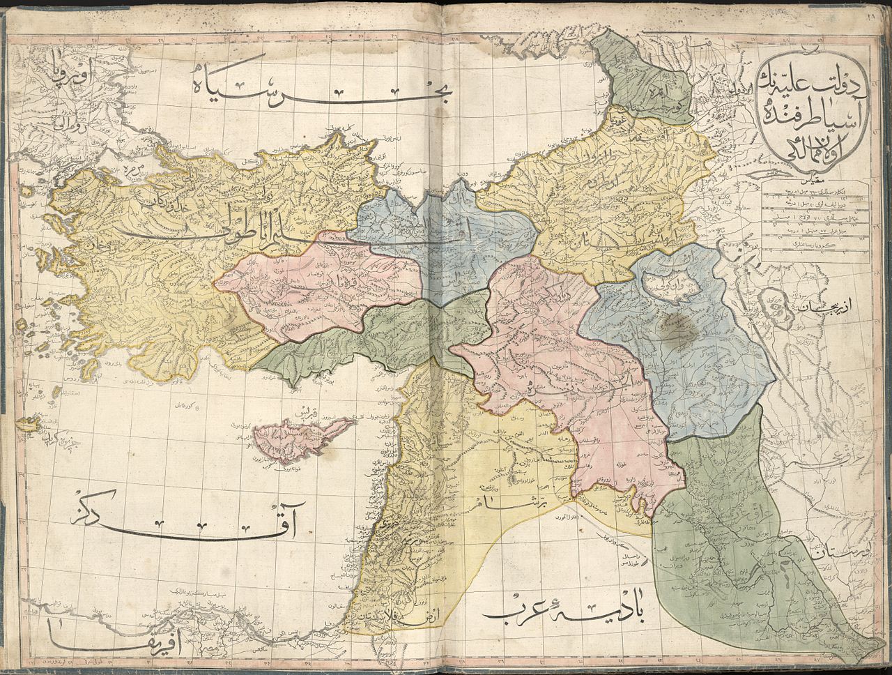
The term Kurdistan first appears as a designation for an area in the Armenian chronicle of Matthias of Edessa. It designates with K'rdstanac an area between Diyarbakır and Siverek. The chronicle describes in three parts the events of the years 952-1136. As an administrative unit, Kurdistan emerged as a province of the Seljuk Empire at the time of Sultan Ahmad Sandshar (r. 1097-1157). It included the present-day Iranian territories of Hamadan, Kermānshāh, Dinawar, and Sanandaj. Hamdollah Mostowfi enumerates the 16 cantons of this province in his 1349 work Nuzhat al-ḳulūb.
In the Sherefname, the Luri are also counted as part of Kurdistan. In the 4th volume of his Seyahatnâme, the Ottoman traveler Evliya Çelebi lists nine Vilâyets that belonged to Kurdistan at the time: Erzurum, Van, Hakkari, Diyarbakir, Jazira (Cizre), ʿAmādiya, Mosul, Shahrazūr, and Ardalan. Rivalry between the Ottoman Empire and the Safavids led to the partition of Kurdistan. In the 17th century, on the Ottoman side, only the districts of Dersim, Muş and Diyarbakir belonged to the Vilâyet Kurdistan. In the 16th century, Kurdistan was administratively limited to the Ardalan region in the Safavid domain. Hamadan and Lorestan were separated.
In a 1526 letter from the Ottoman Sultan Suleyman to the French King Francis I, Suleyman names Kurdistan as part of his domain.

Geography
The borders of Kurdistan cannot be defined precisely. For one thing, apart from the Autonomous Region of Kurdistan in Iraq and the Iranian province of Kordestān, there is no political territory and no administrative unit of Kurdistan. To make matters worse, there is no ethnically homogeneous compact settlement area of Kurds. The borders of Kurdistan are therefore highly disputed.
Kurdistan lies between 34 and 40 degrees north latitude and 38 and 48 degrees east longitude (37° N, 43° E3743coordinates: 37° N, 43° E). It stretches across eastern and southeastern Anatolia - more specifically from İskenderun and the Taurus Mountains up to Mount Ararat - to Lake Urmia in Iran and includes the region of the Zagros mountain range, i.e. northern Iraq and western Iran, as well as parts of northern Syria. Kurdish activists have increasingly used the terms Eastern Kurdistan, Northern Kurdistan, Southern Kurdistan, and Western Kurdistan for the Kurdish regions belonging to Iran, Turkey, Iraq, and Syria since the 1980s. The following is a characterization of the individual parts of Kurdistan according to the states to which the regions belong.
Turkish part
The Turkish part makes up about 25% of the national territory, depending on the definition. The center of gravity extends geographically from the province of Gaziantep to Hakkâri and from Malatya to Kars. In addition, Kurds (Central Anatolian Kurds) have been living in Central Anatolia such as around Lake Tuz, Konya, Aksaray, Ankara, etc. for several generations. In the last decades, due to internal migration and flight, many Kurds moved to the big cities. In the meantime, Kurds can be found everywhere in Turkey.
The Turkish part is characterized by the Taurus Mountains. Here run the two rivers Euphrates and Tigris. Agriculturally this region is used by wheat, barley, wine, olive and pistachio cultivation. In addition to mountain ranges, the region east of the Euphrates is characterized by a high plateau. As part of the Southeast Anatolia Project along the Euphrates and Tigris rivers, over 22 dams are being built.
Iranian part
The eastern part of Kurdistan coincides in large parts with the provinces of Kermānschāh, Kordestān, Ilam and Western Azerbaijan. The area is dominated by the Zāgros Mountains.
Syrian part
→ Main article: Rojava
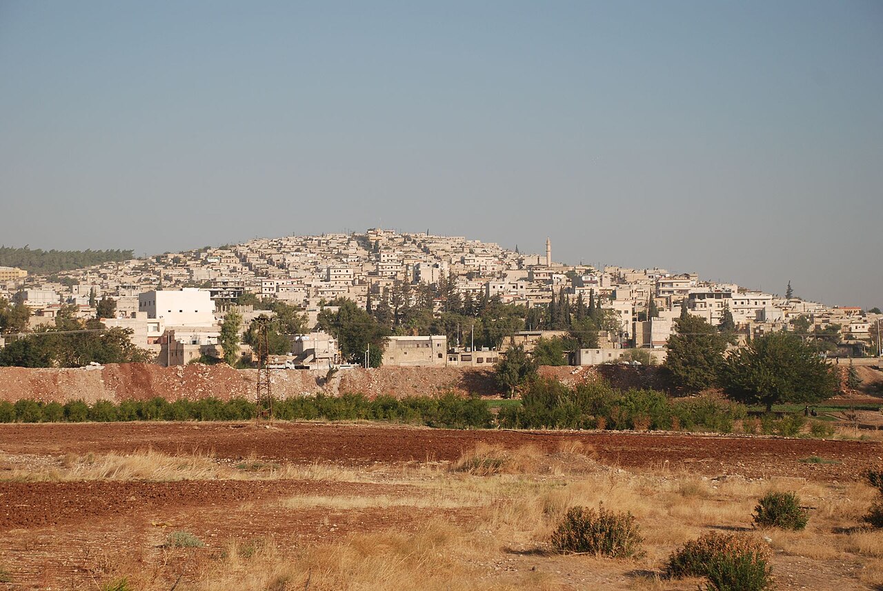
Kurdish activists refer to the Syrian part of Kurdistan as Rojava (West Kurdistan). Due to the unnatural drawing of borders, the Kurdish settlement area here does not form a contiguous territory. It extends over the greater part of the al-Hasakah governorate. The largest cities in the region are Qamishli and al-Hasakah. Syria's largest oil reserves are located in the Kurdish-populated areas in the northeast of the Jazirah region there, which therefore has particular strategic relevance. The largest oil refineries in the country are located in the Rumelan region, east of Qamishli.
Another region with a significant Kurdish population is Ain al-Arab (Kobanî) in northern Syria near the city of Jarabulus and Kurd Dagh in the northwest, around the city of Afrin in Aleppo governorate. The Kurd Dagh region extends to the Turkish counties of İslahiye and Kırıkhan. Many Kurds further live in major cities such as Aleppo and Damascus. The Kurdish-inhabited northern and northeastern parts of Syria are also called Kurdistana Binxetê ("Kurdistan under the border") in Kurdish.
Iraqi part
The Iraqi part of Kurdistan coincides in large parts with the Autonomous Region of Kurdistan and overlaps with the Türkmeneli area. The Autonomous Region of Kurdistan includes the provinces of Arbil, Dohuk, Halabja and Sulaymaniyah and parts of the provinces of Diyala, Kirkuk and Ninawa.


Related articles
Author
AlegsaOnline.com Kurdistan: geography, people, and political status Leandro Alegsa
URL: https://en.alegsaonline.com/art/54657
Sources
- dictionary.reference.com : "Kurdistan – Definitions from Dictionary.com"
- institutkurde.org : "The Kurdish population"