
Kobuk River: geography, people, history, and ecological significance
The Kobuk River is a major Arctic river in northwestern Alaska. This article explains its course, watershed, cultural history, ecological role, and protected status, plus notable landforms and historical events.
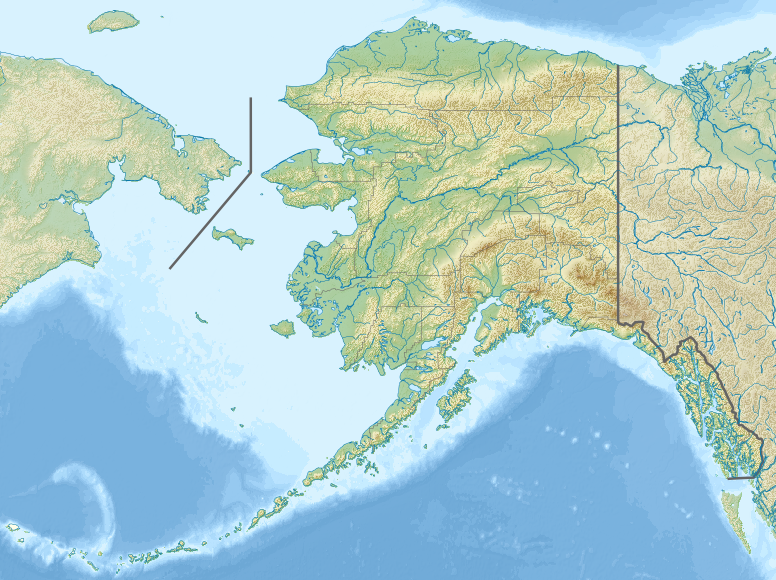
The Kobuk River is a large river in the Arctic region of Alaska, in the United States. Running roughly 280 miles (about 450 km), it drains a broad basin and empties across an extensive coastal delta. The Kobuk is a defining feature of northwest Alaska: its valley and floodplain shape local ecosystems, support fish and wildlife, and have sustained human communities for millennia.
Image gallery
6 Images


Geography and physical characteristics
The river rises near the southern slope of the Brooks Range, a long mountain range across northern Alaska, and flows generally westward toward the Chukchi Sea. Its watershed covers approximately 12,300 square miles and spans elevations from sea level to more than 11,000 feet. The Kobuk River Delta at the mouth extends about 32 miles and forms a complex network of channels, wetlands, and tidal flats.
The basin includes a variety of landforms—from high mountains to broad plateaus and lowland plains—creating sharp transitions in climate, vegetation, and hydrology. Within the valley are notable features such as dune fields and braided channels. Seasonal ice cover, spring breakup floods, and permafrost influence the river’s flow and shape.
People, culture, and history
Indigenous peoples have relied on the Kobuk for food, travel, and cultural life for thousands of years. Local communities, including Inuit and Athabascan groups such as the Inuit and Koyukon people, developed seasonal patterns of fishing, hunting, and trade tied to the river corridor. Archaeological and oral histories indicate human presence in the region dating back many millennia, with continuous adaptation to Arctic conditions.
In the late 19th century the river became the focus of outside interest during a regional gold rush, often called the Kobuk River Stampede, which brought prospectors and temporary settlements into the valley. More recently, parts of the Kobuk were designated for federal protection to conserve its natural and cultural values.
Ecology, uses, and protections
The Kobuk supports important runs of salmon and other anadromous fish, as well as resident whitefish and diverse freshwater and riparian communities. Terrestrial wildlife in the basin includes caribou, bears, and migratory birds that utilize the river corridor for breeding and feeding. Local subsistence economies depend on seasonal fish, marine mammals, and game taken along and near the river.
- Key resources: salmon, whitefish, waterfowl, muskrat and other small aquatic mammals.
- Transportation: historically a canoe and dog‑sled route; today used for river travel and subsistence access.
- Conservation: stretches of the Kobuk have been designated for protection to preserve natural scenery, wildlife habitat, and cultural sites.
Distinctive facts and modern relevance
The Kobuk valley contains striking contrasts—from rugged alpine headwaters to broad, sandy dune areas within the interior basin—making it an area of interest for geologists and ecologists as well as for residents. Its designation as a protected river segment reflects both ecological importance and the desire to safeguard traditional lifeways. The river remains central to regional identity, subsistence food security, and ongoing scientific study of Arctic rivers in a changing climate.
For more information on specific topics such as hydrology, cultural sites, or recreational access, consult regional resources and management agencies that specialize in Arctic river systems and indigenous heritage (river overview, Arctic environments, Alaska geography, U.S. federal resources, Brooks Range studies, mountain research, landform guides, mountain ecology, plateau landscapes, Inuit cultures, gold rush history).
Questions and answers
Q: Where is the Kobuk River located?
A: The Kobuk River is located in the Arctic region of Alaska, in the United States.
Q: How long is the Kobuk River?
A: The Kobuk River is about 280 miles (450 km) long.
Q: From how many square miles of land does the Kobuk River receive water?
A: The Kobuk River receives water from about 12,300 square miles (31,850 km2) of land.
Q: What is the average elevation of the Kobuk River watershed?
A: The average elevation of the Kobuk River watershed is 1,300 feet (400 m).
Q: What is the meaning of the river's name in the native Inuit language?
A: The river's name in the native Inuit language means "big river".
Q: How long is the Kobuk River Delta?
A: The Kobuk River Delta is about 32 miles (51 km) long.
Q: How long was the Kobuk River deemed the Kobuk Wild and Scenic River?
A: In 1980, 110 miles (177 km) of the river were deemed the Kobuk Wild and Scenic River.
Related articles
Author
AlegsaOnline.com Kobuk River: geography, people, history, and ecological significance Leandro Alegsa
URL: https://en.alegsaonline.com/art/54068
Sources
- geonames.usgs.gov : "USGS GNIS Detail: Kobuk River"
- nps.gov : "Kobuk River"
- geonames.usgs.gov : "USGS GNIS Detail: Kobuk River Delta"
- nps.gov : "Kobuk Valley FAQ"