Kinder Scout: Derbyshire plateau, moorland, waterfall and access history
High gritstone plateau in the Peak District, England. Noted for peat moorland, Kinder Downfall waterfall, Pennine Way, Jacobs Ladder and the 1932 mass trespass that advanced public access rights.
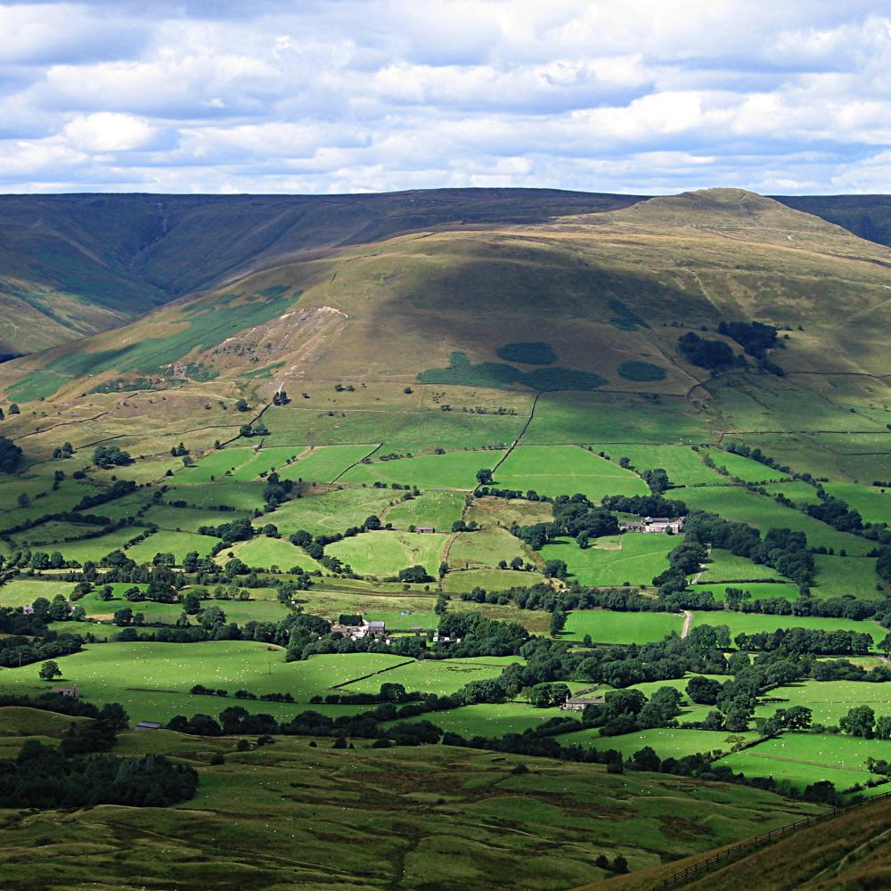
Kinder Scout is a high gritstone plateau in the Peak District of Derbyshire, England, rising to roughly 600 metres above sea level with its highest point at Kinder Low (about 633 m). It occupies a prominent upland position roughly between Hayfield, Edale and Glossop and is one of the best-known expanses of open moor in England. The plateau’s broad, windswept character makes it a focal point for walkers, naturalists and those interested in the history of public access. Location
Image gallery
10 Images


Geology, peat and vegetation
The plateau rests on millstone grit, a coarse sandstone that forms flat edges and outcrops, capped by a deep blanket of peat. This peat supports a classic upland heath mosaic—heather, bilberry and sphagnum mosses—interspersed with wet hollows and bare peat where erosion has exposed the underlying grit. On lower slopes bracken and grasses become more common. The peatland is an important carbon store and a distinctive habitat type; its condition and hydrology are central to conservation efforts. Geology Peatland
Hydrology and notable features
A dense network of small streams drains the plateau. The Kinder River is a principal watercourse and forms Kinder Downfall where water plunges from the western escarpment, producing a dramatic waterfall that can be blown back into spray in windy conditions. The plateau is cut by cloughs (steep-sided valleys), peat hags and gritstone edges that provide distinctive landforms and viewpoints. Wet ground and flow patterns make the area hydrologically sensitive. Hayfield approaches Kinder River
Routes, access and recreation
The 268-mile Pennine Way long-distance footpath crosses Kinder Scout; the trail begins in nearby Edale and traverses the plateau as part of its upland route. One well-known ascent is Jacobs Ladder, a steep flagged track from the Vale of Edale that leads onto the moor. Many paths have been paved with stone slabs in high-use sections to reduce peat erosion; these works aim to concentrate wear on durable flagstones rather than damage the surrounding peat. Jacobs Ladder Pennine Way
History of access: the 1932 mass trespass
Kinder Scout is closely associated with the mass trespass of 24 April 1932, when groups of ramblers deliberately entered private moorland in protest at restrictions on access to open countryside. The event became emblematic of the wider campaign for public rights of way and influenced later reforms that expanded access to uplands. The Countryside and Rights of Way Act 2000 established a clearer legal framework under which much of Kinder Scout is now designated as public "Access Land." Mass Trespass 1932 CRoW Act 2000
Conservation and management
Conservation work on Kinder Scout focuses on peat restoration, stabilising eroded paths, re-vegetation and sensitive management of shooting moorland where it occurs. Healthy peatland reduces downstream flood peaks and stores carbon; restoration typically involves blocking gullies, re-establishing sphagnum mosses and repairing flagged routes to limit trampling. Land managers, NGOs and statutory bodies often collaborate on projects to reconcile public recreation with habitat protection. Restoration projects Wildlife and habitats Bracken and heather management
- Key facts: plateau height circa 600 m; highest point Kinder Low c. 633 m; traversed by the Pennine Way.
- Popular approaches: Jacobs Ladder from Edale, climbs from Hayfield, routes from Glossop and circular walks along gritstone edges.
- Practical advice: weather can change quickly, routes cross wet and eroded peat, carry map and compass, wear waterproof footwear and respect restoration works.
Kinder Scout remains an emblematic landscape: a wild, open moorland important for ecology, water management and the cultural history of walkers’ rights. Visitors are encouraged to follow waymarked or paved lines where provided, to stay on repaired surfaces when possible and to support conservation initiatives that protect the plateau’s peatlands and distinctive upland habitats.
Related articles
Author
AlegsaOnline.com Kinder Scout: Derbyshire plateau, moorland, waterfall and access history Leandro Alegsa
URL: https://en.alegsaonline.com/art/53506