Khardung La Pass: high mountain gateway to Nubra and the Shyok valleys
Khardung La is a high mountain pass north of Leh in Ladakh, India (5,359 m). It links Leh with the Nubra and Shyok valleys, is maintained by the Border Roads Organisation, and is a popular but challenging tourist route.
Overview
Khardung La (often written Khardong La) is a high mountain pass on the Ladakh Range north of the city of Leh in the Indian union territory of Ladakh. The pass sits at about 5,359 metres (17,582 feet) above sea level and forms the principal overland route from Leh into the Nubra and Shyok river valleys. In local languages the word "la" means pass; see the linguistic note below for context. The pass is both a popular attraction for visitors to Ladakh and an important logistical route for the Indian armed forces.
Image gallery
10 Images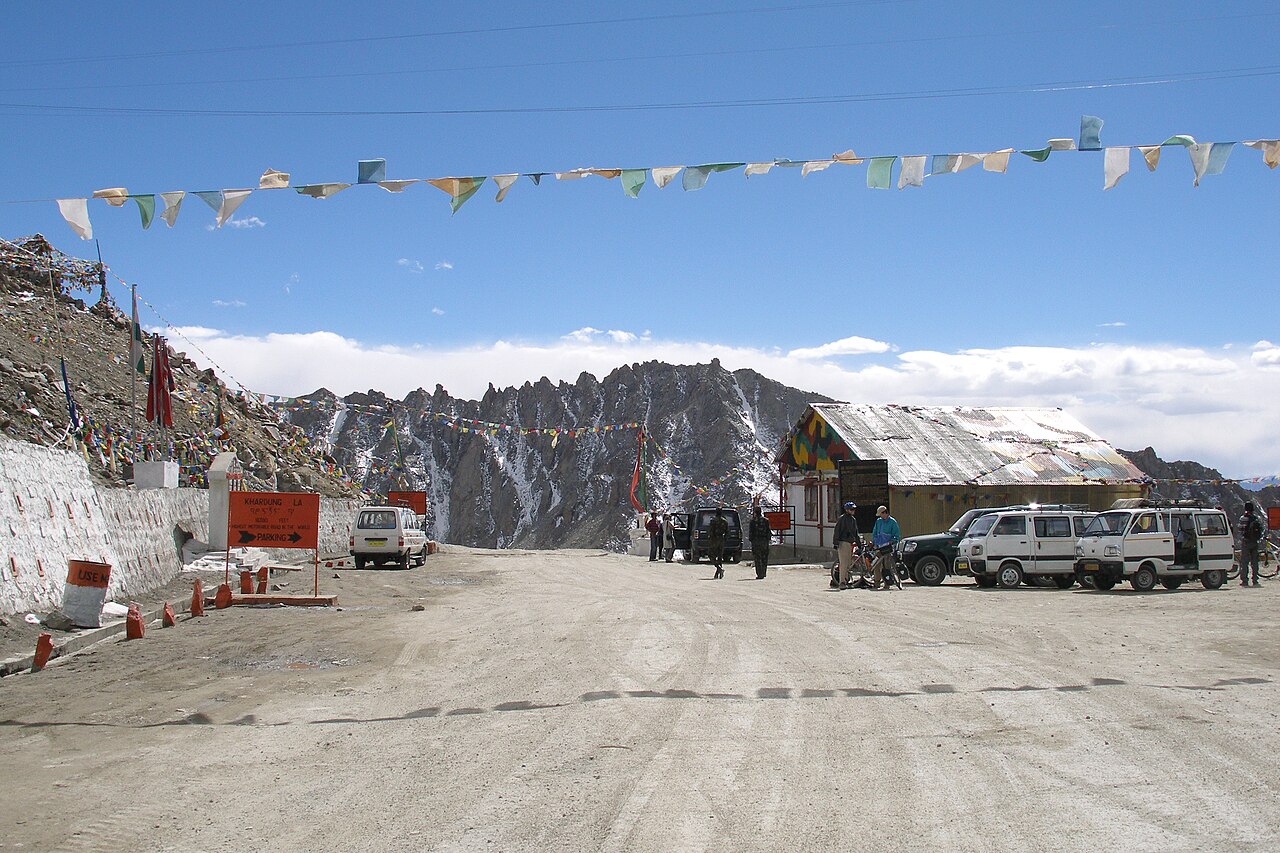


Geography and route
Khardung La connects Leh with Diskit and other settlements in the Nubra Valley, and continues toward the Shyok Valley and the approaches used to reach the Siachen Glacier region. Approaching from Leh, the road climbs steeply along the Ladakh Range with barren high-altitude landscapes, sparse vegetation, and frequent snowfields in colder months. The road is maintained by the Border Roads Organisation (BRO) and is normally negotiable by two-wheelers and four-wheel drive vehicles during the summer season.
History and strategic importance
The modern road to Khardung La was constructed in the late 20th century by the Border Roads Organisation to improve access to northern valley systems. The route was opened to civilian vehicles after being used primarily for military transport. Because it provides one of the practical road links toward the Siachen Glacier, Khardung La has strategic significance for logistics and supply in the region.
Tourism, seasons and safety
Khardung La is a common destination for tourists, motorcyclists and adventure travellers visiting Ladakh. The best time to attempt the pass is typically between late spring and early autumn, when snow clearance is most reliable. Outside this window the pass can be closed by snow and avalanches. High altitude sickness is a real risk; visitors are advised to acclimatize in Leh (3,500 m) for several days before ascending, to stay hydrated, and to limit exertion on the first days at altitude. Road surfaces vary from paved sections to rough gravel; weather can change quickly and temperatures remain low even in summer.
Practical tips
- Acclimatize in Leh for 48–72 hours before attempting the pass.
- Carry warm clothing, basic first aid, and sufficient food and water.
- Check local road and weather updates with authorities or tour operators.
- Respect regulations: military convoys and restricted sections can affect timings.
Claims, signage and notable facts
Signs at the pass and many tourist materials claim higher elevations and sometimes call Khardung La the "world's highest motorable pass." The widely accepted survey elevation for the summit is 5,359 m; higher figures shown on local signage are inaccurate. There are several other mountain roads and passes internationally that contend for the title of highest motorable pass depending on measurement criteria and seasonal accessibility. Variations in the romanized spelling of the pass reflect local pronunciation and transliteration differences.
For language background on the term "la" and place-name traditions see Tibetan and Ladakhi naming conventions. For regional context about the Ladakh range and valley systems consult general regional guides at Ladakh geography resources. Practical travel advisories and military road updates are often posted by local authorities and infrastructure agencies; an overview can be found via official or specialist pages such as Border Roads and travel notices.
In sum, Khardung La combines striking high-altitude scenery with practical importance for access to northern Ladakh. Visitors should prepare carefully for the altitude and changing conditions, recognize the strategic context of the route, and treat commonly repeated claims about record elevations with caution.

Pass and dispute
The signs on the Khardung La as well as maps indicate the pass height with 5602 m. However, independent measurements with GPS and analogue devices of different travellers indicate that the true altitude of the pass is about 5359m. A similar value of 5350 m is also arrived at by analyzing the SRTM data.

Related articles
Author
AlegsaOnline.com Khardung La Pass: high mountain gateway to Nubra and the Shyok valleys Leandro Alegsa
URL: https://en.alegsaonline.com/art/53200