
Karst: Landscapes and Systems Formed by Rock Dissolution
Karst landscapes arise where soluble rocks such as limestone dissolve to create caves, sinkholes, springs and underground drainage; they are important for water resources, ecology and hazards.
Karst denotes a class of landscapes and subterranean systems that develop where water chemically dissolves soluble bedrock, producing distinctive landforms and underground networks. This process typically affects carbonate rocks and creates features ranging from small karren grooves to vast cave systems. Because karst controls how water moves and is stored, it has major consequences for water supply, engineering and ecosystems.
Image gallery
10 Images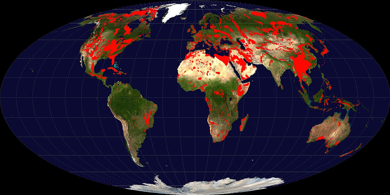




How karst forms
Karst develops when naturally acidic water—commonly rainwater mixed with atmospheric or soil carbon dioxide to form carbonic acid—reacts with and dissolves minerals in bedrock. In most classic karst settings the bedrock is a carbonate rock, for example limestone or dolomite, which are readily soluble under slightly acidic conditions. The result is progressive enlargement of fractures and pores in the bedrock, eventual collapse of unstable ground and development of conduits that route water below the surface. This general concept is often summarized as a geological system driven by dissolution.
Common surface and subterranean features
- Sinkholes (dolines): closed depressions formed by collapse or gradual dissolution of the surface.
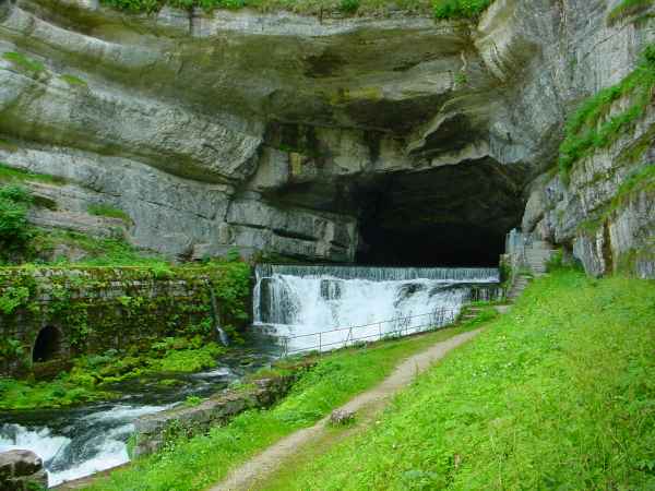
- Caves and passages: networks carved by flowing groundwater; many regions contain thousands of caves (cave examples).
- Disappearing streams and springs: surface water that sinks to feed underground flow and re-emerges at springs.
- Poljes and karst plains: large, flat-floored depressions with seasonally changing water levels.
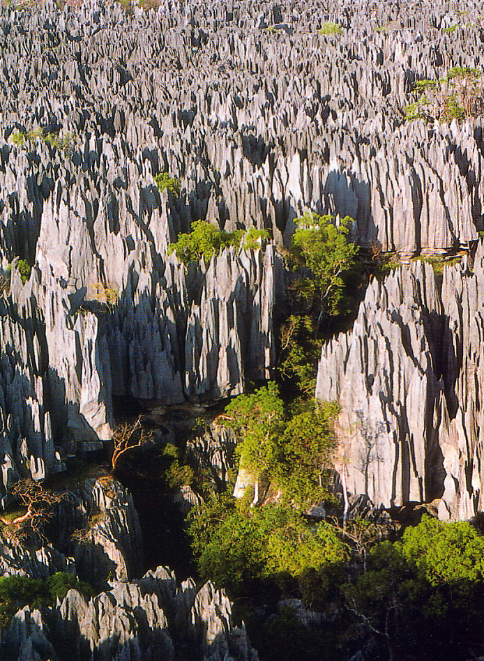
- Tower karst and karren: steep residual hills and small solutional sculpting of exposed rock faces.
Distribution, notable examples and scale
Because sedimentary carbonate rocks are widespread, karst terrain occurs on every continent. Some regions expose extensive limestone at the surface and host the world’s most extensive karst landforms. The Nullarbor Plain in southern Australia is a classic example: it is the largest single exposure of limestone bedrock in the world and spans a broad, treeless plain on the coast of the Great Australian Bight. The area reaches across the border between South Australia and Western Australia and lies north of the Great Victoria Desert. Other famous karst regions and cave systems occur globally and illustrate the variety of karst expression.
Importance, uses and hazards
Karst aquifers store and transmit groundwater in ways that differ from porous media: flow can be rapid in conduits and slow in fracture networks, making water quality and contamination behavior complex. Karst springs are important water sources for many communities, while caves support specialized fauna and are valued for scientific research and tourism. Conversely, karst presents engineering challenges—unpredictable sinkhole collapse, subsidence and variable foundation conditions can threaten buildings, roads and pipelines. Effective land use planning over karst requires an understanding of the hidden drainage and voids below the surface.
Variations and key distinctions
Not all dissolutional landscapes are identical. Some soluble rocks such as gypsum can develop karst more quickly than limestone. Areas where the soluble layer is covered by a non-soluble mantle may show fewer surface indicators despite extensive subterranean karst (covered karst). There are also topographic contrasts between rugged karst badlands that are hard to traverse and more subdued karst plains. Geomorphologists distinguish true karst from pseudokarst phenomena that mimic karstic forms but result from other processes.
For overview reading and regional studies, see general references on karst hydrology and geomorphology (sedimentary rock contexts) and resources that summarize cave inventories and karst mapping (regional case studies, thematic summaries). Practical guidance for managing karst landscapes—groundwater protection, hazard assessment and conservation—is available from geological surveys and environmental agencies (dissolution process, limestone example, dolomite example).
Understanding karst requires integrating surface observations with subsurface investigation—exploring caves, tracing underground flow and mapping sinkholes—to reveal the hidden architecture of these dynamic landscapes.


General
Deeply developed karst landscapes can have completely dry soils despite abundant and sometimes high precipitation. Karst landscapes are subject to an age-related erosion cycle. In principle, this is caused by stronger corrosion and erosion under humid-tropical climatic conditions. Tropical and extratropical karst forms are distinguishable, as well as geomorphologically fully developed karst (holokarst) and less developed karst (merokarst). Karstification and erosion of the karst relief are part of a global biogeochemical material and geological rock cycle; specifically, the carbonate-silicate cycle is directly related to the carbon cycle through biogenic and geological processes that are the result of the evolution of life. Carbonates (calcite CaCO3 and dolomite CaMg(CO3)2) are also the largest carbon reservoirs on Earth.
Etymology of the terms
The Karst landscape, which lies halfway between Lubljana and Trieste on the southeastern edge of the Alps, is considered to be the type locality and thus the eponym of the Karst geological phenomenon.
In this significant karst landscape, where the largest karst lake (seepage lake) in the world is located, the Cerkniško jezero (German: Zirknitzer See), the phenomenon of karst was researched in detail for the first time.
The results of research by scientists of the Habsburg Monarchy, such as Marko Vincenc Lipold, Dionýs Štúr and Guido Stache, were published in German and therefore the German name Karst became internationally accepted.
The term karst and all its similar-sounding names in other languages derive from Latin carsus with the word root *kar- meaning 'stone, rock' (cf. Slovenian kras, Croatian krš, Serbian Cyrillic крш, Italian carso, Latin carsus 'stony and barren ground'; Indo-European most likely*kar- 'stone, rock').
Only in the wake of the first standard work Morphology of the Earth's Surface (Albrecht Penck, 1884) and especially through the work of the first karstologist Jovan Cvijić did geomorphology establish itself as an independent science. In the process, the local names of karst forms of the Dinaric countries were generalized from Slovenian, Croatian and Serbian for the German and French technical language (so dolina, polje, ponor, hum).
With the exploration of tropical karst areas in the Caribbean and Southeast Asia, the range of terms expanded (for example, the Spanish terms mogote and cenote and the English term cockpit). Thus, karst terminology today uses a variety of terms from different languages. Due to the historical development of karst research, some terms used in English differ from those used in Central Europe.

Questions and answers
Q: What is Karst?
A: Karst is a geological system of rocks where water has eroded (dissolved) the bedrock. It is classed as a badland if it difficult to travel through the environment, which it often is. Almost always, karst is formed in carbonate rocks, such as limestone or dolomite.
Q: Where does Karst occur?
A: Since carbonate sedimentary rocks are very common, karst areas occur all over the world.
Q: What are some surface features associated with Karst?
A: Many karst regions display distinctive surface features, with sinkholes being the most common. However, karst surface features may be absent where the soluble rock is mantled (covered), such as by a non-soluble rock strata on top of the carbonate strata.
Q: Are there caves associated with Karsts?
A: Yes, some karst regions include thousands of caves and the water is generally underground.
Q: What is an example of a large Karstic area?
A: The world's largest karstic area is the Nullarbor Plain in southern Australia which occupies an area of about 200,000 square kilometres (77,000 sq mi). At its widest point it stretches about 1,100 kilometres (684 mi) from east to west across the border region between South Australia and Western Australia.
Q: Is Nullabor Plain treeless?
A: Yes, Nullabor Plain is flat and almost treeless dry country.
Related articles
Author
AlegsaOnline.com Karst: Landscapes and Systems Formed by Rock Dissolution Leandro Alegsa
URL: https://en.alegsaonline.com/art/52399
Sources
- wilderness.esmartweb.com : "Across the Nullarbor Plain"
- bbc.co.uk : bbc.co.uk/news/magazine-21600410
- bbc.co.uk : bbc.co.uk/news/science-environment-25983415
- bbc.co.uk : bbc.co.uk/news/world-us-canada-21773499
- geol105naturalhazards.voices.wooster.edu : geol105naturalhazards.voices.wooster.edu/the-largest-sinkhole-in-the-world/