Kangchenjunga — The Five Treasures of Snow
Kangchenjunga is the third-highest mountain on Earth (8,586 m), straddling Nepal and Sikkim. Known for its five major summits, cultural significance, and challenging routes, it is a prominent Himalayan peak.
Kangchenjunga (also spelled Khangchendzonga; Nepali: कञ्चनजङ्घा) stands as the world's third-highest mountain. Its main summit reaches an altitude of 8,586 metres (28,169 ft) and the massif forms part of the greater Himalayas. The name is commonly rendered as "The Five Treasures of Snow," reflecting the five principal peaks on the massif and the cultural reverence afforded the mountain by local communities.
Image gallery
10 Images


Overview and location
The Kangchenjunga massif lies on the border between eastern Nepal and the Indian state of Sikkim. It dominates a remote region of high ridges, glaciers and deep valleys. Because of its position and steep relief, Kangchenjunga presents a complex set of approaches and a variety of climatic zones from subtropical foothills to permanent snow and ice near the summits. For regional geography and context, see third highest mountain and comparisons with Mount Everest and K2.
Physical characteristics
The massif includes five prominent peaks, traditionally counted as the "treasures":
- Five main summits clustered along the crest, with four exceeding about 8,450 metres.
- Extensive glaciers radiating from the central ridge feed major river systems in the region.
- Sharp ridgelines, serac-covered faces and heavy snowfall make large sections of the mountain technical and hazardous for climbers.
Its quoted altitude, often presented as a single agreed figure, is 8,586 metres (altitude), though survey methods and datum choices can produce small variations in published numbers.
History and climbing
Kangchenjunga has a long human history in local religion and folklore; it remained largely unpenetrated by outsiders until the 20th century because of its remoteness and the cultural restrictions placed on climbing. The first recorded ascent of the main summit occurred in the mid-1950s by a Himalayan expedition; since then it has been climbed by a number of international teams but remains less frequently summited than some other eight-thousanders due to difficult conditions and objective hazards.
Importance and protection
Beyond mountaineering, Kangchenjunga is important for biodiversity, watershed services and cultural identity. Parts of the region have protected status: on the Indian side, the area around the mountain is managed as a national park and has been recognized for its natural and cultural values. The massif contributes glaciers and seasonal meltwater that sustain downstream communities and ecosystems.
Notable distinctions
Kangchenjunga is distinct among the 8,000-metre peaks for the combination of multiple high summits, its position near the eastern end of the high Himalaya, and the strong local traditions that treat the highest points as sacred. Climbers and scholars alike note the mountain's dramatic relief, complex technical routes, and its role in regional geography and conservation efforts.
For further general reading and comparative lists of the world's highest peaks, consult overview resources on major Himalayan mountains and mountaineering histories via reference listings and specialized accounts linked to Everest and K2.
Name
The name Kangchendzönga comes from Tibetan and consists of the four words (in the transcription according to Wylie) gangs "snow", chen "big", mdzod "treasury" and lnga "five", which can be translated as "The five treasuries of the big snow". This could mean either the five highest peaks or, according to G. O. Dyhrenfurth, the five main glaciers of the mountain.
The peaks
Kangchendzönga is the only eight-thousander where three peaks other than the main peak reach an altitude of more than 8000m. The (presumably) namesake five peaks of Kangchendzönga are:
| Summit | Height | |
| Kangchendzönga | 8586 m | 3922 m |
| Kangchendzönga West Peak (Yalung Kang) | 8505 m | 135 m |
| Kangchendzönga South Summit | 8476 m | 116 m |
| Kangchendzönga-Middle Summit | 8473 m | 63 m |
| Kangbachen Peak | 7902 m | 103 m |
Other mountains of the massif
From the main summit of Kangchendzönga, four long ridges descend in an x-shape in all directions: North and West ridges begin at the main summit. To the southeast, an almost horizontal ridge runs across the middle to the south summit, where the south and east ridges branch off.
- The west ridge runs on the Nepalese side over the west peak and Kangbachen to the 7710 m high Jannu.
- The east ridge finally ends at Siniolchu (6888 m) in Sikkim.
- The south ridge runs over Kabru North (7338 m), Kabru South (7316 m) and the Rathong peaks, which are up to 6678 m high. It forms the border between Nepal and India.
- The peaks of the North Ridge are also on the border. The North Ridge extends over the secondary peak Kangchendzönga North (7741 m), the Twins and Tent Peak to Jongsong La, a 6120 m high pass on the border with Tibet.
· 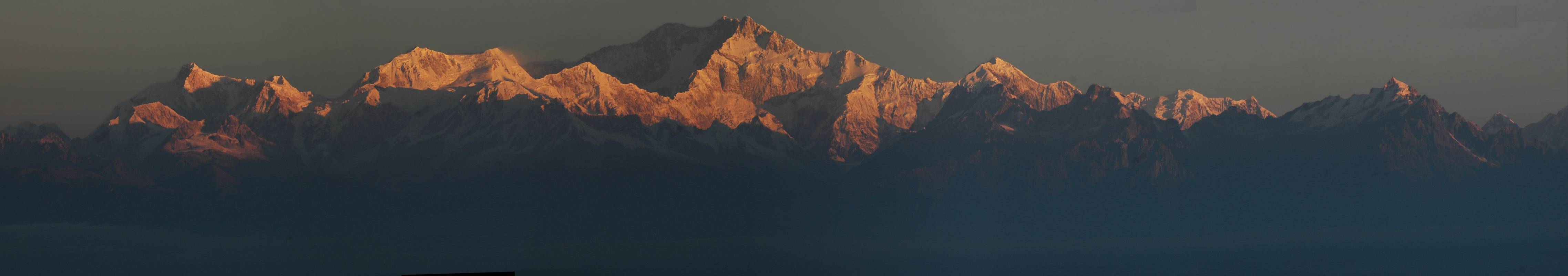
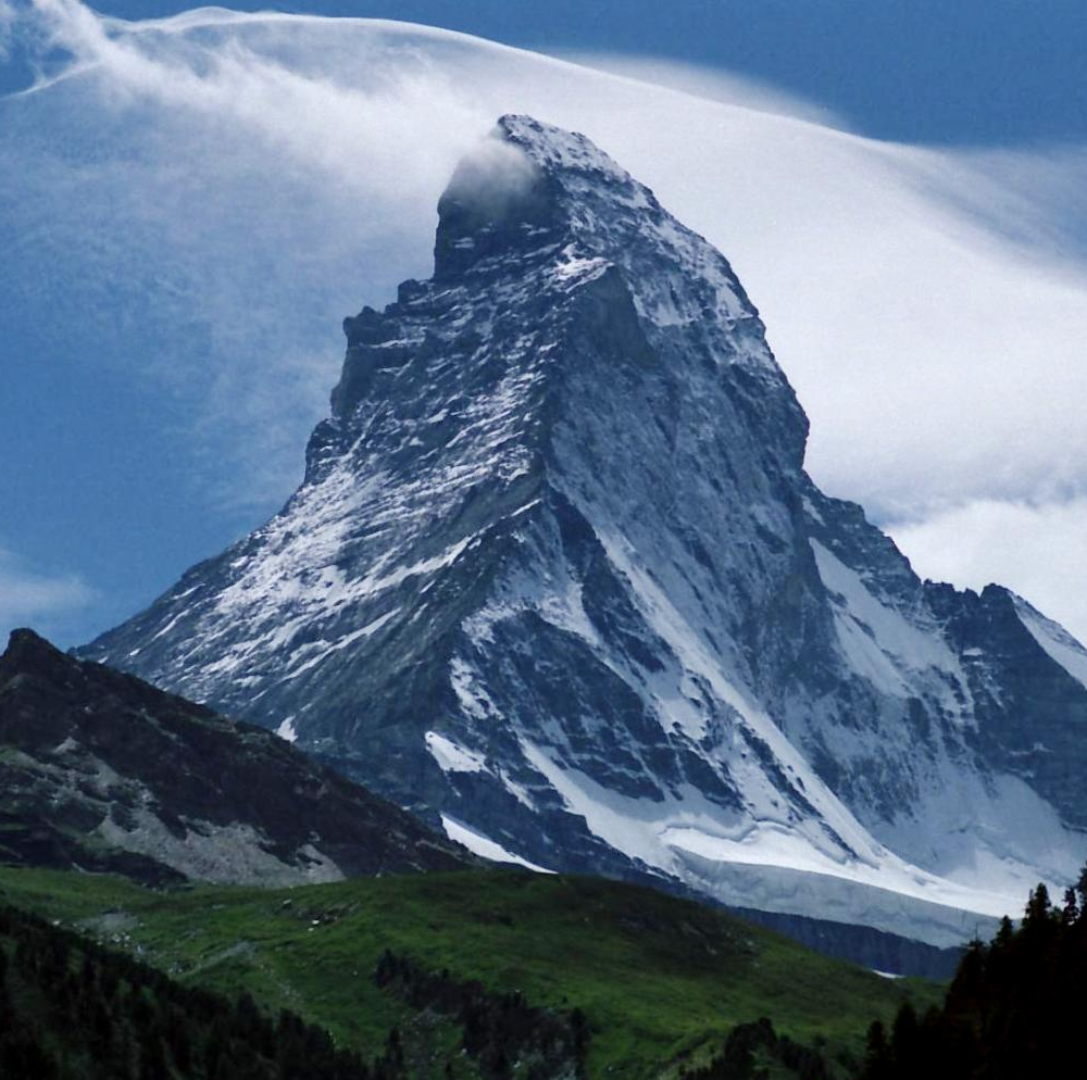
View from the south of Tiger Hill (Darjeeling): In the sun the south summit and the south and east ridge, in the shadow on the left above the south summit the three other 8000m peaks, on the far left, also in the sunlight, Jannu

Related articles
Author
AlegsaOnline.com Kangchenjunga — The Five Treasures of Snow Leandro Alegsa
URL: https://en.alegsaonline.com/art/52105
Sources
- tools.wmflabs.org : 27°42′09″N 88°08′54″E / 27.70250°N 88.14833°E / 27.70250; 88.14833
- wikidata.org : wikidata.org/wiki/Q82019
- d-nb.info : 4073193-5
- id.loc.gov : sh85071451
- aleph.nkp.cz : xx0174891
- libris.kb.se : 149879
- viaf.org : 240806666
- worldcat.org : 240806666