
Kalahari Desert: geography, ecology, people and conservation
Large semi-arid region of southern Africa spanning Botswana, Namibia and South Africa; notable for sandy plains, seasonal life after rains, the Okavango Delta and rich human and wildlife history.
Overview
The Kalahari is an extensive arid to semi-arid region in southern Africa, often described as a desert but more accurately a broad sandy basin with areas of grassland and shrubland. The sandy Kalahari proper covers roughly 900,000 km² and forms part of a larger geological Kalahari Basin. Although much of the landscape is dry for long periods, seasonal rains transform large tracts into productive grazing and burst into wildflower displays that attract grazing mammals and birds. The name appears in regional usage such as the Kgalagadi area.
Image gallery
10 Images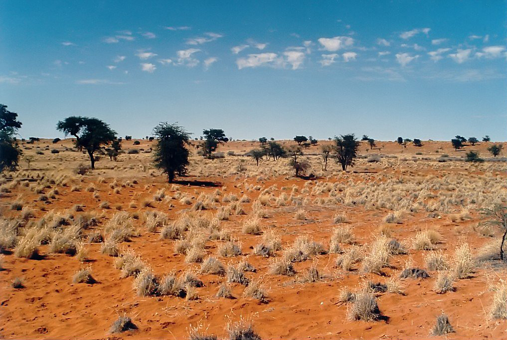



Geography and climate
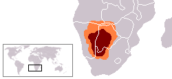
The Kalahari lies mainly within Botswana, with significant portions in Namibia and South Africa. Its geomorphology mixes sand plains, shallow pans, red dunes and rocky outcrops; parts of the region are uplifted or form a broad plateau. The wider Kalahari Basin stretches into neighbouring countries including Angola, Zambia and Zimbabwe. Rainfall is low and variable: the driest zones may average about 110–200 mm yearly while some northern sections receive several hundred millimetres, so the area is often better characterized as semi-arid than true desert. The Okavango River is notable for terminating as the Okavango Delta, where seasonal flooding creates permanent and seasonal wetlands rich in life.
Ecology and characteristic species
The Kalahari supports a mix of adapted plants and animals. Deep sands favor drought-tolerant shrubs and grasses, while interdunal pans and ancient riverbeds (omuramba) hold water after rains. Common plant types include acacias and other thorn trees, hardy grasses and succulents. Animal life ranges from small specialists to large mammals; after good rains herds of antelope expand and predators follow. Typical species include:
- Large herbivores: gemsbok (oryx), springbok, kudu and occasionally elephant near the wetter northwest
- Predators: lion, cheetah, leopard and spotted hyena in suitable habitats
- Smaller mammals and specialists: meerkats, bat-eared foxes, brown hyenas and a variety of rodents
- Birdlife: raptors, bustards and many migratory species that exploit seasonal wetlands
People, history and cultural landscape
Humans have occupied the Kalahari for tens of thousands of years. Indigenous hunter-gatherer peoples, commonly known as the San (Bushmen), have long adapted to the sparse resources and left abundant rock art and cultural traces. In more recent centuries, pastoral communities and farming groups moved into wetter patches and riverine areas to graze livestock. Traditional ecological knowledge of water points, edible plants and animal behavior has been central to survival in this variable environment.
Conservation, uses and challenges
Large protected areas cover substantial tracts of the Kalahari, including the Central Kalahari Game Reserve and the Kgalagadi Transfrontier Park, which conserve core wildlife populations and provide tourism opportunities. Human uses range from pastoral grazing to ecotourism and, in some places, mineral exploration. Key conservation issues include the impacts of climate variability, pressures from overgrazing or inappropriate land use, water management upstream of seasonal floodwaters and tensions between development and traditional livelihoods.
Further information and resources
For summaries and regional overviews, consult resources on the Kalahari and its components. Representative links (placeholders) for more detailed pages and park information include:
- Kgalagadi region overview
- Kalahari in Botswana
- Kalahari landscapes in Namibia
- Kalahari areas in South Africa
- General deserts and arid zones
- Plateau and geological notes
- Northern basin reaches (Angola)
- Eastern basin margins (Zambia)
- Southern basin fringe (Zimbabwe)
- Okavango Delta and wetlands
The Kalahari remains a dynamic region where seasonal water pulse and long dry spells create a shifting mosaic of habitats. Its combination of open sandy plains, pockets of marsh or woodland, long human history and important protected areas make it a key part of southern Africa's natural and cultural heritage.
Questions and answers
Q: What is the Kalahari Desert?
A: The Kalahari Desert is a large sandy area that covers much of Botswana and parts of Namibia and South Africa.
Q: Does the Kalahari Desert have excellent grazing lands?
A: Yes, the Kalahari Desert has huge tracts of excellent grazing lands after good rains.
Q: Is the Kalahari Desert a true desert?
A: Most of the Kalahari Desert is not a true desert, but it has small amounts of rainfall and a very high summer temperature.
Q: How much rainfall does the driest area of the Kalahari Desert receive per year?
A: The driest areas usually receive 110–200 millimetres (4.3–7.9 inches) of rain per year.
Q: What is the surrounding area of the Kalahari Basin?
A: The surrounding Kalahari Basin covers over 2.5 million km² extending farther into Botswana, Namibia, and South Africa, and encroaching into parts of Angola, Zambia, and Zimbabwe.
Q: Is there a permanent river in the Kalahari Desert?
A: Yes, the Okavango River is the only permanent river, and it flows into a delta in the northwest, forming marshes that are rich in wildlife.
Q: What are the ancient dry riverbeds in the Kalahari Desert called and what is their purpose?
A: The ancient dry riverbeds are called omuramba, and they traverse the central northern reaches of the Kalahari. They provide standing pools of water during the rainy season and were previously havens for wild animals such as elephant and predators such as lion and cheetah. However, they are now mostly grazing spots, though leopard or cheetah can still be found.
Related articles
Author
AlegsaOnline.com Kalahari Desert: geography, ecology, people and conservation Leandro Alegsa
URL: https://en.alegsaonline.com/art/51936
Sources
- commons.wikimedia.org : Kalahari