
Araluen, New South Wales — town in the Southern Tablelands
Araluen is a small rural community in the Southern Tablelands of New South Wales, Australia, known for its valley, creek and historical goldfields, located south of Braidwood in Queanbeyan-Palerang.
Overview
Araluen is a small rural locality in the Southern Tablelands of New South Wales, Australia. It lies about 27 km south of Braidwood and is administered by the Queanbeyan–Palerang Regional Council. The town sits in a narrow valley through which Araluen Creek runs; that stream later joins the Deua River. The setting is typical of the tablelands zone — open country with pockets of remnant woodland, riparian vegetation and cleared grazing land.
Image gallery
1 Image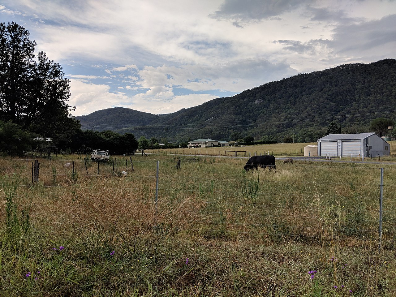
Geography and environment
The Araluen valley is a distinct landscape feature: a small, enclosed valley with a creek system that supports riparian habitat amidst drier surrounding slopes. Soils in the valley include gravel and alluvial deposits laid down along the creek. The climate is temperate with cool winters and warm summers; rainfall patterns are variable and the valley is sensitive to drought and bushfire.
History and name
Araluen has a history shaped by pastoralism and small‑scale gold extraction. During the nineteenth century, alluvial gold was discovered in the area and attracted prospecting activity; traces of that period remain in the landscape and local heritage. The place name is derived from an Aboriginal word and is often rendered as meaning something like "place of water lilies" or "running water," though exact translations vary and should be cited cautiously.
Economy and land use
The local economy is predominantly agricultural, with grazing and small farms the main land uses. Tourism and recreation also contribute: visitors come for scenic drives, fossicking at historical gold sites, fishing and nature appreciation. Land and water management, including maintaining stream health in Araluen Creek and protecting remnant vegetation, are ongoing local concerns.
Community and visitor information
Araluen is sparsely populated and retains a rural character. Facilities are limited in the valley itself, so residents and visitors rely on nearby towns for services. The locality is accessible via regional roads from other parts of New South Wales and is within driving distance of the Australian Capital Region; maps and council information are published by the local government and regional tourism bodies.
Notable facts and distinctions
- The creek system: Araluen Creek flows through the valley and joins the Deua River, forming an important local watercourse.
- Heritage: nineteenth‑century gold‑rush activity shaped settlement and left a legacy of historical sites and cultural interest.
- Administration: the area lies in the Queanbeyan–Palerang Regional Council jurisdiction, part of the broader Southern Tablelands region of Australia.
For people researching small rural communities, Araluen is an example of a valley settlement where natural features, colonial history and contemporary rural land use intersect. Conservation of creek corridors and the management of bushfire risk remain priorities for residents and local authorities.
Questions and answers
Q: Where is Araluen located?
A: Araluen is located in the Southern Tablelands area of New South Wales, Australia, 27 km south of Braidwood.
Q: What is the local government area of Araluen?
A: Araluen is in the Queanbeyan-Palerang Regional Council local government area.
Q: What body of water is Araluen located on the banks of?
A: Araluen is located on the banks of Araluen Creek.
Q: What river does Araluen Creek join?
A: Araluen Creek joins the Deua River.
Q: How far is Araluen from Braidwood?
A: Araluen is 27 km south of Braidwood.
Q: What is the latitude and longitude of Araluen?
A: The latitude and longitude of Araluen are 35°39′S 149°49′E / 35.650°S 149.817°E.
Q: What type of town is Araluen?
A: Araluen is a small town.
Related articles
Author
AlegsaOnline.com Araluen, New South Wales — town in the Southern Tablelands Leandro Alegsa
URL: https://en.alegsaonline.com/art/5171
Sources
- censusdata.abs.gov.au : "Araluen (State Suburb)"
- wikidata.org : wikidata.org/wiki/Q3305460
- argylecounty.com.au : "Araluen"
- gnb.nsw.gov.au : "Araluen, New South Wales"
- walkabout.com.au : "Walkabout - Araluen"
- ema.gov.au : "Araluen and Braidwood, NSW: Floods - 1860"
- hotelscombined.com : "Old Court House Bed and Breakfast Araluen"
- cortonaresources.com.au : "Gold Escort Coach Gifted to the Braidwood Museum"
- middlemiss.org : "Araluen by Henry Kendall (1839 - 1882)"
- nla.gov.au : "Araluen Kendall, The Argus, November 22, 1924"
- musicatthecreek.com : "Music at the Creek"
- environment.gov.au : "National Recovery Plan for the Araluen Zieria"