Jhelum District: geography, history, economy and administration
Comprehensive overview of Jhelum District in Punjab, Pakistan: geography, history, mineral resources, administration, transport, culture and notable sites such as Khewra Salt Mine and Rohtas Fort.
Overview
Jhelum District is an administrative district in the northern part of Pakistan's Punjab province, within the country of Pakistan. The district takes its name from the city of Jhelum, which serves as its administrative centre. Historically the area is noted for high rates of military recruitment and is often called the "city of soldiers" or the "land of martyrs and warriors" because of its long association with service in the armed forces during the colonial era and after independence. Official counts recorded by the 1998 census reported a district population of approximately 936,957, with an urbanisation share of around 31 percent.
Image gallery
10 Images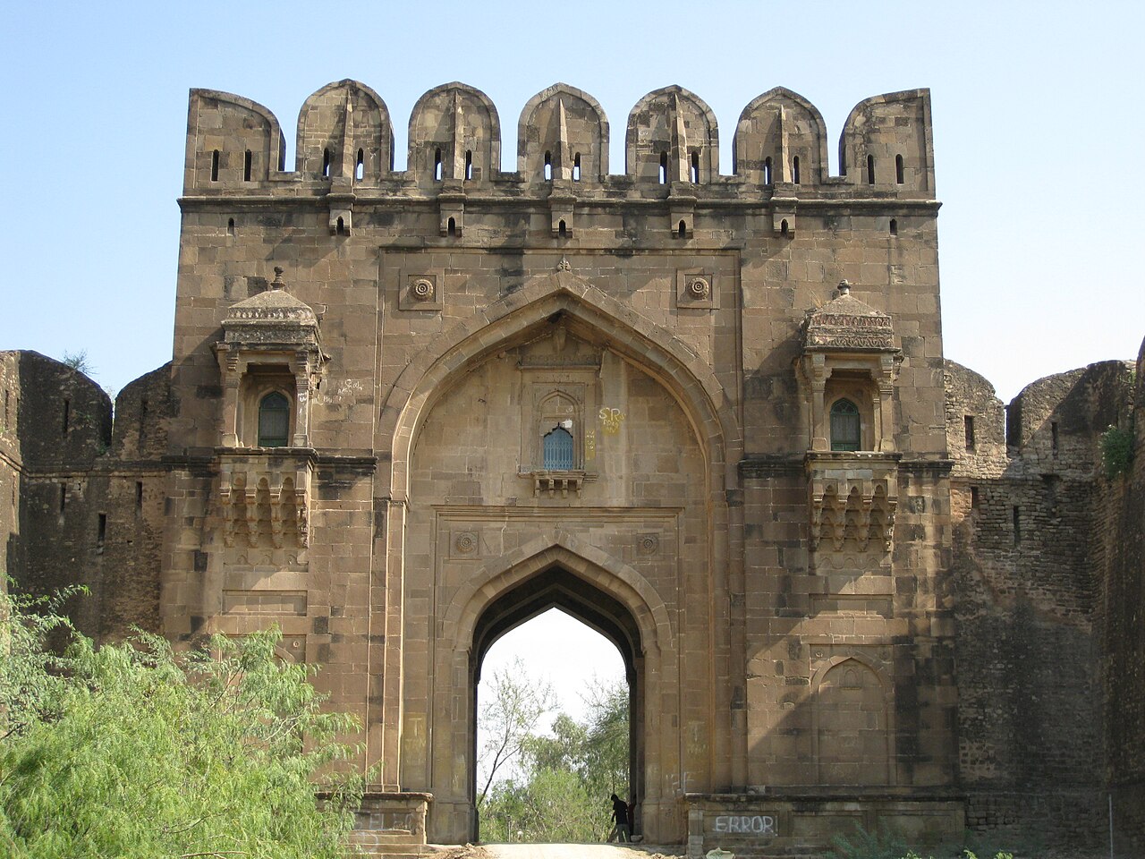


Geography and natural features
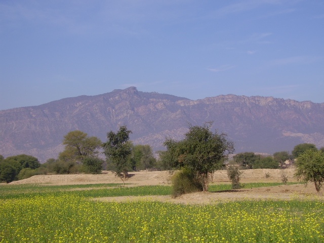
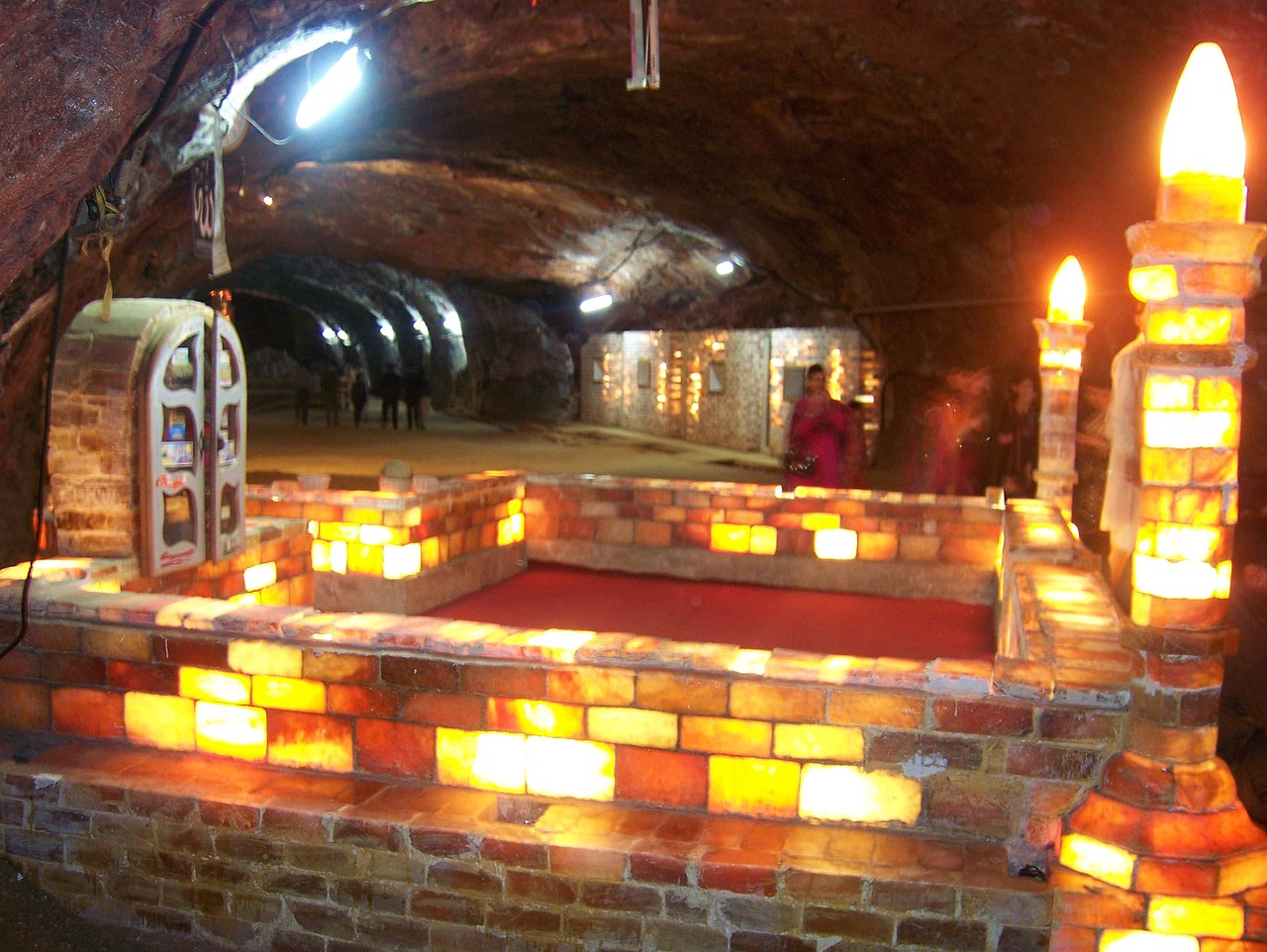
The district lies along the banks of the Jhelum River and reaches into the southern slopes of the Salt Range, a compact chain of hills known for extensive mineral deposits. The terrain combines riverine plains, terraces and salt-bearing hills. The Salt Range contains several important salt deposits and long-established quarries; the Khewra salt mine (historically referenced in some sources as the "Mayo" mine) is among the best known. Jhelum District borders several neighbouring districts and regions, including Sargodha, Gujrat, Chakwal, the district of Mirpur across the river in the adjacent region, and Rawalpindi to the north.
History and martial tradition
The river historically known as the Hydaspes was the scene of the famous Battle of the Hydaspes between Alexander the Great and King Porus in the 4th century BCE, an event often cited in accounts of the region's ancient past. In more recent centuries the area experienced Mughal, Sikh and British rule. During the British period many men from Jhelum enlisted in the British Indian Army and later in the Pakistan Armed Forces; that tradition of military service remains a notable feature of local identity and social structure.
Economy and natural resources
Jhelum's economy combines agriculture, mineral extraction, services and remittances. The fertile plains along the river support wheat, sugarcane and other crops, while orchards and small-scale farming occur in upland areas. The Salt Range provides salt for domestic use and trade; coal seams and small coal workings have also been worked historically. Towns such as Pind Dadan Khan have long functioned as market centres for salt and agricultural produce. Employment in the armed forces and overseas remittances are additional income sources for many households.
Administration and settlements
Administratively the district is part of the Rawalpindi division and is subdivided into tehsils and union councils that manage local government functions. Principal tehsils include Jhelum Tehsil, Dina Tehsil, Sohawa Tehsil and Pind Dadan Khan Tehsil. The district's principal settlements are the city of Jhelum and several smaller towns that act as commercial and administrative hubs.
Transport and infrastructure
Transport links include the main railway line that historically formed part of the North-Western Railway network and a network of provincial and national roads that connect the district to Rawalpindi, Gujrat and other regional centres. Rail and road infrastructure have long supported the movement of goods such as salt and agricultural produce to wider markets.
Culture, demographics and notable sites
The population is predominantly Punjabi-speaking, with Urdu widely understood and used in official and educational contexts. The majority religion is Islam, and local cultural life combines Punjabi traditions with influences from the wider Pothohar and northern Punjab region. Notable heritage sites include the Khewra Salt Mine, both an industrial resource and a tourist attraction, and the 16th-century Rohtas Fort near Dina, a large fortification built during the early Mughal period and recognised for its historic significance.
Further information and references
Readers seeking administrative, demographic or historical details may consult official district descriptions and census materials. The following anchors point to general reference entries and regional pages:
- Province: Punjab
- Country: Pakistan
- Population data: 1998 census
- District overview: Jhelum District
- Main city: Jhelum
- Colonial era context: British
- River: Jhelum River
- Salt Range and mines: Salt Range
- Neighbouring district: Sargodha
- Neighbouring district: Gujrat
- Neighbouring district: Chakwal
- Adjacent region: Mirpur
- Division capital: Rawalpindi
For up-to-date statistics and governance information consult the district administration and national census authorities; historical and tourist information is available from regional heritage and tourism sources.
Questions and answers
Q: What is Jhelum District?
A: Jhelum District is a district in the Punjab province of Pakistan.
Q: How many people lived in the district according to the 1998 census?
A: According to the 1998 census, there were 936,957 people living in the district.
Q: What percentage of those people were urban?
A: 31.48% of those people were urban.
Q: Why is Jhelum known as "the city of soldiers"?
A: Jhelum is known for providing many soldiers to the British and later to the Pakistan armed forces, which has earned it its nickname "the city of soldiers".
Q: Where does salt come from in Jhelum?
A: Salt is quarried at Mayo mine in the Salt Range in Jhelum.
Q: Are there any coal-mines in Jhelum?
A: Yes, there are two coal-mines that are worked in the province, from which North-Western railway gets some coal.
Q: What other districts border Jhelum?
A: The districts bordering Jhelum are Sargodha to its south, Gujrat and the Jhelum River to its south and east, Chakwal to its west, Mirpur to its east, and Rawalpindi to its north.
Related articles
Author
AlegsaOnline.com Jhelum District: geography, history, economy and administration Leandro Alegsa
URL: https://en.alegsaonline.com/art/50153
Sources
- urckarachi.org : Punjab Population (1988 Census) - Urban Resource Centre
- news.bbc.co.uk : BBC NEWS - City of Soldiers
- punjabpolice.gov.pk : Jhelum District Overview - Punjab Police
- statpak.gov.pk : Administrative Units of Pakistan
- nrb.gov.pk : Tehsils & Unions in the District of Jhelum -Government of Pakistan
- statpak.gov.pk : statpak.gov.pk
- dailytimes.com.pk : Punjab Education Department's annual literacy statistics for 2006
- dailytimes.com.pk : Literacy rate figures still not updated - Daily Times
- weatherbase.com : "Weatherbase: Historical Weather for Jhelum, Pakistan"