
Ismaïlia: Egyptian city on the Suez Canal
Ismaïlia, founded in 1863 by Khedive Ismail, is a canal-side Egyptian city and governorate capital known for its Suez Canal administration, colonial-era architecture, and Ismaily football club.
Overview
Ismaïlia (Arabic: الإسماعيلية) is a city in Egypt located on the west bank of the Suez Canal. It serves as the administrative center of the Ismaïlia Governorate and has a population of roughly three quarters of a million residents according to modern estimates (population data). Situated approximately midway between Port Said to the north and Suez to the south, Ismaïlia occupies a strategic position along the canal and on the shore of Lake Timsah.
Image gallery
10 Images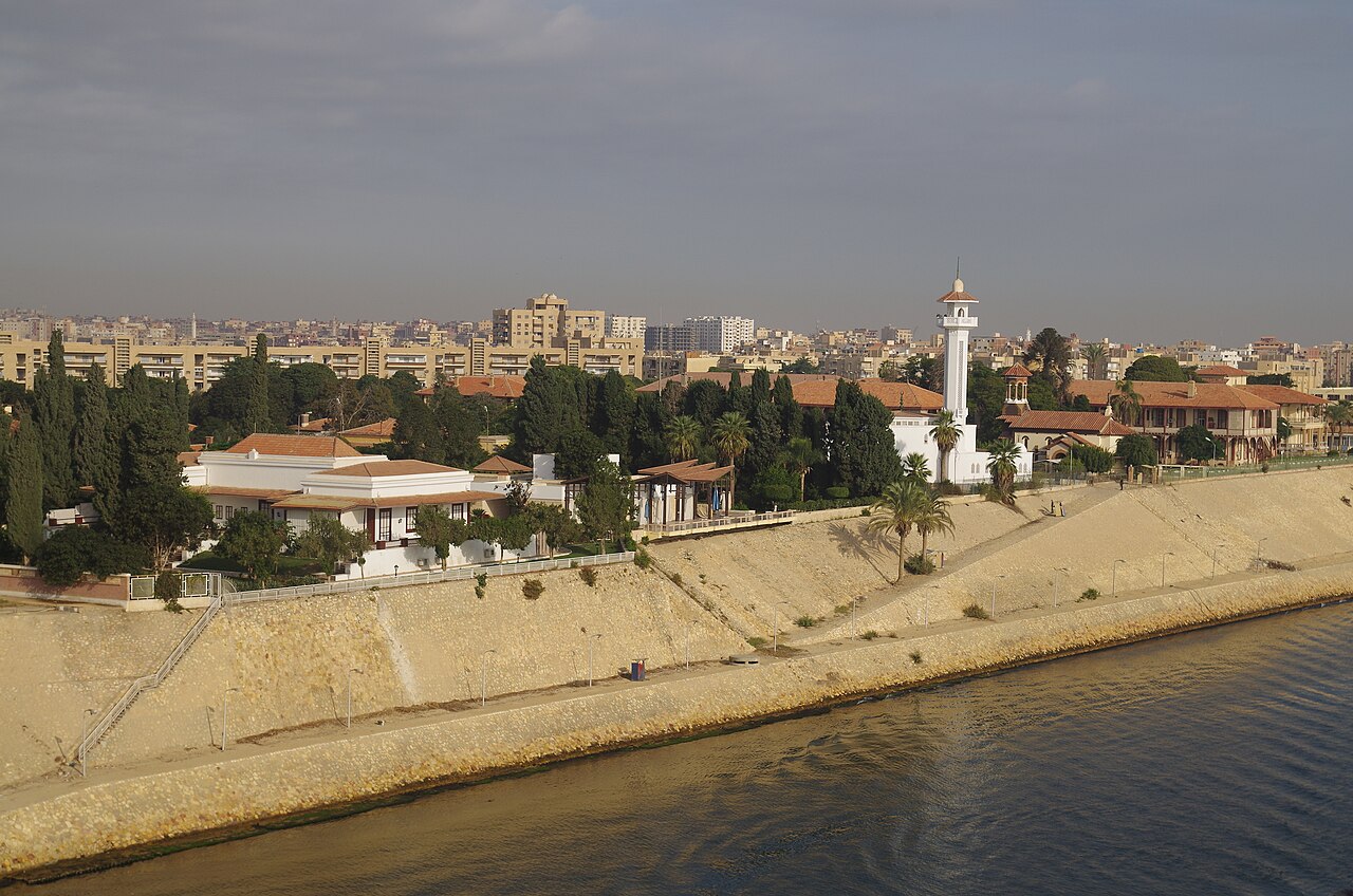




Geography and setting
The city grew around a widening of the Suez Canal at Lake Timsah, a shallow lake fed by the canal waters. The local environment is broadly arid, but the presence of the lake and nearby irrigation areas moderates temperatures and supports pockets of green space within an otherwise desert landscape. Transport links include the canal itself, major road arteries that run along the canal corridor, and rail connections to other Nile Delta and canal cities.
History and development
Ismaïlia was established in 1863 during the construction of the Suez Canal and named for Khedive Ismail, the Ottoman-Egyptian ruler who championed the canal project. The town initially developed as a base for canal engineers, company offices and international workers. During the period of European involvement in canal operations, French and British engineers and administrators built many of the civic and residential buildings that remain notable for their colonial-era architectural styles.
Administration, economy and role
The presence of the Suez Canal Authority makes Ismaïlia an administrative hub for one of the world’s busiest shipping lanes; the authority’s regional offices and related services provide significant local employment. The city’s economy mixes public administration, shipping and logistics support, light industry, and service sectors such as education and healthcare. Tourism is modest but steady, focused on canal history and local museums.
Culture, sports and notable institutions
Ismaïlia retains a cosmopolitan legacy from the era when international workers lived and worked there, reflected in its architecture and some community traditions. The city is home to the prominent Egyptian football club Ismaily SC, which has a strong local following and contributes to civic identity. Cultural sites include museums and preserved canal-era structures that interpret the engineering and social history of the waterway.
Points of interest and distinguishing facts
- The Suez Canal Authority headquarters and administrative complexes on Lake Timsah remain central to the city’s identity and function; see the authority’s facilities for canal operations (Suez Canal offices).
- Several 19th- and early-20th-century buildings from the French and British periods are still in use by canal agencies and municipal institutions; efforts exist to conserve this built heritage (heritage sites).
- Ismaïlia’s position between Port Said and Suez makes it a frequent stopping point for travelers following the canal route, and for workers engaged in canal maintenance and logistics.
For readers seeking further detail, the city’s Arabic name and administrative status are often used when consulting regional maps and official Egyptian sources (Arabic name), while contemporary population and governance information can be found through local government and statistical references (demographics). Additional general background about the canal, its route and nearby cities is available through resources on the Suez Canal and the broader canal corridor connecting Port Said, Suez and other canal communities.

History
Text old
Ismailia itself is the seat of the Suez Canal Authority, which manages the canal and regulates shipping traffic; since 1932 there has been the Ismailia Museum, built in the neo-Pharaonic style, whose garden contains sculptures from the nearby archaeological site of Tell el-Maskhuta (Pithom), which were discovered during the construction of the Ismailia Canal. Since 1976, Ismailia has been home to the Suez Canal University.
Near the city is the El Ferdan Bridge, the longest swing bridge in the world.
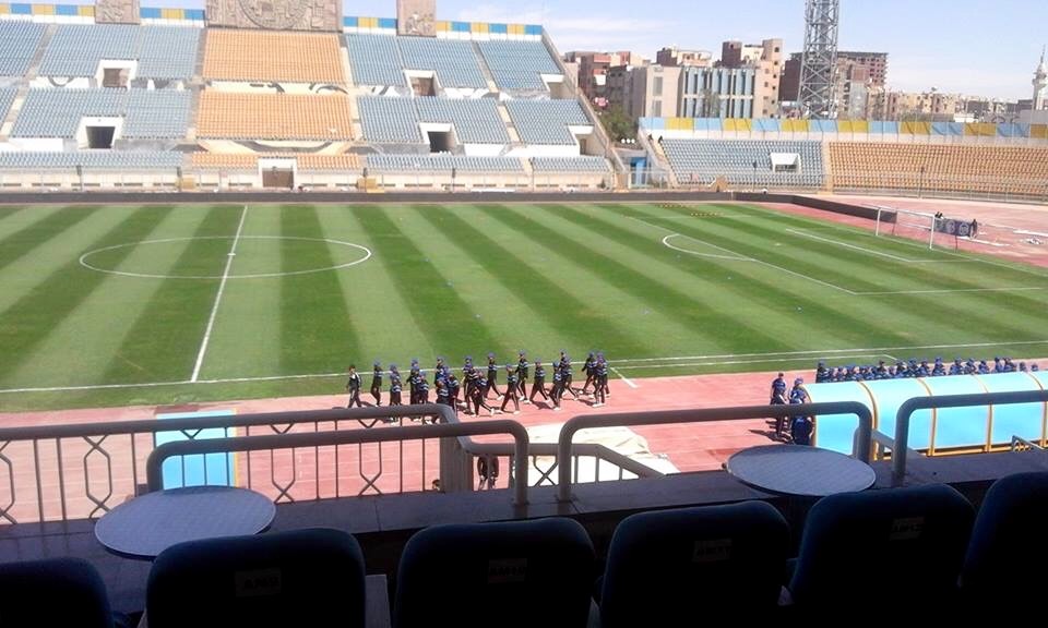
The Ismailia Stadium, located in the city, is used by the Ismaily SC football club and for major events such as the 2006 African Football Championship.
From August 1974 to July 1979, the city was the headquarters of the United Nations Emergency Force (UNEF II). In 2008, about 10 military observers of the United Nations Truce Supervision Organization (UNTSO) are still stationed in the city.
Ismaïlia in present and past times is mentioned in detail in Markus Werner's 1999 novel Der ägyptische Heinrich (The Egyptian Henry), in which the Swiss author traces the life story of his great-great-grandfather Heinrich Bluntschli and his role as director of the post office in Ismaïlia in the 1960s.
Text new
Ismailia was originally laid out as a residential town for canal workers, engineers and officials, mostly from France, Britain and Greece. The foundation stone was laid on 17 April 1862 by the Inspector General of the Suez Canal Company and was initially named the village of Timsāḥ (Arabic قرية التمساح Qaryat at-Timsāḥ). After the accession of the Khedive (Viceroy) Ismail Pasha on 18 January 1863, this settlement was renamed Ismailia and became the capital of the Canal Governorate. During the canal works, it was the most important town along the Suez Canal and headquarters of the Suez Canal Company. To ensure the supply of drinking water, the freshwater canal, also called the Ismāʿīlīya Canal, was constructed between 1861 and 1863 by French engineers from the Nile at Shubraal-Chaima through the Wadi Tumilat to Ismailia.
In 1864, the settlement already had several streets with residential buildings, a central square and a government building. In 1868, the connection to the railway network was made. However, the splendor and importance of the city were lost as quickly as they had come. Indeed, after the completion of the canal works and the opening of the canal on 17 November 1869, most of the workers were relocated to Port Said.
Between 1870 and 1890, about 3,000 inhabitants lived here. In the following period, the population increased steadily. In 1928 already 15,507 inhabitants were counted here and in 1950 about 50,000 inhabitants. These were mainly foreigners. Until the British withdrew in 1954, they also used Ismailia as a garrison town. The headquarters of the British military and the civil administrative centre of the Canal Zone were located here. Troops were mainly stationed in the southwestern suburb of Moascar (Arabic المعسكر al-Muʿaskar 'the troop camp'). Since 1916, the British also owned a military airfield here, 4 kilometers west-northwest of the city, the Royal Air Force Ismailia Airfield, which is now used by the Egyptian military. Another military airfield was built by the British in the 1930s, the Royal Air Force Base Deversoir (LG-209), located 19 kilometers to the south-southeast.
In 1916 ʿAbdul-Baha' (1844-1921), the eldest son of the founder of the religion Bahāʾullāh, arrived in Ismailia and founded a Baha'i center around the city. In 1928, Hasan al-Bannā (1906-1949), a primary school teacher, founded the Muslim Brotherhood. El-Bannāʾ had been appearing as a preacher in local cafes since 1926. Initially, the Brotherhood was still supported by the Suez Canal Society so that a school and a mosque could be founded here. However, the Muslim Brotherhood prevented the spread of the Baha'i religion. The Brotherhood grew very rapidly. In the early 1940s, the secret military wing of the Brotherhood emerged. The Brotherhood's hostility to the British became increasingly visible. They carried out anti-British attacks and supported the Palestinians in the emerging Middle East conflict in what was then Mandate Palestine. The Brotherhood's struggle against the British led to a full-scale petty war in the late 1940s, and the Brotherhood then supported the overthrow of the Free Officers in July 1952.
From October 1951 onwards, clashes between British troops and the local Egyptian police became increasingly frequent. The climax was reached on January 25, 1952, when 50 Egyptian policemen were killed in a six-hour skirmish between the two forces. January 25 later became the Egyptian police's day of honor. A day later, this news reached Cairo, where there was massive rioting against the British occupation and looting by fire. This day, on which large parts of downtown Cairo were destroyed, went down in history as "Black Saturday".
Today Ismailia is the seat of the Suez Canal Authority, which was established by law on 26 July 1956.
Since 1963, the city has been the capital of the al-Ismaʿiliyya governorate, which was created by partition from the Canal governorate.
After the Six-Day War in 1967, many residents left the city or were evacuated. On October 6, 1973, Egyptian forces crossed the Suez Canal at five points along it, including north of the city, initiating the Yom Kippur War, called the October War in Egypt. On 24 October 1973, the ceasefire reached by the UN was declared. Ismailia was subsequently the headquarters of the United Nations Emergency Force (UNEF II) from August 1974 to July 1979. Military observers from the United Nations Truce Supervision Organization are still stationed here today. After the ceasefire, however, only some of the inhabitants returned to the city.
In 2006, the city had a population of about 293,000, and the greater Ismailia area had a population of about 750,000.
Economy and infrastructure
Education
Ismailia has been a university town since 1976. The Suez Canal University, represented in several cities, established twelve of the 28 faculties here.
Traffic
Street
Ismailia is connected to Cairo via highway 4, which passes through the city to the northwest. The distance to Cairo is about 130 kilometers. The highway continues via al-Qantara (44 kilometers) to Port Said (80 kilometers). From the highway exit, the route continues east via trunk roads 49 and 31, reaching the city to the south.
About four kilometres east of the town of Ismailia, the Nimra Sitta car ferry (number 6) operates, connecting the west and east banks of the Suez Canal along trunk road 31. Of course, the ferries can only run when there are no ships on the canal at the moment. The next bridge is in el-Qanṭara to the north and there is a tunnel in Sues under the canal.
Railway
There are train connections to Cairo, Suez and Port Said via Ismailia station. The El Ferdan Bridge, located about 12 km north of Ismailia and the longest swing bridge in the world, connects the Sinai Railway east of the Suez Canal with the rest of the Egyptian railway network on a single track and also provides a two-lane road connection across the canal.
Inland navigation
There are boat moorings to the south of the city centre.
Air traffic
Ismailia does not have a civilian airport. Al Ismailiyah Air Base in the northwest is operated by the Egyptian Air Force.

Related articles
Author
AlegsaOnline.com Ismaïlia: Egyptian city on the Suez Canal Leandro Alegsa
URL: https://en.alegsaonline.com/art/48461
Sources
- howtocallabroad.com : "How to call Egypt: country code, area codes, phone books"
- voxcall.com : How to call Ismailia from USA
- commons.wikimedia.org : Ismailia