
Ismailia Governorate (Egypt)
Governorate along the Suez Canal in northeastern Egypt centred on the city of Ismailia. Named for Ismail Pasha, its identity and economy remain linked to canal transport, irrigation agriculture, light industry and public services.
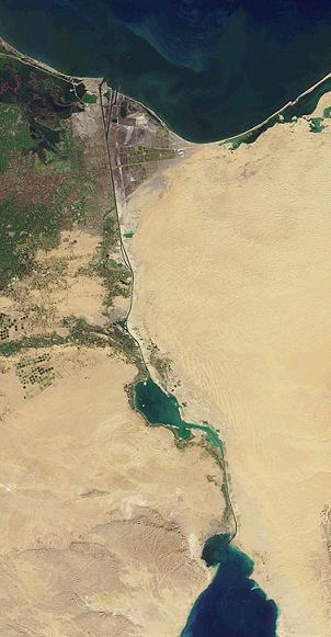
Ismailia Governorate lies on the western bank of the Suez Canal in northeastern Egypt. Its administrative capital is the city of Ismailia. The governorate takes its name from Ismail Pasha and developed rapidly when the canal was constructed in the mid‑19th century; the waterway continues to shape the region's economy, transport links and urban geography.
Image gallery
6 Images


Geography and climate
The landscape combines stretches of desert with irrigated agricultural land and a number of lakes and canals that connect to the Suez water system. Climate is typically arid: summers are hot and dry while winters are mild. Proximity to the canal and inland waterways moderates temperature extremes compared with deeper desert areas, and irrigated zones support cultivation that would otherwise be impossible.
History
The area grew in importance during the construction and operation of the Suez Canal, which attracted engineers, labourers and administrators from many countries. Urban centres expanded to provide housing, services and facilities for canal operations. Over time the governorate acquired administrative structures that reflect both its local communities and its strategic role for international shipping.
Administration and population
The governorate is divided into administrative districts and municipalities that manage local services, planning and infrastructure. The capital city functions as the principal hub for government, education and commerce; the population includes long‑established families as well as workers and professionals connected to canal and transport activities.
Economy
The local economy blends activities linked to maritime transit with agriculture and light industry. Important components include:
- Canal services and logistics supporting vessel passage and maintenance
- Irrigated agriculture where water from canal systems is available
- Manufacturing, food processing and light industrial enterprises
- Public administration, education and local commerce
- Tourism related to the canal and local natural features
Transport and infrastructure
Road and rail connections link the governorate with Cairo and neighbouring canal cities. Infrastructure and facilities serving shipping, pilotage and maintenance are an important part of the built environment. The Suez waterway remains the defining transport corridor for the region's maritime economy.
Environment and challenges
The governorate faces environmental issues common to canal zones and arid regions: water management, salinity control, protection of irrigated soils and balancing urban growth with conservation of natural and aquatic habitats. Local authorities and specialist bodies monitor and plan responses to these challenges.
Culture and landmarks
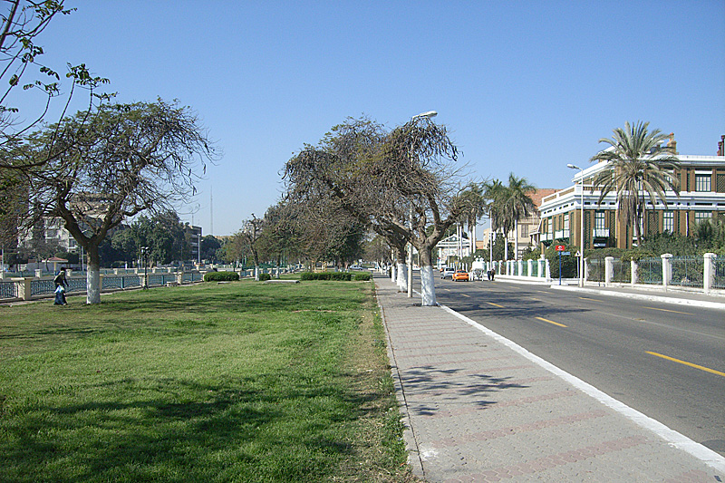
Ismailia and nearby towns contain museums, memorials and civic architecture that reflect the history of the canal and the multicultural communities that formed around it. Cultural life includes local traditions, educational institutions and events tied to the maritime and agricultural heritage of the governorate.
For updated administrative boundaries, demographic statistics and planning documents consult official publications and specialist sources on regional geography and transport in Egypt, on the city of Ismailia and on the Suez Canal.
Related articles
Author
AlegsaOnline.com Ismailia Governorate (Egypt) Leandro Alegsa
URL: https://en.alegsaonline.com/art/48460
Sources
- ismailia.gov.eg : "About the governorate"
- capmas.gov.eg : "Population Estimates By Governorate ( Urban /Rural ) 1/1/2018" · web.archive.org
- britannica.com : "Ismail-Pasha" · web.archive.org
- tools.wmflabs.org : 30°36′N 32°17′E / 30.600°N 32.283°E / 30.600; 32.283