Irrawaddy River (Ayeyarwady): Myanmar's principal river and delta
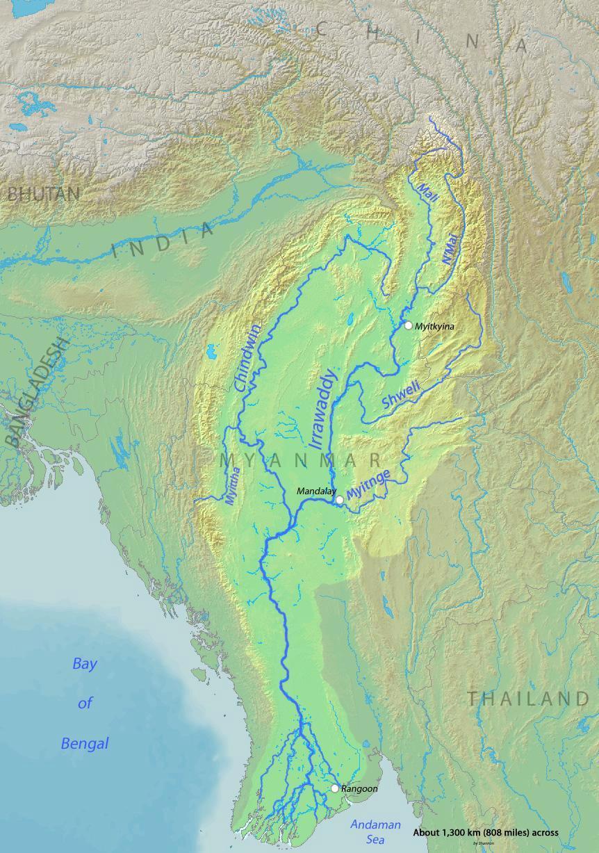
Major north–south river of Myanmar, formed by the N'mai and Mali confluence, flowing to the Andaman Sea. Myanmar's largest waterway with a 404,200 km² basin and a diverse, economically vital delta.
Overview
The Irrawaddy River, also spelled Ayeyarwady, is the principal river of Myanmar. It flows generally from north to south, uniting upland tributaries and then passing through a broad central plain before emptying into the Andaman Sea. The Irrawaddy is the country's largest river and its most important inland waterway for transport, irrigation and cultural identity. Its drainage basin covers about 404,200 square kilometres, an area that encompasses much of Myanmar's agricultural and populated regions; further details on the basin are documented by hydrological studies and national surveys (drainage basin).
Image gallery
10 Images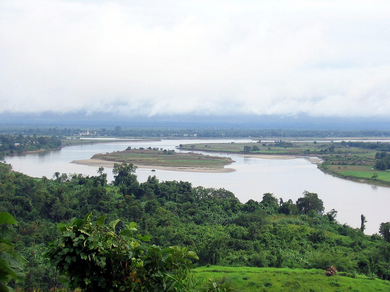


Course and physical characteristics
The river begins where the N'mai and Mali rivers join and then flows southward across a series of physiographic zones. In its upper reaches it runs through steep valleys and gorges; in the middle it crosses a wide alluvial plain that supports intensive farming; and in its lower reaches it fans into the Irrawaddy Delta, a complex of estuaries, channels and islands. Seasonal monsoon rains cause marked fluctuations in flow, with high water during the wet season and lower flows in the dry months.
History and human use
The Irrawaddy has been central to the political and economic life of the region for centuries. It provided a transport corridor for inland trade and communication and supported the growth of historical capitals and towns along its banks. Today the river remains vital for riverine transport, rice cultivation in the delta, fisheries and local livelihoods. Hydropower and irrigation projects have been proposed and built on tributaries and upper reaches, sometimes prompting debate about social and environmental impacts.
Ecology and notable features
The river and its delta support diverse habitats, from freshwater wetlands to estuarine mangroves. The lower river and coastal waters are known for species such as migratory fish and the Irrawaddy dolphin, which occur in some stretches. The delta is a highly productive agricultural zone but also vulnerable to erosion, saltwater intrusion and sea-level rise, which affect farming and coastal communities.
Navigation, economy and challenges
- Navigation: The Irrawaddy serves as a primary inland shipping route, with riverboats carrying passengers and cargo between towns and ports.
- Economy: The river underpins rice production, fishing, local industries and tourism centered on river cruises and cultural sites.
- Challenges: Sedimentation, seasonal variability, pollution, upstream development and climate-related sea-level changes are ongoing concerns for the river's health and the communities that depend on it.
As Myanmar continues to develop, the Irrawaddy remains both a natural resource and a cultural symbol. Its management involves balancing navigation, agriculture, energy needs and ecosystem conservation to sustain the river for future generations.
Questions and answers
Q: Where does the Irrawaddy River flow through?
A: The Irrawaddy River flows through Myanmar.
Q: What is the Irrawaddy River considered to be in Myanmar?
A: The Irrawaddy River is considered to be the country's largest river and most important commercial waterway in Myanmar.
Q: How long is the Irrawaddy River?
A: There is no information about the length of the Irrawaddy River in the given text.
Q: Where is the source of the Irrawaddy River?
A: The source of the Irrawaddy River is at the confluence of the N'mai and Mali rivers.
Q: Where does the Irrawaddy River end?
A: The Irrawaddy River ends at the Andaman Sea.
Q: How large is the drainage basin of the Irrawaddy River?
A: The drainage basin of the Irrawaddy River is about 404,200 square kilometres (156,100 sq mi) and covers a large part of Myanmar.
Q: What are some uses of the Irrawaddy River in Myanmar?
A: The Irrawaddy River serves as an important commercial waterway for Myanmar.
Related articles
Author
AlegsaOnline.com Irrawaddy River (Ayeyarwady): Myanmar's principal river and delta Leandro Alegsa
URL: https://en.alegsaonline.com/art/48253
Sources
- books.google.com : Rivers of the World: A Social, Geographical, and Environmental Sourcebook
- arcbc.org.ph : "Irrawaddy Delta"
- reuters.com : "Myanmar death toll soars, devastation huge"
- worldwildlife.org : "Irrawaddy Dolphin"
- phys.org : "Myanmar's 'smiling' Irrawaddy dolphins on brink of extinction"
- worldwildlife.org : "Myanmar Coast mangroves"
- seaturtle.org : "Sea Turtles in Myanmar: Past and Present"