Irazú Volcano: geography, craters, history and conservation
Irazú Volcano is a prominent stratovolcano in Costa Rica's Central Mountain Range, known for its varied craters, crater lakes, and historical eruptions. The national park protects high-altitude forests and watershed areas.
Overview
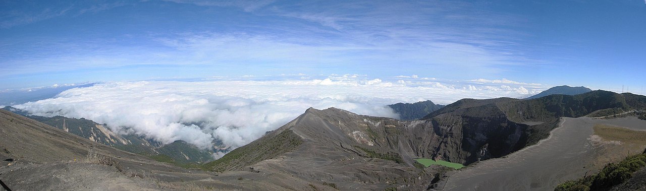
Irazú Volcano is one of Costa Rica's best-known volcanic peaks, rising to about 3,435 metres above sea level in the Cordillera Central. Located roughly northwest of the city of Cartago, it forms the core of Irazú Volcano National Park. Its high elevation and position near the continental divide mean that on exceptionally clear days observers can see both the Pacific Ocean and the Caribbean Sea from viewpoints on the upper slopes (Pacific and Caribbean panoramas).
Image gallery
4 Images

Geology and principal features
Irazú is a composite (stratovolcano) built from alternating layers of lava flows, ash and pyroclastic material. The summit area contains several distinct craters and pit depressions, some of which host acidic or mineral-rich lakes. The most famous is the main crater, which often displays a vivid greenish-yellow hue caused by dissolved minerals and changing chemical conditions; it has occasionally shifted toward rust-red tones depending on eruptive or hydrothermal activity. Nearby craters include the dry, ash-filled Diego de la Haya and a number of smaller pits and fissures distributed across the summit complex. For maps and guides to the crater group see local resources on craters and summit features (craters and crater lakes).
History of eruptions and landscape change
Irazú has a history of intermittent explosive eruptions. The volcano was notably active in the mid-20th century, with significant eruptive episodes recorded in 1963 and 1965 that produced ashfalls and modified local vegetation and drainage patterns. Repeated eruptions over millennia have shaped the summit calderas and deposited layers that influence soil chemistry and hydrology. These disturbances have made the plant communities on the mountain dynamic and often patchy, with succession stages ranging from barren ash fields to established forest.
Ecology and conservation
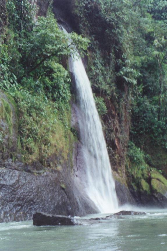
The national park protects several thousand hectares of high-elevation habitat, including native montane forest stands dominated by oaks and alders and areas replanted with conifers and introduced species during past reforestation projects. The native oak and alder woodlands play an important ecological role in stabilizing soils and protecting the watershed of streams such as the Reventado River; they are represented in restoration and conservation planning (oaks, alders).
Visiting and significance
Irazú is accessible by road and attracts visitors for its dramatic summit scenery, crater lakes and interpretive trails. Park infrastructure includes viewpoints and short trails that allow safe observation of the main crater areas; however, volcanic gases and changing weather can limit access and visibility. The site is important for scientific monitoring of volcanic activity, for protecting watershed function, and as a highland recreational and educational resource.
Notable facts
- The main crater's unusual colors result from mineral-rich waters and changing oxidation states rather than plant pigments.
- Historic eruptions have altered vegetation patterns, leading to a mix of native forest and reforested areas within the park.
- The summit region serves both conservation and hazard-monitoring purposes, so management balances public access with safety.
For visitors and researchers alike, Irazú remains a striking example of a tropical highland volcano where geology, ecology and human use intersect. Further practical information on access, safety and current conditions is available from official park sources and visitor centers (park information).
Questions and answers
Q: Where is Irazu Volcano National Park located?
A: Irazu Volcano National Park is located 31 km northwest of the city of Cartago, in the central mountain range of Costa Rica.
Q: How high above sea level is the park?
A: The park is 3,435 meters above sea level.
Q: When did Irazu Volcano last erupt?
A: Irazu Volcano last erupted in 1963 and 1965.
Q: What can visitors to the park see from its highest point on a clear day?
A: From the highest point in the park, on a clear day, visitors can see both the Pacific Ocean and the Caribbean Sea at the same time.
Q: What causes the unusual greenish yellow coloring of the Crater Principal lake?
A: The unusual greenish yellow coloring of the Crater Principal lake is caused by rainfall dissolving the minerals along the crater's walls.
Q: What is the site of a reforestation project in the park?
A: The park is the site of a reforestation project to restore the area which was destroyed by the eruptions.
Q: What types of vegetation are in the park?
A: The vegetation of the park is diverse and includes conifers and other exotic and native species. There is also a native forest consisting mainly of oaks and alder, protecting the watershed of the Reventado River.
Related articles
Author
AlegsaOnline.com Irazú Volcano: geography, craters, history and conservation Leandro Alegsa
URL: https://en.alegsaonline.com/art/48123