
Interstate 81: Appalachian north–south corridor of the eastern United States
Interstate 81 is an approximately 855-mile north–south Interstate running along the Appalachian spine from Dandridge, Tennessee, to Wellesley Island, New York, serving regional centers, freight, and cross-border traffic.
Overview
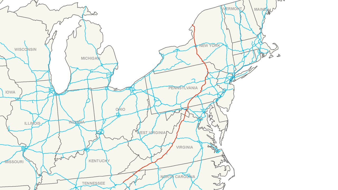
Interstate 81 is a major north–south component of the U.S. Interstate Highway System that runs roughly along the Appalachian Mountain range in the eastern United States. Its southern terminus is at Interstate 40 near Dandridge, Tennessee, and the route continues north to end at Wellesley Island at the Canadian border in New York. The highway covers roughly 855 miles and functions as a backbone for regional travel through mountainous and valley terrain, often paralleling older routes.
Image gallery
7 Images


Route and characteristics
The corridor generally follows the crest and valleys of the Appalachian Mountains, which shapes its alignment and engineering. Beginning in eastern Tennessee, I-81 runs through a series of population centers and college towns in Virginia and beyond. Notable places along the southern sections include the twin cities of Bristol, Tennessee and Bristol, Virginia, the Roanoke Valley near Roanoke, and the university city of Blacksburg. In central Virginia it serves historic and market towns such as Lexington, Staunton, Harrisonburg and Winchester. In Harrisonburg the highway passes close to the campus of James Madison University.
- Southern region: Dandridge area to the Tennessee–Virginia border, through valleys and mountain gaps.
- Central region: Virginia’s Shenandoah Valley and short stretches in West Virginia and Maryland.
- Northern region: Pennsylvania’s northeast-trending sections and the route across New York to the Canadian crossing.
Segments in adjacent states
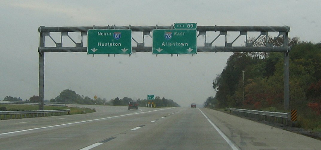
From Virginia the interstate clips the eastern panhandle of West Virginia and serves Martinsburg before crossing Maryland at one of that state’s narrowest points and passing through the Hagerstown area, nicknamed the “Hub City” (Hagerstown). In Pennsylvania I-81 becomes a principal regional artery, connecting communities such as Chambersburg and Carlisle; motorists can reach the Pennsylvania Turnpike via connecting surface roads. Near the state capital it forms part of the northeastern segment of the Harrisburg beltway around Harrisburg, and farther northeast it serves the Wyoming Valley metropolitan area including Wilkes-Barre and Scranton.
New York terminus and international crossing
In New York the highway enters near Binghamton, proceeds past regional hubs such as Syracuse, and then continues north through rural and small-city landscapes toward Watertown and the Thousand Islands area. The route reaches the Canadian border at the international boundary, where the Thousand Islands Bridge spans the St. Lawrence River. Across the border the short connecting roadway leads to Canadian Highway 137 and to Highway 401, integrating I-81 into broader North American networks.
History and construction
Like other Interstates, I-81 was planned and constructed following the mid‑20th‑century interstate program and was completed in stages over subsequent decades. Its corridors frequently follow older federal and state roads, most notably paralleling U.S. Route 11 through large parts of Virginia and New York. Construction in ridge‑and‑valley terrain required extensive earthmoving, cut‑and‑fill work, bridge construction and occasional tunnels or engineered cuts to maintain acceptable grades for heavy vehicles. In several places the mountain topography produced tighter horizontal curves and steeper vertical profiles than typical of plains interstates.
Economic role and freight
I-81 functions as an important freight corridor connecting agricultural and manufacturing regions of the American South with markets and distribution centers in the Northeast and Canada. Because it passes inland of the densely urbanized I‑95 corridor, the route frequently carries through‑truck traffic as an alternative to coastal routes. The corridor supports local economies by linking smaller cities, college towns and regional industrial centers, while also serving seasonal tourism traffic in places such as the Shenandoah Valley and the Thousand Islands area.
Traffic, safety and services
High truck volumes produce recurring operational and safety challenges, including congestion at interchanges, heavy wear on pavement, and air‑quality concerns in valley basins. Traffic management approaches used along I‑81 include targeted lane improvements, truck parking and rest area planning, incident response coordination, and interchange upgrades where crash patterns indicate systemic problems. Services for motorists are concentrated near urban nodes and at periodic service plazas and commercial developments; rural stretches have longer distances between full‑service facilities.
Management, planning and the corridor coalition
State departments of transportation administer their respective segments of I‑81, coordinating on cross‑border issues such as truck routing, permitting and incident management. To address shared concerns, stakeholders established multistate groups such as the I‑81 Corridor Coalition to pursue joint planning, freight performance monitoring and mitigation of environmental impacts. These cooperative efforts aim to balance mobility, safety and local community interests along the corridor.
Distinctive features and outlook
Although signed north–south, long sections of I‑81 follow a northeast–southwest alignment consistent with Appalachian topography. The highway is largely toll‑free and notable for closely following older surface routes while providing limited‑access travel. Ongoing priorities along the route include improving safety at high‑crash interchanges, expanding rest and truck parking capacity, and deploying operational technology to manage freight movements and reduce congestion. As regional growth and freight demand evolve, I‑81 remains a critical inland spine for travel and commerce in the eastern United States.
Questions and answers
Q: What states does Interstate 81 run through?
A: Interstate 81 runs through Tennessee, Virginia, West Virginia, Maryland, Pennsylvania, and New York.
Q: How long is Interstate 81?
A: Interstate 81 is 854.89 miles (1,375.81 km) in length.
Q: Where does Interstate 81 begin and end?
A: Interstate 81 begins in Dandridge, Tennessee and ends at Wellesley Island, New York.
Q: What cities does I-81 pass through on its route?
A: I-81 passes through the twin cities of Bristol (Tennessee and Virginia), Roanoke, Blacksburg, Lexington, Staunton, Harrisonburg Winchester (Virginia); Martinsburg (West Virginia); Chambersburg and Carlisle (Pennsylvania); Syracuse and Watertown (New York).
Q: Does I-81 directly interchange with the Pennsylvania Turnpike?
A: No - motorists must use US 11 to connect to the Pennsylvania Turnpike from I-81.
Q: What organization was created to handle issues along I-81?
A: The Interstate 81 Corridor Coalition was organized to handle issues along I-81 such as truck traffic and air pollution.
Q: How many times has the Corridor Coalition met since October 15th 2008?
A:The Corridor Coalition has met twice since October 15th 2008.
Related articles
Author
AlegsaOnline.com Interstate 81: Appalachian north–south corridor of the eastern United States Leandro Alegsa
URL: https://en.alegsaonline.com/art/47805
Sources
- fhwa.dot.gov : "FHWA Route Log and Finder List: Table 1"
- interstate-guide.com : "Interstate 81"
- whptv.com : I-81 Safety Conference
- witf.org : I-81 Corridor group