
Antonine Wall: Roman frontier across the Scottish Lowlands
A Roman turf-and-stone frontier built in the mid-2nd century across lowland Scotland, the Antonine Wall marked a temporary northern border of the empire and is today a UNESCO World Heritage component.
Overview
The Antonine Wall was a linear Roman fortification constructed across northern Great Britain in the middle 2nd century. Ordered by the emperor Antoninus Pius, it ran between the estuaries now known as the Firth of Forth and the Firth of Clyde in what is today Scotland. Built on a stone foundation and capped with a broad turf rampart, the wall was intended to secure the empire's northern border in Britain and to control movement of local groups often described in Roman sources as the Caledonians.
Image gallery
10 Images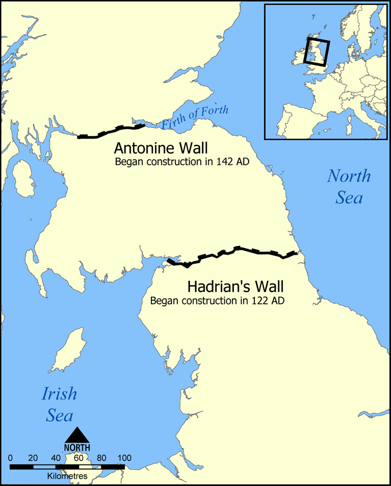




Structure and principal features
The Antonine Wall was shorter than the better known Hadrianic defence to the south but followed the same logic of fixed defences. It stretched for roughly 59 kilometres and included a continuous earth and turf rampart on top of stored foundations, with an outer ditch to impede movement towards the wall. Regularly spaced forts and smaller fortlets provided garrison points and housed patrols. The soldiers used a raised service road, commonly called the Military Way, to move troops and supplies between strongpoints. Decorative carved distance slabs and other inscribed stones record the presence and pride of the units who built and manned these works.
History and occupation
Construction took place under orders from the imperial administration of the Roman Empire, and local command was exercised by the governor of Roman Britain. Ancient and modern sources attribute the field work to units led by Lollius Urbicus acting on behalf of the emperor. After a period of occupation that modern scholars generally describe as brief—roughly two decades—the frontier was withdrawn and troops redeployed to Hadrian's Wall. There were later attempts to reassert control in the northern provinces, including restorations ordered under the emperor Septimius Severus, but these did not restore the Antonine frontier to a permanent status.
Archaeology, remains and conservation
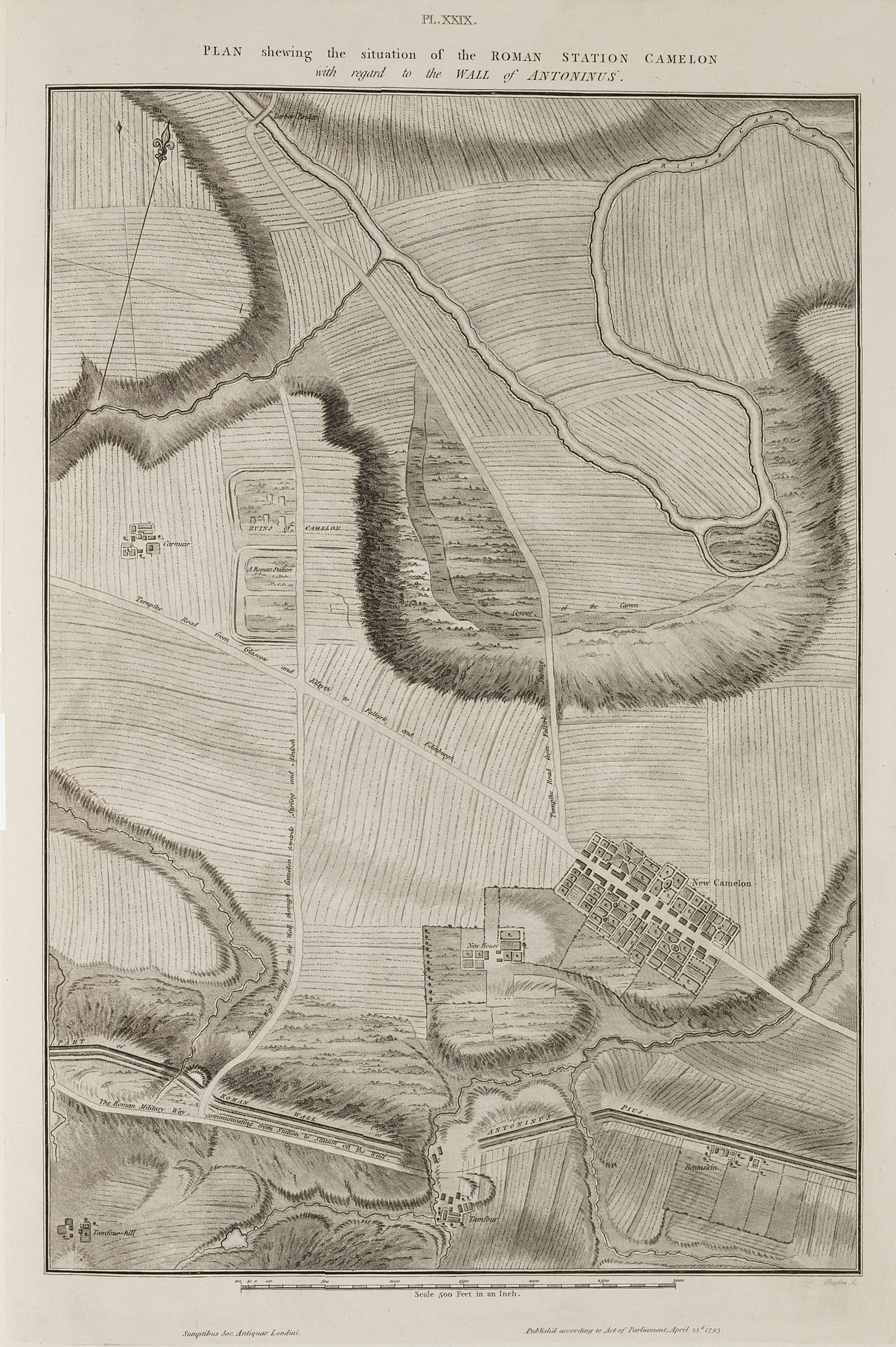
Much of the wall has been lost to agriculture, urban development and natural erosion, leaving scattered ruins, cropmarks and earthworks visible across the Lowlands. Systematic excavation has revealed the sequence of construction, the layout of forts, the road system and a number of inscribed slabs that illustrate soldierly life and imperial propaganda. Preservation and public presentation are managed through a mix of agencies: some sections are cared for by organizations such as Historic Scotland, while other stretches remain in private property and are less accessible. Visitor trails, signage and museum displays interpret finds and explain the wall’s context for modern audiences.
Significance and comparisons
The Antonine Wall is part of the transnational UNESCO initiative for the Frontiers of the Roman Empire, a World Heritage Site program that highlights Roman frontier systems. This listing links the Antonine frontier to other major Roman boundaries, including Hadrian's Wall in England and continental systems such as the Limes Germanicus. While Hadrian's Wall is more complete and visible in stone, the Antonine Wall is notable for its turf construction on stone foundations and for the brief, dynamic period of its use which provides rich archaeological evidence about Roman military logistics and interactions with northern communities.
Key facts at a glance
- Type of work: turf rampart on stone foundations (stone / turf).
- Location: between the Firth of Forth and the Firth of Clyde in Scotland.
- Era: ordered under Antoninus Pius in the middle 2nd century.
- Command and builders: forces under the provincial governor of Roman Britain, including work credited to Lollius Urbicus.
- Heritage: part of the UNESCO-recognised World Heritage Site for Roman frontiers (Frontiers of the Roman Empire).
For anyone studying Roman military architecture, imperial policy in the provinces or the archaeology of Britain, the Antonine Wall provides a distinct counterpoint to longer-lived defences and offers insight into a frontier that balanced engineering, logistics and political ambition in a challenging landscape.
Questions and answers
Q: What is the Antonine Wall?
A: The Antonine Wall is a stone and turf fortification built across northern Great Britain by the Roman Empire in the middle 2nd century. It was built by Roman emperor Antoninus Pius to control barbarians, and it ran between the Firth of Forth and the Firth of Clyde in modern Scotland.
Q: When was the wall constructed?
A: The wall was constructed between 139 and 142 AD at the order of emperor Antoninus Pius.
Q: How long was the wall?
A: The wall was about 59 kilometres (37 miles) long.
Q: How wide was it?
A: Its foundations were made of stone and were between 4.5 metres (15 feet) and 5 metres (16 feet) wide.
Q: What kind of ditch surrounded it?
A: In front of the wall on its northern side there was a ditch that was at least 3.6 metres (12 feet) deep, nearly 12 metres (39 feet) wide in places, and 7 metres (23 feet) away from the wall itself.
Q: Was it ever fortified again after being abandoned?
A: No, after being abandoned around 163 AD, it never received any further fortifications despite attempts by Emperor Septimius Severus to repair it in 208 AD.
Q: Is any part of it still visible today?
A: Yes, some remains are still visible today with many under care from Historic Scotland or UNESCO World Heritage Site Committee, although most is private property now.
Related articles
Author
AlegsaOnline.com Antonine Wall: Roman frontier across the Scottish Lowlands Leandro Alegsa
URL: https://en.alegsaonline.com/art/4738
Sources
- whc.unesco.org : UNESCO World Heritage List