
Indiana
Overview of Indiana: geography, history, economy, culture, symbols, and major cities in the U.S. Midwest and Great Lakes region.
Overview
Indiana is a U.S. state located in the Midwestern and Great Lakes regions of North America. Its capital and largest city is Indianapolis. Residents are commonly known as Hoosiers. The state features a mix of urban centers, agricultural plains and industrial corridors and has played a notable role in manufacturing, transportation and motorsports.
Image gallery
10 Images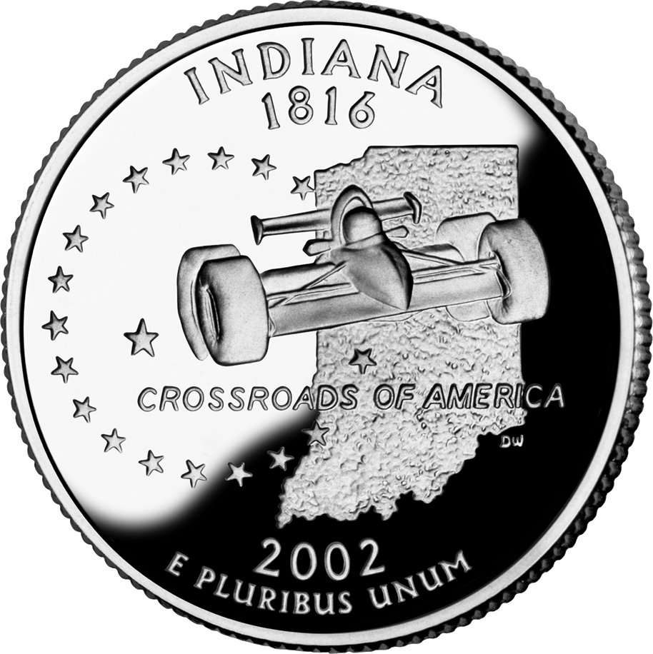



Geography and environment
Indiana is bordered by Illinois to the west, Ohio to the east, Michigan to the north and Kentucky to the south. It also has shoreline on Lake Michigan in the northwest. The state’s southern border is largely defined by the Ohio River. Topography ranges from flat till plains in the north and west to low rolling hills and river valleys in the south. Indiana’s natural environments include deciduous forests, wetlands and extensive agricultural land. For summaries of its boundaries and physiographic context, see related material on state borders and geography.
History
Long before European contact, the region was home to diverse indigenous peoples who developed settlements, trade networks and farming systems. During the colonial era much of the area came under the influence of France and was incorporated into New France, becoming part of broader European contests in North America. Control over the territory shifted through wars, treaties and diplomatic agreements during the 18th and early 19th centuries.
Migration and settlement after the American Revolution brought people from eastern states such as Virginia and Kentucky into the region. The legal status and practice of slavery and other forms of forced labor in the territory and early statehood was complex: federal and territorial laws limited institutional slavery even as various forms of enslavement and servitude persisted into the early 1800s, affecting both Native and Black individuals. Historical records contain references to people being enslaved into the early decades after statehood. Indiana formally joined the Union in 1816 and developed through the 19th and 20th centuries under the influence of agriculture, canals, railroads and industry.
Major cities and regions
Indiana’s urban landscape includes a state capital, regional centers and university towns. Notable municipalities include:
- Indianapolis — state capital and cultural and economic hub
- Fort Wayne — major city in the northeastern part of the state
- South Bend — historic manufacturing center and university town
- Bloomington — home to a major public university and liberal arts culture
- Evansville — commercial and service center in the southwest
- Gary — industrial city on the Lake Michigan shore
- Muncie — representative Midwestern city often studied in social research
- Marion — regional center for manufacturing and services
Economy and education
The state economy blends agriculture (notably corn and soybeans), manufacturing (including automobiles and steel-related industries), logistics and healthcare. Indiana is home to public and private universities and research institutions that contribute to education and workforce development. Cities host hospitals, distribution centers and a range of small and large enterprises that connect the state to national and international markets.
Culture, sports and society
Indiana has a distinct cultural identity shaped by Midwestern traditions. High school and college basketball are culturally significant, and the state is widely known for the Indianapolis 500 auto race. There are active music, arts and festival scenes across cities and towns, and community life often revolves around local institutions and volunteer organizations.
Government, symbols and civic life
Indiana is governed by an elected governor and a bicameral legislature. State symbols commonly cited include the northern cardinal as the state bird, the peony as the state flower, and the tulip tree as the state tree. Civic and historical organizations maintain archives and public programs that explore the state’s past and contemporary issues.
Further reading and resources
For additional overviews and primary-source material consult collections and summaries on regional history, including resources focused on indigenous history, the French colonial period in New France, and discussions of slavery and servitude in the early nineteenth-century Midwest (enslavement, Black history). Timelines and detailed treatments of earlier eras are available for the 18th century and for the decades around statehood; contemporary historical studies include analyses of migration from places such as Virginia and Kentucky. For geographic context and boundary information see materials on state borders and geography and consult surviving primary accounts from the early 19th century.
Questions and answers
Q: What is the capital of Indiana?
A: The capital of Indiana is Indianapolis.
Q: What are some famous cities and towns in Indiana?
A: Some famous cities and towns in Indiana include Bloomington, Gary, Fort Wayne, South Bend, Evansville, Muncie, and Marion.
Q: What is the state bird of Indiana?
A: The state bird of Indiana is a Cardinal.
Q: What is the state flower of Indiana?
A: The state flower of Indiana is a Peony.
Q: What is the state tree of Indiana?
A: The state tree of Indiana is a Tulip Tree.
Q: Which states border with Indiana?
A: Illinois, Kentucky, Michigan, and Ohio border with Indiana. It also touches Lake Michigan; which is the only one of the Great Lakes that is completely inside the United States.
Q: How did people refer to those who lived in what would become known as 'Indiana'?
A: People who live in what would become known as 'Indiana' were sometimes referred to as Hoosiers.
Related articles
Author
AlegsaOnline.com Indiana Leandro Alegsa
URL: https://en.alegsaonline.com/art/47152
Sources
- census.gov : "Population and Housing Unit Estimates"
- kff.org : "Median Annual Household Income"
- wthr.com : "Lightning bug becomes Indiana's official state insect"