
Inca road system (Qhapaq Ñan)
The Inca road system, or Qhapaq Ñan, was a vast pre-Columbian network of roads and trails through the Andes that linked population centers, supported administration, and enabled long-distance communication and transport.
Overview
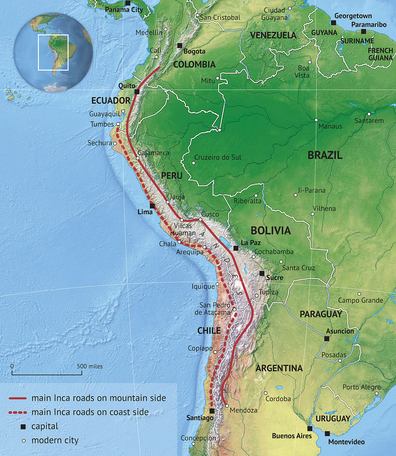
The Inca road system, often called Qhapaq Ñan or El Camino Inca, was the principal transportation and communication network of the Inca state. It ran across a wide variety of environments — coastal plains, high Andean plateaus and tropical cloud forests — and connected administrative centers, ceremonial sites and provincial settlements. Much of this network lay within what is now Peru, but its routes extended throughout pre-Columbian South America and across the spine of the Andes.
Image gallery
10 Images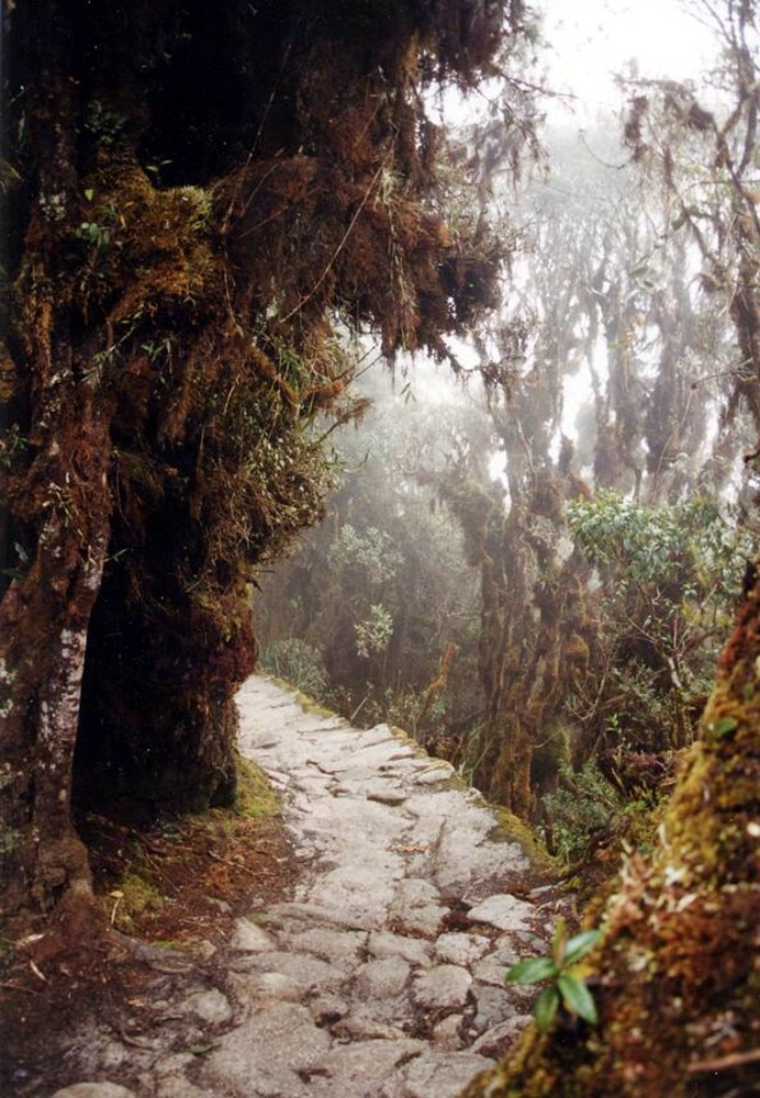





Design and engineering
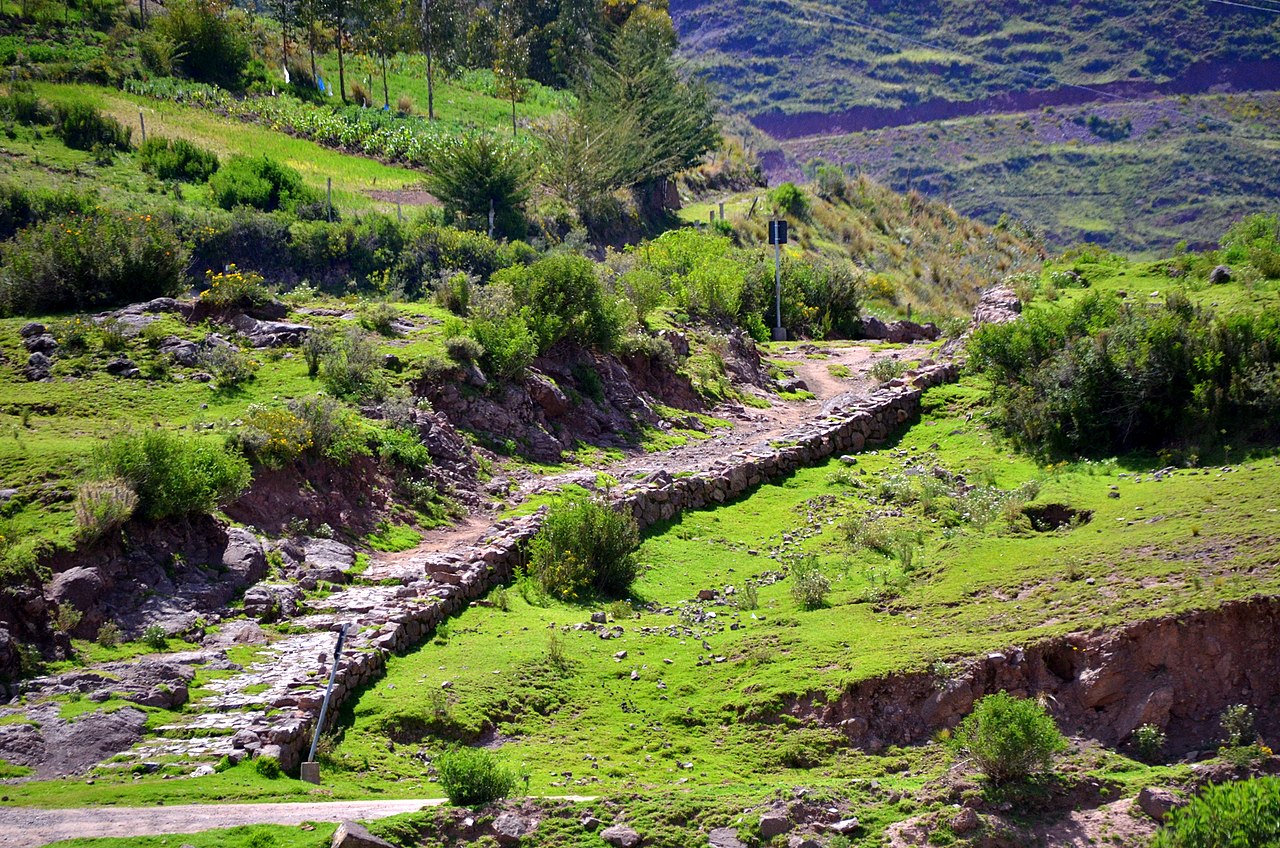
Roads were adapted to steep and difficult terrain with extensive stonework, switchbacks, and staircases cut into rock. Drainage channels, retaining walls and causeways protected routes from erosion and seasonal water flow. Where valleys and gorges interrupted corridors, the Incas built suspension bridges and simple wooden spans; many suspension bridges were traditionally woven from plant fibers and replaced periodically by local communities as an organized duty. Tunnels and carved passages appear where cliffs blocked direct lines of travel.
Components and supporting infrastructure
The system included distinct elements that supported continuous movement and state control:
- Roadways: paved or compacted tracks scaled to foot traffic and pack animals, often terraced on steep slopes.
- Tambos: roadside waystations serving as resthouses, storehouses and administrative posts, placed at regular intervals to supply travelers and state personnel.
- Bridges and tunnels: engineered solutions for rivers and ravines, including woven-fiber suspension bridges maintained by local communities.
- Relay system: trained runners and messengers who carried information and goods quickly between nodes.
Transport, communication and administration
The network functioned without wheeled vehicles for transport over most terrain and before the arrival of European livestock; goods moved by human carriers and pack animals such as the llama. Official couriers, commonly called chasquis, relayed messages and state records. The Incas recorded numeric and administrative information using knotted cords known as quipu, and the road network allowed centralized officials to dispatch orders, troops and supplies across long distances. The speed and reach of the relay system have been compared, in concept, to later postal services such as the Pony Express and other relay couriers of North America, though the technologies and contexts differed markedly.
History and significance
Constructed and maintained over generations, the network reflected the political ambitions of the Inca state to integrate diverse peoples and ecologies. Roads enabled redistribution of resources, rapid military movement, and ceremonial pilgrimages, reinforcing the empire's cohesion across mountain ranges and deserts. The scale and altitude of some routes — reaching very high Andean passes — testify to sophisticated logistics and local organization.
Legacy and modern relevance
Today many Inca roads survive as sections of archaeological route, popular trekking paths and alignments followed by modern highways. Key segments are protected and studied for their engineering, social history and landscape impacts. Ongoing conservation, archaeological work and community stewardship aim to balance tourism, local use and preservation of these routes, which remain important both as cultural heritage and as evidence of pre-industrial state organization and engineering ingenuity.
Notable characteristics of the Inca road system include its integration with local economies through communal maintenance duties, its adaptability to extreme environments, and its role as a conduit for information and goods across an empire without a formal written language. The network stands as one of the most extensive pre-modern road systems in the Americas and an enduring symbol of Andean territorial organization.
Questions and answers
Q: What is the Inca road system?
A: The Inca road system (El Camino Inca) of Peru was a network of roads and trails that were constructed in pre-Columbian South America.
Q: How extensive was the Inca road system?
A: It covered approximately 22,500 kilometers (14,000 mi) and reached heights of over 5,000 m (16,500 feet) above sea level.
Q: What was unique about the Inca road system in terms of transportation?
A: The Incas did not make use of the wheel for transportation, and did not have horses until the arrival of the Spanish in Peru in the 16th century, so the trails were used almost exclusively by people walking, sometimes accompanied by pack animals, usually the llama.
Q: How were messages communicated through the Inca road system?
A: Messages were carried via knotted-cord quipu and by memory, and could be carried by runners covering as much as 240 km (150 mi) per day, working in relay fashion much like the Pony Express of the 1860s in North America.
Q: What were the inns along the Inca road system used for?
A: There were approximately 2,000 inns or tambos placed at even intervals along the trails. They provided food, shelter and military supplies to the tens of thousands who traveled the roads.
Q: What was the territory accessible through the Inca road system?
A: The Inca road system provided access to over three million km² of territory.
Q: How did the Inca road system differ from other road systems of its time?
A: The Inca road system was the most extensive among the many roads and trails that were constructed in pre-Columbian South America.
Related articles
Author
AlegsaOnline.com Inca road system (Qhapaq Ñan) Leandro Alegsa
URL: https://en.alegsaonline.com/art/46990