
Île d'Oléron: French Atlantic island — geography, history and highlights
Île d'Oléron is a large Atlantic island off France's west coast, known for its salt marshes, oyster farming, beaches and the bridge linking it to the mainland since 1966.
Overview
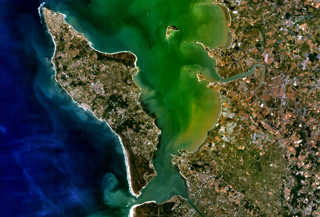
Île d'Oléron lies off the Atlantic coast of France, to the west of Rochefort. It is the second-largest island of metropolitan France after Corsica and is also an administrative canton. The island's principal town and administrative centre is Saint-Pierre-d'Oléron, which occupies a central position and serves as a hub for local services, markets and transport.
Image gallery
10 Images


Geography and natural features
Oléron combines sandy beaches, rocky points and extensive marshes and dunes. Its shoreline faces the open Atlantic and protected bays, giving rise to varied habitats for birds, marine life and coastal plants. The island has a temperate maritime climate, shaped by oceanic winds and mild winters.
History and built heritage
The island has been inhabited since antiquity and developed through medieval trade, salt production and fishing. Defensive works and maritime structures punctuate the coast: lighthouses, coastal forts and traditional oyster huts reflect centuries of seafaring and coastal economy. Fortifications in the surrounding waters, notably the nearby Fort Boyard, are part of the maritime landscape.
Economy and transport
Traditional livelihoods include oyster farming, salt marsh work and small-scale agriculture; today tourism is also a major economic driver. The island has been connected to the mainland by a road bridge since 1966, improving year-round access and commerce. The bridge links Oléron directly to the continental road network and complements seasonal ferry and boat services to nearby points.
Tourism, recreation and local life
Visitors come for long beaches, cycling paths, seafood—especially oysters—and tranquil villages. Notable points of interest include historic towns, a working lighthouse, birdwatching areas and coastal promenades. Leisure activities range from surfing and sailing to exploring salt marshes and tasting local produce at markets and seaside restaurants.
Notable facts and links
Aside from being the second-largest French island in metropolitan territory (Metropolitan France), Oléron is a distinctive blend of natural habitat and human heritage. Its position on the Atlantic coast of France gives it a maritime character, while the 1966 bridge improved ties with the mainland and shaped modern development. For practical information on visiting and local services, see regional guides and transport pages via the relevant links.
- Main town: Saint-Pierre-d'Oléron
- Access: bridge (since 1966) and seasonal boats (bridge information)
- Highlights: beaches, oyster beds, lighthouses and nature reserves
Questions and answers
Q: Where is the Île d'Oléron located?
A: The Île d'Oléron is located on the Atlantic coast of France, to the west of Rochefort.
Q: What is the size of the Île d'Oléron compared to other islands in Metropolitan France?
A: The Île d'Oléron is the second largest island of Metropolitan France, after Corsica.
Q: Which is the capital and largest town of the Île d'Oléron?
A: The capital and largest town of the Île d'Oléron is Saint-Pierre-d'Oléron.
Q: What is the location of Saint-Pierre-d'Oléron?
A: Saint-Pierre-d'Oléron is located in the centre of the Île d'Oléron.
Q: When was the connection between the Île d'Oléron and the mainland established?
A: Since 1966, there is a bridge that connects the Île d'Oléron with the mainland.
Q: What is the pronunciation of Île d'Oléron?
A: The pronunciation of Île d'Oléron is [il doleʁɔ̃].
Q: How is Île d'Oléron accessed?
A: Île d'Oléron is accessed by a bridge that connects it with the mainland.
Related articles
Author
AlegsaOnline.com Île d'Oléron: French Atlantic island — geography, history and highlights Leandro Alegsa
URL: https://en.alegsaonline.com/art/46685
Sources
- insee.fr : "Régions, départements, arrondissements, cantons et communes"
- cdc-oleron.com : "Document n°1 : Diagnostic local de l'Habitat"
- weatherbase.com : "Saint-Denis-d'Oléron, France - Köppen Climate Classification"
- legifrance.gouv.fr : "Décret n° 2014-269 du 27 février 2014 portant délimitation des cantons dans le département de la Charente-Maritime"