Iguaçu Falls: Geography, Ecology, History, and Visitor Guide
Iguaçu Falls is a vast waterfall complex on the Argentina–Brazil border, fed by the Iguaçu River. Known for roughly 275 cataracts, the Devil's Throat, subtropical rainforest and protected national parks.
Overview
Iguaçu Falls (Portuguese: Iguaçu, Spanish: Iguazú) is a large complex of waterfalls on the border between Argentina and Brazil. Fed by the Iguaçu River, which soon joins the larger Paraná River, the system is commonly described as consisting of about 275 separate cataracts. Individual drops vary: many are near 64 m (210 ft) while some reach roughly 82 m (269 ft). The falls form a broad, irregular semicircle that creates dramatic panoramas and powerful river flow below.
Image gallery
10 Images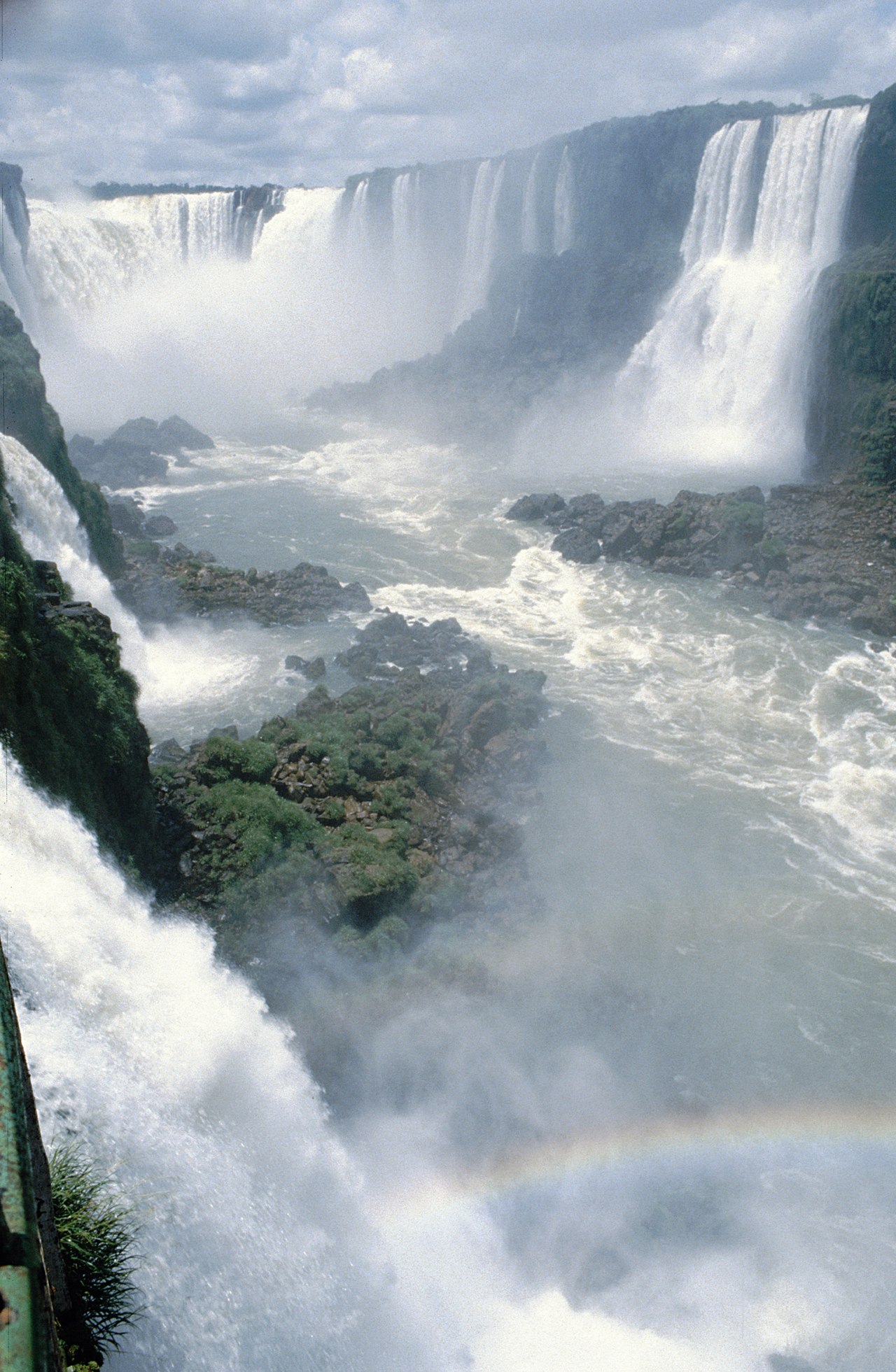


Geography and geology
The waterfalls occur where the river crosses a basalt plateau and a system of faults and joints. Layers of hard volcanic rock overlie softer material; erosion has exploited these contrasts to create ledges, chutes and the deep gorge that receives the main flow. The falls mark the division between the upper and lower sections of the Iguaçu River and span the international boundary, with the majority of individual cataracts located on the Argentine side and extensive viewpoints on both sides.
Hydrology and landscape
Water volume at the falls varies seasonally and with storms upstream; during high flow the individual cataracts merge into a boisterous, mist-shrouded curtain. The most famous rupture in the arc is the so-called Devil's Throat, a U-shaped chasm where many channels converge and spray rises in a near-continuous plume. Channels and islands within the river create a complex pattern of currents and cascades that change slowly over geological time.
Biodiversity and protection
The falls lie within protected areas on both sides of the border. These parks conserve important tracts of subtropical Atlantic Forest and support diverse wildlife, including many bird species, mammals such as coatis and monkeys, reptiles and a rich assemblage of plants. Protected status helps maintain habitat connectivity and provides opportunities for ecological research and environmental education. Park authorities on each side work to manage visitor impact and to preserve water quality and native species.
History and cultural significance
Indigenous peoples knew the river and falls long before European arrival. The dramatic landscape attracted explorers, naturalists and travelers from the 19th century onward, and both countries later created national parks to protect the area. The falls are a shared natural heritage and a symbol of regional identity, featuring in art, literature and tourism narratives of South America.
Visitor access, safety and activities
Facilities include trails, elevated walkways and viewpoints that offer both sweeping panoramas and close-up experiences. Boat excursions that operate under strict safety rules can take visitors near some cataracts, while observation platforms provide safer, curated perspectives. The Argentine side is known for extended footpaths and a short shuttle, while the Brazilian side emphasizes broad vistas and photographic viewpoints. Seasonal variations in flow affect visibility and access; visitors are advised to follow park guidance and respect trail restrictions.
Conservation challenges and management
Park managers balance tourism with habitat protection, invasive species control, and water resource considerations. Transboundary cooperation and scientific monitoring aim to reduce impacts, support local communities and maintain the ecological values of the falls. For current visitor guidance, maps and conservation information consult official park centers and authorized sources in each country.
Notable facts
- Commonly cited number of cataracts: about 275, varying with seasonal flow.
- Devil's Throat: the most spectacular gorge where many channels converge.
- Transboundary parks: the falls are protected on both the Argentine and Brazilian sides and are internationally recognized for their natural importance.
For more detailed logistics, official regulations and current conditions, contact local visitor centers or consult authoritative guides published by park authorities and conservation organizations.
Questions and answers
Q: What are Iguaçu Falls?
A: Iguaçu Falls are a series of massive waterfalls that lie on the border of Argentina (80%) and Brazil (20%).
Q: Where does the Iguaçu River flow into?
A: The Iguaçu River flows into the Paraná River.
Q: How many individual waterfalls make up the Falls?
A: 275 individual waterfalls side by side make up the Falls.
Q: What is the height of some of the waterfalls?
A: Some of the waterfalls are as tall as 269 feet (82 m).
Q: What do most of the waterfalls measure?
A: Most of the waterfalls measure around 210 feet (64 m).
Q: What is the river divided into by the falls?
A: The falls divide the river into the upper and lower Iguaçu.
Q: How popular are the Iguaçu Falls?
A: The Iguaçu Falls are one of the largest and most famous waterfalls in the world, receiving thousands of visitors each year.
Related articles
Author
AlegsaOnline.com Iguaçu Falls: Geography, Ecology, History, and Visitor Guide Leandro Alegsa
URL: https://en.alegsaonline.com/art/46636