Ice sheet (continental glacier)
A vast, continuous mass of glacial ice covering more than 50,000 km². Ice sheets shape climate, store freshwater, and today persist mainly in Antarctica and Greenland.
Overview
An ice sheet is a very large, continuous body of glacial ice that covers more than 50,000 square kilometres and moves under its own weight. By scale and dynamics it is often called a continental glacier. Presently the only two persistent ice sheets are those over Antarctica and over Greenland. Ice sheets differ from floating ice shelves and from smaller, dome-like ice caps, which have limited extent and different flow patterns.
Image gallery
10 Images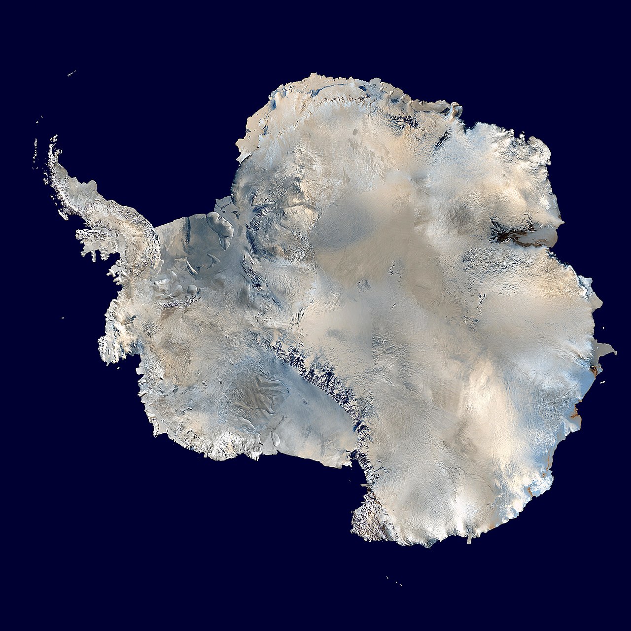


Structure and dynamics
Ice sheets are multilayered systems with distinct zones of accumulation, where snowfall adds mass, and ablation, where melting, sublimation and calving remove mass. Flow is driven by internal deformation of ice crystals and by basal sliding where meltwater or soft sediments reduce friction. Within ice sheets, narrow, fast-moving corridors called ice streams can transport a large fraction of ice to the margins, while ice divides separate drainage basins. Surface features include crevasses, firn layers and stratified snow; at the base there are often complex landscapes of bedrock, sediments and subglacial lakes that strongly influence stability.
History and development
Ice sheets have grown and contracted many times over geological history in response to climate change. The Antarctic ice sheet began to form in the early Oligocene, with repeated expansions and retreats through subsequent epochs until it achieved a broadly persistent form by the Pliocene and later. The Greenland ice sheet formed more recently, during the late Pliocene, and appears to have assembled relatively quickly compared with Antarctica; this difference helps explain why some plants and other fossils are preserved beneath Greenland ice in ways not typical under the much older Antarctic sheet.
Measurement and monitoring
Modern observations use a combination of on-site measurements, airborne surveys and satellite remote sensing to measure thickness, surface elevation, mass balance and flow speed. Agencies and research programmes, including instruments reported by NASA, estimate yearly gains and losses. For example, satellite techniques can detect changes in ice mass equivalent to hundreds of cubic kilometres per year in aggregated regions and can monitor shifts in sea levels that result from ice loss or gain.
Roles in the climate system
Ice sheets interact with the atmosphere and ocean through albedo (reflectivity), freshwater input and topographic influence on atmospheric circulation. The Antarctic ice sheet contains the largest single mass of ice on Earth and holds a major portion of the planet's accessible fresh water. Large changes in ice volume therefore alter global sea level, ocean salinity and circulation, and they can produce feedbacks that amplify or moderate climate change.
Sea-level implications and risks
If major parts of an ice sheet melt or collapse, global mean sea level rises and coastal systems are affected. The Antarctic ice sheet contains ice volumes that, in total, would raise sea level by many tens of metres if entirely lost; the Greenland ice sheet alone would contribute several metres. Even modest regional losses change shoreline positions, increase flooding risk and compound storm impacts for vulnerable populations.
Physical processes affecting stability
- Surface melting and runoff accelerate mass loss in warming conditions.
- Basal lubrication from meltwater can increase sliding and dynamic discharge.
- Ocean-driven melting of ice shelves that buttress grounded ice can lead to faster inland flow.
- Subglacial geology and bed slope strongly influence whether ice retreat is self-sustaining.
Scientific importance
Ice sheets preserve layered records of past climate and atmosphere within trapped air bubbles and impurities. These archives are central to paleoclimate research and provide chronological records that help scientists reconstruct temperature, greenhouse gas concentrations and volcanic events over hundreds of thousands of years.
Notable examples and contemporary change
The Antarctic ice sheet covers roughly 14 million square kilometres and contains a vast volume of ice; it accounts for about 90% of Earth's surface fresh water in solid form. The Greenland ice sheet blankets roughly 82% of Greenland's land area and is an active contributor to recent sea-level rise. Observations show that both sheets exhibit regional patterns of gain and loss; some peripheral sectors are thinning rapidly while other areas gain mass through increased snowfall. Ongoing research focuses on measuring rates of change, understanding the processes that control instability, and improving models that predict future trajectories.
Further reading and resources
For introductory material and technical summaries, consult national and international polar research bodies, scientific reviews and data services that compile satellite and field observations. Historical summaries and detailed studies explore the development of ice sheets through geological time and the implications of their change for human societies and natural systems.
Questions and answers
Q: What is an ice sheet?
A: An ice sheet is a large mass of glacier ice that covers an area of more than 50,000 square kilometres (19,000 sq mi). It may also be called a continental glacier.
Q: How many ice sheets are there in the world?
A: There are two ice sheets in the world at the moment: in Antarctica and Greenland.
Q: What is the difference between an ice sheet and an ice cap?
A: Ice sheets are larger than ice shelves or alpine glaciers. Masses of ice covering less than 50,000 km2 are called ice caps. The ice in an ice cap usually comes from a series of glaciers that drain into it.
Q: How much fresh water does the Antarctic Ice Sheet contain?
A: The Antarctic Ice Sheet contains 30 million km3 of fresh water.
Q: How much would sea levels rise if all of the Antarctic Ice Sheet were to melt?
A: If all of it were to melt, it would cause sea levels to rise by 58 metres.
Q: What percentage of Greenland's surface is covered by its own Ice Sheet?
A: The Greenland Ice Sheet covers about 82% of the surface of Greenland.
Q:How quickly is Greenland's Ice Sheet melting?
A:Satellite images from NASA show that it is melting at a rate of about 239 cubic kilometres (57.3 cubic miles) each year.
Related articles
Author
AlegsaOnline.com Ice sheet (continental glacier) Leandro Alegsa
URL: https://en.alegsaonline.com/art/46434
Sources
- gemini.oscs.montana.edu : "Glossary of Important Terms in Glacial Geology"
- amsglossary.allenpress.com : American Meteorological Society, Glossary of Meteorology
- grida.no : Some physical characteristics of ice on Earth
- realclimate.org : Rasmus Benestad et al.: The Greenland Ice. Realclimate.org 2006
- news.bbc.co.uk : Greenland melt 'speeding up', BBC News, 11 August 2006