Honey War: the 1830s Iowa–Missouri border dispute
A largely bloodless 1830s dispute between Iowa (then part of Wisconsin Territory) and Missouri over their common border; militia standoffs, a jailed sheriff, and cut honey trees led to a legal settlement by the U.S. Supreme Court.
Overview
The Honey War was a peaceful but tense border confrontation in the 1830s between settlers and officials representing Iowa (initially part of Wisconsin Territory and later Iowa Territory) and the state of Missouri. The disagreement concerned a narrow strip of land along their common line and arose from ambiguous descriptions in territorial legislation and imperfect early surveys. The episode is remembered for an oddly literal grievance: several trees used by settlers to store honey were cut down by men enforcing claims, which helped give the conflict its popular name. The event took place near the point often cited by its coordinates.
Image gallery
4 Images

Causes and context
Several overlapping problems produced the dispute. First, the language that defined Missouri's northern boundary in state documents left room for different interpretations; that wording in the Missouri Constitution was not clear to later administrators. Second, early federal surveys of the region after the Louisiana Purchase varied in accuracy and in which natural features they relied on. One influential early line drawn by a federal surveyor (commonly called the Sullivan Line) did not match later understandings of river courses. Third, treaty arrangements and relocations involving Native American nations changed occupation and claims in ways that complicated jurisdiction. Taken together, these factors meant that residents in a strip roughly several miles wide at the border received conflicting tax notices and legal orders from each side.
Key events
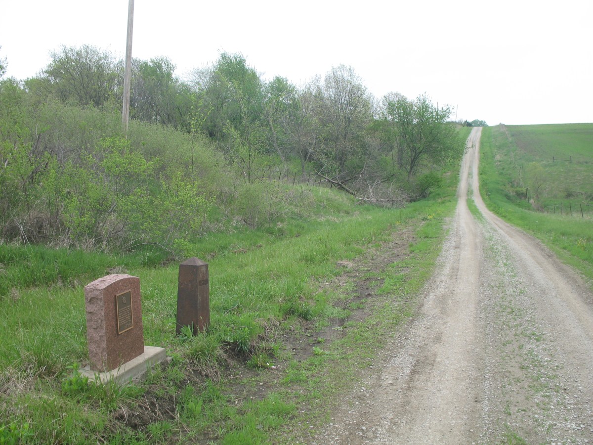
The dispute escalated in a series of incidents rather than by sustained fighting. A Missouri sheriff traveled into the contested area to collect taxes and, according to local accounts, was arrested by authorities aligned with Iowa. Tension mounted as volunteers and small militia units on both sides moved toward the boundary. Men from both states paraded and drilled but did not engage in combat. During the standoff, several trees containing stored beehives were cut down by men enforcing Missouri's claim to collect honey as property and tax; reports usually note that three honey-bearing trees were destroyed. As the situation threatened violence, political leaders and courts were asked to intervene.
Resolution
The matter was ultimately decided by the federal judiciary rather than by force. The dispute reached the national stage, and the United States Supreme Court reviewed the competing boundary claims. The Court favored the interpretation that upheld the surveyed line and settled the boundary in favor of the people and authorities who became part of Iowa. In practical terms the decision confirmed the route along which Iowa's southern border would lie and how it intersects the Mississippi River in the southeastern corner of the state near Keokuk. The legal outcome removed the immediate cause of the tax and jurisdictional disputes.
Aftermath and significance
Although it involved militia movements and arrests, the Honey War produced no battle deaths and is often described as a bloodless conflict. Its significance is mainly legal and symbolic: it highlighted how imprecise language and imperfect surveys could create serious local conflicts on the American frontier, and it demonstrated the role of federal institutions in resolving interstate disagreements. The event also became part of regional folklore, invoked in later years as an example of peaceful dispute resolution combined with colorful local detail.
Notable facts and summary
- The dispute centered on an ambiguous strip of territory where competing tax and land claims overlapped.
- A Missouri official who tried to collect taxes was arrested, which escalated tensions.
- Militia units from both states assembled but were not ordered into battle; their presence illustrated the seriousness of the problem and the desire to avoid bloodshed (state militias).
- Three honey trees were cut down during the enforcement actions, giving the episode its popular name.
- Earlier surveying work and federal mapping during the survey efforts associated with the post-Louisiana Purchase period played a direct role in creating the confusion.
- For contemporary descriptions and maps, see resources listed by local historical societies and state archives (border dispute references may be helpful).
The Honey War remains a frequently cited example of how legal ambiguity and survey error affected frontier life and how those problems were ultimately settled by legal—and not military—means.
Questions and answers
Q: What were the coordinates of the area in dispute?
A: The coordinates of the area in dispute were 40°35′N 93°28′W / 40.58°N 93.46°W / 40.58; -93.46.
Q: What caused the Honey War?
A: The Honey War was caused by a disagreement over a 9.5-mile (15.3 km) wide piece of land covering the entire border due to confusion around the Missouri Constitution's part about borders, the survey of the Louisiana Purchase, and treaties with Native Americans.
Q: How did it end?
A: The United States Supreme Court ended the dispute in Iowa's favor, deciding that Iowa's almost-straight border would follow the Des Moines River south for about 30 miles (48 km) until it reached Mississippi River near Keokuk.
Q: What happened during this war?
A: During this war, state militias faced each other, a Missouri sheriff collecting taxes in Iowa was arrested, and three honey trees were cut down.
Q: Where did this conflict take place?
A: This conflict took place between Iowa (first as a part of Wisconsin Territory, then Iowa Territory) and Missouri over their border.
Q: How long did it last? A: It is unclear how long this conflict lasted but it was resolved by US Supreme Court ruling in favor of Iowa at some point during 1830s.
Q: Who won this war? A: The US Supreme Court ruled in favor of Iowa so they are considered to have won this bloodless border dispute known as "The Honey War".
Related articles
Author
AlegsaOnline.com Honey War: the 1830s Iowa–Missouri border dispute Leandro Alegsa
URL: https://en.alegsaonline.com/art/44985
Sources
- supreme.justia.com : State of Missouri v. State of Iowa
- iowanationalguard.com : The Territorial Militia - History of The Iowa National Guard by Stephen N. Kallestad
- iagenweb.org : Stories of Iowa for Boys and Girls by Bruce E. Mahan - 1931 - reprinted on Iowa History Project
- rootsweb.com : Country Facts and Folklore By Andy Reddick (republished on rootsweb)