Holland: region, history, and modern usage
Holland is a historic region in the western Netherlands, now divided into North Holland and South Holland. This article covers its geography, historical evolution, administrative status, economy, and cultural meaning of the name.
Overview
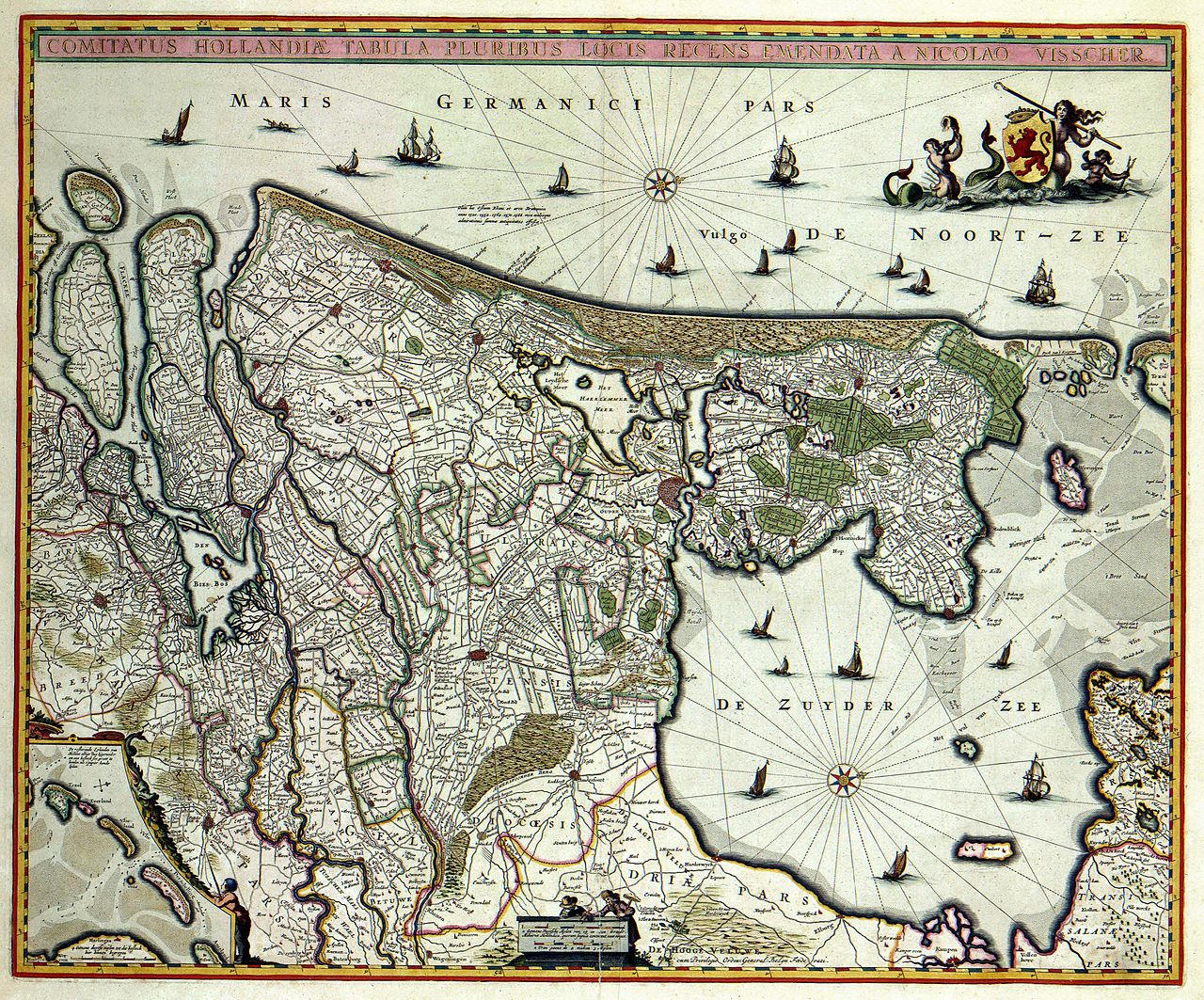
Holland traditionally denotes a coastal and low-lying region in the western part of the Netherlands. From the Middle Ages onward it developed into a distinct political and economic entity, often called the County of Holland, and later served as the most powerful province in the Dutch Republic. The name persists in many contexts — geographic, cultural and commercial — but its modern administrative reality differs from common usage.
Image gallery
4 Images

Geography and administrative divisions
Today the historic area commonly called Holland is principally covered by two provinces: North Holland and South Holland. In the Dutch language these are Noord-Holland and Zuid-Holland. These provinces contain several of the country’s largest cities, important ports, and dense urban and industrial regions. The state internationally known as the Netherlands comprises twelve provinces in total, and referring to the entire country as "Holland" omits the ten provinces that lie outside the two historic Holland provinces altogether.
Historical development
Holland emerged in the medieval period as a feudal territory and later as the County of Holland, within larger imperial frameworks such as the Holy Roman Empire. In the early modern era the province of Holland became the economic and maritime centre of the Republic of the Seven United Netherlands, with major trading cities, shipbuilding and colonial ventures.
The late eighteenth and early nineteenth centuries brought dramatic changes. During the period associated with the French occupation and Napoleonic reorganisation, provincial borders were altered and some localities were reassigned: for example Willemstad became part of North Brabant, the Wadden islands like Vlieland and Terschelling were administratively attached to Friesland, and the former island community of Urk was placed with Overijssel. For a brief interval (1806–1810) the region formed the Kingdom of Holland, a Napoleonic client state whose territory at times included central and northern parts of the Low Countries and adjacent areas such as East Friesland.
After the Napoleonic era and the formation of the modern Kingdom of the Netherlands, the former province of Holland was divided administratively, and the two provinces of North and South Holland were formally created in 1840. The historic county and later province had been larger at various times, but its identity remained influential.
Economy and major cities
The Holland region contains several cities of national and international importance. Amsterdam, the national capital and a historical trading centre, lies in North Holland; Rotterdam, Europe’s largest port by some measures, lies in South Holland; and The Hague, seat of government and many international institutions, also lies in South Holland. Historically the maritime trade, shipbuilding and finance concentrated in Holland shaped Dutch overseas enterprise and urban growth.
Language, culture and regional identity
Residents of the two Holland provinces speak standard Dutch along with regional dialects and accents that have contributed to cultural distinctions within the country. The name "Holland" carries strong associations with certain cultural images — windmills, tulips, canals, historic cities — and with the commercial and artistic output of the western Netherlands. These associations have made "Holland" a widely recognized brand name in tourism and trade.
Usage of the name and common misconceptions
Although many people worldwide use "Holland" as a synonym for the entire Netherlands, this is not formally correct: there is no sovereign state called Holland. The shorthand is similar to referring to the United Kingdom as simply "England" or "Great Britain", a usage that may be irritating to people from regions not named by the shorthand. Some Dutch people who live outside North and South Holland prefer that the country be called "the Netherlands" in international contexts, while others accept "Holland" in informal settings.
Sport is a prominent exception where "Holland" is widely used: for many fans and media the national football team is colloquially known as "Holland" and that usage has become entrenched in many languages and broadcasts, especially during major tournaments (the national football team).
Notable facts and distinctions
- Holland’s ports and trading centres were central to the Dutch Golden Age and the country’s rise as a maritime power.
- The two modern provinces of North Holland and South Holland each have their own provincial governments and identities within the Kingdom of the Netherlands.
- International branding often uses "Holland" for convenience, but precise references to the country should use "the Netherlands."
Summary
Holland is best understood as a historically important region of the western Netherlands whose name endures in geography, commerce and popular language. Administratively it is now represented by two provinces, North Holland and South Holland, while the term continues to be used colloquially and commercially to denote aspects of Dutch identity. For formal and inclusive reference to the whole nation, "the Netherlands" is the accurate term.


History
→ Main article: History of the Netherlands
The area was part of the Roman Empire for a few years under Augustus as Germania magna. After centuries of Frisian independence, it then became part of the Frankish Empire and the subsequent Holy Roman Empire. In 1384 it came under French influence (Burgundian Netherlands). In 1430, the County of Holland finally came by inheritance to the House of Valois-Burgundy and, after the death of the last Burgundian Duke Charles the Bold in 1477, to the House of Habsburg, later to the Spanish line of the Habsburgs (Spanish Netherlands).
From 1581, the County of Holland was the leading province of the Republic of the Seven United Provinces. During the Napoleonic period there was the Kingdom of Holland (1806-1810), which comprised what is now the Netherlands. In order to reduce the dominance of Holland, which was the main cultural, political and social part of the country, it was divided in 1840 into what are now the two provinces of Noord-Holland and Zuid-Holland.
The name Holland was first mentioned in 866 as Holtland ("woodland" or "forest land") for the area around Haarlem.
· 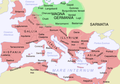
Roman provinces with the adjacent Germania magna
· 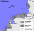
The historical settlement and language area of the Frisians
· 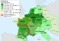
The expansion of the Frankish Empire 481 to 814
· 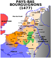
Burgundian Netherlands around 1477
· 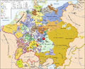
United Netherlands around 1648
· 
The Seven United Provinces
· 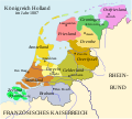
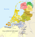
Kingdom of Holland 1806-1810
See also
- Provinces of the Netherlands
- List of the Counts of Holland
- List of Council pensioners
Related articles
Author
AlegsaOnline.com Holland: region, history, and modern usage Leandro Alegsa
URL: https://en.alegsaonline.com/art/44751