Hokkaidō: Japan’s northernmost main island
Hokkaidō is Japan's northernmost main island and prefecture, known for cold winters, volcanic landscapes, large-scale agriculture, rich Ainu heritage, and year‑round outdoor tourism including skiing and hot springs.
Overview
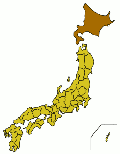
Hokkaidō (北海道), historically called Ezo or Yezo, is the northernmost of the four main islands of Japan. The entire landmass forms Hokkaidō Prefecture, whose largest city and administrative center is Sapporo. It is the second largest Japanese island and is separated from Honshu by the Tsugaru Strait; a rail connection through the Seikan Tunnel links the islands.
Image gallery
3 Images

Geography and climate
Hokkaidō is largely volcanic and mountainous, with notable ranges such as the Daisetsuzan massif and peaks like Asahi-dake. The island’s coastline is indented with bays and peninsulas and supports extensive fisheries. The climate is classified as humid continental under the Köppen climate classification, featuring long, snowy winters and warm to occasionally hot summers. This climate encourages coniferous forests and a pattern of seasonal tourism.
History and people
Indigenous Ainu communities inhabited the island for centuries before intensified contact and settlement by people from Honshu during the Edo and Meiji periods. The name Ezo reflected earlier maps and writings; during the late 19th century the island was more fully integrated into the modern Japanese state. Today roughly five and a half million people live on Hokkaidō, distributed among coastal cities and agricultural plains.
Economy, land use, and culture
Agriculture is a major sector: the island produces large quantities of grains, vegetables and dairy products and supports commercial fisheries and forestry. Tourism is also important—ski resorts, national parks, wildlife viewing, onsen (hot springs) and festivals such as the Sapporo Snow Festival attract visitors year round. Local food culture emphasizes fresh seafood, dairy, and seasonal produce.
Notable features and conservation
Hokkaidō is noted for active volcanic terrain, abundant natural hot springs and protected wilderness areas. Large tracts are set aside as national parks to preserve wildlife and scenic landscapes; some regions are recognized for international conservation value. The island’s long winters and open landscapes create distinctive flora and fauna and make it a center for winter sports and nature-based recreation.
- Major city: Sapporo; other regional centers include Hakodate and Asahikawa.
- Key attractions: national parks, ski areas, onsen, coastal fisheries.
- Historical notes: Ainu heritage and Meiji-era development.

History
Hokkaidō is the homeland of the Ainu people, from whose language many geographical names on the island, for example the name of the capital Sapporo, originate.
The first Japanesesettlements arose in the 15th century in the south of the island as trading posts. However, since the usual forms of agriculture in Japan were useless on the island due to the cool climate, most of the island was settled by Japanese only in the second half of the 19th century. At this time, Western innovations made agriculture possible here as well, and at the same time there was an increasing need for defensive positions against Russia. The island received its present name only in this time. The capital Sapporo was founded in the 1860s; in the 1870s the population of the island quadrupled from 58,000 to 240,000.
Shortly after the Boshin War of 1868, a group of Tokugawa loyalists, led by Enomoto Takeaki, claimed the island as the Republic of Ezo. This rebellion was put down in May 1869.
On July 8, 1869, the Kaitakushi (開拓使), a development authority, was established, and on August 15, Hokkaidō was divided into eleven provinces: Chishima, Hidaka, Iburi, Ishikari, Kitami, Kushiro, Oshima, Shiribeshi, Teshio, and Tokachi. Part of Oshima Province, the former Tate Prefecture (previously the Principality of Matsumae/Tate) on the southwestern tip of the island, was initially briefly part of Aomori Prefecture after the abolition of principalities and initial consolidation of prefectures in 1871, and was not transferred to the Hokkaidō Development Authority until 1872. In 1881, the Kaitakushi Incident occurred, involving the secret sale of Hokkaidō assets. On February 8, 1882, the Development Authority was dissolved and divided into three prefectures, Hakodate, Nemuro, and Sapporo. The prefectures were dissolved on January 1, 1886, in favor of the newly established Hokkaidō Authority (北海道庁 Hokkaidō-chō), directly under the Ministry of the Interior, with headquarters in Sapporo and field offices (支庁 shichō) in Hakodate and Nemuro. On November 2, 1897, the present 14 field offices and the Shana field office were established. In December 1903, Shana was added to Nemuro. On May 3, 1947, the Hokkaidō Authority was dissolved and Hokkaidō Prefecture was established.
It was not until 1901 that Hokkaidō, like other prefectures (-fu/-ken), received an elected parliament. The governor remained part of the imperial government as Hokkaidō-chō chōkan (meaning roughly "head of authority") - but in principle the governors of other prefectures ([fu/ken-]chiji) were also closely tied to the Ministry of the Interior. It was not until after the Pacific War that Hokkaidō became fully equal to other prefectures: in 1946, some of the special laws for Hokkaidō were abolished, and the prefectural order (by then fu-ken-sei) was expanded to include the -dō and renamed dō-fu-ken-sei. In 1947, the Postwar Constitution and Self-Government Law uniformly expanded self-government in all prefectures (henceforth -to/-dō/-fu/-ken) and their municipalities. The governor is now called [dō-]chiji, as in other prefectures, and is elected by the people.
On 28 June 2008, the prefectural parliament decided to replace the 14 field offices with nine Sōgō Shinkō-kyoku (総合振興局 'velvet promotion office') and five subordinate Shinkō-kyoku (振興局 'promotion office'), which then took place on 1 April 2010.
In Russia, the island of Hokkaidō is considered a Russian territory by Cossacks. During the Russian expedition led by I.M.Antipin-D.J.Shabalin in 1778-1779, Russians landed in the north of Hokkaido and brought the local residents (Ainu) into Russian citizenship. Many residents were baptized in the process. In Russia, rallies are held regularly under the slogan "Hokkaido - the Russian island".
Name
Until the Meiji Restoration in 1868, the Ainu were also referred to as Ezo (in German obsolete: Jezo, Jesso or Iesso). Hokkaidō was then consequently called Ezochi (蝦夷地 'Ezo land'), which however also included Sakhalin and the Kuril Islands, or Ezo-ga-shima (蝦夷ヶ島 'Island of the Ezo').
With the establishment of the Development Authority, the Meiji government wanted to change the name. Researcher Matsuura Takeshirō made these six name suggestions: Kitakaidō (北加伊道 'North Quay District'), Kaihokudō (海北道 'Sea North District'), Kaitōdō (海東道 'Sea East District'), Hitakamidō (日高見道), Tōhokudō (東北道 'Northeast District'), and Chishimadō (千島道 '1000 Islands District'). Eventually, as a compromise between Kitakaidō and Kaihokudō, and in reference to the historical regions of the Gokishichidō Tōkaidō ('East Sea District') Nankaidō ('South Sea District') and Saikaidō ('West Sea District'), the name Hokkaidō was chosen. Matsuura suggested Kitakaidō because the Ainu called the region Kai. Also, historically, the Ainu and their islands were referred to as Kuyi, Kuye, Qoy, etc., which may be related to early modern Kai. Kai also strongly resembles the Sino-Japanese reading of the characters 蝦夷 /ka.i/ - more common Kun reading /emisi/ - which were used for over a thousand years in China and Japan to designate the Ainu and related peoples. It is possible that Matsuura's Kai was a variant of the Niwchish exonym Qoy for the Ainu influenced by this Sino-Japanese reading.

Geography
In addition to the main island with 77,984.41 km², the prefecture consists of many offshore islands in the adjacent seas, the Sea of Japan, the Pacific Ocean and the Sea of Okhotsk. The Kuril Islands immediately to the northeast have been administered by Russia since the end of the war; Japan, however, considers the southern Kuril Islands to be part of Hokkaidōs and to this day unsuccessfully demands their return. The highest elevation is Asahidake at 2290 meters above sea level. In the south, Hokkaidō is bordered by the Oshima Peninsula on the Tsugaru Strait, which separates the island from the main Japanese island of Honshū. In total, the Hokkaidō region includes 508 islands other than the main island, with a total area of 5440 km². Apart from the de facto Russian southern Kuril Islands, the largest islands in Hokkaidō after the main island today are Rishiri, Okushiri and Rebun. Lake Tōfutsu lies to the northeast.
Hokkaido is located in a temperate monsoon zone with a sub-boreal climate, i.e. with quite cold and snowy winters. There are active volcanoes on the island.
There is a ferry service to Honshū from the southern ports of Hakodate and Tomakomai. Other ports on Hokkaido are Wakkanai and Abashiri on the north side, and Kushiro and Akkeshi on the east coast.
Since 1988, the two islands of Hokkaidō and Honshū have been connected by the second longest tunnel in the world, the 54-kilometer-long Seikan Railway Tunnel under the sea. Initially only with 1067 mm cap gauge, from 2016 with three-rail track for the high-speed Hokkaidō-Shinkansen railway.
There is an HVDC between Hokkaidō and Honshū for the transfer of electrical energy.
Related articles
Author
AlegsaOnline.com Hokkaidō: Japan’s northernmost main island Leandro Alegsa
URL: https://en.alegsaonline.com/art/44707
Sources
- lcweb2.loc.gov : Library of Congress Country Studies, Japan
- lcweb2.loc.gov : "Geographic Regions, Hokkaido"
- jetro.go.jp : Hokkaido Prefecture, Regional Information
- books.google.com : "Hokkaido"
- books.google.com : "Geography"