Hohes Licht (Allgäu Alps mountain)
Hohes Licht is a 2,651 m peak in the Allgäu Alps, located in Tyrol, Austria. Second-highest in the range, it has early survey history and remains a popular but exposed alpine objective for experienced hikers.
Overview
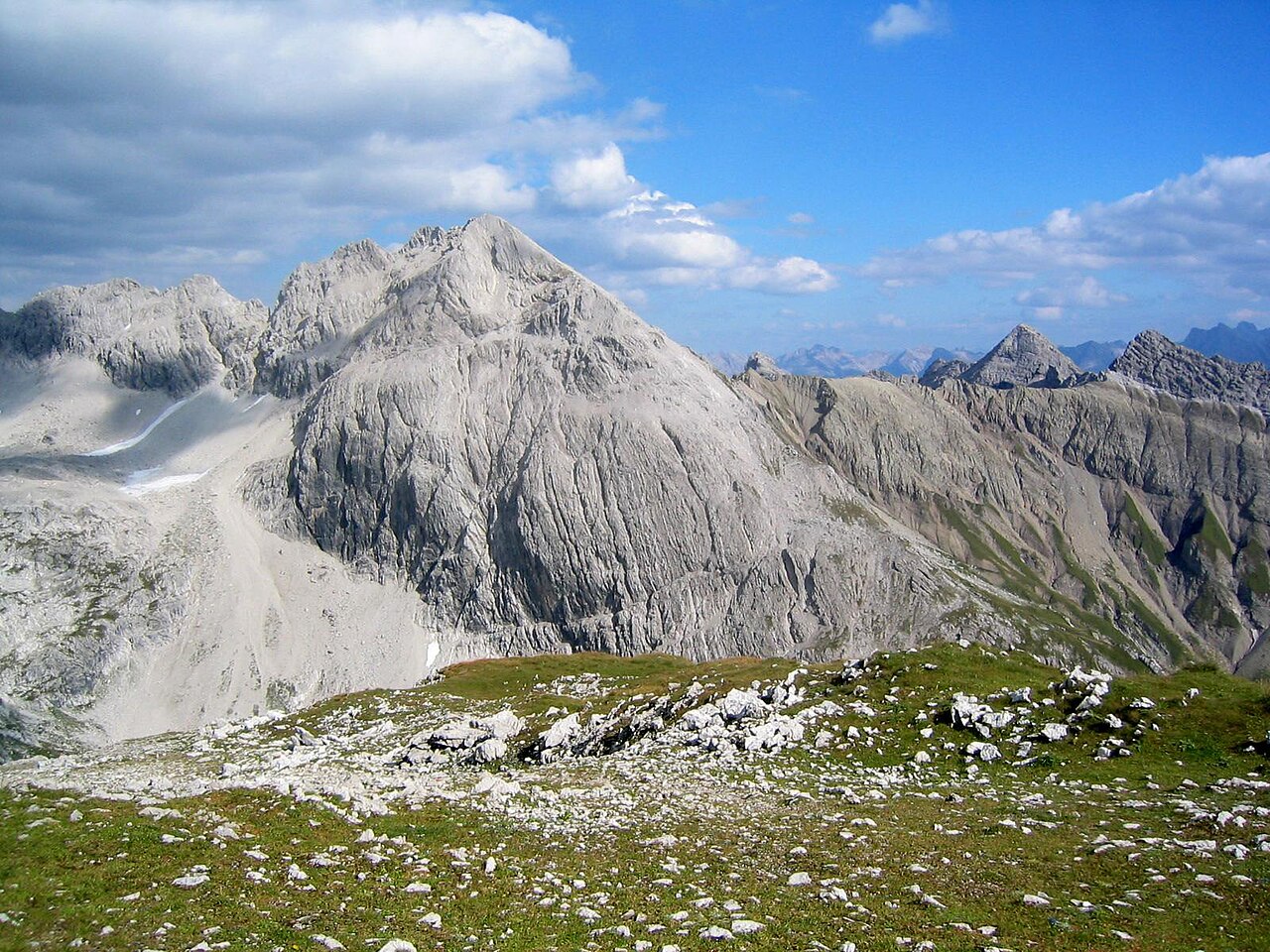
The Hohes Licht rises to 2,651 metres above sea level in the Allgäu Alps. It is the range's second-highest summit after the Großer Krottenkopf. The peak lies within the Austrian state of Tyrol, near the German border and about 14 kilometres south of Oberstdorf. The summit provides a clear alpine landmark for the central Allgäu region.

Image gallery
4 Images


Characteristics
Formed as part of the Northern Limestone Alps, Hohes Licht displays the steep, craggy profiles typical of limestone massifs. Its upper slopes sit above the treeline and are characterised by alpine grassland, scree and exposed rock. Weather at this altitude is changeable and the summit ridge can be exposed; summer routes are mainly non-technical but demand sure-footedness and basic scrambling in places.
History
The summit was first recorded in connection with nineteenth-century surveying: a trigonometrical signal was placed during mapping work in 1854. On 6 August 1869 the mountaineer Hermann von Barth made one of the early documented recreational ascents and reported finding the old survey marker still in place. These exploratory and scientific climbs helped establish many of the tracks and place names used today.
Routes and access
Approaches come from both the German and Austrian sides via marked high-alpine trails. Typical itineraries use valley trailheads and nearby mountain huts as bases; in summer most parties reach the summit by long day-hikes with sections of easy scrambling. Winter ascents require alpine equipment, avalanche awareness and experience in snow travel. Conditions can vary rapidly, so careful planning and proper gear are essential.

Significance and practical notes
As the second-highest peak in its range, Hohes Licht is a frequent objective for experienced hikers and climbers seeking broad panoramas and classic high-Alpine terrain. From the summit there are extensive views of neighbouring peaks and valleys on clear days. Visitors should respect local conservation measures to protect fragile alpine vegetation and follow safety guidance for mountain weather and route difficulty.
- Elevation: 2,651 m
- Range: Allgäu Alps
- Nearby high peak: Großer Krottenkopf
- Location: Tyrol, Austria
Questions and answers
Q: What is the Hohes Licht?
A: The Hohes Licht is a mountain in the Allgäu Alps.
Q: How high is it?
A: It is 2,651 metres (8,698 ft) high.
Q: Where is it located?
A: The summit of the Hohes Licht is in Tyrol, Austria. It is 14km south of Oberstdorf.
Q: When was it first climbed?
A: It was first climbed in 1854 and then again for leisure purposes by Hermann von Barth on 6 August 1869.
Q: Was there a signal left on top for triangulation when it was first climbed?
A: Yes, when it was first climbed a "survey signal" was left on top for triangulation.
Q: Are there views from the summit of Hohes Licht?
A: Yes, there are views from the summit of Hohes Licht.
Related articles
Author
AlegsaOnline.com Hohes Licht (Allgäu Alps mountain) Leandro Alegsa
URL: https://en.alegsaonline.com/art/44692