Hesse (Hessen): German state — geography, history, economy, administration
Hesse (German: Hessen) is a centrally located state of Germany known for its varied landscape, the Rhine–Main metropolitan area, historic cities, and a mixed economy centered on finance, industry and research.
Overview
Hessen (English: Hesse) is a federal state (Land) in central Germany. The modern entity was created after World War II as Greater Hesse in 1945 and was reorganized as the state now called Hesse in 1946. Its official capital is Wiesbaden, while the largest urban and economic hub is Frankfurt am Main, which anchors a wider metropolitan region.
Image gallery
10 Images


Geography and landscape
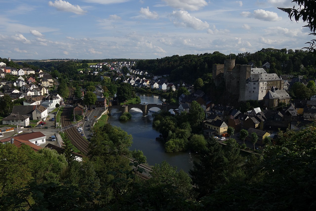
Hesse is characterised by varied terrain: river valleys, rolling hills and several low mountain ranges. In the north the main rivers include the Werra and the Fulda, which join to form the Weser, while the Lahn and the Main flow across central parts of the state. Much of western Hesse borders the Rhine and the populated south between the Main and Rhine is the state's economic core.
The countryside is generally hilly and forested, with several named ranges and uplands. Major features include the Rhön, the Westerwald and the Odenwald, together with the Taunus and the Spessart foothills. These landscapes provide recreation, timber resources and protected natural areas.
History and development
The region now called Hesse has medieval roots as a landgraviate and later existed as several separate states, including branches historically known as Hesse-Darmstadt and Hesse-Kassel. After the upheavals of the 19th and early 20th centuries and the Second World War, the present federal state was formed from parts of those earlier territories and reorganised under the postwar German constitution.
Economy, culture and institutions
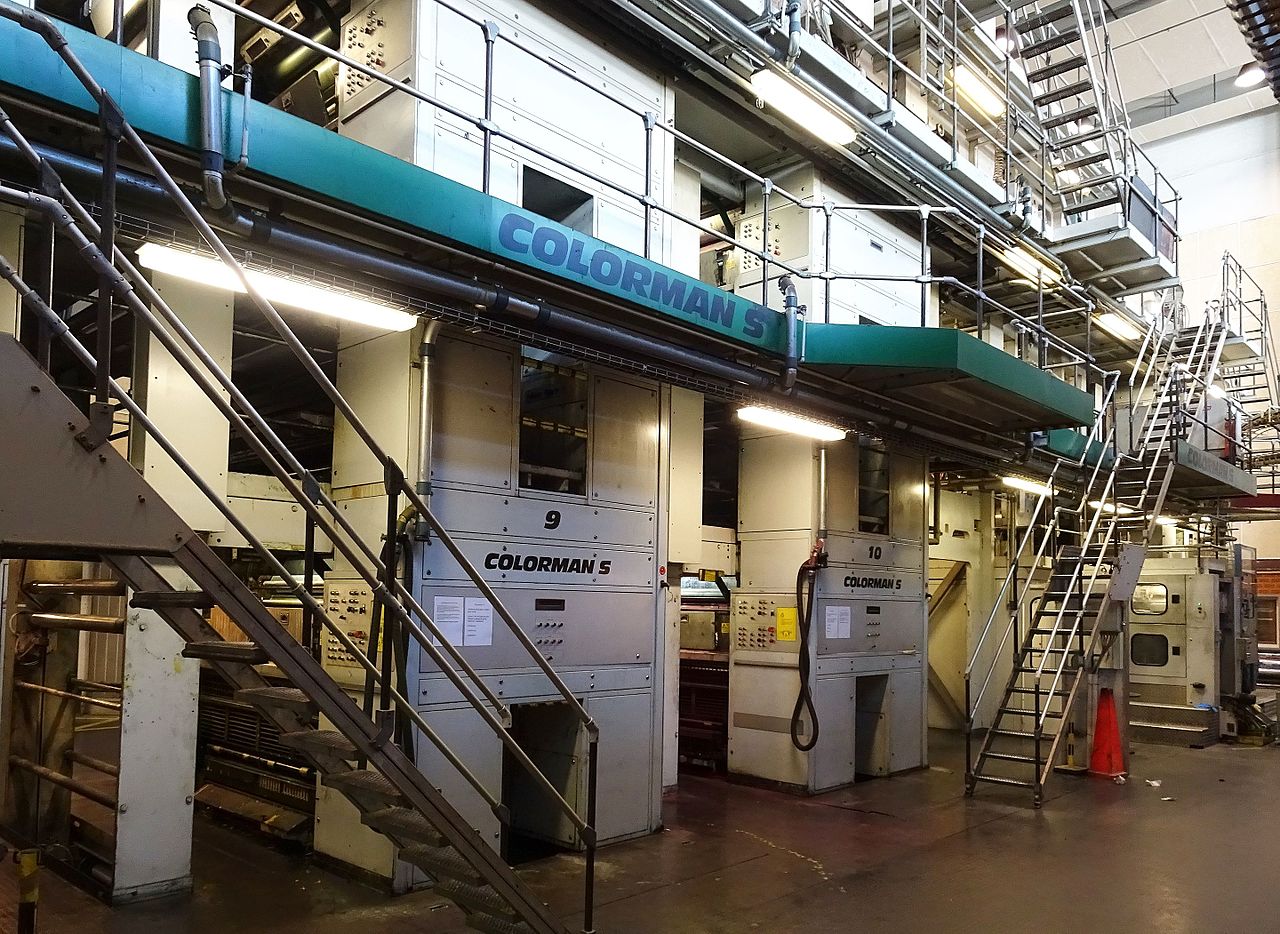
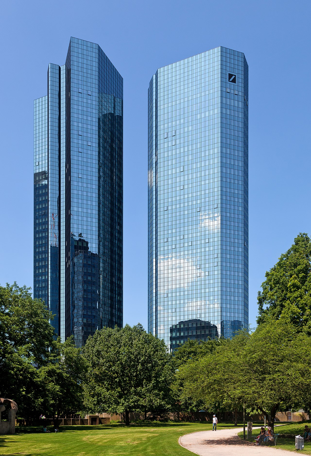
Hesse combines a strong service sector with manufacturing, research and transport. The Frankfurt area hosts major financial institutions and a large international airport; Darmstadt and other cities are noted for technology and research institutes, while traditional industries remain important in smaller towns. Cultural contributions include historic universities and ties to writers such as Goethe and other figures associated with the region.
Administration and major places
Administratively, Hesse is subdivided into 21 rural districts (Landkreise) and a number of independent urban districts. Five cities are independent of the surrounding districts and administer themselves as urban districts (kreisfreie Städte), among them regional centers that include Wiesbaden, Frankfurt, Darmstadt and Kassel. These cities are focal points for government, culture and business.
Notable facts
- Hesse occupies a central position in Germany, serving as a transport hub between north and south.
- The state combines rural natural areas with one of Europe’s most important financial centers.
- Its mixture of historic towns, university cities and industrial centres gives Hesse a diverse identity within the German federal system.
For overviews and further reading see regional guides and official state resources linked from cultural and governmental pages.
Geography
Hesse has an area of 21,114.94 square kilometers. As of December 31, 2014, the land use of this total land area is distributed among the following types of use:
- Settlement and transport area 3,315 km², including
- Building and open space 1,572 km²
- For residential 910 km²
- For commerce and industry 170 km²
- Recreation area 209 km²
- Transport area 1.433 km²
- Agricultural area: 8,859 km²
- Forest area 8,477 km²
- Water surface 294 km²
The geographical center of Hesse is located in Flensungen, a district of the municipality of Mücke in the Vogelsberg district, according to an evaluation of around 35,000 measuring points along the Hessian border. From January 1, 2007 to June 30, 2013, the geographic center of the European Union was located in the Barbarossa town of Gelnhausen, district of Meerholz, in the Main-Kinzig district.
Neighboring countries
Hesse stretches from the approximate center of Germany south to southwest and, with a total border length of 1410 km, borders the states of North Rhine-Westphalia (border length: 269.3 km), Lower Saxony (167.0 km), Thuringia (269.6 km), Bavaria (261.9 km), Baden-Württemberg (176.5 km) and Rhineland-Palatinate (266.3 km).
Natural classification
See also: List of natural units in Hesse
Hesse is characterized by low mountain ranges up to 950 m above sea level. The basin landscapes, on the other hand, are often at altitudes below 200 m above sea level, and the river valleys sometimes fall below the 100-meter mark.
The north of Hesse belongs to the so-called German low mountain range threshold. This includes, on the one hand, the main natural unit groups of the Rhenish Slate Mountains, the Southern Uplands, the Taunus, the Westerwald, the Giessen-Koblenzer Lahn Valley and the Middle Rhine area, and, on the other hand, in the Hessian Fracture Slate Tableland, the Western and Eastern Hessian Uplands as well as the Lower Saxony Uplands in the north and the Thuringian Basin in the east.
The south and southeast of Hesse belong to the Southwest German stratified lowland with the main unit group Hessisch-Fränkisches Bergland, the southwest to the Upper Rhine lowland.
Hesse is one of the most densely forested states in Germany, with forests covering around 42 percent of the state's land area.
Low mountains and mountains
Hessen's landscape consists of numerous low mountain ranges, sorted by their respective highest (Hessian) mountains are these: Rhön, Taunus, Rothaargebirge, Vogelsberg, Hoher Meißner, Kellerwald, Westerwald, Söhre, Kaufunger Wald, Knüllgebirge, Habichtswald, Gladenbacher Bergland, Odenwald, Stölzinger Gebirge, Spessart, Schlierbachswald, Seulingswald, Richelsdorfer Gebirge and Reinhardswald.
The highest point in the state is on the Wasserkuppe (950.2 m above sea level) in the Rhön Mountains in the district of Fulda (for Hesse's low mountain ranges and other mountains: List of mountains in Hesse).
Basins and lowlands
In the southwest of Hesse, the largest basin landscape in terms of area is located in the Upper Rhine Lowland, which also contains the Rhine-Main conurbation and the Wetterau. It is part of the Mediterranean-Mjösen zone and is extended within it to the north (east) by the Giessen Basin, the Amöneburg Basin and the West Hessian Depression, which extends as far as north of Kassel.
Away from it, the Limburg Basin on the western border to Rhineland-Palatinate between Taunus and Westerwald forms a larger intramontane subsidence area within the Rhenish Slate Mountains. In contrast, the Wetschaft Depression extends the eastern border of the Rhenish Slate Mountains north of the Wetterau and Giessen Basins.
The mostly tectonically formed basins are usually not basins in the geomorphological sense, but rather partly extensive lowlands through which rivers flow. In many cases, loess covers are found here, which, together with the favorable climate, form the basis for high-yield agriculture.
The lowest point in Hesse is near Lorch am Rhein (81 m above sea level) in the Rheingau-Taunus district.
Waters
Rivers
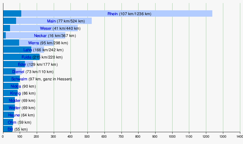
The north and east of Hesse belong to the catchment area of the Weser River, which crosses the state in the far north. Its headwaters, the Fulda and Werra, flow through Hesse for 215 km and 95 km, respectively. In contrast, the rest of the state drains to the Rhine, which forms the border with Rhineland-Palatinate for 107 km in the southwest. Its most important tributaries for Hesse are the Main and Lahn rivers, but the Neckar also flows a short distance through the extreme south of Hesse.
In the following, all rivers flowing through Hesse with a total length of more than 100 km or a flow length in Hesse of more than 50 km are listed. The Hessian and the total length are indicated in each case.
Streams
At the end of August 2019, the Hessian Ministry for the Environment, Climate Protection, Agriculture and Consumer Protection announced a renaturation program for 100 streams.
Lakes
There are no larger natural lakes in Hesse. No less than four of the state's largest reservoirs are located in the Waldeck-Frankenberg district in northwestern Hesse: Lake Edersee, by far the largest lake in Hesse, as well as Lake Affolderner See, Lake Diemelsee and Lake Twistesee. Other important reservoirs are the Kinzig reservoir in the Main-Kinzig district of eastern Hesse and the Aartalsee in the municipality of Bischoffen in the Lahn-Dill district of western Hesse.
The largest quarry lakes in Hesse include Lake Borken in the Schwalm-Eder district, Lake Werratal in the Werra-Meißner district and Lake Langener Waldsee in the Offenbach district as the largest lake in southern Hesse.
Nature and protected areas
In the various natural areas of Hessen, 763 nature reserves with a total size of more than 36,000 ha have been designated. This corresponds to about 1.7% of the state's area. In addition, 125 landscape protection areas have been established.
Within the framework of the European Natura2000 program, 583 FFH areas and 60 EU bird sanctuaries have been placed under protection. There are 31 natural forest reserves in Hesse with a total reserve area of 1228 ha. Numerous individual trees, rock formations or smaller areas are protected as natural monuments.
Hesse's only national park is the Kellerwald-Edersee National Park. Part of it has been part of the UNESCO World Natural Heritage "Ancient Beech Forests and Primeval Beech Forests of the Carpathians and Other Regions of Europe" since 2011. The Messel Pit, a world-class fossil deposit, has been a World Natural Heritage Site since 1995.
See also: list of nature reserves in Hesse, list of landscape conservation areas in Hesse and [[list of FFH areas in Hesse ]].
See also: List of EU bird sanctuaries in Hesse, List of natural forest reserves in Hesse and [[List of natural monuments in Hesse ]].


History
History of Hesse
→ Main article: History of Hesse
Today's state of Hesse includes the former territories of the Hessian principalities of Landgraviate Hesse (later Hesse-Kassel, Hesse-Darmstadt, Hesse-Rotenburg and Hesse-Homburg, among others), the County of Erbach, the Principality of Solms and large parts of the Duchy of Nassau, the County of Hanau, the County of Isenburg, the Principality of Waldeck, the Prince-Bishoprics of Mainz and Fulda, as well as the Free Imperial Cities of Frankfurt am Main, Friedberg, Gelnhausen and Wetzlar, respectively the former territories of the successor states.
By proclamation of the American military government of September 19, 1945, the foundations were laid for today's state of Hesse, which united the Prussian provinces of Kurhessen and Nassau as well as the Volksstaat Hessen to form the state of Groß-Hessen, excluding the areas in the west that had become part of the French occupation zone. These were, on the one hand, the Nassau districts of Sankt Goarshausen, Unterlahn, Oberwesterwald, Unterwesterwald and, on the other hand, Rheinhessen, the province on the left bank of the Rhine of the former Volksstaat Hessen, whereby the districts of the cities of Mainz and Worms located on the right bank of the Rhine in the American occupation zone remained in the occupation zone and therefore (continue to) belong to Hessen today. The French-occupied areas became part of the state of Rhineland-Palatinate in 1946 as the administrative districts of Montabaur and Rheinhessen. The former exclave of Wimpfen became part of the newly founded state of Württemberg-Baden against the majority resistance of the population and Hesse. With the adoption of the constitution of the State of Hesse by referendum on December 1, 1946, the previously formed "State of Greater Hesse" became the "State of Hesse".
See also: List of Hessian Minister Presidents and Hessian State Government
Name origin
The name Hesse is generally believed to be the modified form of the tribal name of the Germanic Chatti, whose main settlement area was in what is now northern and central Hesse.
Questions and answers
Q: What is Hesse?
A: Hesse is a state of Germany.
Q: When was Hesse formed and what was it called before?
A: Hesse was formed in 1945 as Greater Hesse and became Hesse in 1946.
Q: What is the capital of Hesse?
A: The capital of Hesse is Wiesbaden.
Q: What are the main rivers in the northern part of Hesse?
A: The main rivers in the northern part of Hesse are Werra, Fulda, and Lahn.
Q: What are the main mountain chains in Hesse?
A: The main mountain chains in Hesse are Rhön, Westerwald, Odenwald, Taunus, and Spessart.
Q: Where do most inhabitants of Hesse live?
A: Most inhabitants of Hesse live in the southernmost part of Hesse between the rivers Main and Rhine.
Q: How many districts and cities does Hesse have?
A: Hesse is divided into 21 districts and there are also five cities that belong to no district.
Related articles
Author
AlegsaOnline.com Hesse (Hessen): German state — geography, history, economy, administration Leandro Alegsa
URL: https://en.alegsaonline.com/art/43940