
La Habana Province (1976–2010)
Former Cuban province that surrounded the City of Havana from 1976 until it was divided into Artemisa and Mayabeque in 2011; overview of geography, economy, history and administration.

Overview
La Habana Province (Provincia de La Habana) was an administrative province of Cuba established in the 1976 territorial reorganization and existing until it was dissolved on 1 January 2011. It encircled the separate provincial entity formed by the City of Havana and contained a mix of small cities, towns and rural areas. The province played an intermediate role between the metropolitan capital and the more agricultural or industrial provinces to its west and east.
Image gallery
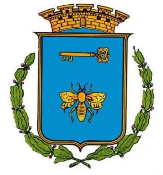
2 Images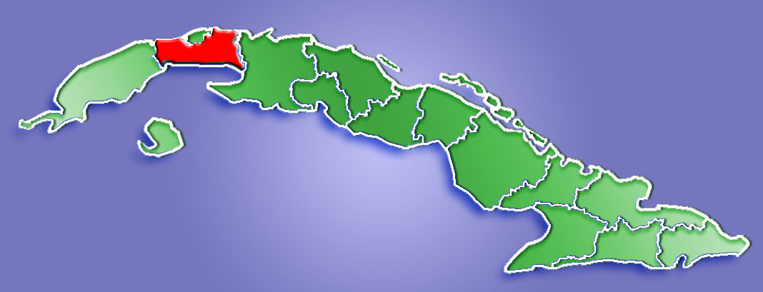
Geography and environment
The former province bordered the City of Havana to the north, and contiguous provinces including Pinar del Río and Matanzas on its western and eastern flanks. It had coastlines on both the northern and southern shores of the island, with the southern fringe featuring extensive wetlands and swampy zones that influenced settlement and land use. These coastal marshes are noted in environmental surveys and are important for local biodiversity and water management; references to regional ecology can be found via wetland resources and swamp conservation.
Administrative history
Created during Cuba's 1976 reorganization, La Habana Province functioned for three and a half decades as the provincial layer between municipal administrations and the national government. On 1 January 2011 the province was split into two new provinces, Artemisa and Mayabeque, a change intended to improve local administration and planning. The City of Havana remained a separate provincial-level entity throughout this period; for material on the capital see Havana (city).
Population and urban centers
The province comprised numerous municipalities with a mixture of urban and rural populations. Among its larger towns were Artemisa, which served as a major local center, and Güines, both noted in local statistics as among the biggest population centers in the province. Municipal population figures from early 2000s censuses are available in demographic reports and local gazetteers; for municipal listings consult archive databases such as regional statistics.
Economy and land use
Agriculture and light industry were the backbone of the provincial economy. Farms concentrated on cattle raising and the production of food crops—potatoes and various fruits were important local staples—rather than the large-scale sugarcane or tobacco cultivation that characterizes other Cuban regions. The province did host industrial facilities including power plants and some sugar-processing mills, though sugar production played a relatively smaller role in overall output. For sector summaries see overviews on livestock, food crops, root vegetables and fruit production. Historic links to the island's sugar and tobacco economy are discussed in materials at sugar industry and tobacco cultivation, while industrial infrastructure references include energy facilities.
Legacy and distinctions
The former La Habana Province is most often discussed today in the context of the administrative change that created Artemisa and Mayabeque. Its legacy includes a pattern of mixed land uses—urbanizing corridors near the capital, agricultural plains and coastal wetlands—that shaped local transport, planning and environmental management. Researchers and readers seeking primary source material on the province's boundaries, municipalities and economic indicators should consult national archives and statistical yearbooks preserved under provincial and municipal entries.
- Key administrative dates: created 1976, split 2011.
- Main economic activities: cattle, food crops, fruit, light industry.
- Notable towns: Artemisa, Güines, and several mid-sized municipalities.
For further reading and archival links consult provincial records and national statistical publications accessible through official Cuban repositories and regional research guides.
Questions and answers
Q: What is Havana Province?
A: Havana Province is a former province of Cuba that was split into two new provinces - Artemisa Province and Mayabeque Province - on January 1, 2011.
Q: What is the population of Havana Province?
A: The population of Havana Province was 711 066 people in the 2002 census.
Q: What are the largest cities in Havana Province?
A: The largest city in Havana Province is Artemisa with a population of 75,000 in 2003, followed by Güines (70,000).
Q: What are the borders of Havana Province?
A: The borders of Havana Province include the city of Havana, Pinar del Rio, and Matanzas. It has coasts in the south and north and has dozens of towns and a few small cities which rank between the 20 and 40 largest of the island.
Q: What kind of farming takes place in Havana province?
A: Most farms in Havana province raise cattle and grow food such as potatoes and fruit. Sugar and tobacco play only a small role in its economy.
Q: Is there industrialization present within this province?
A: Yes, there is much industrialization present within this province with many electricity plants and sugar mills.
Q: Are there any wetlands or swamps located near this area?
A: Yes, there are many swamps and wetlands located along its southern coast.
Related articles
Author
AlegsaOnline.com La Habana Province (1976–2010) Leandro Alegsa
URL: https://en.alegsaonline.com/art/42883
Sources
- cubagob.cu : Cuba Census 2002
- cubagob.cu : Population table