
Hato Mayor Province (Dominican Republic)
Eastern Dominican province created in 1984 with capital Hato Mayor del Rey. Known for cattle ranching, mixed agriculture, coastal wetlands and nearby natural areas; administratively formed from El Seibo.
Hato Mayor is a province in the eastern Dominican Republic with its capital at Hato Mayor del Rey. The province's name derives from Spanish colonial land-use terminology: "hato" refers to a ranch or cattle estate and the full name historically signified a large royal cattle estate. Hato Mayor occupies lowland plains and coastal areas and has long been associated with livestock production and mixed agriculture.
Image gallery
3 Images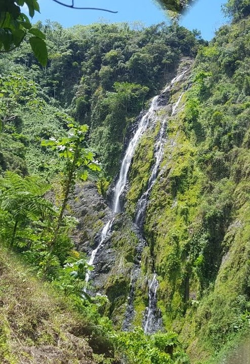


Geography and climate
The landscape of the province includes flat to gently rolling plains, river valleys and coastal lowlands. Soils and seasonal rainfall support a variety of agricultural uses while coastal margins hold mangroves, estuaries and wetlands important for local fisheries and biodiversity. The climate is tropical, with a pronounced wet season and a drier period that influences planting and grazing cycles.
History and administrative development
Hato Mayor was established as a separate province on 3 December 1984 when its territory was taken from the older El Seibo province. The creation of the province reflected administrative reorganisation to provide more local government services and development focus. The capital, Hato Mayor del Rey, functions as the political, commercial and cultural centre.
Economy and society
Traditional economic activities include cattle ranching and crop farming. Local farmers cultivate staple and tropical crops, and many communities combine livestock with small-scale cultivation of rice, root crops, plantains, coconut and other products suited to coastal plain soils. Markets in the capital and towns link producers to regional supply chains. Rural life retains elements of ranching culture and community festivals tied to agricultural calendars and patron saint celebrations.
Environment and conservation
Coastal wetlands and mangrove stands are among the province's important natural features. These habitats support fishery resources, birdlife and shoreline protection. Conservation attention in the eastern Dominican Republic often highlights nearby protected areas, marine cays and protected wetlands that are relevant to Hato Mayor's coastal environment.
Administration, transport and visitors
Governance is organised through the provincial seat and subordinate municipalities and municipal districts; public services and commerce concentrate in the capital while outlying communities remain largely rural. Roads connect Hato Mayor to neighbouring provinces and to Santo Domingo, facilitating travel and trade. Visitors may be drawn by nature-based activities, rural cultural experiences and coastal scenery.
Further information and resources
- Official provincial overview
- Regional geography and maps
- Hato Mayor del Rey municipal information
- Historical context and archives
- Cultural and linguistic notes
- Agriculture and livestock resources
- Conservation and protected areas
- Tourist information and practical tips
- Statistical and demographic data
Questions and answers
Q: What is Hato Mayor?
A: Hato Mayor is a Dominican province located in the eastern part of the country.
Q: Where does its name come from?
A: Its name comes from the name of its capital city, Hato Mayor del Rey (in English: the largest cattle farm of the King).
Q: When was it made a province?
A: It was made a province on 3 December 1984.
Q: Was it always an independent province?
A: No, before becoming an independent province, its territory was part of El Seibo Province.
Q: What type of terrain can be found in Hato Mayor?
A: The terrain in Hato Mayor varies and includes mountains, valleys, plains and coastal areas.
Q: What is the population size in Hato Mayor?
A: According to estimates from 2019, the population size in Hato Mayor is approximately 114,000 people.
Q:What are some major cities located within this province? A:The major cities located within this province include El Valle, Sabana de la Mar and Bayaguana.
Related articles
Author
AlegsaOnline.com Hato Mayor Province (Dominican Republic) Leandro Alegsa
URL: https://en.alegsaonline.com/art/42808
Sources
- censo2010.one.gob.do : "IX Censo Nacional de Población y Vivienda 2010"
- one.gob.do : "División Territorial 2015"
- one.gob.do : "REPÚBLICA DOMINICANA: Población por año calendario, según sexo y grupos quinquenales de edad, 2015-2020"
- geonames.org : "Hato Mayor del Rey"