Angas Downs Indigenous Protected Area
A large Indigenous Protected Area in southern Northern Territory, Australia, managed by the Imaṉpa community to protect cultural sites, native species and restore land degraded by pastoral use and feral animals.
Overview
Angas Downs Indigenous Protected Area is a 320,500-hectare pastoral property in the south of the Northern Territory, Australia. It lies along the Luritja Highway and is situated roughly 135 km east of Uluṟu–Kata Tjuṯa National Park and about 100 km south‑east of Kings Canyon. Administratively the reserve is in the Northern Territory (state) of Australia and is owned and managed by the Imaṉpa community (Imaṉpa), a local Indigenous group (community). The property borders pastoral stations to the east and west, including Mount Ebenezer Station and Curtin Springs Station. The area was formally declared an Indigenous Protected Area on 10 June 2009 and contributes to Australia’s National Reserve System.
Image gallery
10 Images


Cultural significance
Angas Downs lies within the homelands of southern Luritja and northern Yankunytjatjara peoples. These groups are often collectively referred to as Matutjara and speak a mixed dialect that reflects both languages. The land contains numerous songlines and sacred places that are central to local law and spiritual knowledge, commonly called Tjukurpa. Many animals and plants across the property are associated with ancestral totems and kinship stories; these links shape identity, customary responsibilities and traditional land management practices for families who live at Imaṉpa. The local population includes people of Luritja, Yankunytjatjara and Pitjantjatjara background (Pitjantjatjara), and cultural connections remain a primary reason for conservation and restoration work on the property.
Landscape, biodiversity and resources
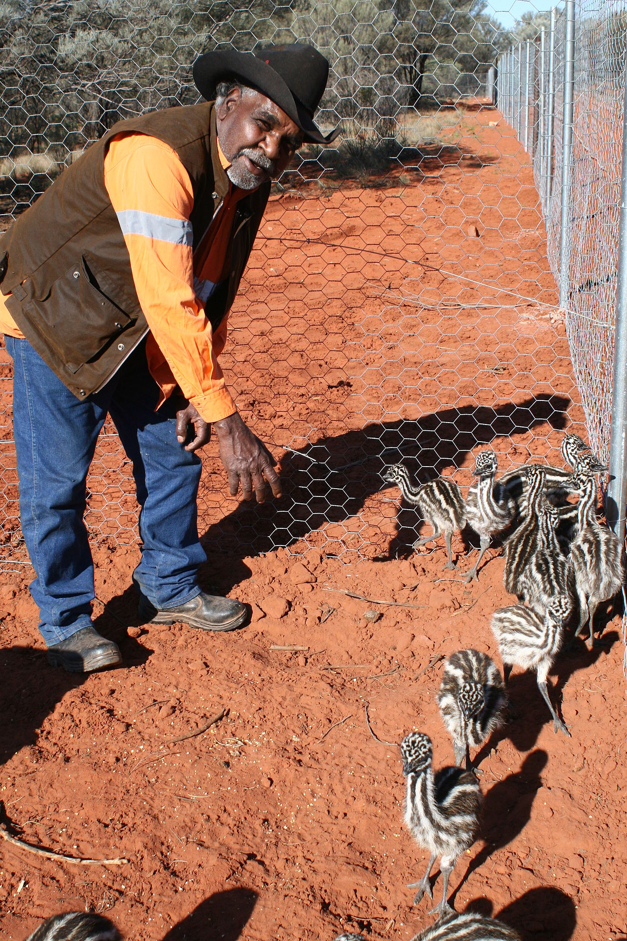
The reserve encompasses arid and semi‑arid landscapes typical of central Australia: spinifex and shrublands, rocky outcrops and ephemeral watercourses that support a range of native plants and animals. For millennia many of these species provided food resources and materials for local people. Traditional edible plants and game animals have declined in abundance following pastoral development and invasive species. Feral camels and horses are documented problems on the property (camel, horse), and invasive weeds have altered vegetation communities (weeds). Local rangers and custodians work to protect remaining native species and to revive traditional food sources (edible plants, game animals), while respecting cultural connections to fauna that are also ancestral emblems (ancestral, totems).
History and declaration as an IPA
The land now known as Angas Downs was operated as a pastoral lease prior to its return to Indigenous ownership. Historical grazing, altered fire regimes and other pressures reduced habitat quality and led to local extinctions or low populations of some native species. Recognising both cultural and conservation values, the Imaṉpa community secured the lease and entered the Indigenous Protected Area program, declaring the property an IPA in 2009 to integrate customary land management with national conservation objectives. As part of this process the site joined the broader network of protected areas in Australia, and management plans were developed to address ecological recovery and cultural site protection.
Management, challenges and actions
Current land stewardship is a joint effort involving the local community, the Central Land Council and ranger teams based at Imaṉpa. The ranger program carries out tasks such as feral animal control, weed management, cultural site maintenance and community education. Active programs aim to reintroduce or protect native plants and animals used for food and ceremony, and to restore traditional fire regimes where appropriate. Key management priorities are:
- Controlling feral species and reducing their impacts (camels, horses).
- Managing invasive plants and restoring native vegetation (weeds).
- Protecting culturally significant sites, songlines and Tjukurpa locations (songlines, Tjukurpa).
- Reviving traditional food sources and species that embody kinship and totemic ties (edible plants, ancestral, totems).
Importance and notable facts
Angas Downs illustrates how Indigenous ownership supports both cultural continuity and biodiversity conservation. The protected area provides a focus for intergenerational knowledge transfer, employment through ranger work and a local approach to landscape recovery. The property’s status as an IPA links community priorities to national conservation frameworks and enables access to resources for long‑term restoration. Organisations such as the Central Land Council support governance and practical programs, while local custodians maintain authority over cultural matters and land use decisions (dialect, homeland, southern Luritja, identity, kinship, Kings Canyon, Curtin Springs, Mount Ebenezer, Northern Territory, Australia, Pitjantjatjara, Imaṉpa).
Ongoing monitoring and community‑led management aim to reverse past degradation and to safeguard both natural and cultural values for future generations. The Angas Downs IPA therefore serves as an example of how Indigenous land tenure and traditional knowledge can be central to conserving arid landscapes.
Questions and answers
Q: What is Angas Downs Indigenous Protected Area?
A: Angas Downs Indigenous Protected Area is a protected area in the south of the Northern Territory, Australia. It consists of a 320,500-hectare (3,205 km2) pastoral lease that is owned by the indigenous community Imaṉpa.
Q: Where is Angas Downs located?
A: Angas Downs is located along the Luritja Highway, about 135 km east from Uluṟu-Kata Tjuṯa National Park and 100 km south-east of Kings Canyon. It borders the Mount Ebenezer Station to the east and the Curtin Springs Station to the west.
Q: When was it made an Indigenous Protected Area?
A: The property was made an Indigenous Protected Area on 10 June 2009, and forms part of Australia's National Reserve System.
Q: Who are Matutjara people?
A: Matutjara people are composed of southern Luritja and northern Yankunytjatjara people who speak a dialect that is a mix of both languages. The people living at Imaṉpa include Luritja, Yankunytjatjara and Pitjantjatjara.
Q: What are some important places in Angas Downs?
A: The property contains several places (songlines and sacred sites) that are important to native families' Tjukurpa. Several animals that live in the reserve represent ancestral totems, reminders of people's identity, kinship and descent. Many of the plants and animals have also been important sources of food for locals for thousands of years.
Q: What type of damage has occurred in Angas Downs?
A: Previous land management practices and other pressures damaged Angas Downs resulting in many native species disappearing while game animals and edible plants became less common. Feral animals (camel and horse) as well as weeds have become major problems due to this damage caused over time.
Related articles
Author
AlegsaOnline.com Angas Downs Indigenous Protected Area Leandro Alegsa
URL: https://en.alegsaonline.com/art/4102
Sources
- learnline.cdu.edu.au : "A history of the pastoral development of Angus Downs"
- atns.net.au : "Angus Downs Joint Management Indigenous Protected Area"
- awt.com.au : Angas Downs Indigenous Protected Area Plan of Management